NWS Tulsa(@NWStulsa) 's Twitter Profile Photo

[4/15/24 4:49 AM]Scattered showers/storms are expected across E OK & W AR tonight into Tuesday as a Pacific cold front moves through the region. A few of the storms could become severe late tonight into Tuesday morning. All modes of severe weather are possible.

[4/15/24 4:49 AM]Scattered showers/storms are expected across E OK & W AR tonight into Tuesday as a Pacific cold front moves through the region. A few of the storms could become severe late tonight into Tuesday morning.  All modes of severe weather are possible.  #okwx #arwx
account_circle
Simon Brewer(@SimonStormRider) 's Twitter Profile Photo


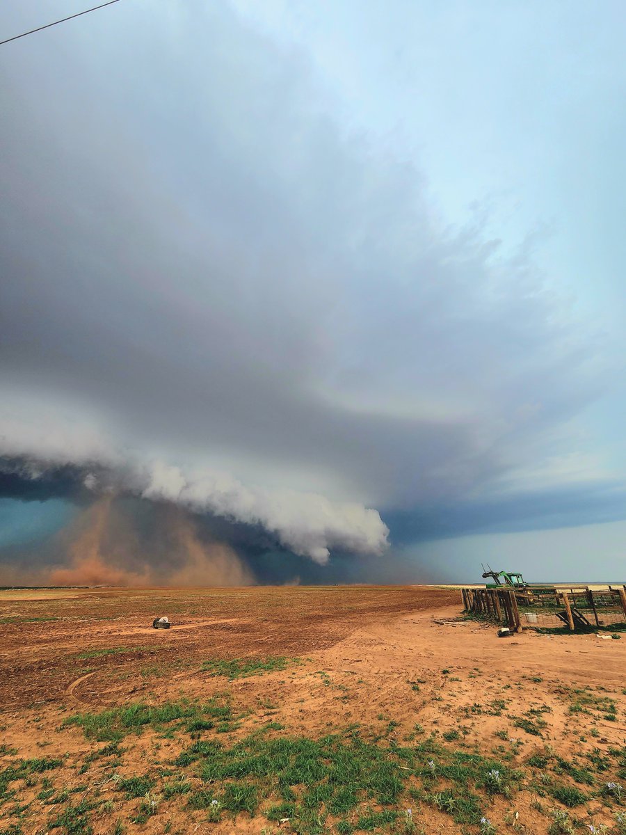
Juston Drake & I documented several supercells & tornadoes over Kansas & Oklahoma during a significant Great Plains Outbreak OTD 12 years ago, 14 April 2012.
Photos are from Cherokee, OK cyclic supercell.

#weatherpicofday
@JustonStrmRider & I documented several supercells & tornadoes over Kansas & Oklahoma during a significant Great Plains Outbreak OTD 12 years ago, 14 April 2012.
Photos are from Cherokee, OK cyclic supercell. #OKwx #KSwx
account_circle
NWS Norman(@NWSNorman) 's Twitter Profile Photo

Severe storms are still possible this afternoon through the overnight hours will all hazards possible. Main change to the outlook was removing the enhanced risk from the entire area. Nevertheless, make sure you are weather aware today!

Severe storms are still possible this afternoon through the overnight hours will all hazards possible. Main change to the outlook was removing the enhanced risk from the entire area. Nevertheless, make sure you are weather aware today! #okwx #txwx
account_circle
David Payne(@tornadopayne) 's Twitter Profile Photo

The atmosphere looks to remain capped thru the daytime hours tomorrow with warm air aloft. Trigger/jet streak continues to not time out well with daytime heating. So we may stay dry until overnight with a broken line of storms with the actual front. The latest at 10:30!

The atmosphere looks to remain capped thru the daytime hours tomorrow with warm air aloft. Trigger/jet streak continues to not time out well with daytime heating. So we may stay dry until overnight with a broken line of storms with the actual front. The latest at 10:30!  #okwx
account_circle
Weather Track US(@weathertrackus) 's Twitter Profile Photo

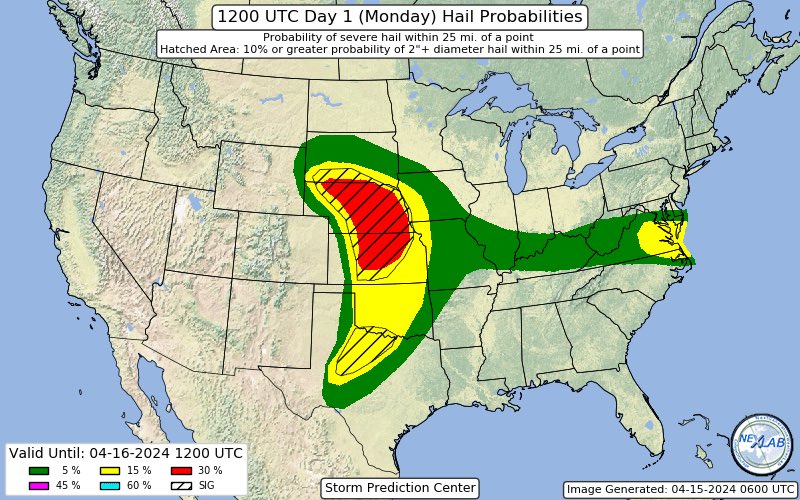
Enhanced Risk of severe storms across parts of the Central Plains today.

Main threat will be large/very large hail, but a few tornadoes & damaging winds are possible as well.

Enhanced Risk of severe storms across parts of the Central Plains today.

Main threat will be large/very large hail, but a few tornadoes & damaging winds are possible as well.

#newd #kswx #okwx #txwx #weather
account_circle
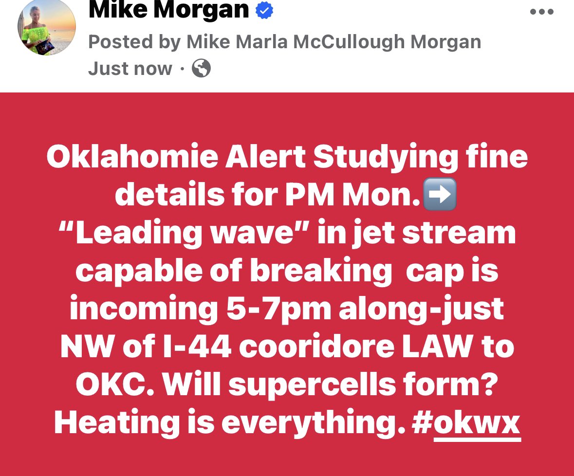
Mike Morgan(@MikeMorganKFOR) 's Twitter Profile Photo

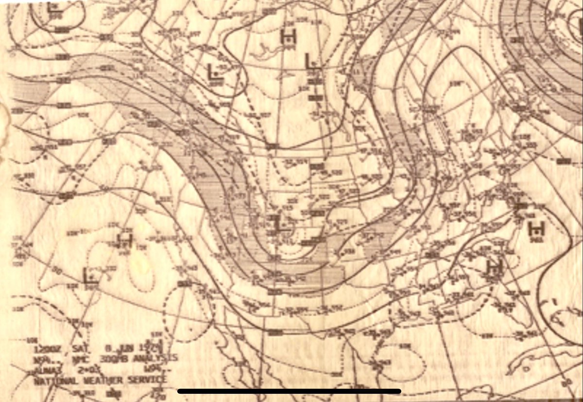
With permission, original image from Mike Smith, here is 12z 300mb chart June 8, 1974 Saw Reed Timmer, PhD ask everybody about their ideal TOR set up This is it✅Preceding trough lifts out✅Incoming trough is difluent, aiding early AM storms✅Trough digs, scoops, lifts

With permission, original image from @USWeatherExpert, here is 12z 300mb chart June 8, 1974 Saw @ReedTimmerUSA ask everybody about their ideal TOR set up This is it✅Preceding trough lifts out✅Incoming trough is difluent, aiding early AM storms✅Trough digs, scoops, lifts #okwx
account_circle
Max Archer(@MaxArcherWX) 's Twitter Profile Photo

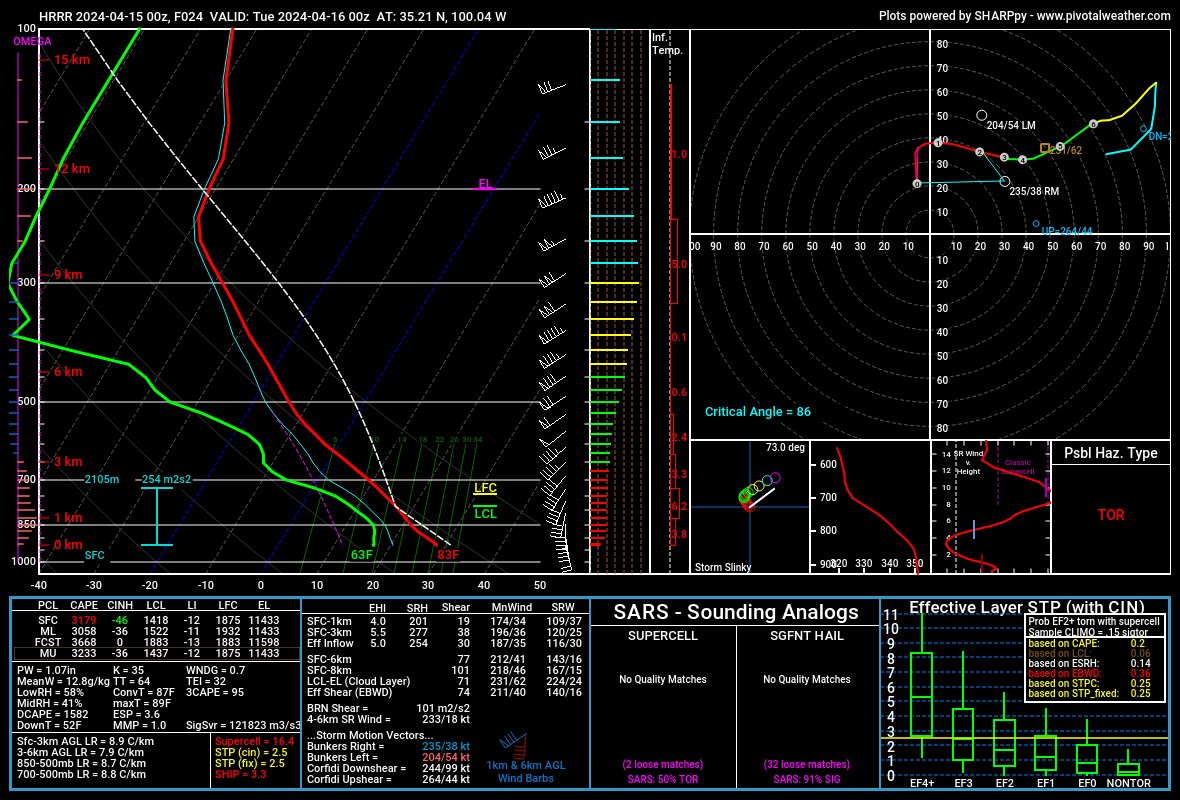
Strong synoptic support continues with the 00z HRRR showing a stronger lead shortwave that ejects into the TX PH and W OK along with a 700mb jet max over NW TX and SW OK which will also help with breaking the cap and helping with storm initiation.

Strong synoptic support continues with the 00z HRRR showing a stronger lead shortwave that ejects into the TX PH and W OK along with a 700mb jet max over NW TX and SW OK which will also help with breaking the cap and helping with storm initiation.

#txwx #okwx
account_circle
Jason H (AU) 🇦🇺(@OreboundImages) 's Twitter Profile Photo

This outflow dominant storm near Hollis, OK back in 2022 was producing several fairly convincing gustnadoes as it tracked quickly over western parts of the state, some of which prompted tornado reports - none of which we were able to confirm from what we saw 🌩

This outflow dominant storm near Hollis, OK back in 2022 was producing several fairly convincing gustnadoes as it tracked quickly over western parts of the state, some of which prompted tornado reports - none of which we were able to confirm from what we saw 🌩

#okwx #StormHour
account_circle