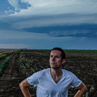
Quincy Vagell
@stormchaserq
Meteorologist, storm chaser; photographer. Media inquiries: stormchaserQ @ gmail . com Instagram: stormchaserQ
ID: 1377780391
http://www.quincyvagell.com 24-04-2013 19:02:10
22,22K Tweet
17,17K Takipçi
1,1K Takip Edilen
 on Twitter photo 18z subjective surface analysis. Complex setup leading to low confidence in convective evolution this afternoon and early evening: #mtwx #ndwx #sdwx")
Tornado-warned supercell thunderstorm near Reva, SD at 6:33 PM / 0033 UTC #sdwx NWS Rapid City
 on Twitter photo Tornado-warned supercell thunderstorm near Reva, SD at 6:33 PM / 0033 UTC #sdwx <a href=\"/NWSRapidCity/\">NWS Rapid City</a>")
 on Twitter photo Big win for the eastern target chasers yesterday. Many factors/variables can make or break a storm chase. Risk tolerance, timing, logistics, personal biases, model preference, etc. Sometimes you’re right for the right reasons, wrong for the wrong reasons or anything in between.")
 's Twitter Profile Photo")
Zero metering dust devils on the links today at Rio Bravo Golf Course in Bakersfield, CA this morning with desert steep lapse rates abound NWS Los Angeles @kcalnews Quincy Vagell Jordan Hall Aaron Jayjack Jack am I doing it right?
 on Twitter photo 18z subjective surface analysis #iawx #mnwx #ndwx #newx #sdwx")
 on Twitter photo The (north) eastern target area is trying to thread the needle again, but struggling so far. The northern half of the Tornado Watch is too cool in the boundary layer, while mean 700mb temps across the watch are ~+14C. Going to need more cooling aloft to steepen 0-3km lapse rates.")
 on Twitter photo Earlier tornado and supercell structure in western Beltrami County, MN. This was at 7:34 pm in the woody marshlands, looking NW from near Malcolm, MN. <a href=\"/mnwx/\">unagi626</a> <a href=\"/NWSGrandForks/\">NWS Grand Forks</a>")
Alternate photos of the supercell that produced a few intermittent tornadoes between Grygla and Malcolm, MN. Between 7:21 and 7:34 PM. Found myself on a questionable road, standing on my car roof to see over the treeline. Got a car full of bugs too, but worth it! NWS Grand Forks
 on Twitter photo Alternate photos of the supercell that produced a few intermittent tornadoes between Grygla and Malcolm, MN. Between 7:21 and 7:34 PM. Found myself on a questionable road, standing on my car roof to see over the treeline. Got a car full of bugs too, but worth it! <a href=\"/NWSGrandForks/\">NWS Grand Forks</a>")
Supercell time lapse showing one of the tornadoes NW of Malcolm, MN earlier, toward the end of the clip. #mnwx NWS Grand Forks
 on Twitter photo This was one of the most unique vantage points I’ve had of a tornado, in Beltrami Island State Forest last night. I watched this storm produce a few intermittent tornadoes in the secluded woods of northern Minnesota.")
 on Twitter photo Saw several ground-scraping wall clouds across northern Iowa and southeastern Minnesota today. Each photo is a different storm:")
 on Twitter photo Goodnight, Iowa")
 's Twitter Profile Photo")
Dominating Penn Square Mall and bumped into Reed Timmer, PhD ! Awesome catching up and talking about the Floyd tornado chase
 on Twitter photo Dominating Penn Square Mall and bumped into <a href=\"/ReedTimmerUSA/\">Reed Timmer, PhD</a> ! Awesome catching up and talking about the Floyd tornado chase")
 's Twitter Profile Photo")
 on Twitter photo OMG we ran into the legendary <a href=\"/stormchaserQ/\">Quincy Vagell</a> and saw the TOTY")
 on Twitter photo Welcome to Montana. Supercell near Biddle, MT a short time ago. <a href=\"/NWSBillings/\">NWS Billings</a>")
 on Twitter photo Transient supercell near Quincy, KS. 5:10 p.m. <a href=\"/NWSWichita/\">NWS Wichita</a>")
I’m offering a $250 reward for the return of stolen equipment, a Sony a7iii and 16-35mm GMII lens. These items, a 10th gen iPad and accessories were stolen in Oklahoma City on Friday. I can supply serial numbers. Email stormchaserQ @ gmail .com or Quincy Vagell on Instagram
 on Twitter photo I’m offering a $250 reward for the return of stolen equipment, a Sony a7iii and 16-35mm GMII lens. These items, a 10th gen iPad and accessories were stolen in Oklahoma City on Friday. I can supply serial numbers. Email stormchaserQ @ gmail .com or <a href=\"/stormchaserQ/\">Quincy Vagell</a> on Instagram")