Robert Womack (@sgtrwomack) 's Twitter Profile
Robert Womack

@sgtrwomack

Tweets are mine and not endorsed by my Agency.

ID: 3086355096

calendar_today15-03-2015 18:23:53

900 Tweet

102 Followers

44 Following

Robert Womack (@sgtrwomack) 's Twitter Profile Photo

Interesting project for weather geeks (and anyone else interested in snowfall information). facebook.com/story.php?stor…

Robert Womack (@sgtrwomack) 's Twitter Profile Photo

Remember to enroll now if you are interested in Concepts of Criminal Law ADMJ 055. Looking forward to seeing you. facebook.com/story.php?stor…

NWS Reno (@nwsreno) 's Twitter Profile Photo

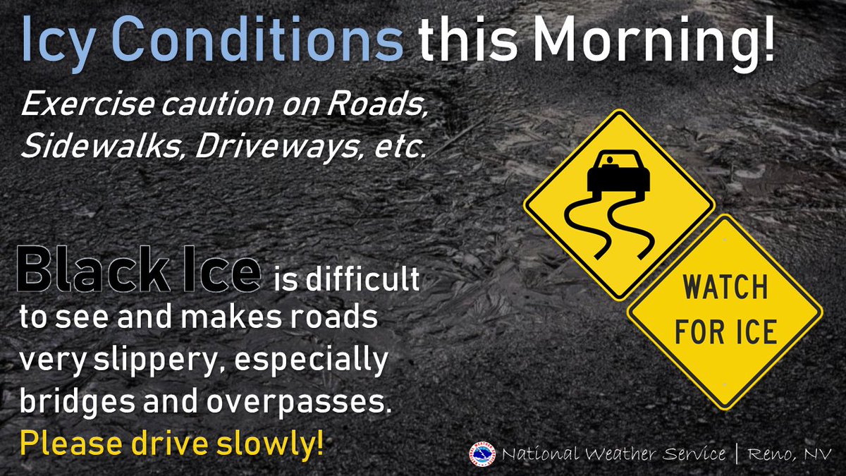
Caution this morning with icy conditions out there! 🥶 Roads, sidewalks, driveways may be extremely slick this morning! Check w/ CalTrans and NDOT for the latest road conditions/chain controls before heading out. NDOT: nvroads.com CalTrans: quickmap.dot.ca.gov

Caution this morning with icy conditions out there! 🥶  Roads, sidewalks, driveways may be extremely slick this morning! 

Check w/ CalTrans and NDOT for the latest road conditions/chain controls before heading out.
NDOT: nvroads.com
CalTrans: quickmap.dot.ca.gov
Robert Womack (@sgtrwomack) 's Twitter Profile Photo

Always make sure you have a plan for your pets, especially if you are not home during an evacuation and can’t get back to get your pets. Truckee Police Humane Society

NWS Reno (@nwsreno) 's Twitter Profile Photo

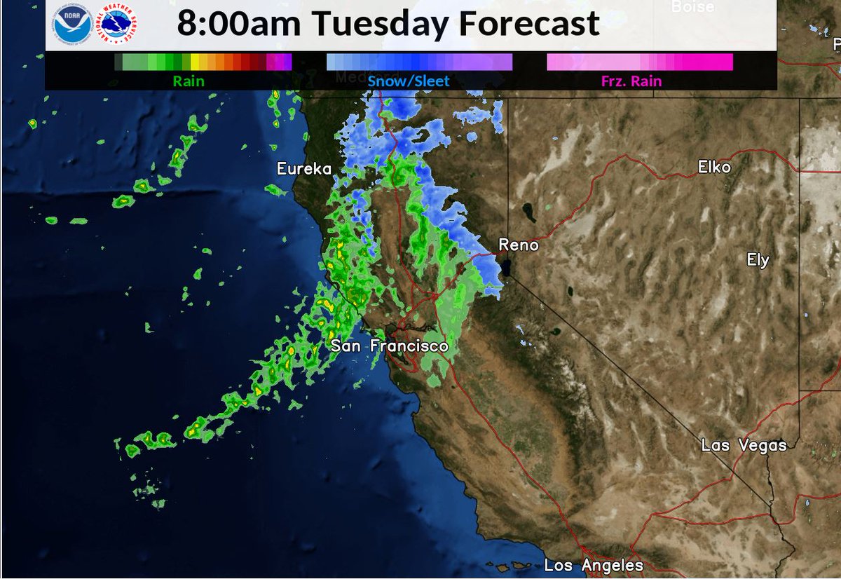
A weak storm system will bring gusty winds Tue, along with light snow for the Sierra and northeast CA. Mainly dry conditions w/light winds & warming temps are then expected Wed-Fri. Next weekend, another storm system may bring a chance of valley rain & mountain snow with winds.

A weak storm system will bring gusty winds Tue, along with
light snow for the Sierra and northeast CA. Mainly dry
conditions w/light winds & warming temps are
then expected Wed-Fri. Next weekend,
another storm system may bring a chance of valley rain &
mountain snow with winds.
NWS Reno (@nwsreno) 's Twitter Profile Photo

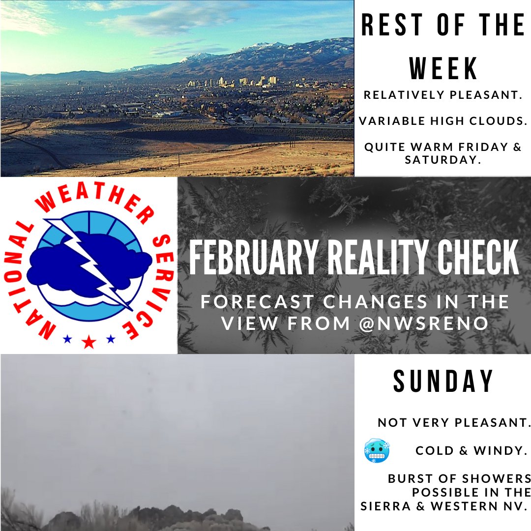
Warming trend thru SAT before a reality check that it is still winter SUN. SAT will be a good outdoor plans day, & SUN indoor plans will be more suitable. We are having a hard time finding something fun to do indoors SUN. Is anything going on? 🙃 Details bit.ly/2U75rB5

Warming trend thru SAT before a reality check that it is still winter SUN. SAT will be a good outdoor plans day, & SUN indoor plans will be more suitable.
We are having a hard time finding something fun to do indoors SUN. Is anything going on? 🙃

Details  bit.ly/2U75rB5
NWS Reno (@nwsreno) 's Twitter Profile Photo

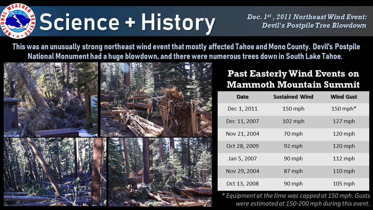
Enjoy the warm afternoon! Strong NE winds will impact the Tahoe Basin and Mono Co Sun/Sun N. While not expected to be as extreme as Dec 1, 2011, the forecast winds could be the strongest northeasterly wind event the region has seen in years. Details: bit.ly/37e2H7X.

Enjoy the warm afternoon! Strong NE winds will impact the Tahoe Basin and Mono Co Sun/Sun N. While not expected to be as extreme as Dec 1, 2011, the forecast winds could be the strongest northeasterly wind event the region has seen in years. Details: bit.ly/37e2H7X.
NWS Reno (@nwsreno) 's Twitter Profile Photo

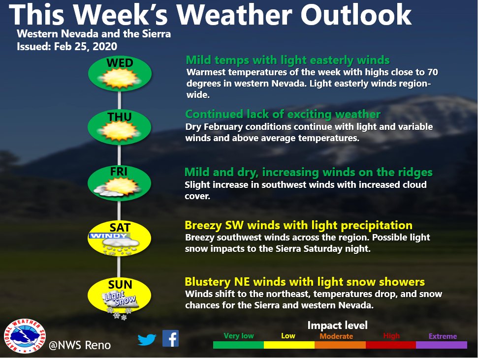
High pressure remains in control this week over western NV and the Sierra with dry conditions, light winds, and above average high temps. Low pressure looks to impact the region this weekend with gusty southwest winds and the chance for rain and snow showers. #NVWx #CAWx

High pressure remains in control this week over western NV and the Sierra with dry conditions, light winds, and above average high temps. Low pressure looks to impact the region this weekend with gusty southwest winds and the chance for rain and snow showers. #NVWx #CAWx
NWS Reno (@nwsreno) 's Twitter Profile Photo

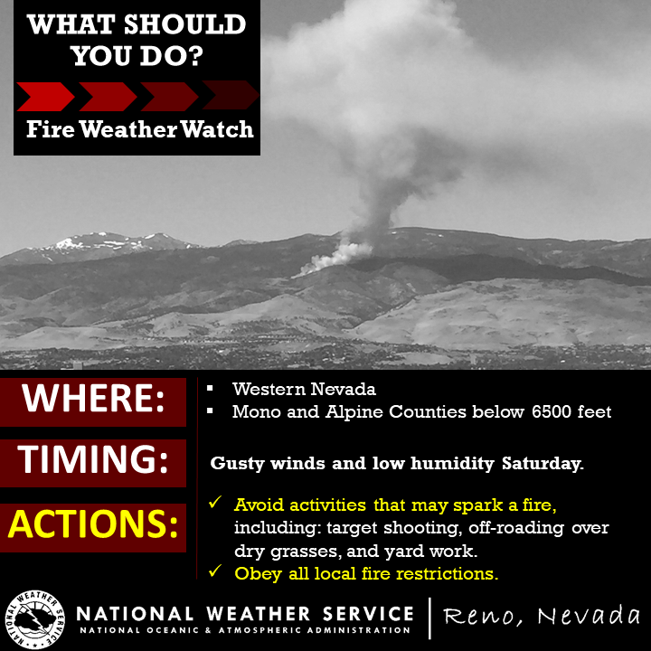
Windy and dry Saturday! Lack of rain/snow in Jan-Feb, has led to dry fine fuels in the lower elevations of wrn NV & the Ern Sierra. Help us to get the word out & avoid activities that may spark a fire. Fire Weather Watch - forecast.weather.gov/product.php?si… #firesafety

Windy and dry Saturday! Lack of rain/snow in Jan-Feb, has led to dry fine fuels in the lower elevations of wrn NV & the Ern Sierra. Help us to get the word out & avoid activities that may spark a fire. Fire Weather Watch - forecast.weather.gov/product.php?si… #firesafety
NWS Reno (@nwsreno) 's Twitter Profile Photo

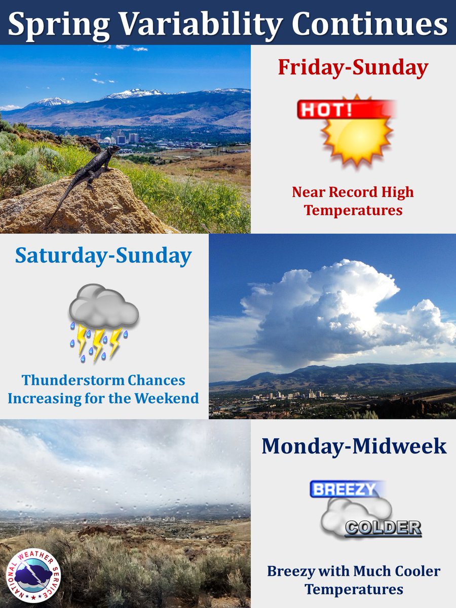
Typical spring weather variability continues with very warm temperatures the next few days, chances of thunderstorms over the weekend, then breezy and cooler weather for next week.

Typical spring weather variability continues with very warm temperatures the next few days, chances of thunderstorms over the weekend, then breezy and cooler weather for next week.
California Governor's Office of Emergency Services (@cal_oes) 's Twitter Profile Photo

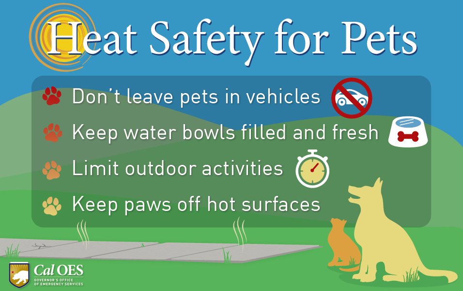
If you are hot, then they probably are too. Make sure to check on your pets and follow these tips so they stay safe. You can find more info here: tinyurl.com/y54rvhar #BeatTheHeat

If you are hot, then they probably are too. Make sure to check on your pets and follow these tips so they stay safe. You can find more info here: tinyurl.com/y54rvhar #BeatTheHeat
Robert Womack (@sgtrwomack) 's Twitter Profile Photo

Remember - "Hear the Hi/Lo, time to Go". Now is the time to prepare for an evacuation by having a plan & a Go Bag ready. Also, don't forget to add face covers to your supplies in your Go Bag. More info available at Readyforwildfire.org Truckee Fire Truckee Police Nevada County OES

NWS Reno (@nwsreno) 's Twitter Profile Photo

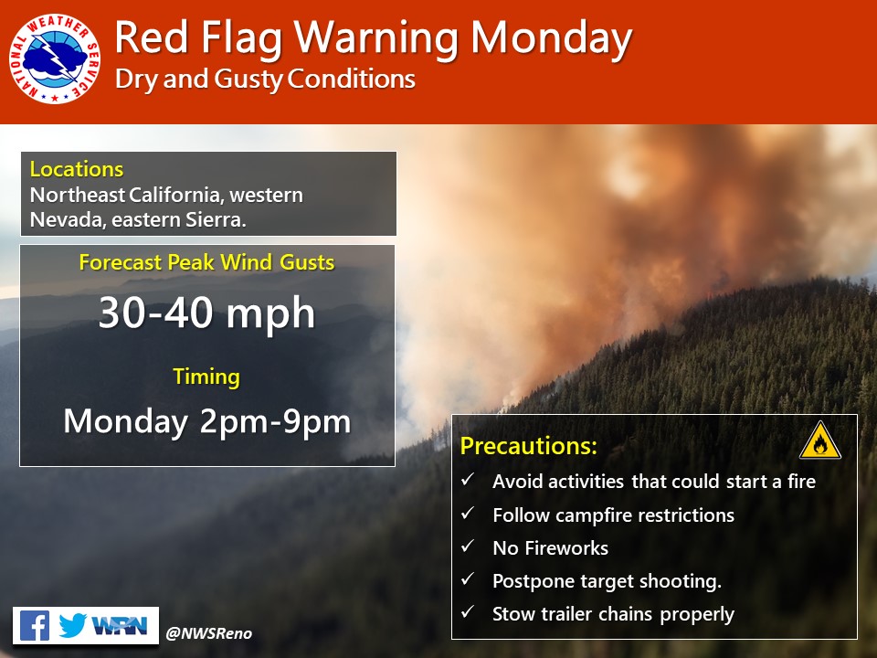
Increased fire weather danger will be in place on Monday as dry and gusty winds are expected. A Red Flag Warning has been issued for Monday. Dry conditions with peak wind gusts of 30 to 40 mph are possible. Take precautions to avoid activities that could start a fire!

Increased fire weather danger will be in place on Monday as dry and gusty winds are expected. A Red Flag Warning has been issued for Monday. Dry conditions with peak wind gusts of 30 to 40 mph are possible.  Take precautions to avoid activities that could start a fire!