Ryan Kane (@ryankanerwx) 's Twitter Profile
Ryan Kane

@ryankanerwx

Meteorologist @Norcastweather || Terps Atmospheric Science Degree 🐢 || East Coast & MD Weather Updates || Golfer || Summer '23 Intern @wbaltv11

ID: 4786361036

calendar_today20-01-2016 01:20:26

8,8K Tweet

3,3K Followers

150 Following

Logan Giles (@logangileswx) 's Twitter Profile Photo

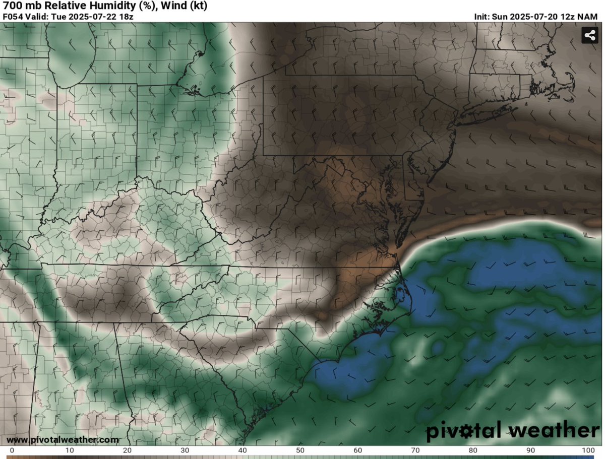
Tuesday will be the best day in awhile with northerly flow bringing temperatures to near 80˚F. Dry airmass with low humidity expected

Tuesday will be the best day in awhile with northerly flow bringing temperatures to near 80˚F. Dry airmass with low humidity expected
Ryan Kane (@ryankanerwx) 's Twitter Profile Photo

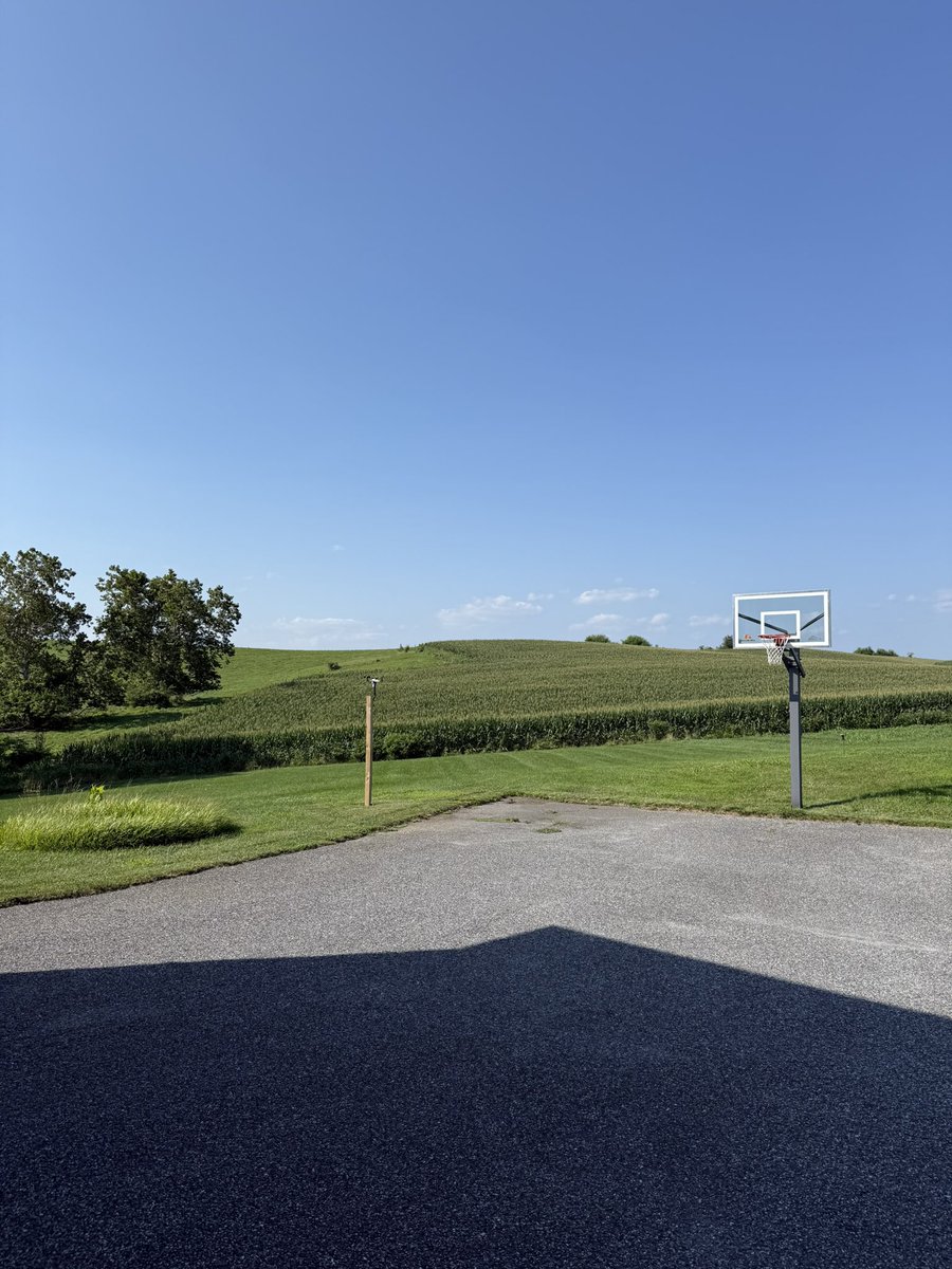
I forgot how nice low humidity days are…. everyone enjoy this fantastic weather the rest of today & tomorrow. Things start to heat back up Wednesday into the weekend & humidity will ramp back up as well. #MdWx

I forgot how nice low humidity days are…. everyone enjoy this fantastic weather the rest of today & tomorrow. Things start to heat back up Wednesday into the weekend & humidity will ramp back up as well. #MdWx
Ryan Kane (@ryankanerwx) 's Twitter Profile Photo

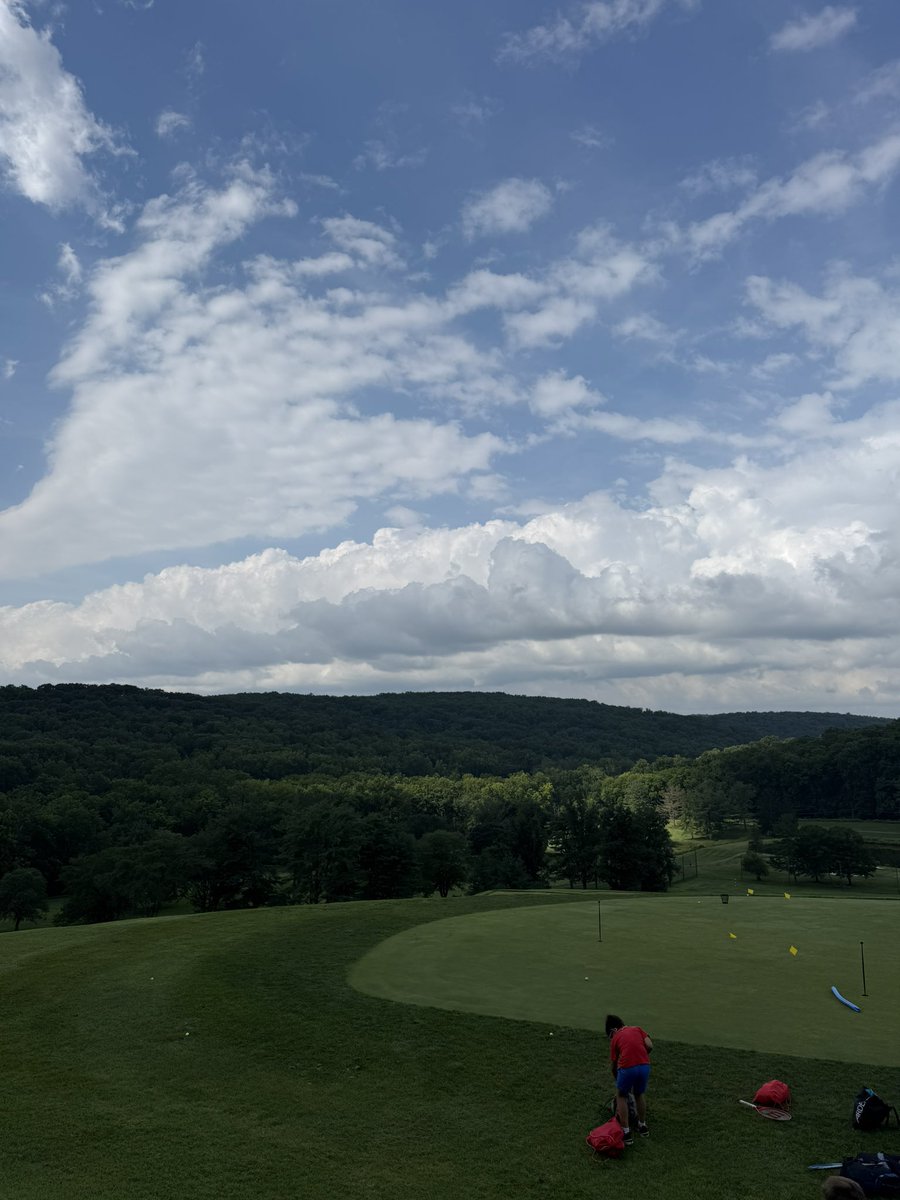
Nice horizontal convective rolls out here in northern MD this morning. Areas of upward motion & sinking motion in between. #MdWx

Nice horizontal convective rolls out here in northern MD this morning. Areas of upward motion & sinking motion in between. #MdWx
Ryan Kane (@ryankanerwx) 's Twitter Profile Photo

Today could be the hottest day of the summer. Highs reach the 94-98 degree mark with heat index values in the 105-110 degree range. Scattered to isolated storms possible from 2-5pm. A weak cold front drops through from 6-9pm with more iso. storm chances. Drink lots of H2O today!

Blain Crain (@blain_crain) 's Twitter Profile Photo

Some say the perfect Saturday doesn’t exist… 7 AM 🚿 8 AM 🏌️‍♂️ 9 AM 🏌️‍♂️ 10 AM 🏌️‍♂️ 11 AM 🏌️‍♂️ 12 PM 🏈 1 PM 🏈 2 PM 🏈 3 PM 🏈 4 PM 🏈 5 PM 🏈 6 PM 🏈 7 PM 🏈 8 PM 🏈 9 PM 🏈 PERFECTION…..

Ryan Kane (@ryankanerwx) 's Twitter Profile Photo

A moderate risk for excessive rainfall has been issued by the WPC for tomorrow. Scattered shower/storms likely beginning 9-10am on Thursday across MD. Heavy storms will linger along a boundary in the mod. risk zone throughout day. Heaviest rain expected 4-9pm. Iso 4"+ amounts.

Ryan Kane (@ryankanerwx) 's Twitter Profile Photo

Skies are partly cloudy as CAPE is already building to 3,000j/kg across central MD. Numerous showers and storms are likely anytime after 10am this morning. The worst of it comes through from 3-8pm this evening. High flash flood risk & isolated severe threat. Stay safe! #MdWx

Ryan Kane (@ryankanerwx) 's Twitter Profile Photo

Satelittle shows developing cumulus in the zone drawn, which is in the most favorable zone for flash flooding with strong low level convergence. Development of showers & storms likely now through 1pm. 4000J/kg of CAPE across northern MD is ample fuel. Stay aware this afternoon!

Satelittle shows developing cumulus in the zone drawn, which is in the most favorable zone for flash flooding with strong low level convergence. Development of showers & storms likely now through 1pm. 4000J/kg of CAPE across northern MD is ample fuel. Stay aware this afternoon!
Ryan Kane (@ryankanerwx) 's Twitter Profile Photo

Watching this zone over the next 2-3 hours for backbuilding flash flooding as the convergence zone strengthens near the mason dixon line. Another push of very heavy storms likely from the northwest from 4-8pm. Very active afternoon & evening ahead! #MdWx

Watching this zone over the next 2-3 hours for backbuilding flash flooding as the convergence zone strengthens near the mason dixon line. Another push of very heavy storms likely from the northwest from 4-8pm. Very active afternoon & evening ahead! #MdWx
Ryan Kane (@ryankanerwx) 's Twitter Profile Photo

Safe to say things are quickly deteriorating across central & northern MD… Flash flooding is imminent as rainfall rates of 2-3” per hour ongoing #MdWx

Ryan Kane (@ryankanerwx) 's Twitter Profile Photo

Our active day of storms is settling down. 3.2” here in northern MD. Streams are high & there is still some ongoing flooding out there so be safe if driving this evening. Forecast went pretty well today! Hope everyone is staying safe! Less humid conditions tomorrow into weekend!

Ryan Kane (@ryankanerwx) 's Twitter Profile Photo

High pressure will remain in control over the next couple days. Temps will drop into low 60s/upper 50s tonight. Sunshine with highs in the upper 70s to low 80s through Tuesday. Humidity will remain lower, with an uptick by Wednesday. Watching for potential coastal system by Wed.

High pressure will remain in control over the next couple days. Temps will drop into low 60s/upper 50s tonight. Sunshine with highs in the upper 70s to low 80s through Tuesday. Humidity will remain lower, with an uptick by Wednesday. Watching for potential coastal system by Wed.
Ryan Kane (@ryankanerwx) 's Twitter Profile Photo

In the tropics, currently two invests that pose no threat to US. By this weekend, a stronger tropical wave moves into the ITCZ over the eastern Atlantic. This will try to develop by middle-late next week. Areas along Gulf & east coast need to keep a close eye come nxt weekend.

In the tropics, currently two invests that pose no threat to US. By this weekend, a stronger tropical wave moves into the ITCZ over the eastern Atlantic. This will try to develop by middle-late next week. Areas along Gulf & east coast need to keep a close eye come nxt weekend.