Pixalytics (@pixalytics) 's Twitter Profile
Pixalytics

@pixalytics

Earth Observation company. We use satellite data to answer questions about our planet's behaviour - we also produce some interesting images!

ID: 565756984

linkhttp://www.pixalytics.com calendar_today28-04-2012 21:24:23

5,5K Tweet

2,2K Followers

2,2K Following

Pixalytics (@pixalytics) 's Twitter Profile Photo

Yesterday saw the successful launch of the NISAR #satellite, which is a joint mission between NASA & ISRO. It is the first mission to have both L-band and S-band synthetic aperture radar (SAR) instruments onboard. buff.ly/5DcGWUp #EarthObservation

Yesterday saw the successful launch of the NISAR #satellite, which is a joint mission between NASA & ISRO. It is the first mission to have both L-band and S-band synthetic aperture radar (SAR) instruments onboard. buff.ly/5DcGWUp #EarthObservation
Pixalytics (@pixalytics) 's Twitter Profile Photo

Yesterday saw the launch of Pakistan's latest Remote Sensing Satellite. It's an optical satellite, with data to be used for applications including precision farming, urban planning, environmental monitoring and disaster management. buff.ly/5DcGWUp

Yesterday saw the launch of Pakistan's latest Remote Sensing Satellite. It's an optical satellite, with data to be used for applications including precision farming, urban planning, environmental monitoring and disaster management. buff.ly/5DcGWUp
Pixalytics (@pixalytics) 's Twitter Profile Photo

The last week has seen three #EarthObservation #satellite launches! We began with MicroCarb and CO3D last Friday, followed this week by NASA & ISRO's joint NISAR mission, and Pakistan's Remote Sensing Satellite. buff.ly/5DcGWUp

The last week has seen three #EarthObservation #satellite launches! We began with MicroCarb and CO3D last Friday, followed this week by NASA & ISRO's joint NISAR mission, and Pakistan's Remote Sensing Satellite. buff.ly/5DcGWUp
Pixalytics (@pixalytics) 's Twitter Profile Photo

We've seen three #EarthObservation #satellite launches over the last ten days! It began with MicroCarb and CO3D, and they were followed by NASA & ISRO's joint NISAR mission, and Pakistan's Remote Sensing Satellite. buff.ly/5DcGWUp

We've seen three #EarthObservation #satellite launches over the last ten days! It began with MicroCarb and CO3D, and they were followed by NASA & ISRO's joint NISAR mission, and Pakistan's Remote Sensing Satellite. buff.ly/5DcGWUp
Pixalytics (@pixalytics) 's Twitter Profile Photo

Looking at how #satellite imagery can support the farming industry with details of a current UK project, article from NASA Earth Observatory, plus market size for this sector. buff.ly/ZktglAZ #EarthObservation

Looking at how #satellite imagery can support the farming industry with details of a current UK project, article from NASA Earth Observatory, plus market size for this sector. buff.ly/ZktglAZ #EarthObservation
Pixalytics (@pixalytics) 's Twitter Profile Photo

Current Space4Climate project is gathering views and inputs into how #satellite data and imagery is used by UK farming sector, and how this can be improved. Get in touch if you interested in contributing or would like further details. buff.ly/ZktglAZ #EarthObservation

Current <a href="/Space4Climate/">Space4Climate</a> project is gathering views and inputs into how #satellite data and imagery is used by UK farming sector, and how this can be improved. Get in touch if you interested in contributing or would like further details. buff.ly/ZktglAZ #EarthObservation
Pixalytics (@pixalytics) 's Twitter Profile Photo

Interesting article demonstrating that crop rotation generally makes a positive impact on yields, plus details of a current UK Space4Climate project on agriculture. buff.ly/ZktglAZ #EarthObservation

Interesting article demonstrating that crop rotation generally makes a positive impact on yields, plus details of a current UK Space4Climate project on agriculture. buff.ly/ZktglAZ #EarthObservation
Pixalytics (@pixalytics) 's Twitter Profile Photo

Looking at how #satellite data and imagery can support the farming industry with details of a current UK project, article from NASA Earth Observatory, plus market size for this sector. buff.ly/ZktglAZ #EarthObservation

Looking at how #satellite data and imagery can support the farming industry with details of a current UK project, article from NASA Earth Observatory, plus market size for this sector. buff.ly/ZktglAZ #EarthObservation
Pixalytics (@pixalytics) 's Twitter Profile Photo

Do you have views or thoughts on how #satellite data and imagery is used by UK farming sector? A #Space4Climate project is currently looking for comments. Further details can be found at buff.ly/ZktglAZ #EarthObservation

Do you have views or thoughts on how #satellite data and imagery is used by UK farming sector? A #Space4Climate project is currently looking for comments. Further details can be found at buff.ly/ZktglAZ #EarthObservation
Pixalytics (@pixalytics) 's Twitter Profile Photo

As the UK enters its fourth heatwave of the summer and a national water shortfall declared due to a lack of rain, we look at how #remotesensing and #satellite data can be used to help monitor and mitigate drought issues. buff.ly/GfzDQ8g #EarthObservation

As the UK enters its fourth heatwave of the summer and a national water shortfall declared due to a lack of rain, we look at how #remotesensing and #satellite data can be used to help monitor and mitigate drought issues. buff.ly/GfzDQ8g #EarthObservation
Pixalytics (@pixalytics) 's Twitter Profile Photo

Do you work in, or provide services, to the agriculture sector? If so, we'd like your views on how #satellite data is currently used. We have a short survey, no personal details requested, & would love to include your opinions in our Space4Climate project. buff.ly/Rumk2j2

Do you work in, or provide services, to the agriculture sector? If so, we'd like your views on how #satellite data is currently used. We have a short survey, no personal details requested, &amp; would love to include your opinions in our Space4Climate project. buff.ly/Rumk2j2
Pixalytics (@pixalytics) 's Twitter Profile Photo

There are lots of datasets #remotesensing and #satellite data can provide that can help users monitor and mitigate drought issues; including look at crop stress, soil moisture , temperature and rainfall - together with combined indices. buff.ly/GfzDQ8g #EarthObservation
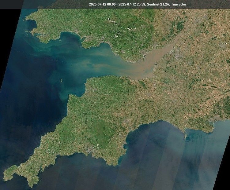
There are lots of datasets #remotesensing and #satellite data can provide that can help users monitor and mitigate drought issues; including look at crop stress, soil moisture , temperature and rainfall - together with combined indices. buff.ly/GfzDQ8g #EarthObservation
Pixalytics (@pixalytics) 's Twitter Profile Photo

The UK's had four heatwaves this summer, so it's important to understand what's happening to the climate - it's disappointing to see rumours the USA is looking to end NASA's two Orbiting Carbon Observatory missions which provide valuable data. buff.ly/GfzDQ8g

The UK's had four heatwaves this summer, so it's important to understand what's happening to the climate - it's disappointing to see rumours the USA is looking to end NASA's two Orbiting Carbon Observatory missions which provide valuable data. buff.ly/GfzDQ8g
Pixalytics (@pixalytics) 's Twitter Profile Photo

Following the UK's fourth heatwave of the summer and a national water shortfall declared this week due to a lack of rain, we're looking at how #remotesensing and #satellite data can be used to help monitor and mitigate drought issues. buff.ly/GfzDQ8g #EarthObservation

Following the UK's fourth heatwave of the summer and a national water shortfall declared this week due to a lack of rain, we're looking at how #remotesensing and #satellite data can be used to help monitor and mitigate drought issues. buff.ly/GfzDQ8g #EarthObservation
Pixalytics (@pixalytics) 's Twitter Profile Photo

Heatwave have impacts on health, travel, and agriculture. This week we're looking at how #remotesensing and #satellite data can provide data and actionable information to help monitor and mitigate drought issues. buff.ly/GfzDQ8g #EarthObservation

Heatwave have impacts on health, travel, and agriculture. This week we're looking at how #remotesensing and #satellite data can provide data and actionable information to help monitor and mitigate drought issues. buff.ly/GfzDQ8g #EarthObservation
Pixalytics (@pixalytics) 's Twitter Profile Photo

Following the fourth heatwave of the summer in the UK last week, we looked at how #remotesensing and #satellite data can be used to help monitor and mitigate drought issues. buff.ly/GfzDQ8g #EarthObservation
Following the fourth heatwave of the summer in the UK last week, we looked at how #remotesensing and #satellite data can be used to help monitor and mitigate drought issues. buff.ly/GfzDQ8g #EarthObservation
Pixalytics (@pixalytics) 's Twitter Profile Photo

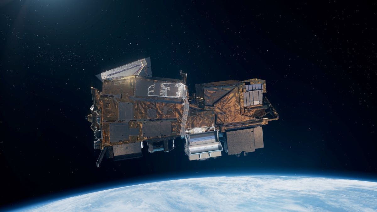
Last week saw the latest mission in the European Union’s Copernicus Programme lift off, Sentinel-5A was successfully launched onboard the MetOp-SG A1 satellite. The mission will collect data on atmospheric pollutants and trace gases. buff.ly/Qe2W1yT #EarthObservation

Last week saw the latest mission in the European Union’s Copernicus Programme lift off, Sentinel-5A was successfully launched onboard the MetOp-SG A1 satellite. The mission will collect data on atmospheric pollutants and trace gases. buff.ly/Qe2W1yT #EarthObservation
Pixalytics (@pixalytics) 's Twitter Profile Photo

Sentinel-5A was successfully launched last week onboard the MetOp-SG A1 satellite. It is a high-resolution spectrometer with seven spectral bands: 2 in UV, 2 in NIR, 2 in SWIR, and one in the visible spectrum. buff.ly/Qe2W1yT #EarthObservation #Sentinel

Sentinel-5A was successfully launched last week onboard the MetOp-SG A1 satellite. It is a high-resolution spectrometer with seven spectral bands: 2 in UV, 2 in NIR, 2 in SWIR, and one in the visible spectrum. buff.ly/Qe2W1yT #EarthObservation #Sentinel
Pixalytics (@pixalytics) 's Twitter Profile Photo

Sentinel-5A was launched last week onboard the MetOp-SG A1 satellite. It is part of the Copernicus' wider atmospheric monitoring strategy and will collect data on atmospheric pollutants and trace gases. buff.ly/Qe2W1yT #EarthObservation

Sentinel-5A was launched last week onboard the MetOp-SG A1 satellite. It is part of the  Copernicus' wider atmospheric monitoring strategy and will collect data on atmospheric pollutants and trace gases. buff.ly/Qe2W1yT #EarthObservation
Pixalytics (@pixalytics) 's Twitter Profile Photo

Last week saw the successful launch of Sentinel-5A launched onboard the MetOp-SG A1 satellite, this is the latest mission in the European Union’s Copernicus Programme. The mission will collect data on atmospheric pollutants & trace gases. buff.ly/Qe2W1yT #EarthObservation

Last week saw the successful launch of Sentinel-5A launched onboard the MetOp-SG A1 satellite, this is the latest mission in the European Union’s Copernicus Programme. The mission will collect data on atmospheric pollutants &amp; trace gases. buff.ly/Qe2W1yT #EarthObservation