pix4d(@pix4d) 's Twitter Profileg
pix4d

@pix4d

Professional photogrammetry software for mobile and drone mapping.
https://t.co/i7a8nuzrYZ

ID:240293896

linkhttps://www.pix4d.com calendar_today19-01-2011 16:02:32

4,6K Tweets

20,4K Followers

1,3K Following

pix4d(@pix4d) 's Twitter Profile Photo

📆 Sign up for our next & online workshop! May 28-30th. Register today (by April 30th) and use EARLYBIRD coupon code to save 130 USD! 💰

Register here: hubs.li/Q02vjmmC0

📆 Sign up for our next #PIX4Dmatic & #PIX4Dsurvey online workshop! May 28-30th. Register today (by April 30th) and use EARLYBIRD coupon code to save 130 USD! 💰 Register here: hubs.li/Q02vjmmC0
account_circle
pix4d(@pix4d) 's Twitter Profile Photo

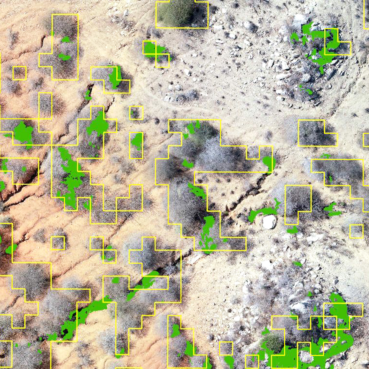
Tanzania Flying Labs used to monitor vegetation regrowth on barren land in Kongwa, Tanzania. With the Magic Tool they identified, tracked, and monitored tree regrowth: hubs.li/Q02v0JB00

Tanzania Flying Labs used #PIX4Dfields to monitor vegetation regrowth on barren land in Kongwa, Tanzania. With the Magic Tool they identified, tracked, and monitored tree regrowth: hubs.li/Q02v0JB00 #dronesforgood #sustainabledevelopment #Pix4D #sustainablefarming
account_circle
pix4d(@pix4d) 's Twitter Profile Photo

Check out our latest post, a submission from our flythough contest 📽

This project, showing a landfill in Apulia, Italy, was created with a DJI Phantom 4 and a dataset of 997 photos!

Don't forget to check out our next submission next Monday! 📆

account_circle
pix4d(@pix4d) 's Twitter Profile Photo

📱Ever wondered the best way to capture different surfaces with ? 🤳

We cover the best practices for scanning stockpiles, flat surfaces, slopes, and structures with our mobile scanning app !

Learn more in our article: hubz.li/Q02trh-70
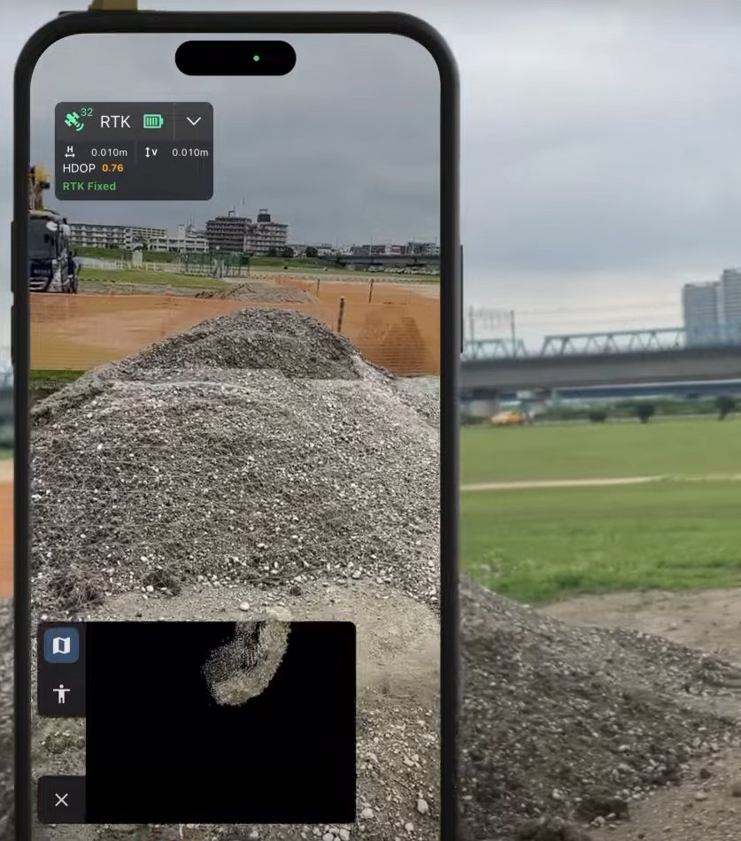
📱Ever wondered the best way to capture different surfaces with #3Dscanning? 🤳 We cover the best practices for scanning stockpiles, flat surfaces, slopes, and structures with our mobile scanning app #PIX4Dcatch! Learn more in our article: hubz.li/Q02trh-70
account_circle
pix4d(@pix4d) 's Twitter Profile Photo

🗺️ PIX4Dmapper Essentials online workshop, May 7-9 ⭐

➡️ Get introduced to critical workflows
➡️ Capture RGB images
➡️ Create, manage, and share 2D & 3D representations of reality

Sign up here: hubs.li/Q02tkV0P0

🗺️ PIX4Dmapper Essentials online workshop, May 7-9 ⭐ ➡️ Get introduced to critical #PIX4Dmapper workflows ➡️ Capture RGB images ➡️ Create, manage, and share 2D & 3D representations of reality Sign up here: hubs.li/Q02tkV0P0
account_circle
pix4d(@pix4d) 's Twitter Profile Photo

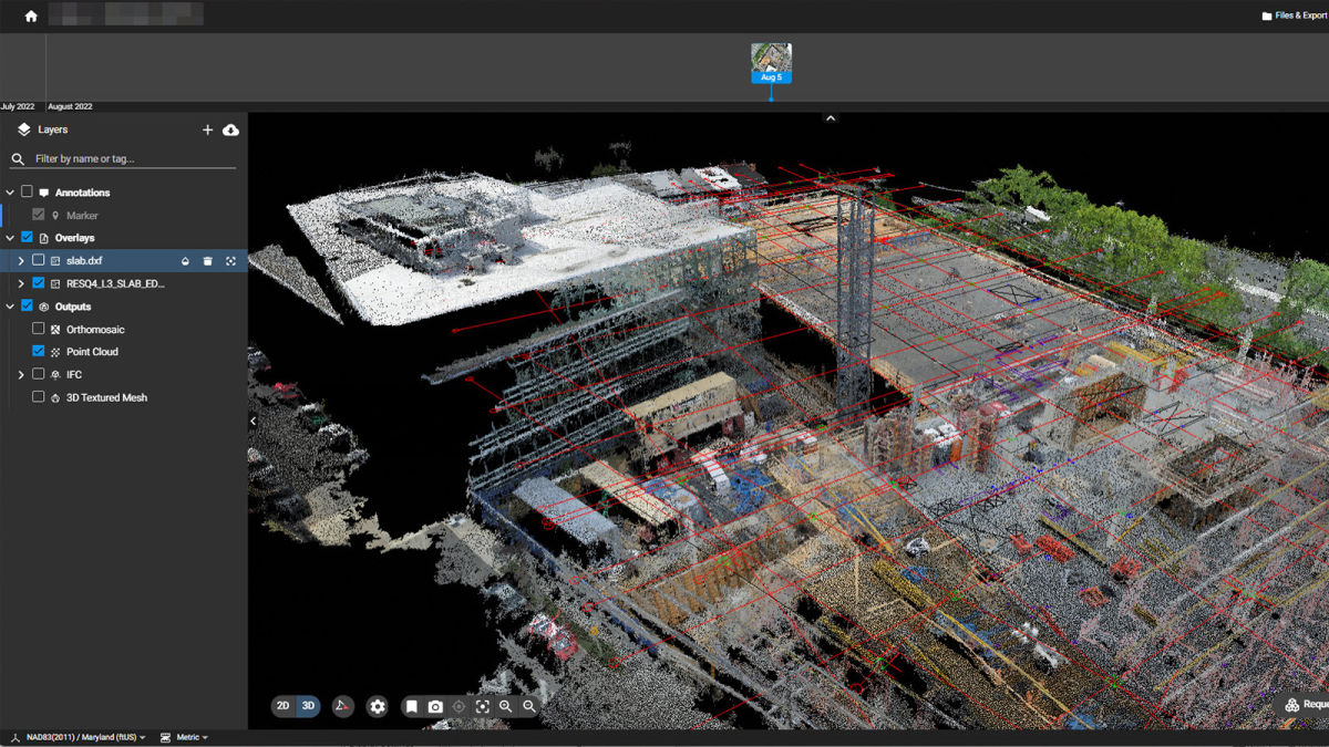
📽️ Dive deeper into with our new video tutorials! ☁️

Learn how to:
▶️ Compare as-built to design with DXF and IFC files
▶️ Compare data sets
▶️ Generate annotation reports, and more!!

Check them out here: hubs.li/Q02t7Mk-0

📽️ Dive deeper into #PIX4Dcloud with our new video tutorials! ☁️ Learn how to: ▶️ Compare as-built to design with DXF and IFC files ▶️ Compare data sets ▶️ Generate annotation reports, and more!! Check them out here: hubs.li/Q02t7Mk-0 #DXF #IFC #construction #Pix4D
account_circle
pix4d(@pix4d) 's Twitter Profile Photo

Don't forget to sign up for the upcoming workshops with our training partner Navigate! Level up your skills with and , enhance your knowledge in 3D mapping & precision agriculture!

Sign up today: hubs.li/Q02t8ffq0

Don't forget to sign up for the upcoming workshops with our training partner Navigate! Level up your skills with #PIX4Dmapper and #PIX4Dfields, enhance your knowledge in 3D mapping & precision agriculture! Sign up today: hubs.li/Q02t8ffq0 #precisionagriculture #3Dmapping

account_circle
pix4d(@pix4d) 's Twitter Profile Photo

🚀 Open QA Engineer position in Madrid

We’re seeking a skilled QA Engineer to focus on PIX4Dcloud and PIX4Dcatch, our web & mobile applications for photogrammetry. Apply now: hubs.li/Q02s_YHF0

🚀 Open QA Engineer position in Madrid We’re seeking a skilled QA Engineer to focus on PIX4Dcloud and PIX4Dcatch, our web & mobile applications for photogrammetry. Apply now: hubs.li/Q02s_YHF0 #QAEngineer #TechJobs #JoinOurTeam #GIS #CapturingReality #AugmentedReality
account_circle
pix4d(@pix4d) 's Twitter Profile Photo

Even with moderate tree cover, Jon Altschuld and Chinook Landscape Architecture were able to collect good ground data with DJI drones and Pix4D software for this project near South Lake Tahoe, CA.

account_circle
pix4d(@pix4d) 's Twitter Profile Photo

A civil engineering and construction firm in Japan pits against a laser scanner and a drone, conducting a comparative test in terms of both usability and accuracy. They found that PIX4Dcatch delivered on both fronts: hubs.li/Q02snVQ50

A civil engineering and construction firm in Japan pits #PIX4Dcatch against a laser scanner and a drone, conducting a comparative test in terms of both usability and accuracy. They found that PIX4Dcatch delivered on both fronts: hubs.li/Q02snVQ50
account_circle
pix4d(@pix4d) 's Twitter Profile Photo

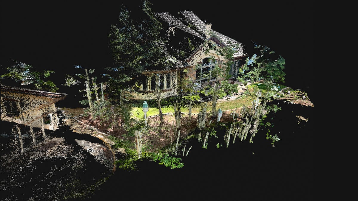
PIX4Dcatch, combined with PIX4Dcloud, is used by surveyors to increase their profits by 64%! Mapping an area covered with foliage proved challenging with aerial mapping, so they turned to mobile scanning: hubs.li/Q02rGlHG0

PIX4Dcatch, combined with PIX4Dcloud, is used by surveyors to increase their profits by 64%! Mapping an area covered with foliage proved challenging with aerial mapping, so they turned to mobile scanning: hubs.li/Q02rGlHG0 #PIX4Dcatch #PIX4Dcloud #Pix4D #CAD #DXF
account_circle
pix4d(@pix4d) 's Twitter Profile Photo

📢 2.6 is here!

The latest update brings you AMAZONE spot spraying maps, improved zonation workflow, and more! Discover the release in full: hubs.li/Q02rtg7s0

📢#PIX4Dfields 2.6 is here! The latest update brings you AMAZONE spot spraying maps, improved zonation workflow, and more! Discover the release in full: hubs.li/Q02rtg7s0
account_circle
pix4d(@pix4d) 's Twitter Profile Photo

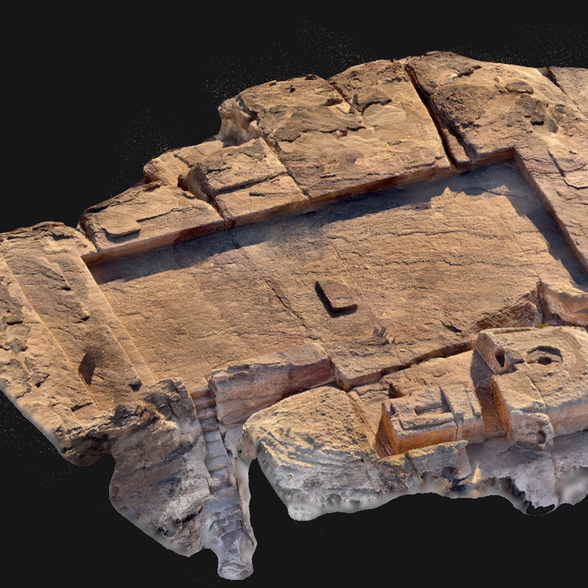
collaborated with the ifpo, VUB, and Université de Lausanne to help digitize an archaeological mission in ! With the archaeologists could the site with their phones, resulting in precise data capture & analysis: hubs.li/Q02r2Vkq0

#Pix4D collaborated with the @ifporient, @VUBrussel, and @unil to help digitize an archaeological mission in #Petra! With #PIX4Dcatch the archaeologists could #3Dscan the site with their phones, resulting in precise data capture & analysis: hubs.li/Q02r2Vkq0
account_circle
pix4d(@pix4d) 's Twitter Profile Photo

Discover the power of importing and exporting DXF files with PIX4Dcloud! ☁️ Our article explores possibilities for seamless integration and collaboration: hubs.li/Q02qTTK30

Discover the power of importing and exporting DXF files with PIX4Dcloud! ☁️ Our article explores possibilities for seamless integration and collaboration: hubs.li/Q02qTTK30 #DXF #PIX4Dcloud #Pix4D #BIM
account_circle
pix4d(@pix4d) 's Twitter Profile Photo

was used for a cadastral survey on a steep slope. To ensure precise results, the drone followed the terrain gait, with another flight that used the 5 different axes of the P1 camera. This ensured complete data collection: hubs.li/Q02q8wR_0

#Pix4D was used for a cadastral survey on a steep slope. To ensure precise results, the drone followed the terrain gait, with another flight that used the 5 different axes of the P1 camera. This ensured complete data collection: hubs.li/Q02q8wR_0
account_circle
pix4d(@pix4d) 's Twitter Profile Photo

⏳Just one day left to register for our on finding success with ! Join us tomorrow at 4PM CET! Register now hubs.li/Q02q5BGk0

⏳Just one day left to register for our #webinar on finding success with #PIX4Dfields! Join us tomorrow at 4PM CET! Register now hubs.li/Q02q5BGk0
account_circle
pix4d(@pix4d) 's Twitter Profile Photo

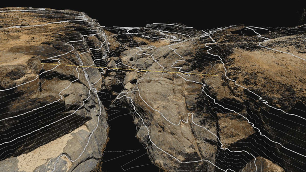
and are used to construct a footbridge in Malawi. 👣

Irish NGO Wells for Zoë turned to drone mapping to plan the construction process. Using enabled them to share a comprehensive visualization of the site with experts: hubs.li/Q02ptf-00

#PIX4Dmatic and #PIX4Dsurvey are used to construct a footbridge in Malawi. 👣 Irish NGO Wells for Zoë turned to drone mapping to plan the construction process. Using #Pix4D enabled them to share a comprehensive visualization of the site with experts: hubs.li/Q02ptf-00
account_circle
pix4d(@pix4d) 's Twitter Profile Photo

📢Only a few days left to register for our ! Join us on March 21st at 4PM CET for a discussion on how to successfully plan your agricultural spray drone flight and a live Q&A! Register today hubs.li/Q02ppcHd0

📢Only a few days left to register for our #webinar! Join us on March 21st at 4PM CET for a discussion on how to successfully plan your agricultural spray drone flight and a live Q&A! Register today hubs.li/Q02ppcHd0 #precisionagriculture #PIX4Dfields
account_circle
pix4d(@pix4d) 's Twitter Profile Photo

A construction consulting company in Japan utilized drones for planning a river excavation system. 🌊 However, sharing large volumes of 3D data with external parties can be challenging. Their solution was , which offers a URL for easy sharing: hubs.li/Q02pdRW80
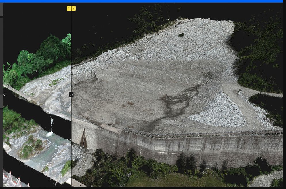
A construction consulting company in Japan utilized drones for planning a river excavation system. 🌊 However, sharing large volumes of 3D data with external parties can be challenging. Their solution was #PIX4Dcloud, which offers a URL for easy sharing: hubs.li/Q02pdRW80
account_circle
pix4d(@pix4d) 's Twitter Profile Photo

We spoke with a professional surveyor about terrestrial 3D scanning. 📱They believed that is a game-changer for surveyors due to ease of use, cost-effectiveness, and accuracy.

Read the article here: hubs.li/Q02nyQBK0
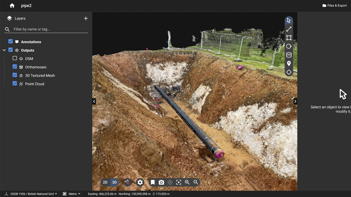
We spoke with a professional surveyor about terrestrial 3D scanning. 📱They believed that #PIX4Dcatch is a game-changer for surveyors due to ease of use, cost-effectiveness, and accuracy. Read the article here: hubs.li/Q02nyQBK0
account_circle