Orion Geospatial (@oriongeospatial) 's Twitter Profile
Orion Geospatial

@oriongeospatial

🌍 Welcome to Orion Geospatial Solutions
We offer Precision geospatial services:
Engineering Surveying | Cadastral/Boundary
Drone LiDAR & Aerial Mapping | GIS

ID: 1886340344159019008

linkhttp://oriongeospatial.co.ke calendar_today03-02-2025 09:06:09

34 Tweet

88 Takipçi

124 Takip Edilen

HMC (@47k254) 's Twitter Profile Photo

GeoAI: Artificial Intelligence for Geospatial Data GeoAI is a Python package that bridges AI and geospatial analysis, providing tools for processing, analysis, and visualization of spatial data using machine learning. It supports raster, vector, and point cloud formats and

GeoAI: Artificial Intelligence for Geospatial Data

GeoAI is a Python package that bridges AI and geospatial analysis, providing tools for processing, analysis, and visualization of spatial data using machine learning. It supports raster, vector, and point cloud formats and
HMC (@47k254) 's Twitter Profile Photo

ArcGIS Living Atlas by Esri now with 100+ pre-trained and ready-to-use #GeoAI models, covering topics, such as 📄 Building Footprint Extraction 🗺️ Land Cover Classification 🛣️ Road Extraction 🚗 Car Detection 🌞 Solar Panel Detection 🚢 Ship Detection 🏗️ Building Change

ArcGIS Living Atlas by Esri now with 100+ pre-trained and ready-to-use #GeoAI models, covering topics, such as

📄 Building Footprint Extraction
🗺️ Land Cover Classification
🛣️ Road Extraction
🚗 Car Detection
🌞 Solar Panel Detection
🚢 Ship Detection
🏗️ Building Change
HMC (@47k254) 's Twitter Profile Photo

This is a well-done map. One of the most important skills after mastering feature visualization is map arrangement—especially when the legend is long and contains multiple features. I have worked with many map makers fresh from school, and the number one challenge I notice is the

This is a well-done map. One of the most important skills after mastering feature visualization is map arrangement—especially when the legend is long and contains multiple features. I have worked with many map makers fresh from school, and the number one challenge I notice is the
Fahari Aviation (@fahariaviation) 's Twitter Profile Photo

𝐘𝐨𝐮𝐫 𝐂𝐫𝐨𝐩𝐬 𝐀𝐫𝐞 𝐓𝐚𝐥𝐤𝐢𝐧𝐠. 𝐎𝐮𝐫 𝐃𝐫𝐨𝐧𝐞𝐬 𝐇𝐞𝐥𝐩 𝐘𝐨𝐮 𝐋𝐢𝐬𝐭𝐞𝐧. At Fahari Aviation , we use our drones to capture detailed crop health data through 𝑵𝑫𝑽𝑰 (𝑵𝒐𝒓𝒎𝒂𝒍𝒊𝒛𝒆𝒅 𝑫𝒊𝒇𝒇𝒆𝒓𝒆𝒏𝒄𝒆 𝑽𝒆𝒈𝒆𝒕𝒂𝒕𝒊𝒐𝒏 𝑰𝒏𝒅𝒆𝒙) analysis.
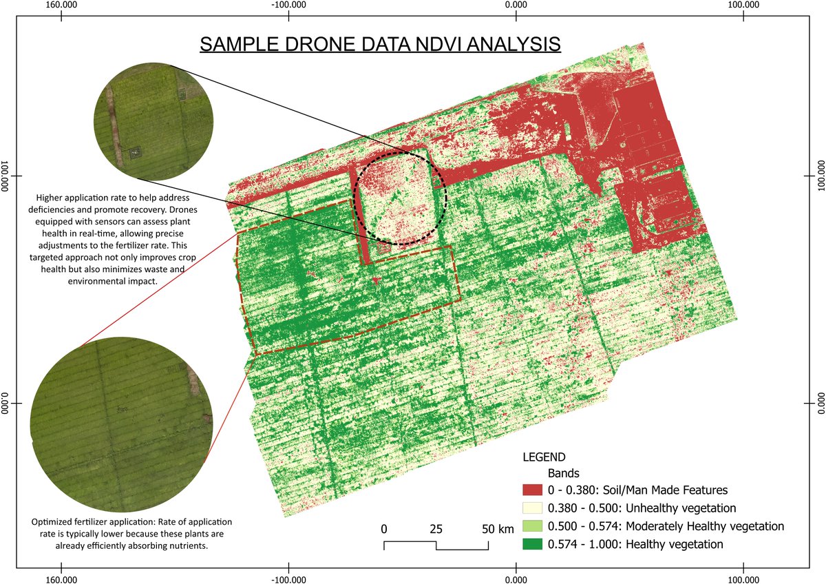
𝐘𝐨𝐮𝐫 𝐂𝐫𝐨𝐩𝐬 𝐀𝐫𝐞 𝐓𝐚𝐥𝐤𝐢𝐧𝐠. 𝐎𝐮𝐫 𝐃𝐫𝐨𝐧𝐞𝐬 𝐇𝐞𝐥𝐩 𝐘𝐨𝐮 𝐋𝐢𝐬𝐭𝐞𝐧.

At <a href="/FahariAviation/">Fahari Aviation</a> , we use our drones to capture detailed crop health data through 𝑵𝑫𝑽𝑰 (𝑵𝒐𝒓𝒎𝒂𝒍𝒊𝒛𝒆𝒅 𝑫𝒊𝒇𝒇𝒆𝒓𝒆𝒏𝒄𝒆 𝑽𝒆𝒈𝒆𝒕𝒂𝒕𝒊𝒐𝒏 𝑰𝒏𝒅𝒆𝒙) analysis.
Survey Kenya 360⁰ (@surveyorofkenya) 's Twitter Profile Photo

New tutorial! Learn how to convert a DWG to KML & view it in Google Earth. 1. Assign the right coordinate system to drawings (MAPCSASSIGN) 2. Export with MAPEXPORT 3. Compare UTM Arc 1960 37S vs WGS84 37S. A perfect guide for land surveyors Watch here: youtube.com/watch?v=NCENRa…

Orion Geospatial (@oriongeospatial) 's Twitter Profile Photo

Drones are redefining #stockpile & #volumetric surveys—delivering high-accuracy DTMs & volume estimates. Using #LiDAR + tools like #AgisoftMetashape, #DJITerra, #TrimbleBusinessCenter, we enable faster, precise earthworks planning, even in hard-to-reach sites. #Surveying

Drones are redefining #stockpile &amp; #volumetric surveys—delivering high-accuracy DTMs &amp; volume estimates.

Using #LiDAR + tools like #AgisoftMetashape, #DJITerra, #TrimbleBusinessCenter, we enable faster, precise earthworks planning, even in hard-to-reach sites. 
#Surveying
Nicholas Mutethia Karuma (@mutethia_karuma) 's Twitter Profile Photo

I have created hundreds of topos for architects and design engineers to inspire their design and concepts. I have used both terrestrial (RTKs & TS) and aerial (UAVs) methods to accomplish this. One day, I asked them how they use the data we send. I was introduced to design.

I have created hundreds of topos for architects and design engineers to inspire their design and concepts. I have used both terrestrial (RTKs &amp; TS) and aerial (UAVs) methods to accomplish this. One day, I asked them how they use the data we send. I was introduced to design.
HMC (@47k254) 's Twitter Profile Photo

Kenya primarily utilizes the Universal Transverse Mercator (UTM) projection, specifically UTM zone 37S and UTM zone 36S. Nairobi, Kenya, falls within zone 37. The UTM projection is favored for its accuracy and ease of use in surveying and mapping compared to older projections

Kenya primarily utilizes the Universal Transverse Mercator (UTM) projection, specifically UTM zone 37S and UTM zone 36S. Nairobi, Kenya, falls within zone 37. The UTM projection is favored for its accuracy and ease of use in surveying and mapping compared to older projections
HMC (@47k254) 's Twitter Profile Photo

📐 As-Built Surveying — Not Just for New Builds When most people hear As-Built Survey, they picture surveyors on a brand-new construction site. But here’s the thing — it’s just as important for existing properties, sometimes even years after they were built. Think about this: A

📐 As-Built Surveying — Not Just for New Builds

When most people hear As-Built Survey, they picture surveyors on a brand-new construction site. But here’s the thing — it’s just as important for existing properties, sometimes even years after they were built.

Think about this:
A
HMC (@47k254) 's Twitter Profile Photo

🌍 Free QGIS Training — Learn GIS Step by Step Ever wanted to make your own maps or analyze spatial data, but didn’t know where to start? The Government of Canada (Statistics Canada) has put together a free, beginner-friendly training series on QGIS — the world’s leading

🌍 Free QGIS Training — Learn GIS Step by Step

Ever wanted to make your own maps or analyze spatial data, but didn’t know where to start?
The Government of Canada (Statistics Canada) has put together a free, beginner-friendly training series on QGIS — the world’s leading
Nicholas Mutethia Karuma (@mutethia_karuma) 's Twitter Profile Photo

🏗️ The #EngineeringSurveyor: First on Site In any project involving an #Architect and an #Engineer, precise pre-design measurements are essential. The #Surveyor is among the first professionals to step onto the site. This is how they make a difference. 1. Control Extension

🏗️ The #EngineeringSurveyor: First on Site

In any project involving an #Architect and an #Engineer, precise pre-design measurements are essential. The #Surveyor is among the first professionals to step onto the site.  This is how they make a difference. 

1. Control Extension
HMC (@47k254) 's Twitter Profile Photo

Baseline Establishment — The First Step to Precision in Construction Every great structure starts with one invisible line — the baseline. It’s the backbone of any survey on a construction site, and without it, everything else risks being off-track. Take this real example: A

Baseline Establishment — The First Step to Precision in Construction

Every great structure starts with one invisible line — the baseline. It’s the backbone of any survey on a construction site, and without it, everything else risks being off-track.

Take this real example:
A
HMC (@47k254) 's Twitter Profile Photo

Imagine completing a brand-new development, only to discover that part of your building sits inside your neighbor’s property 😱. This is called encroachment — when a building, fence, or any structure crosses the rightful boundary line. It’s a costly mistake that can lead to

Imagine completing a brand-new development, only to discover that part of your building sits inside your neighbor’s property 😱.

This is called encroachment — when a building, fence, or any structure crosses the rightful boundary line. It’s a costly mistake that can lead to
HMC (@47k254) 's Twitter Profile Photo

At launch, millions will hit the system at once for just 27K tickets. To handle this, the platform should run behind a pre-warmed CDN and load balancers, with Redis managing queues, sessions, and rate limits. A virtual waiting room (FIFO or lottery) ensures fairness, while a

HMC (@47k254) 's Twitter Profile Photo

🚰 Reducing Non-Revenue Water with Smart GIS Solutions Many utilities lose over 40% of their water due to leaks, aging infrastructure, and limited operational visibility. The result? Lost revenue, high costs, and dissatisfied customers. At Orion Terrametrics, we’ve built an
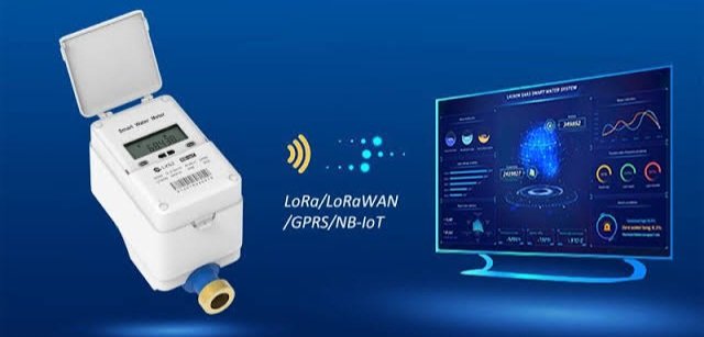
🚰 Reducing Non-Revenue Water with Smart GIS Solutions

Many utilities lose over 40% of their water due to leaks, aging infrastructure, and limited operational visibility. The result? Lost revenue, high costs, and dissatisfied customers.

At <a href="/OrionGeospatial/">Orion Terrametrics</a>, we’ve built an
Nicholas Mutethia Karuma (@mutethia_karuma) 's Twitter Profile Photo

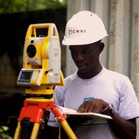
A total station is one of the most accurate optical instruments in surveying and construction, offering 1.5mm + 2ppm linear accuracy and 1" angular precision. However, the key to its accuracy lies in proper human input and maintaining the machine’s condition. For this reason, it

A total station is one of the most accurate optical instruments in surveying and construction, offering 1.5mm + 2ppm linear accuracy and 1" angular precision. However, the key to its accuracy lies in proper human input and maintaining the machine’s condition. For this reason, it
HMC (@47k254) 's Twitter Profile Photo

🌍 Accessing geospatial data in Africa has been too hard for too long. At Orion Terrametrics, we’re changing that. Soon, we launch Africa’s first unified GIS Data Platform — making spatial data searchable, accessible & ready for action. 🚀 #GIS #Africa
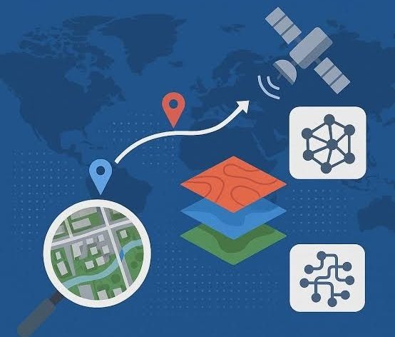
🌍 Accessing geospatial data in Africa has been too hard for too long. At <a href="/OrionGeospatial/">Orion Terrametrics</a>, we’re changing that. Soon, we launch Africa’s first unified GIS Data Platform — making spatial data searchable, accessible &amp; ready for action. 🚀 #GIS #Africa