Myanmar War Map (@myanmarwarmap) 's Twitter Profile
Myanmar War Map

@myanmarwarmap

Approximate map of Myanmar civil war
Link to map - rb.gy/8vbnhl
Disclaimer - lines of control are approximate, based on open source news reports

ID: 1777063600567259137

linkhttps://buymeacoffee.com/myanmarwarmap calendar_today07-04-2024 19:59:51

1,1K Tweet

2,2K Followers

95 Following

Myanmar War Map (@myanmarwarmap) 's Twitter Profile Photo

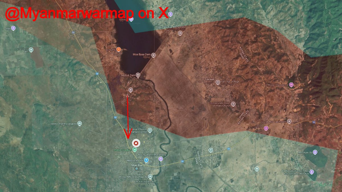
At 5am this morning, the State Administrative Council (SAC) reportedly attacked Karenni National Defence Force (KNDF) positions in the town of Moe Bye, Shan state, from the Battalion 422 base. More than 100 troops apparently took part in the battles which lasted for two hours,

At 5am this morning, the State Administrative Council (SAC) reportedly attacked Karenni National Defence Force (KNDF) positions in the town of Moe Bye, Shan state, from the Battalion 422 base. 

More than 100 troops apparently took part in the battles which lasted for two hours,
Myanmar War Map (@myanmarwarmap) 's Twitter Profile Photo

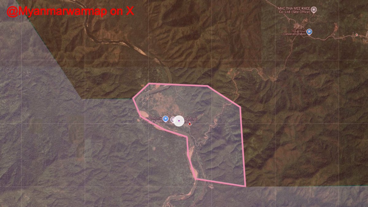
After nine days of fighting, Karen National Union (KNU) forces have captured the Htee Khee Strategic Camp in the Dawei district of Tanintharyi state near the Thai-Myanmar border. The number of casualties and seized equipment is currently unknown.

After nine days of fighting, Karen National Union (KNU) forces have captured the Htee Khee Strategic Camp in the Dawei district of Tanintharyi state near the Thai-Myanmar border. 

The number of casualties and seized equipment is currently unknown.
Myanmar War Map (@myanmarwarmap) 's Twitter Profile Photo

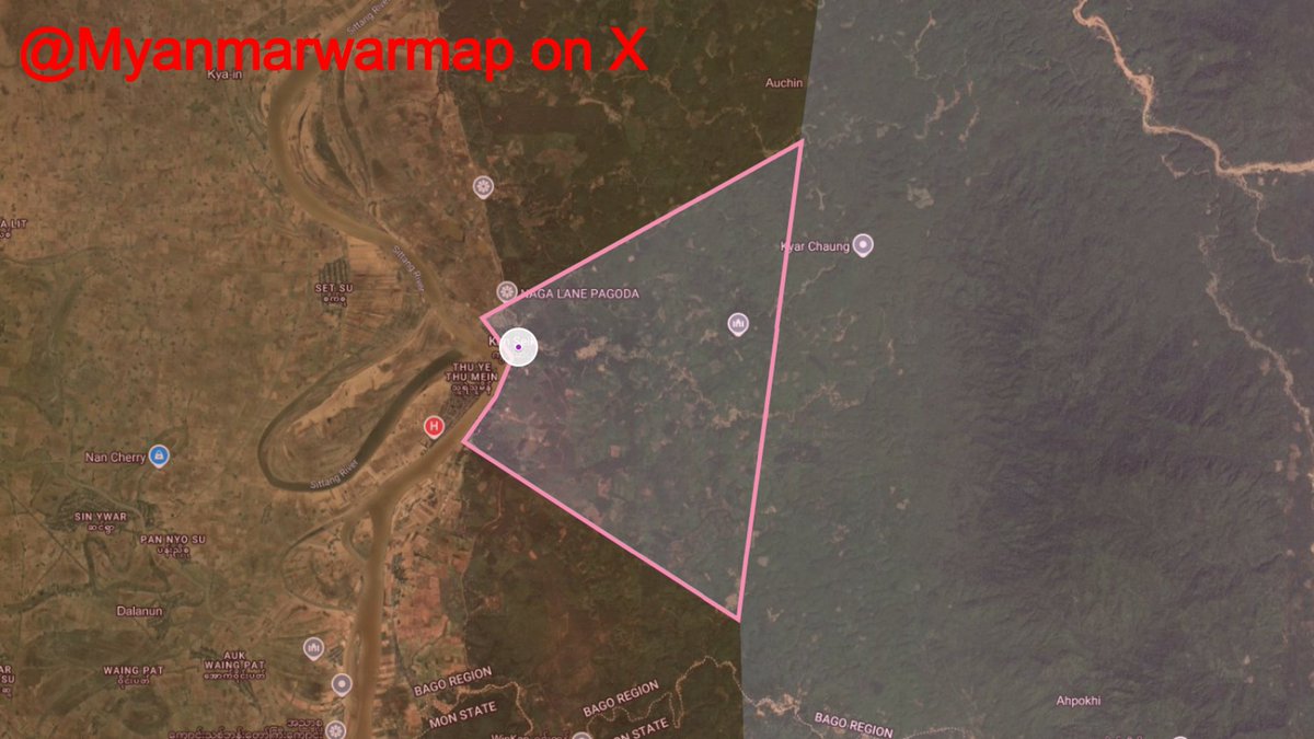
Fighters from the 3rd brigade of the Karen National Union (KNU) captured the village of Kun seik in the Shwe Kyin Township, eastern Bago State. During the battle, the State Administrative Council (SAC) launched an airstrike, forcing the remaining locals to flee. The battles

Fighters from the 3rd brigade of the Karen National Union (KNU) captured the village of Kun seik in the Shwe Kyin Township, eastern Bago State. During the battle, the State Administrative Council (SAC) launched an airstrike, forcing the remaining locals to flee. 

The battles
Myanmar War Map (@myanmarwarmap) 's Twitter Profile Photo

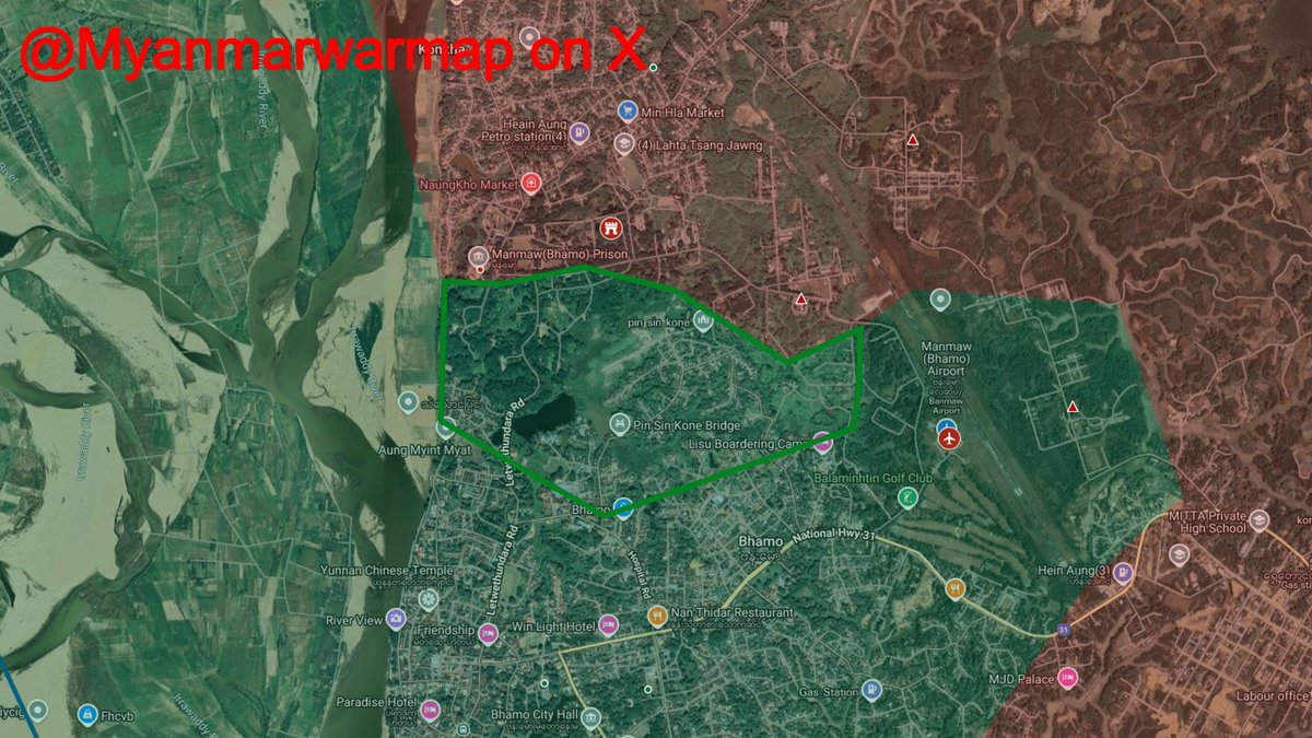
Following the end of the ceasefire between the State Administrative Council and the Kachin Independence Army (KIA), the KIA went on the offensive in the besieged city of Bhamo, Kachin State. KIA forces launched simultaneous attacks throughout the city, targeting the State

Following the end of the ceasefire between the State Administrative Council and the Kachin Independence Army (KIA), the KIA went on the offensive in the besieged city of Bhamo, Kachin State.

KIA forces launched simultaneous attacks throughout the city, targeting the State
Myanmar War Map (@myanmarwarmap) 's Twitter Profile Photo

A big thank you to AMK Mapping 🇳🇿 for trying his best to keeps things updated while I was away. Ultimately it didn't work out because of the enormous amount of work he does on other regions, but his help is still enormously appreciated.

Myanmar War Map (@myanmarwarmap) 's Twitter Profile Photo

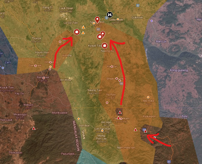
The majority of Nawnghkio is now back under SAC control after a protracted counter-attack by government forces. The first major advance, after several months of intermittent fighting, was regaining full control of the 902 Artillery Command in Taung Hkam, in March. TNLA had

The majority of Nawnghkio is now back under SAC control after a protracted counter-attack by government forces. 

The first major advance, after several months of intermittent fighting, was regaining full control of the 902 Artillery Command in Taung Hkam, in March. TNLA had
Myanmar War Map (@myanmarwarmap) 's Twitter Profile Photo

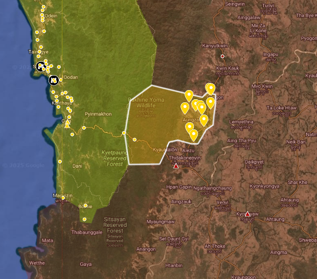
Since the capture of Gwa in December, the AA alongside local PDFs has gradually advanced into areas of neighbouring Ayeyarwady Region. They now control a ~20km stretch of the Pthein-Monywa highway, between the Artillery Battalion 344 base in Yegyi Township, and the Military

Since the capture of Gwa in December, the AA alongside local PDFs has gradually advanced into areas of neighbouring Ayeyarwady Region. 

They now control a ~20km stretch of the Pthein-Monywa highway, between the Artillery Battalion 344 base in Yegyi Township, and the Military
Myanmar War Map (@myanmarwarmap) 's Twitter Profile Photo

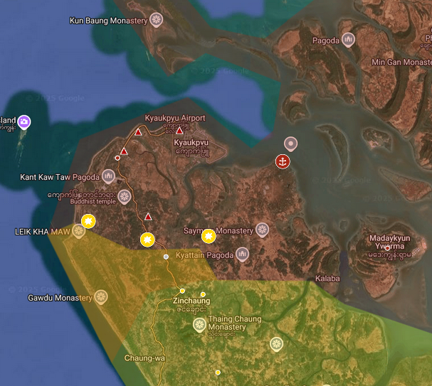
Heavy fighting has been reported in Kyaukpyu township in recent months. The fighting has been two way, with SAC attempting counterattacks after receiving significant reinforcements earlier in the year. Government forces suffered heavy casualties in these failed attacks and the

Heavy fighting has been reported in Kyaukpyu township in recent months. The fighting has been two way, with SAC attempting counterattacks after receiving significant reinforcements earlier in the year.

Government forces suffered heavy casualties in these failed attacks and the
Myanmar War Map (@myanmarwarmap) 's Twitter Profile Photo

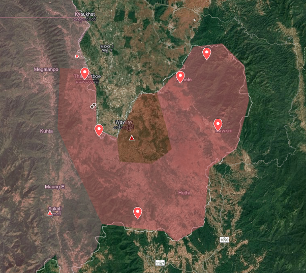
In May, KNLA captured a number of bases on the border region of Hlaingbwe township, including Kha Law Day and Tar Lay, increasing their control in this region. Over recent months, KNLA and joint forces also captured several important bases in the War Lee region, on the Thai

In May, KNLA captured a number of bases on the border region of Hlaingbwe township, including Kha Law Day and Tar Lay, increasing their control in this region.

Over recent months, KNLA and joint forces also captured several important bases in the War Lee region, on the Thai
Myanmar War Map (@myanmarwarmap) 's Twitter Profile Photo

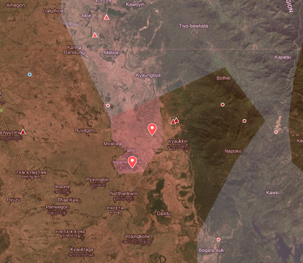
KNLA Battalion 9 and joint PDF forces captured the villages of Yin Taik Kone and La Pat in Bago region on Sunday. They are close to achieving encirclement of Kyaukkyi town and the nearby bases of Infantry Battalion 60 and Light Infantry Battalion 351. #Myanmar #Bago Map -

KNLA Battalion 9 and joint PDF forces captured the villages of Yin Taik Kone and La Pat in Bago region on Sunday. They are close to achieving encirclement of Kyaukkyi town and the nearby bases of Infantry Battalion 60 and Light Infantry Battalion 351.

#Myanmar #Bago
Map -
Myanmar War Map (@myanmarwarmap) 's Twitter Profile Photo

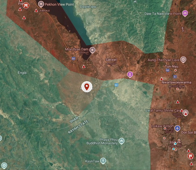
SAC forces have retaken the majority of Moe Bye town from Karenni joint forces after months of fighting. The SAC has claimed full control, however revolutionary sources state that fighting continues. #Myanmar #Kayah #Karenni Map - https:// rb.gy/8vbnhl

SAC forces have retaken the majority of Moe Bye town from Karenni joint forces after months of fighting. The SAC has claimed full control, however revolutionary sources state that fighting continues.

#Myanmar #Kayah #Karenni
Map -  https:// rb.gy/8vbnhl
Myanmar War Map (@myanmarwarmap) 's Twitter Profile Photo

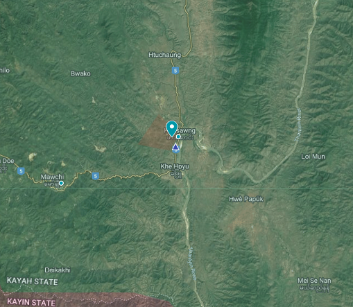
Karenni joint forces completed their capture of the Battalion 134 base in Hpasawng at the start of July, taking full control of the town. This base was under siege since the beginning of Operation 1111 in November 2023. #Myanmar #Kayah #Karenni Map - rb.gy/8vbnhl

Karenni joint forces completed their capture of the Battalion 134 base in Hpasawng at the start of July, taking full control of the town. This base was under siege since the beginning of Operation 1111 in November 2023.

#Myanmar #Kayah #Karenni
Map -  rb.gy/8vbnhl
Myanmar War Map (@myanmarwarmap) 's Twitter Profile Photo

A convoy of river boats left Mandalay on July 17th, intended to resupply and reinforce the beleaguered garrison of Bhamo. The ships came under attack multiple times en-route, with Mandalay PDF able to sink 1 boat and damage 3 more on July 23rd. On July 27th, the convoy

A convoy of river boats left Mandalay on July 17th, intended to resupply and reinforce the beleaguered garrison of Bhamo. 

The ships came under attack multiple times en-route, with Mandalay PDF able to sink 1 boat and damage 3 more on July 23rd.

On July 27th, the convoy