Michael Cruickshank (@mj_cruickshank) 's Twitter Profile
Michael Cruickshank

@mj_cruickshank

Geospatial analyst and former journalist from 🇦🇺. Currently building 'Anthropocene Analytics' - an urban critical infrastructure resilience modelling project.

ID: 2399928805

linkhttps://michaelcruickshank.me calendar_today20-03-2014 14:03:02

11,11K Tweet

8,8K Followers

4,4K Following

Michael Cruickshank (@mj_cruickshank) 's Twitter Profile Photo

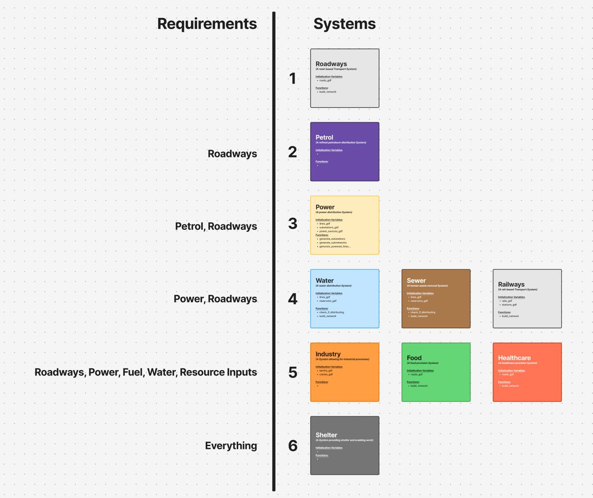
*Anthropocene Analytics Update* The prototype model now has seven critical infrastructure networks geocoded, & all interconnections/dependencies are programmed with just a few minor networks to go. The problem to solve now is: If everything depends on everything else, how do I

*Anthropocene Analytics Update*

The prototype model now has seven critical infrastructure networks geocoded, & all interconnections/dependencies are programmed with just a few minor networks to go. 

The problem to solve now is: If everything depends on everything else, how do I
Michael Cruickshank (@mj_cruickshank) 's Twitter Profile Photo

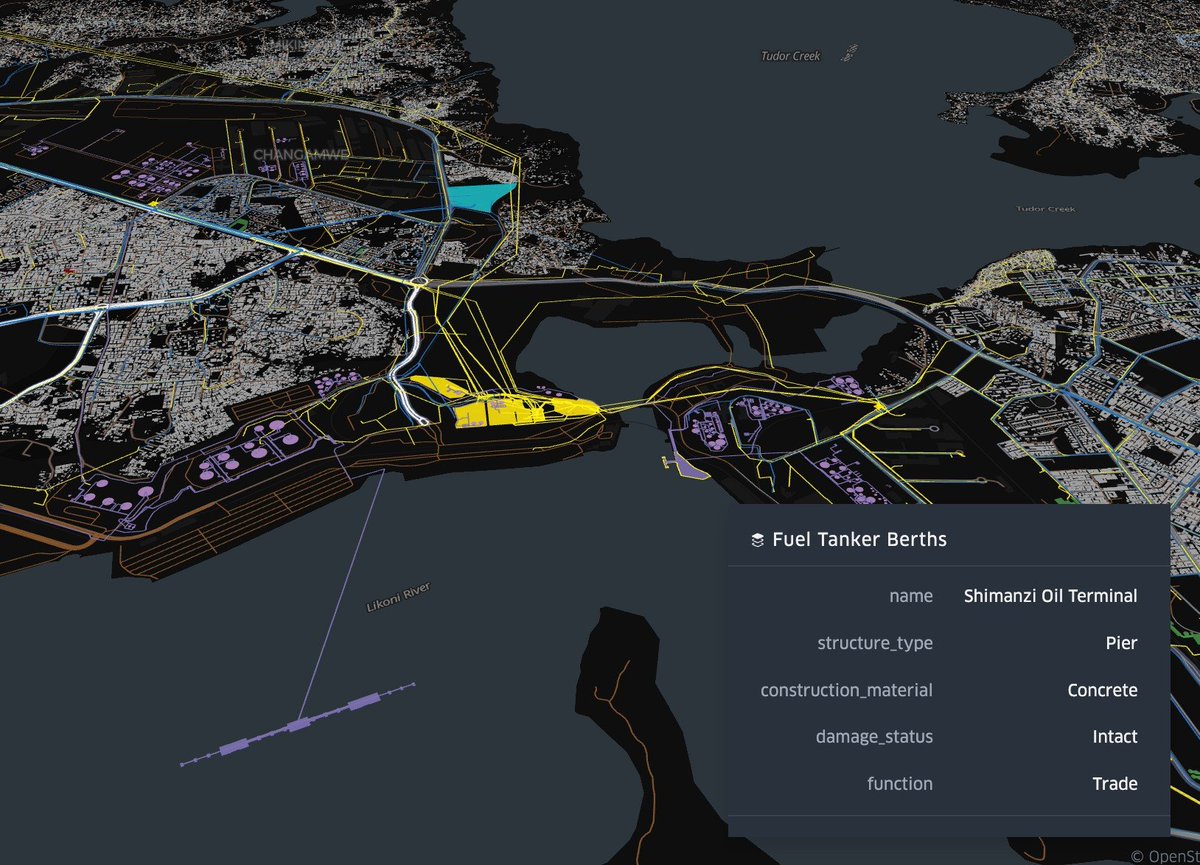
And here's some chaotic visualisation of all of the critical infrastructure systems in Mombasa (each system is a different colour). Finding/creating all of this geodata from public sources really put my OSINT skills to the test...

And here's some chaotic visualisation of all of the critical infrastructure systems in Mombasa (each system is a different colour).   

Finding/creating all of this geodata from public sources really put my OSINT skills to the test...
Michael Cruickshank (@mj_cruickshank) 's Twitter Profile Photo

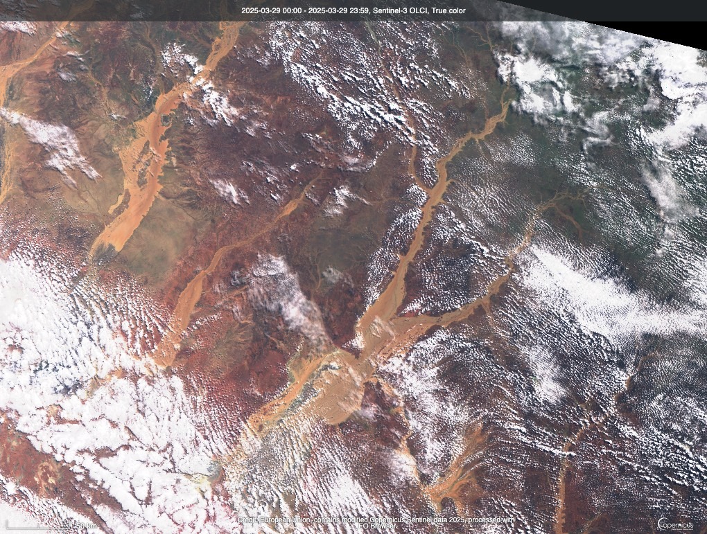
Sentinel-3 imagery of the massive flooding going on in outback Queensland. Very easy to see how some of the early explorers of the area convinced themselves that there was an inland sea that all of these rivers led to. link.dataspace.copernicus.eu/pf7b

Sentinel-3 imagery of the massive flooding going on in outback Queensland.   

Very easy to see how some of the early explorers of the area convinced themselves that there was an inland sea that all of these rivers led to.  link.dataspace.copernicus.eu/pf7b
Michael Cruickshank (@mj_cruickshank) 's Twitter Profile Photo

If anyone has read Ada Palmer's series 'Terra Ignota' and/or likes political philosophy, I will be hosting a three-part discussion group focusing on some of the political ideas in the books with Interintellect 🧭 First discussion will be on April 17: interintellect.com/salons/the-wor…

Interintellect đź§­ (@interintellect_) 's Twitter Profile Photo

In Ada Palmer’s Terra Ignota, a non-geographic nation-state challenges traditional borders. This discussion with Michael Cruickshank explores its viability and whether it can prevent inter-state conflict in the modern world. interintellect.com/salons/the-wor…

Interintellect đź§­ (@interintellect_) 's Twitter Profile Photo

Explore Ada Palmer’s Terra Ignota and the concept of the 'Non-Geographic Nation-State' in this discussion with Michael Cruickshank.  The viability of this model raises important questions about the future. interintellect.com/salons/the-wor…

Michael Cruickshank (@mj_cruickshank) 's Twitter Profile Photo

The fire caused by the RSF attack on the Zamzam IDP camp is large enough that you can see its smoke plume with the low-resolution Sentinel-3 satellite.

The fire caused by the RSF attack on the Zamzam IDP camp is large enough that you can see its smoke plume with the low-resolution Sentinel-3 satellite.
Michael Cruickshank (@mj_cruickshank) 's Twitter Profile Photo

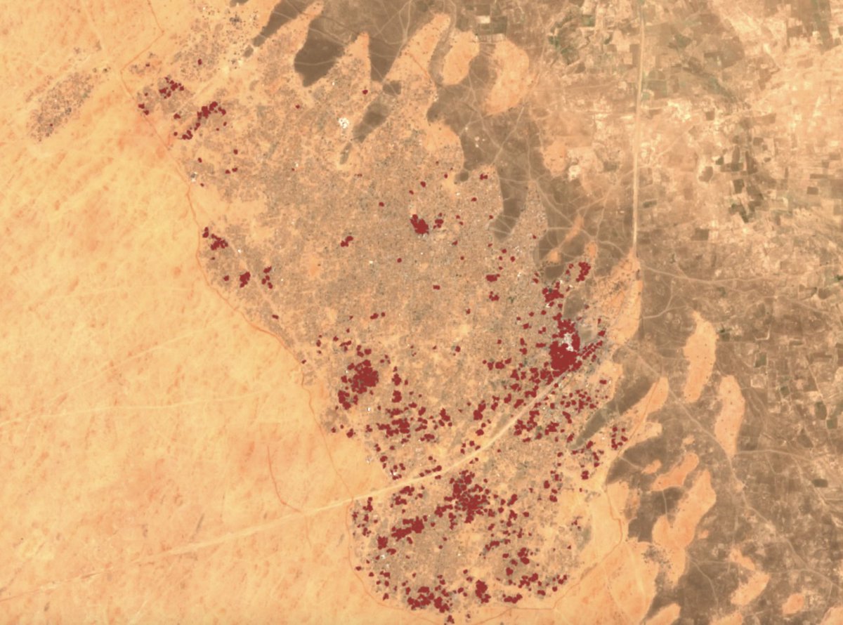
Burned Area Index analysis on Sentinel-2 imagery of the Zamzam camp in Darfur would suggest that approx. 7000 structures have been razed in the RSF attack on the camp through to 2025-04-15. This is a humanitarian catastrophe and an ongoing repeat of the 2006 genocide.

Burned Area Index analysis on Sentinel-2 imagery of the Zamzam camp in Darfur would suggest that approx. 7000 structures have been razed in the RSF attack on the camp through to 2025-04-15.   

This is a humanitarian catastrophe and an ongoing repeat of the 2006 genocide.
Michael Cruickshank (@mj_cruickshank) 's Twitter Profile Photo

The Hindenburg Disaster really did a number on humanity, that we don’t see the obvious and low tech way to reach space on high gravity planets with atmospheres…

Michael Cruickshank (@mj_cruickshank) 's Twitter Profile Photo

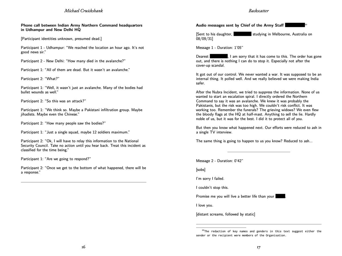
With tensions between India and Pakistan once again disturbingly high, I'd invite you to read an excerpt from my forthcoming novel (provisionally titled 'Backscatter') detailing a near-future scenario of how this could go alarmingly wrong. michaelcruickshank.me/the-subcontine…

With tensions between India and Pakistan once again disturbingly high, I'd invite you to read an excerpt from my forthcoming novel (provisionally titled 'Backscatter') detailing a near-future scenario of how this could go alarmingly wrong.

michaelcruickshank.me/the-subcontine…
Interintellect đź§­ (@interintellect_) 's Twitter Profile Photo

After centuries of peace, could humanity be more prone to war? Michael Cruickshank explores this unsettling question through Ada Palmer’s Terra Ignota in this second book club discussion.interintellect.com/salons/terra-i…

Michael Cruickshank (@mj_cruickshank) 's Twitter Profile Photo

The 2nd discussion will be on May 10, and will focus on another core philosophical idea of the series: That long-term peace causes more brutal wars when the peace invariably ends. And, if true, what does this mean for the present? interintellect.com/salons/terra-i… x.com/MJ_Cruickshank…

Michael Cruickshank (@mj_cruickshank) 's Twitter Profile Photo

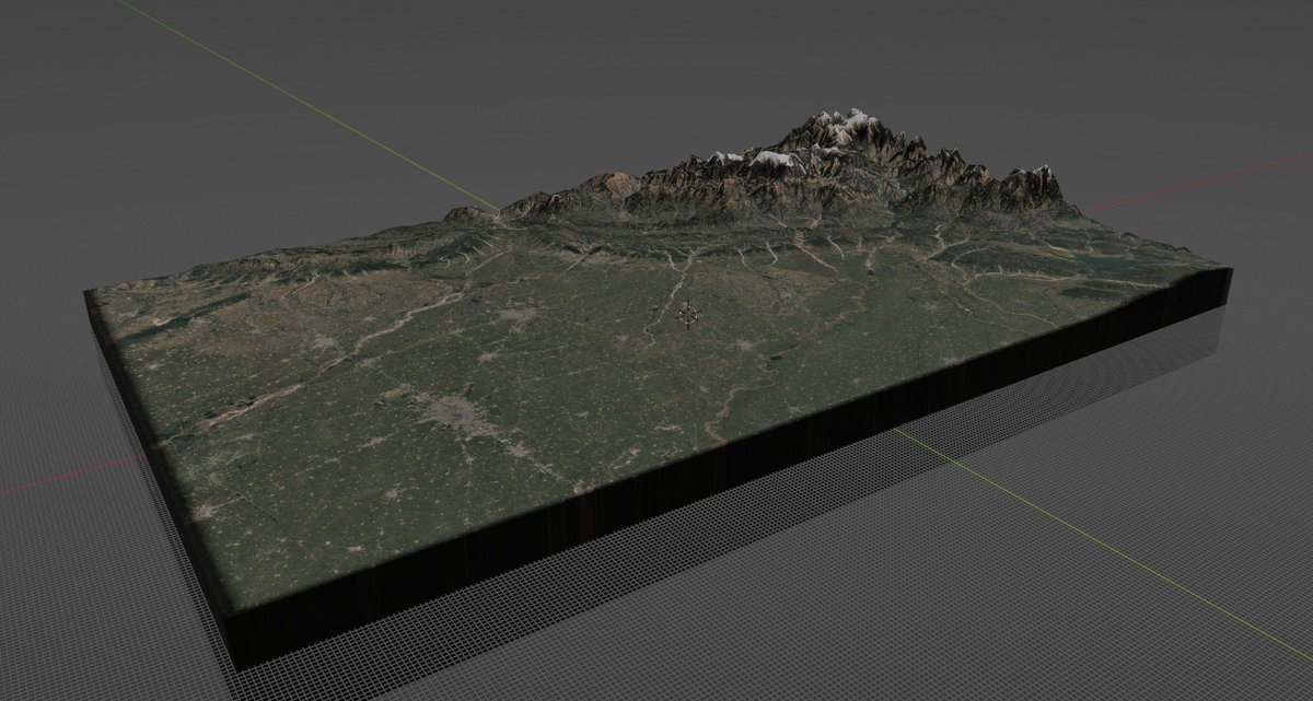
I'll leave the India-Pakistan commentary to people who are more knowledgeable, but here's a 3D map I made of the current area of fighting.

I'll leave the India-Pakistan commentary to people who are more knowledgeable, but here's a 3D map I made of the current area of fighting.
Interintellect đź§­ (@interintellect_) 's Twitter Profile Photo

TOMORROW✨ 300 years of peace. No memory of war. What happens when it all snaps? Michael Cruickshank leads a new Terra Ignota Discussion: peace, power, and the return of conflict. interintellect.com/salons/terra-i…

Michael Cruickshank (@mj_cruickshank) 's Twitter Profile Photo

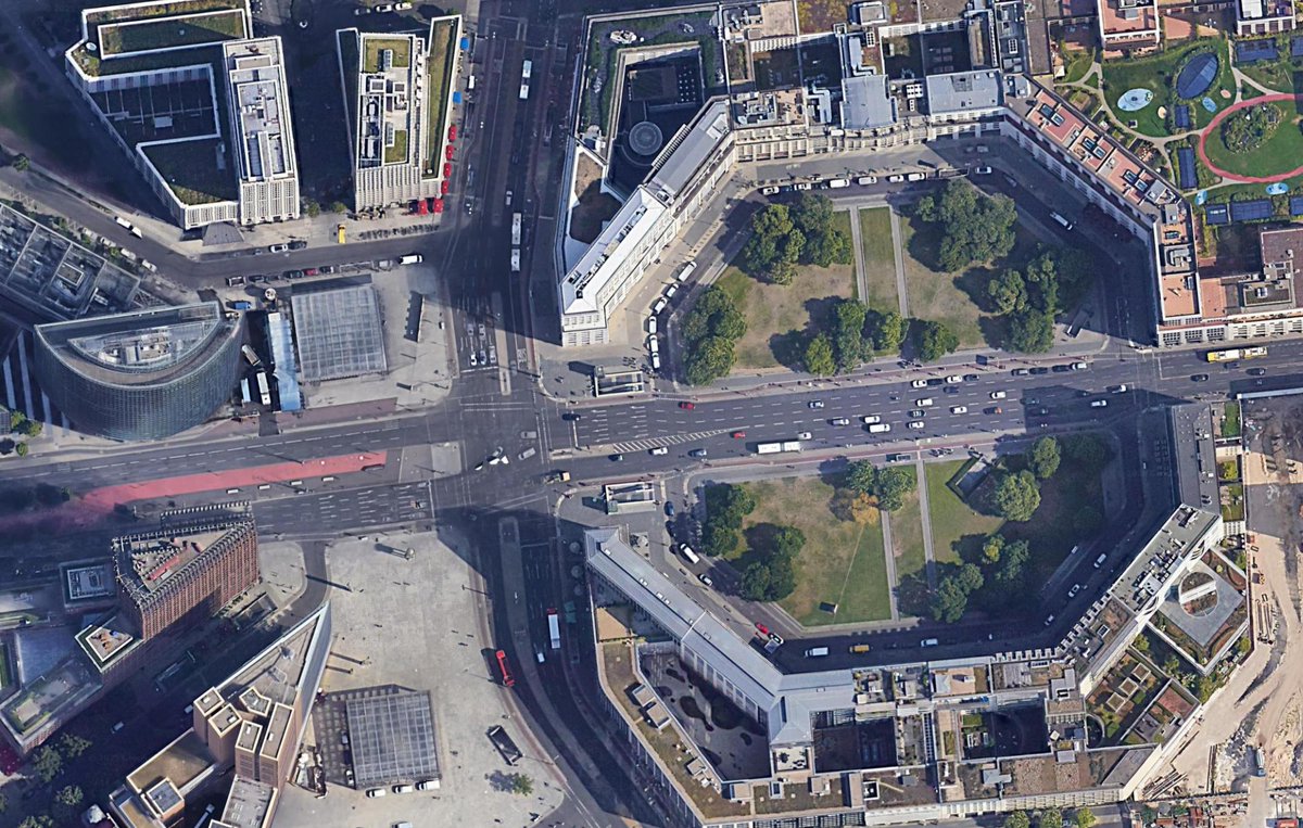
So it turns out you can use Apple's Depth Pro algorithm to take a pretty good guess at building heights in 2D satellite/aerial imagery. The main limitation is that the heights outputted are in relative units and must be scaled by objects of known height.

So it turns out you can use Apple's Depth Pro algorithm to take a pretty good guess at building heights in 2D satellite/aerial imagery. 

The main limitation is that the heights outputted are in relative units and must be scaled by objects of known height.