Mike Hamernik (@mikehamernik) 's Twitter Profile
Mike Hamernik

@mikehamernik

Born & raised in Chicago on the shores of Lake Michigan. Breaking Weather. Travel. Meteorologist for WGN-TV, WGN720.

ID: 44270952

linkhttps://m.facebook.com/Mike-Hamernik-1417212315182866/ calendar_today03-06-2009 02:26:13

30,30K Tweet

8,8K Followers

2,2K Following

Mike Hamernik (@mikehamernik) 's Twitter Profile Photo

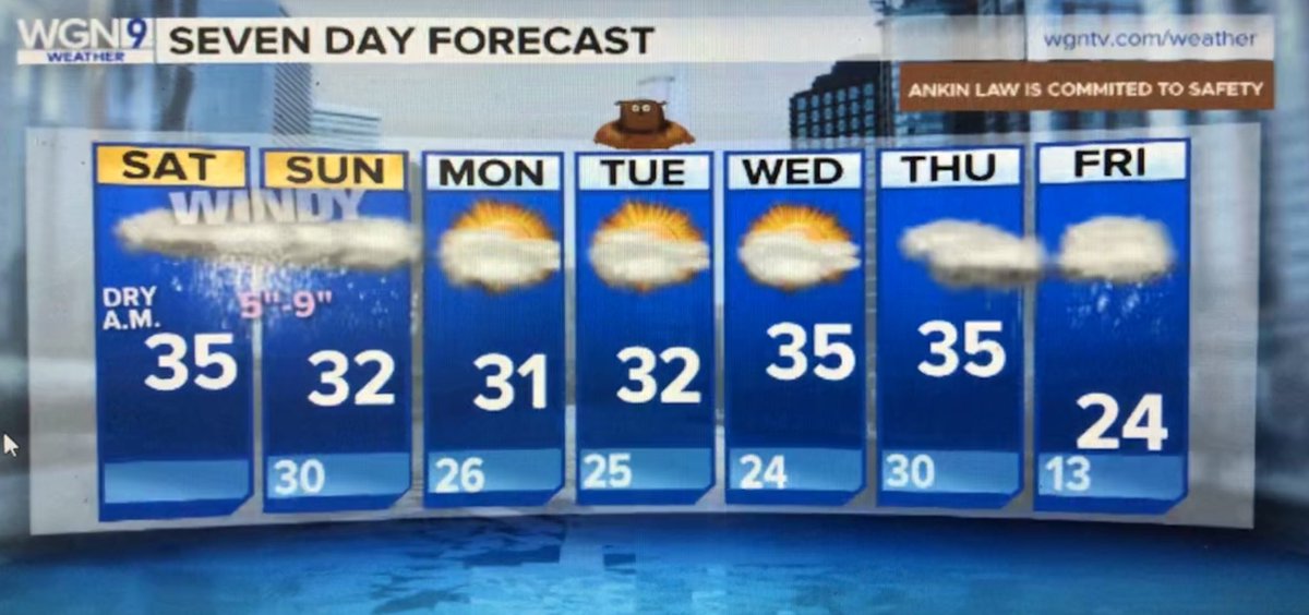
2PM Storm Update: Long duration snowfall tonight into Tuesday. Slight drop in expected metro snow totals to 4”-7”, although locally higher numbers (8”-9”) downwind of the lake (10-20% of the area) are still possible.

2PM Storm Update:   Long duration snowfall tonight into Tuesday.  

Slight drop in expected metro snow totals to 4”-7”, although locally higher numbers (8”-9”) downwind of the lake (10-20% of the area) are still possible.
Mike Hamernik (@mikehamernik) 's Twitter Profile Photo

11AM Storm Update: -Precipitation ETA remains 3-6PM. -Heaviest snow (1”-2” per hour) is expected between 6PM-Midnight. -Keep any travel tonight very local as road crews will struggle to keep up with snowfall rates (avoid expressways) -Storm totals 5”-9” by Sun Eve.

11AM Storm Update:  

-Precipitation ETA remains 3-6PM.   

-Heaviest snow (1”-2” per hour) is expected between 6PM-Midnight. 

-Keep any travel tonight very local as road crews will struggle to keep up with snowfall rates (avoid expressways)

-Storm totals 5”-9” by Sun Eve.
Mike Hamernik (@mikehamernik) 's Twitter Profile Photo

Winter Storm Warning continues until 6PM. Additional accumulation this afternoon & evening: -Up to 3” downwind of the lake (Cook, Will, Lake-IN) -Around 1” or less elsewhere

Winter Storm Warning continues until 6PM.  Additional accumulation this afternoon & evening: 

-Up to 3” downwind of the lake (Cook, Will, Lake-IN)

-Around 1” or less elsewhere
Nick Ulivieri (@chiphotoguy) 's Twitter Profile Photo

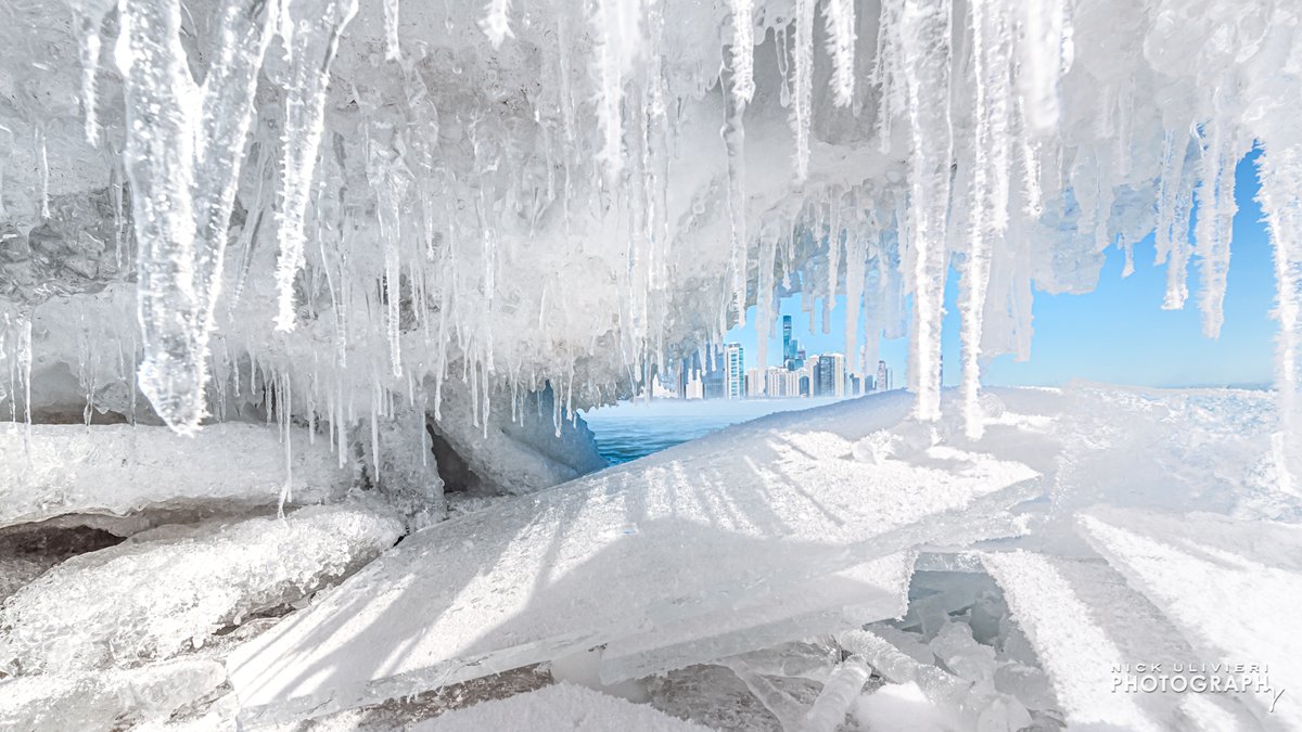
I made this boomerang-esque clip last night from 24 still frames to illustrate the rolling waves churning with ice 🧊🧊

Mike Hamernik (@mikehamernik) 's Twitter Profile Photo

1:47PM: Heavy Snow Squall that brought some traffic to a temporary standstill in central Chicago will be moving out over Lake Michigan by 2PM.

Mike Hamernik (@mikehamernik) 's Twitter Profile Photo

3:12PM Radar Check: New round of snow squalls rolling in. Not quite unite as intense as the one that hit central Chicago earlier this P.M. Note the thundersnow near Bloomington. ⚡️

IDOT_Illinois (@idot_illinois) 's Twitter Profile Photo

Per IllinoisStatePolice, roads have deteriorated and travel is hazardous. Please limit your travel if you can. #DontCrowdThePlow Road conditions as of 6:55 pm via gettingaroundillinois.com/WinterConditio….

Per <a href="/ILStatePolice/">IllinoisStatePolice</a>, roads have deteriorated and travel is hazardous. Please limit your travel if you can. #DontCrowdThePlow 

Road conditions as of 6:55 pm via gettingaroundillinois.com/WinterConditio….
Mike Janssen (@mikejanssenwx) 's Twitter Profile Photo

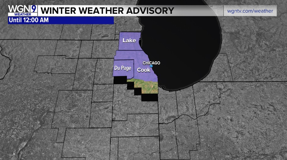
A Winter Weather Advisory is in effect until 12AM for the purple highlighted counties. Lake effect #snow, heavy at times, could produce localized 2-4" snowfall accumulations. Plan on slick roads & reduced visibility. WGN TV News WGNTV #Chicago #ilwx

A Winter Weather Advisory is in effect until 12AM for the purple highlighted counties. Lake effect #snow, heavy at times, could produce localized 2-4" snowfall accumulations. Plan on slick roads &amp; reduced visibility. <a href="/WGNNews/">WGN TV News</a> <a href="/WGNTV/">WGNTV</a>  #Chicago #ilwx
Mike Janssen (@mikejanssenwx) 's Twitter Profile Photo

We can see on radar there is a band of lake effect #snow in Evanston. We can use the Northwestern WeatherBug camera along the Lake Michigan shoreline to see what it looks like inside that snow band. NWS Chicago Mike Hamernik WGN TV News WGNTV #ilwx

We can see on radar there is a band of lake effect #snow in Evanston. We can use the <a href="/NorthwesternU/">Northwestern</a> <a href="/WeatherBug/">WeatherBug</a> camera along the Lake Michigan shoreline to see what it looks like inside that snow band. <a href="/NWSChicago/">NWS Chicago</a> <a href="/MikeHamernik/">Mike Hamernik</a> <a href="/WGNNews/">WGN TV News</a> <a href="/WGNTV/">WGNTV</a> #ilwx
Bill Snyder (@billyweather) 's Twitter Profile Photo

NO ARCTIC OUTBREAKS at least the next 2 weeks! Highly regarded European model suggests a warm open to March. Climatology supports this notion. Average date of first occurring 50°+ day is January 27th (we're overdue), first 60°+ day March 1. #ilwx WGN TV News

NO ARCTIC OUTBREAKS  at least the next 2 weeks! Highly regarded European model suggests a warm open to March. Climatology supports this notion. Average date of first occurring 50°+ day is January 27th (we're overdue), first 60°+ day March 1. #ilwx <a href="/WGNNews/">WGN TV News</a>
WGNTV (@wgntv) 's Twitter Profile Photo

WAY TO GO, @SKILLING! Writes our Tom: "One year ago, I weighed in at 292 pounds. This morning I’m at 172 pounds! Not only that but my diabetes is gone, my cholesterol is the lowest it’s ever been and the doctors are thrilled—so am I!"

WAY TO GO, @SKILLING!

Writes our Tom: "One year ago, I weighed in at 292 pounds. This morning I’m at 172 pounds! Not only that but my diabetes is gone, my cholesterol is the lowest it’s ever been and the doctors are thrilled—so am I!"