WxManMichael
@mikegouldrick
ID: 1897808935
23-09-2013 16:34:14
4,4K Tweet
615 Followers
492 Following
 's Twitter Profile Photo")
 's Twitter Profile Photo")
 on Twitter photo I haven't shared our estimate of the Northern Hemisphere snowfall anomalies all winter but here it is for winter 2024/25. Big winners - Japan, coastal Alaska, Great Lakes, Eastern Canada and in general higher latitudes and altitudes. Notable mention, parts of the Southeastern US.")
 on Twitter photo Scattered thunderstorms still expected to develop this afternoon and evening. Potential for severe storms still exists. I agree with the storm prediction center’s discussion. Keep an eye to the southwest sky this afternoon and evening.")
 on Twitter photo Flood watch for counties in green late afternoon and evening. Poor drainage in urban areas as well as flash flooding possible later today. Never drive across a flooded road way.")
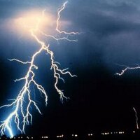
 on Twitter photo OMG?! What is that?")
 's Twitter Profile Photo")
 on Twitter photo \"Good news, everyone!\" - Professor Hubert J. Farnsworth
From the vantage point of the STEREO Ahead spacecraft, it appears that this significant CME is clearly headed towards Earth.")
 on Twitter photo Beautiful day for March 31st !")
 's Twitter Profile Photo")
 on Twitter photo BREAKING: Widespread auroral displays possible in the northern/central U.S. and much of Europe!
NOAA is now forecasting a *SEVERE* geomagnetic storm – reaching G4 level on the 1 through 5 scale – on June 2. That corresponds with Sunday night/Monday morning U.S. time.")
 on Twitter photo Feeling I live north of the Arctic circle and spring is just arriving……")
@mikegouldrick
ID: 1897808935
23-09-2013 16:34:14
4,4K Tweet
615 Followers
492 Following