David Paul (@metdavidpaul) 's Twitter Profile
David Paul

@metdavidpaul

Chief Meteorologist at WTVY-TV in Dothan, AL, continuing my life-long passion for weather. B.S. Degree in Meteorology from Northern Illinois University.

ID: 1378499550

linkhttp://wtvy.com calendar_today25-04-2013 02:59:11

12,12K Tweet

1,1K Followers

343 Following

David Paul (@metdavidpaul) 's Twitter Profile Photo

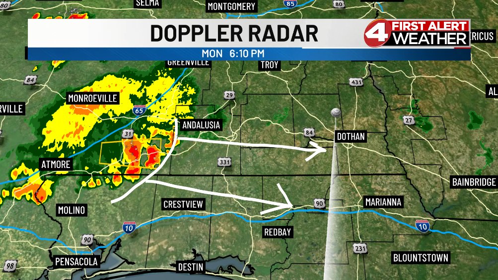
We'll see more showers and thunderstorms move through the Wiregrass Monday evening, especially areas across far South Alabama and into the Florida Panhandle. Gusty winds and small hail will be possible with the strongest storms. Remain weather-aware!

We'll see more showers and thunderstorms move through the Wiregrass Monday evening, especially areas across far South Alabama and into the Florida Panhandle. Gusty winds and small hail will be possible with the strongest storms. Remain weather-aware!
David Paul (@metdavidpaul) 's Twitter Profile Photo

We're seeing some subtle changes in the tropics as a couple tropical waves move off the coast of Africa and into the Atlantic. Development is very unlikely, though, as the waves are near a big plume of Saharan dust. This dust will continue spreading westward over the next several

We're seeing some subtle changes in the tropics as a couple tropical waves move off the coast of Africa and into the Atlantic. Development is very unlikely, though, as the waves are near a big plume of Saharan dust. This dust will continue spreading westward over the next several
David Paul (@metdavidpaul) 's Twitter Profile Photo

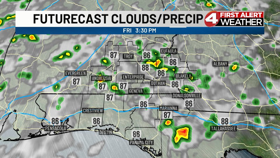
Little will change in our weather pattern over the coming days. Daily pop-up showers and thunderstorms will be with us Thursday and Friday and through the weekend. The activity will be scattered, though. Some spots may see some rain everyday, while other spots will miss out. If

Little will change in our weather pattern over the coming days. Daily pop-up showers and thunderstorms will be with us Thursday and Friday and through the weekend. The activity will be scattered, though. Some spots may see some rain everyday, while other spots will miss out. If
David Paul (@metdavidpaul) 's Twitter Profile Photo

On this date in 1998 I saw my first tornado. I was working weekends at KTVO-TV in Kirksville, MO. I had worked from 2 pm Saturday until 7 am Sunday solo, tracking severe thunderstorms. I went home to grab a little sleep, knowing another spoke of energy from an upper-level low

On this date in 1998 I saw my first tornado. I was working weekends at KTVO-TV in Kirksville, MO. I had worked from 2 pm Saturday until 7 am Sunday solo, tracking severe thunderstorms. I went home to grab a little sleep, knowing another spoke of energy from an upper-level low
David Paul (@metdavidpaul) 's Twitter Profile Photo

I’m excited to share we have another special guest coming your way on Weather Extra Tuesday evening at 10 pm! Our hurricane chaser Scott Jankowski Scott Jankowski is heading to Mexico for the landfall of Erick, expected to be a hurricane as it comes ashore Wednesday night, east of
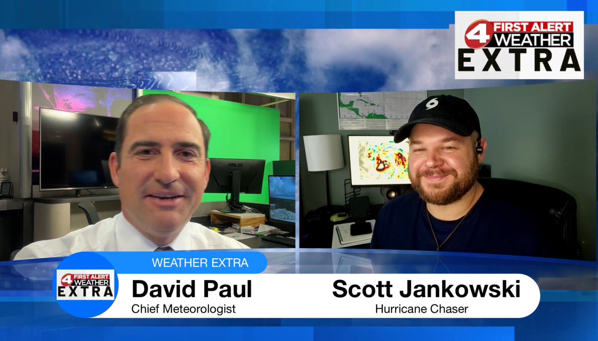
I’m excited to share we have another special guest coming your way on Weather Extra Tuesday evening at 10 pm! Our hurricane chaser Scott Jankowski <a href="/EyewallAddict/">Scott Jankowski</a> is heading to Mexico for the landfall of Erick, expected to be a hurricane as it comes ashore Wednesday night, east of
David Paul (@metdavidpaul) 's Twitter Profile Photo

Deep moisture flowing in from the Gulf is helping to produce more pop-up showers and thunderstorms on Tuesday. We'll see similar weather for Wednesday and Thursday, before the coverage drops on Friday and we turn hotter.

Deep moisture flowing in from the Gulf is helping to produce more pop-up showers and thunderstorms on Tuesday. We'll see similar weather for Wednesday and Thursday, before the coverage drops on Friday and we turn hotter.
David Paul (@metdavidpaul) 's Twitter Profile Photo

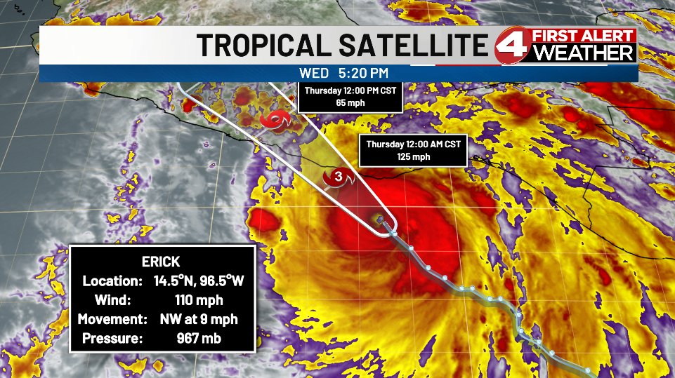
The Atlantic Basin is tranquil, but the Eastern Pacific Hurricane Basin is active! Hurricane Erick has a well-defined eye Wednesday afternoon as it moves to the NW. Landfall will occur early Thursday morning over Mexico, likely as a major hurricane.

The Atlantic Basin is tranquil, but the Eastern Pacific Hurricane Basin is active! Hurricane Erick has a well-defined eye Wednesday afternoon as it moves to the NW. Landfall will occur early Thursday morning over Mexico, likely as a major hurricane.
David Paul (@metdavidpaul) 's Twitter Profile Photo

What a shot by Kayla Elizabeth on Wednesday! A beautiful view of lightning spreading across the sky over Enterprise, AL. Wow!

What a shot by Kayla Elizabeth on Wednesday! A beautiful view of lightning spreading across the sky over Enterprise, AL. Wow!
David Paul (@metdavidpaul) 's Twitter Profile Photo

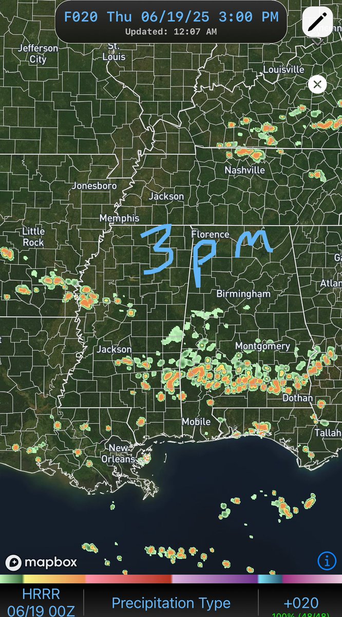
Midnight view of the developing showers and thunderstorms that look to roll across the Wiregrass later Thursday afternoon. We could see some heavy downpours and gusty winds, so don’t forget the rain gear!

Midnight view of the developing showers and thunderstorms that look to roll across the Wiregrass later Thursday afternoon. We could see some heavy downpours and gusty winds, so don’t forget the rain gear!
David Paul (@metdavidpaul) 's Twitter Profile Photo

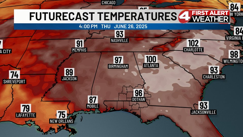
The biggest weather story to track over the next week is the progression of a ridge of high pressure from the far Southwest US Thursday afternoon, to the Mid-Atlantic by next Thursday. The result will be a massive dome of hot air building across the eastern half of the country

The biggest weather story to track over the next week is the progression of a ridge of high pressure from the far Southwest US Thursday afternoon, to the Mid-Atlantic by next Thursday. The result will be a massive dome of hot air building across the eastern half of the country
David Paul (@metdavidpaul) 's Twitter Profile Photo

Did you catch my interview earlier this week with seasonal hurricane forecaster Dr. Phil Klotzbach (Philip Klotzbach) of Colorado State University? If not, have a listen! Hurricane season is tranquil so far, but we all know that will change over the months ahead.

David Paul (@metdavidpaul) 's Twitter Profile Photo

There looks to be an uptick in rain chances Saturday with isolated pop-up PM showers and thunderstorms. Before any rain forms we’ll be hot, with highs reaching the lower 90s.

There looks to be an uptick in rain chances Saturday with isolated pop-up PM showers and thunderstorms. Before any rain forms we’ll be hot, with highs reaching the lower 90s.
David Paul (@metdavidpaul) 's Twitter Profile Photo

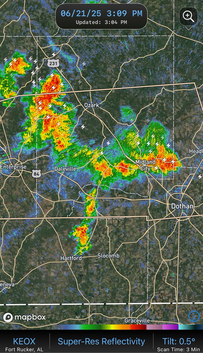
Radar check at 3:10 pm Saturday. Locally heavy downpours with a few showers and thunderstorms. The activity is slowly drifting southward as it develops. This rain will end early this evening.

Radar check at 3:10 pm Saturday. Locally heavy downpours with a few showers and thunderstorms. The activity is slowly drifting southward as it develops. This rain will end early this evening.
David Paul (@metdavidpaul) 's Twitter Profile Photo

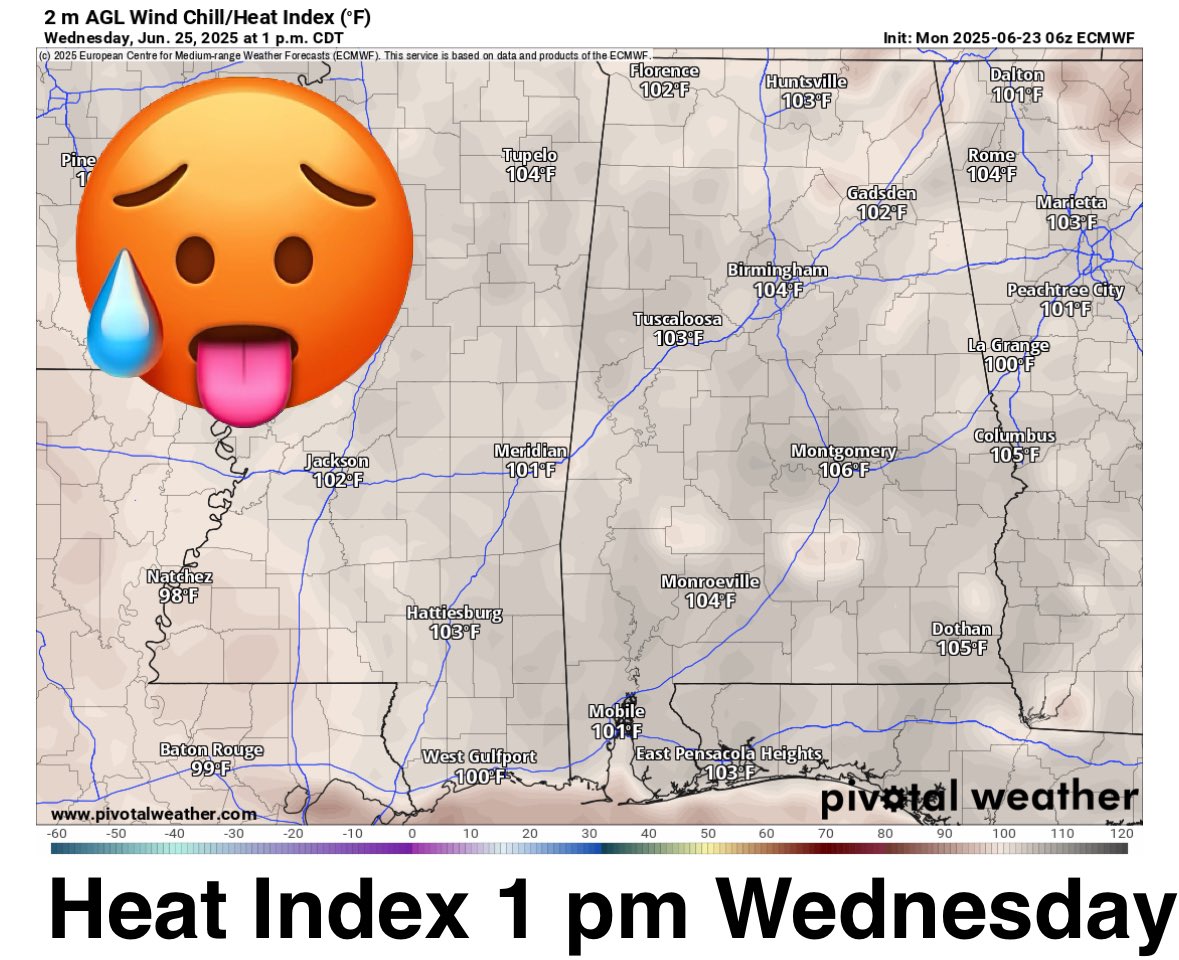
The heat builds this week and peaks around Wednesday when the heat index will top 105° in spots. Might want to plan some indoor activities if you can!

The heat builds this week and peaks around Wednesday when the heat index will top 105° in spots. Might want to plan some indoor activities if you can!
David Paul (@metdavidpaul) 's Twitter Profile Photo

We're tracking two big weather stories for this week. First, the heat, which will peak on Wednesday with highs in the middle to upper 90s and heat indices around 105°. Look for some relief later in the week as energy moves in aloft from the east. There could be a round of showers

We're tracking two big weather stories for this week. First, the heat, which will peak on Wednesday with highs in the middle to upper 90s and heat indices around 105°. Look for some relief later in the week as energy moves in aloft from the east. There could be a round of showers
David Paul (@metdavidpaul) 's Twitter Profile Photo

So far so good this hurricane season. A non-tropical low pressure system is spinning over the North Atlantic Monday afternoon. There is no deep convection around the center, so subtropical or tropical development is not occurring. This system should weaken as it moves to the

So far so good this hurricane season. A non-tropical low pressure system is spinning over the North Atlantic Monday afternoon. There is no deep convection around the center, so subtropical or tropical development is not occurring. This system should weaken as it moves to the