Brian May (@mapnut) 's Twitter Profile
Brian May

@mapnut

Interested in all things geospatial, guitar and fishing. Founder of MapWise - providing GIS and property data for all of Florida for Real Estate professionals.

ID: 1263189836

linkhttp://www.mapwise.com calendar_today13-03-2013 00:17:08

272 Tweet

71 Followers

325 Following

Philip Klotzbach (@philklotzbach) 's Twitter Profile Photo

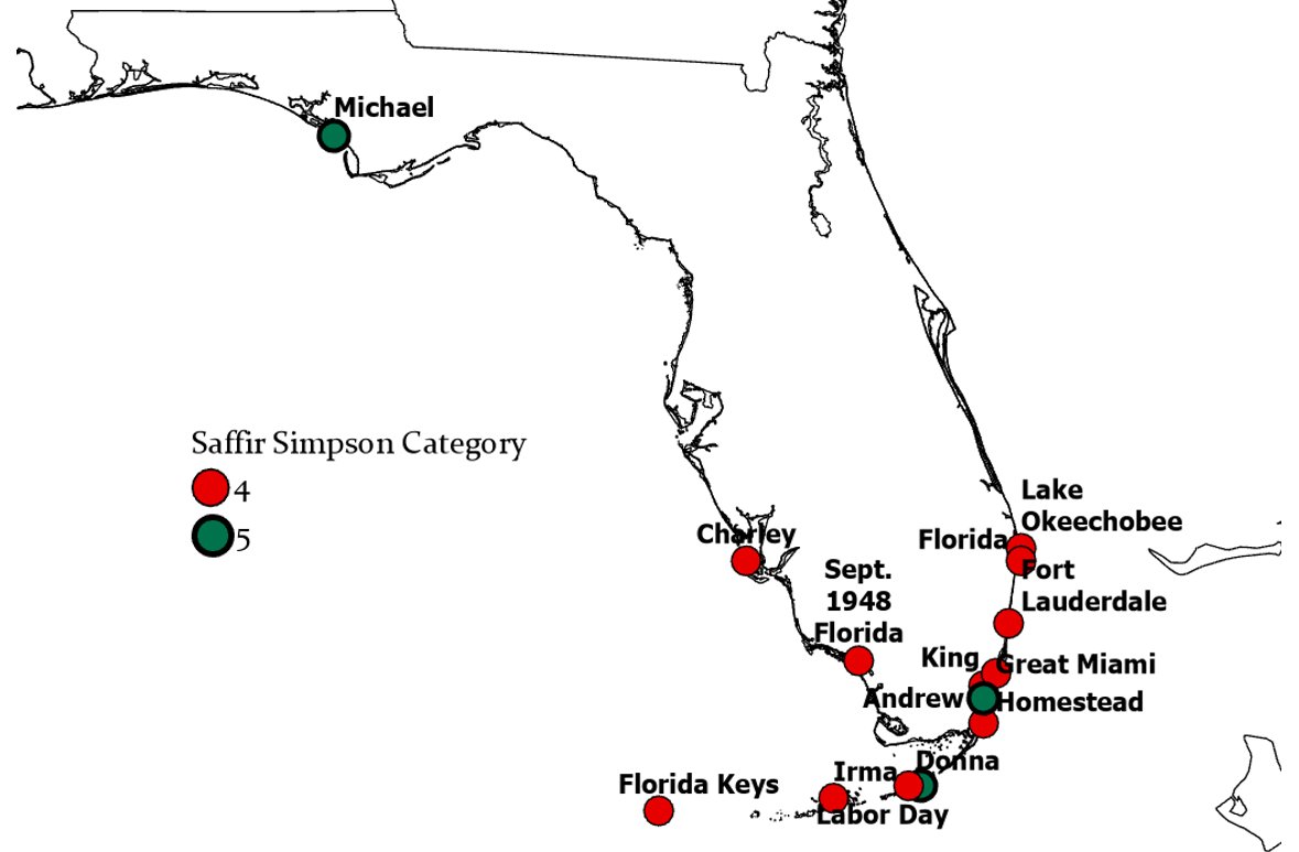
Landfall location of all 14 Category 4-5 #hurricanes to make landfall in Florida on record. Unfortunately, we're going to be adding another dot to this map shortly. #HurricaneIan

Landfall location of all 14 Category 4-5 #hurricanes to make landfall in Florida on record. Unfortunately, we're going to be adding another dot to this map shortly. #HurricaneIan
Philip Klotzbach (@philklotzbach) 's Twitter Profile Photo

#HurricaneIan ranks in a tie for 4th with Charley (2004) and Florida Keys (1919) for the strongest #hurricanes by maximum sustained wind (150 mph) to make landfall in Florida on record. Table shows all 15 Category 4-5 hurricanes to make landfall in Florida on record.

#HurricaneIan ranks in a tie for 4th with Charley (2004) and Florida Keys (1919) for the strongest #hurricanes by maximum sustained wind (150 mph) to make landfall in Florida on record. Table shows all 15 Category 4-5 hurricanes to make landfall in Florida on record.
Alex Cordero (@alexcorderowx) 's Twitter Profile Photo

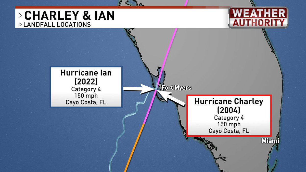
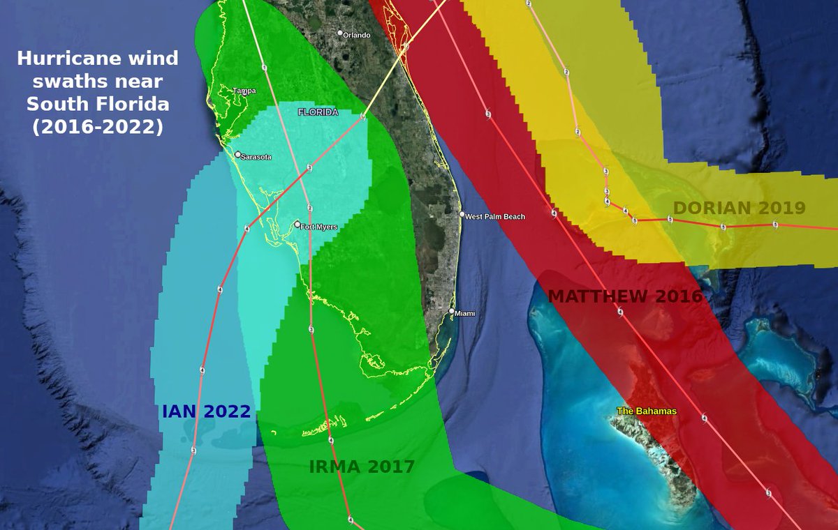
#Ian and Charley may differ in size and impact, but this stat is uncanny: They both made landfall at the same spot with maximum winds identical.

#Ian and Charley may differ in size and impact, but this stat is uncanny:

They both made landfall at the same spot with maximum winds identical.
Mike Seidel (@mikeseidel) 's Twitter Profile Photo

We were in the eye wall of Cat. 4 #Hurricane #Ian for over 5 hours and the back side was the worst. I haven't experienced anything close to this in over 30 years The Weather Channel

NOAA Marine/Aviation (@noaa_omao) 's Twitter Profile Photo

#HurricaneIan made for a rough ride during a NOAA WP-3D #Kermit #HurricaneHunter flight into the storm this morning. Head to noaa.gov/Ian for the latest storm forecasts, maps, and information. Video: Nick Underwood/NOAA

Parker Branton (@parkerbranton) 's Twitter Profile Photo

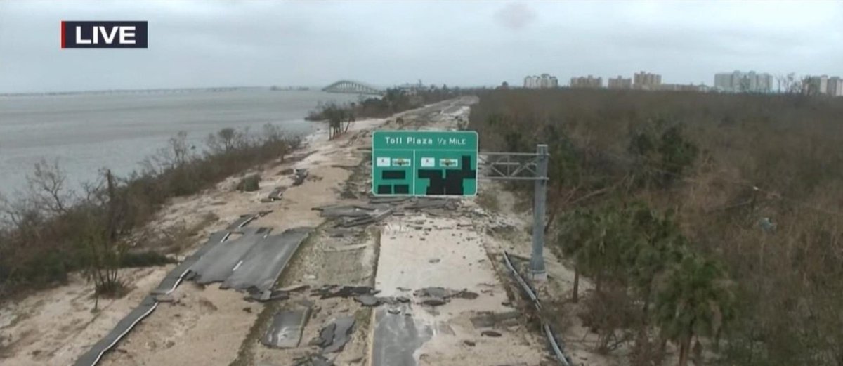
Aerial footage showing some of the destruction in Ft Myers… bridges are washed away and streets flooded. #HurricaneIan local10.com/weather/hurric…

Evan Fisher (@efisherwx) 's Twitter Profile Photo

Aerial imagery of Fort Myers Beach is now available and I'm out of words to describe the devastation. If you're still looking for updates on a home in the area, this imagery is a good place to start. Here, see what little remains of Gulfview Colony... 🔗 storms.ngs.noaa.gov/storms/ian/ind…


Stu Ostro (@stuostro) 's Twitter Profile Photo

Mesmerizing, suspenseful satellite imagery of the life of #Ian From tropical wave to catastrophic to post-tropical #weather #meteorology

Reed Timmer, PhD (@reedtimmerusa) 's Twitter Profile Photo

Severe river flooding with slow motion disaster from Ian along the Peace River in Arcadia today on boat with local delivering supplies to communities cutoff by the record-breaking flooding. The river crested above 27’. Please support Peace River Canoe Outpost for canoe tours

Brian Emfinger (@brianemfinger) 's Twitter Profile Photo

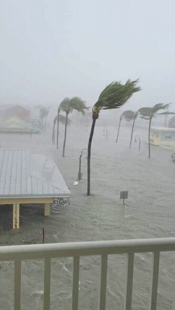
A look at the downtown area of Fort Myers Beach Florida. There used to be many more businesses here than there are now with some whole buildings just wiped away. Most notably to me is the debris that was washed onto the roof of the ice cream/pizza place. #HurricanIan #Florida

Jim Dickey (@wxdickey) 's Twitter Profile Photo

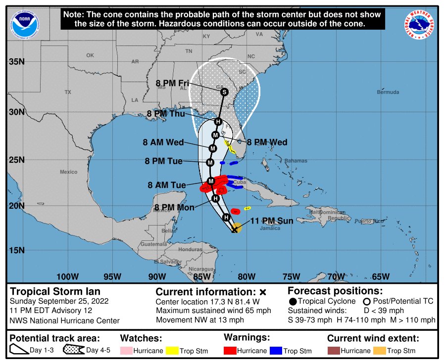
Here is the NHCs 'cone of concern' forecast from Sunday evening at 11 PM. You can see, coastal Lee County is very much in it. A storm surge watch went into effect for the entire SWFL coastline with this advisory. Evacuation for Lee County wasn't announced until Tuesday morning.

Here is the NHCs 'cone of concern' forecast from Sunday evening at 11 PM. You can see, coastal Lee County is very much in it. A storm surge watch went into effect for the entire SWFL coastline with this advisory.

Evacuation for Lee County wasn't announced until Tuesday morning.