Tom Armitage (@mapnav_tom) 's Twitter Profile
Tom Armitage

@mapnav_tom

Data Viz, Maps & GIS. Tech Writer for MapTiler. FOSS4G UK 2019 Co-Chair. Honorary Fellow of the University of Edinburgh GeoSciences. Views are all mine.

ID: 381118369

calendar_today27-09-2011 19:35:55

23,23K Tweet

2,2K Takipçi

823 Takip Edilen

MapTiler (@maptiler) 's Twitter Profile Photo

Forward and reverse geocoding can now have separate configuration options. For example, you can include POIs in reverse geocoding while keeping them out of forward geocoding search results. Learn more in the first comment.

MapTiler (@maptiler) 's Twitter Profile Photo

Today is #WorldOceanDay, and we encourage everyone to visit Weltwassertag to find out what you can do to take action and support the movement to protect our oceans! Find out more at: maptiler.link/4dRfWiI

Today is #WorldOceanDay, and we encourage everyone to visit <a href="/WorldOceanDay/">Weltwassertag</a> to find out what you can do to take action and support the movement to protect our oceans!  Find out more at:  maptiler.link/4dRfWiI
MapTiler (@maptiler) 's Twitter Profile Photo

Explore satellite maps of Luxembourg with stunning 2023 aerial imagery at a 10 cm/px resolution. From the historic Abbey of Echternach to the vibrant streets of Luxembourg City, see unparalleled detail in every pixel. Dive into the map: maptiler.link/3FJaVvO

Explore satellite maps of Luxembourg with stunning 2023 aerial imagery at a 10 cm/px resolution. From the historic Abbey of Echternach to the vibrant streets of Luxembourg City, see unparalleled detail in every pixel.

Dive into the map: maptiler.link/3FJaVvO
MapTiler (@maptiler) 's Twitter Profile Photo

Watch Rob Smith from Away Team Software explain the new OGC standard Web Video Map Tracks (WebVMT) for synchronizing location with video for the web. Check the video at maptiler.link/4dUYud2
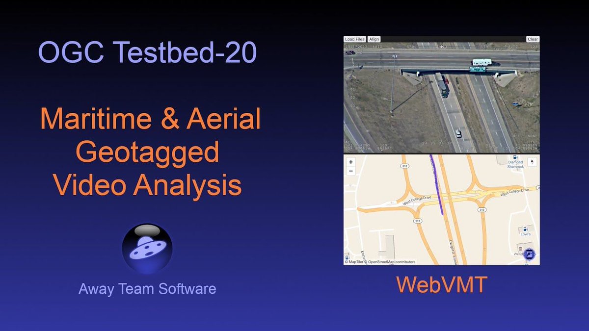
Watch Rob Smith from <a href="/away_team/">Away Team Software</a> explain the new OGC standard Web Video Map Tracks (WebVMT) for synchronizing location with video for the web. Check the video at maptiler.link/4dUYud2
Ordnance Survey (@ordnancesurvey) 's Twitter Profile Photo

We are thrilled to announce that Principal Geospatial Consultant, Duncan Moss has been awarded an OBE in the King's Birthday Honours! 🏅 This prestigious recognition highlights Duncan's outstanding contributions to geospatial data and mapping. 👏 ow.ly/r8Sb50Wa6RV

We are thrilled to announce that Principal Geospatial Consultant, Duncan Moss has been awarded an OBE in the King's Birthday Honours! 🏅

This prestigious recognition highlights Duncan's outstanding contributions to geospatial data and mapping. 👏

ow.ly/r8Sb50Wa6RV
MapTiler (@maptiler) 's Twitter Profile Photo

Show detailed architectural or civil engineering meshes & point clouds on maps. The MapTiler #3D module handles multiple complex models, helping users visualize the scale and location of the structures. Check out this code sample: maptiler.link/43dVHHd

Kyle Walker (@kyle_e_walker) 's Twitter Profile Photo

If you need a professional basemap for your MapLibre maps, MapTiler is an excellent option. Choose from a range of dataviz-optimized styles, many of which include light, dark, and pastel variants. In #rstats {mapgl}: use the `maptiler_style()` function for streamlined access!

If you need a professional basemap for your <a href="/maplibre/">MapLibre</a> maps, <a href="/MapTiler/">MapTiler</a> is an excellent option.

Choose from a range of dataviz-optimized styles, many of which include light, dark, and pastel variants.

In #rstats {mapgl}: use the `maptiler_style()` function for streamlined access!
MapTiler (@maptiler) 's Twitter Profile Photo

The new satellite map for central Germany features stunning 20 cm/px aerial imagery! Zoom in to Frankfurt, Cologne, Bonn, Mainz, Saarbrücken, Erfurt, and more—now visible in crisp detail thanks to aerial updates from 2022–2024. Start your journey with the link in the 1st reply.

MapTiler (@maptiler) 's Twitter Profile Photo

Use the power of maps to add context to your video stories. @Jayasim's captivating crime series on YouTube brings each case to life by showing where it all happened. MapTiler maps are used to guide the viewer! See how maps elevate the narrative: maptiler.link/4jZJWdJ

Use the power of maps to add context to your video stories. @Jayasim's captivating crime series on YouTube brings each case to life by showing where it all happened. MapTiler maps are used to guide the viewer!

See how maps elevate the narrative: maptiler.link/4jZJWdJ
Quintin Lake (@quintinlake) 's Twitter Profile Photo

Allt a’Mhuilinn and the north face of Ben Nevis 🏴󠁧󠁢󠁳󠁣󠁴󠁿 A full-page opener introducing the South #Inverness-shire chapter of #ThePerimeterBook Order here 👉 amzn.eu/d/3pWJtK6

Allt a’Mhuilinn and the north face of Ben Nevis 🏴󠁧󠁢󠁳󠁣󠁴󠁿

A full-page opener introducing the South #Inverness-shire chapter of #ThePerimeterBook Order here 👉 amzn.eu/d/3pWJtK6
MapTiler (@maptiler) 's Twitter Profile Photo

1/2 We’re sending a team to “Run the Woods” this weekend! Naturally, we used our #map skills to get ahead and developed an app to plan how we’ll run the course. You can use it too, we wouldn't want to have an unfair advantage! maptiler.link/3T2R1z7 #BehejLesy

1/2 We’re sending a team to “Run the Woods” this weekend! Naturally, we used our #map skills to get ahead and developed an app to plan how we’ll run the course. You can use it too, we wouldn't want to have an unfair advantage! maptiler.link/3T2R1z7
#BehejLesy
MapTiler (@maptiler) 's Twitter Profile Photo

Have a look at the enhanced coastlines on our Landscape #map style! We’ve introduced our land gradient layer, created by our expert cartographers, to give you the highest quality basemaps. Find out more at: maptiler.link/4kNMsEz

Have a look at the enhanced coastlines on our Landscape #map style!  We’ve introduced our land gradient layer, created by our expert cartographers, to give you the highest quality basemaps. Find out more at:  maptiler.link/4kNMsEz
MapTiler (@maptiler) 's Twitter Profile Photo

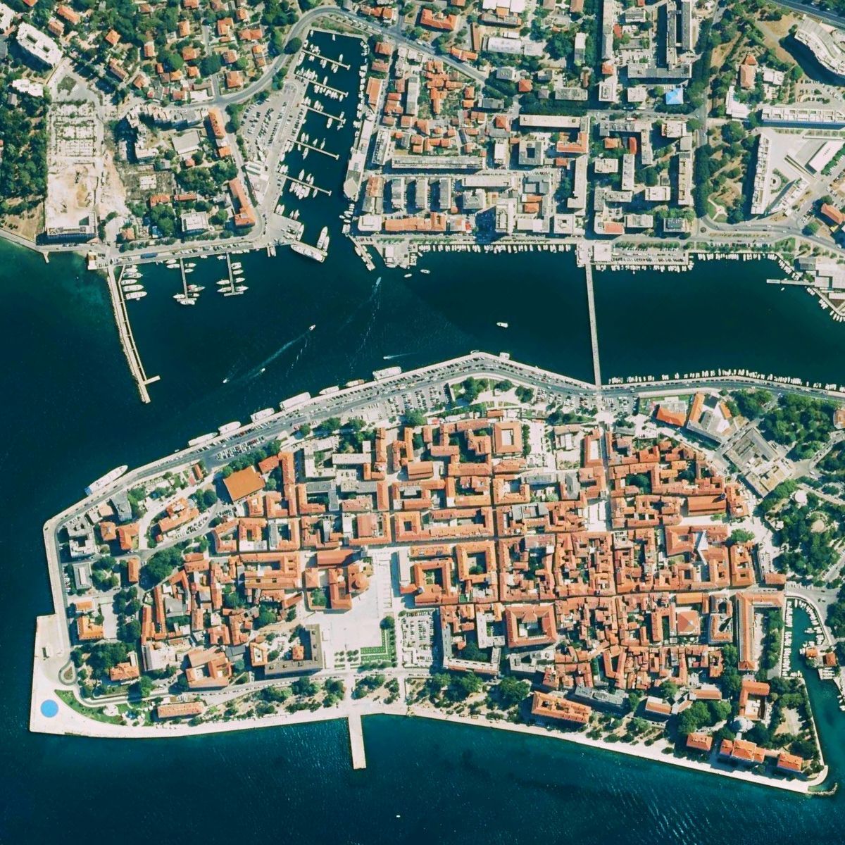
Aerial imagery of Croatia at 50 cm/px resolution lets you explore the Adriatic coast in remarkable detail. Stroll through the streets of Dubrovnik, uncover the Roman ruins of Pula, or take in the historic charm of Zadar from a bird’s-eye view. See it at maptiler.link/4mThOf3

Aerial imagery of Croatia at 50 cm/px resolution lets you explore the Adriatic coast in remarkable detail. Stroll through the streets of Dubrovnik, uncover the Roman ruins of Pula, or take in the historic charm of Zadar from a bird’s-eye view. See it at maptiler.link/4mThOf3
Quintin Lake (@quintinlake) 's Twitter Profile Photo

Keiss Castle, built in the sixteenth century 🏴󠁧󠁢󠁳󠁣󠁴󠁿 A full-page opener introducing the #Caithness chapter of #ThePerimeterBook Order here 👉 amzn.eu/d/3pWJtK6

Keiss Castle, built in the sixteenth century 🏴󠁧󠁢󠁳󠁣󠁴󠁿

A full-page opener introducing the #Caithness chapter of #ThePerimeterBook Order here 👉 amzn.eu/d/3pWJtK6
MapTiler (@maptiler) 's Twitter Profile Photo

Maps for #DataVisualisation: Our #Dataviz map style highlights the data you put on top. It’s simple, elegant, and ideal for dashboards. Available in color, light, and dark variants! Find out more: maptiler.link/3T0fB3A

MapTiler (@maptiler) 's Twitter Profile Photo

We have been truly inspired by Jimmy Pelletier’s World Tour! 🧡 An extraordinary challenge, an inspiring cause, and an athlete with an exceptional journey. We’re honored to be part of this adventure and to cheer Jimmy on in his mission of inclusion and personal achievement.

We have been truly inspired by Jimmy Pelletier’s World Tour! 🧡 An extraordinary challenge, an inspiring cause, and an athlete with an exceptional journey. We’re honored to be part of this adventure and to cheer Jimmy on in his mission of inclusion and personal achievement.
MapTiler (@maptiler) 's Twitter Profile Photo

Explore Canada’s 10 biggest cities — from Ottawa and Edmonton to Vancouver — with stunning 7.5 cm/px resolution aerial imagery. See the vibrant streets and cityscapes like never before. Check it out yourself at maptiler.link/4n5v4gA

Explore Canada’s 10 biggest cities — from Ottawa and Edmonton to Vancouver — with stunning 7.5 cm/px resolution aerial imagery. See the vibrant streets and cityscapes like never before. Check it out yourself at maptiler.link/4n5v4gA
MapTiler (@maptiler) 's Twitter Profile Photo

For #maps that exude quality, add a hand-drawn hillshade layer with just a few clicks! Follow this guide: maptiler.link/3FIZjZR

For #maps that exude quality, add a hand-drawn hillshade layer with just a few clicks!  Follow this guide: maptiler.link/3FIZjZR