LocateIT_KE (@locateit_ke) 's Twitter Profile
LocateIT_KE

@locateit_ke

A #Geo-ICT company offering unmatched cutting-edge #Space technologies & #Geomatics driven products, services & solutions #EO #EarthObservation #GIS #Geospatial

ID: 943465253546930177

calendar_today20-12-2017 12:56:59

436 Tweet

888 Followers

656 Following
UNOSAT (@unosat) 's Twitter Profile Photo

New map showing satellite-detected water extent over Garissa City #Kenya as observed from a #Sentinel-2 imagery: 🔹~45 km² of lands appear to be affected 🔹~6,500 buildings are identified as affected by the floods ▶️unosat.org/products/3759

New map showing satellite-detected water extent over Garissa City #Kenya as observed from a #Sentinel-2 imagery:      

🔹~45 km² of lands appear to be affected 
🔹~6,500 buildings are identified as affected by the floods

▶️unosat.org/products/3759
RCMRD GMES project (@rcmrd_gmes) 's Twitter Profile Photo

Aboubakar Nair highlights Consortia Service delivery: 'RCMRD GMES project in collaboration with LocateIT_KE is developing the coastal geomorphology maps from high-res images. Our collaborative effort will also develop coastal trend mapping and analysis utilizing ESA data'. #GMESforum
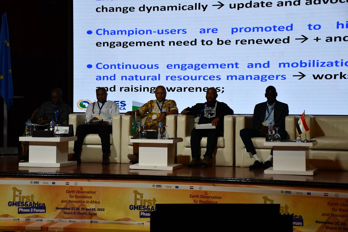
Aboubakar Nair highlights Consortia Service delivery: '<a href="/RCMRD_GMES/">RCMRD GMES project</a> in collaboration with <a href="/LocateIT_KE/">LocateIT_KE</a> is developing the coastal geomorphology maps from high-res images. Our collaborative effort will also develop coastal trend mapping and analysis utilizing ESA data'.  #GMESforum
World Meteorological Organization (@wmo) 's Twitter Profile Photo

2023 is set to be the warmest year on record! 🔴 Greenhouse gas levels continue to increase 🔴 Record sea surface temperatures and sea level rise 🔴 Record low Antarctic sea ice The WMO provisional #StateOfClimate report informs negotiations at #COP28: ow.ly/vPUK50Qcmih

EMMANUEL KIPNGETICH (@kip__emmanuel) 's Twitter Profile Photo

Exploring the dynamic duo: #CapacityBuilding lays the foundation, and #CapacityTransfer completes the cycle, turning knowledge into action. 🔄💡 Grateful for the transformative journey! #Empowerment #SkillsTransfer RCMRD 🇰🇪 🇺🇬 🇸🇴 🇹🇿 🇲🇼 🇰🇲 🇿🇲 🇱🇸 🇸🇿 LocateIT_KE David Ongo Kaino✨ 2022 vs2023
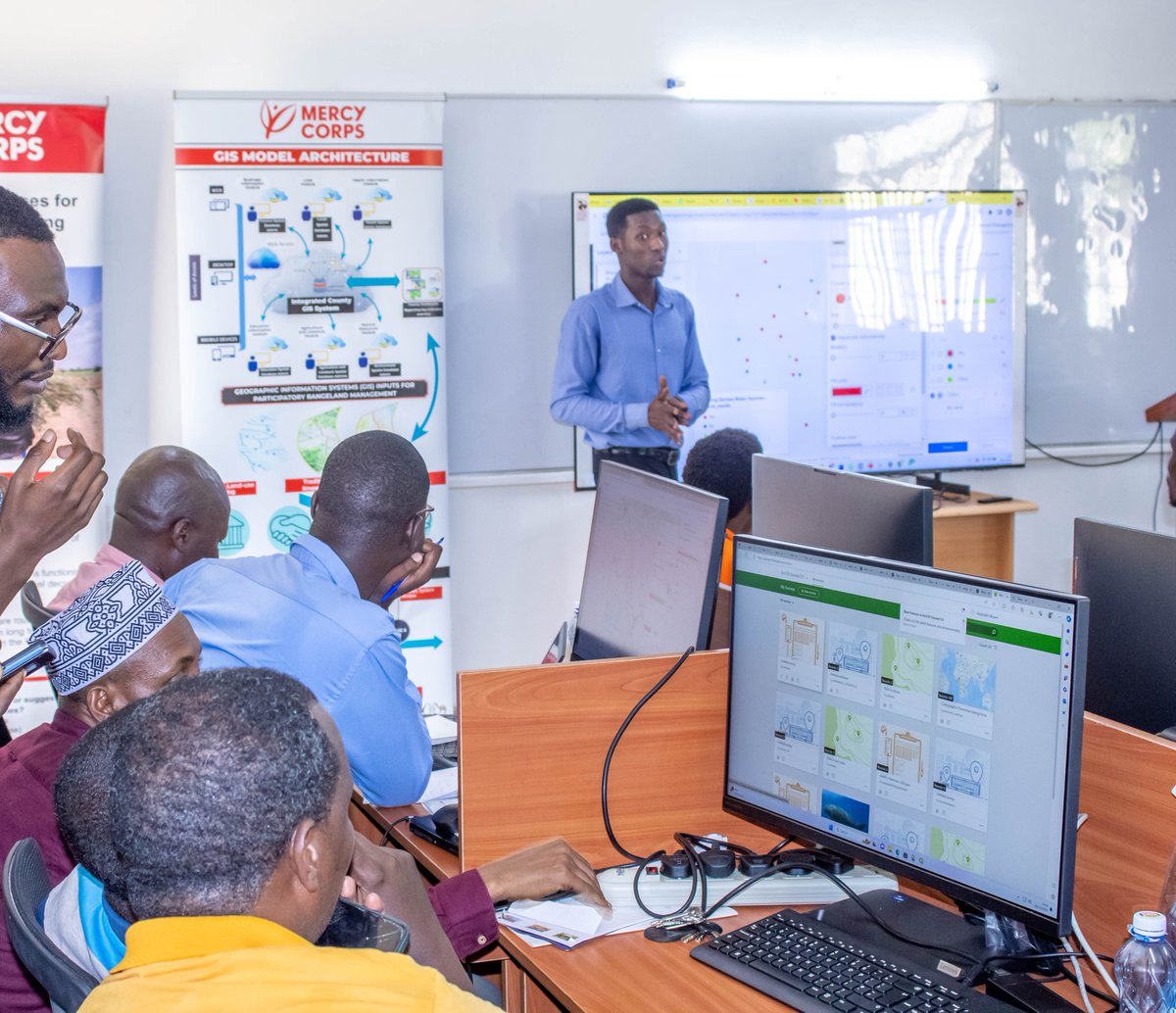
Exploring the dynamic duo: #CapacityBuilding lays the foundation, and #CapacityTransfer completes the cycle, turning knowledge into action. 🔄💡 Grateful for the transformative journey!  #Empowerment #SkillsTransfer  <a href="/RCMRD_/">RCMRD 🇰🇪 🇺🇬 🇸🇴 🇹🇿 🇲🇼 🇰🇲 🇿🇲 🇱🇸 🇸🇿</a>  <a href="/LocateIT_KE/">LocateIT_KE</a> <a href="/David_OngoN/">David Ongo</a> <a href="/FlorineKaino4/">Kaino✨</a>  2022 vs2023
GMES, and Africa (@gmesafrica) 's Twitter Profile Photo

COMING SOON. REGISTRATION OPENED !! Coastal zone management is one of the flagship themes for GMES and Africa, and for good reasons: 1) Africa's coastline is about 30,000 km long, the second longest in the world after Asia. 2) 38 African countries have a maritime border, i.e.

RCMRD GMES project (@rcmrd_gmes) 's Twitter Profile Photo

It's today! Coastal Geomorphology Mapping and Shoreline Change Analysis Online Training is starting today at 2:00pm EAT. This training will equip you with skills in utilizing advanced environmental monitoring tools; QGIS plugin and Dashboards. Login:us06web.zoom.us/meeting/regist…

It's today!
Coastal Geomorphology Mapping and Shoreline  Change Analysis Online Training is starting today at 2:00pm EAT.

This training will equip you with skills in utilizing advanced environmental monitoring tools; QGIS plugin and Dashboards.
Login:us06web.zoom.us/meeting/regist…
LocateIT_KE (@locateit_ke) 's Twitter Profile Photo

Please join us starting today at 2:00pm EAT for a training on Coastal Geomorphology Mapping and Shoreline Change Analysis hosted by RCMRD 🇰🇪 🇺🇬 🇸🇴 🇹🇿 🇲🇼 🇰🇲 🇿🇲 🇱🇸 🇸🇿 in partnership with LocateIT. The registration link is found here: us06web.zoom.us/meeting/regist…
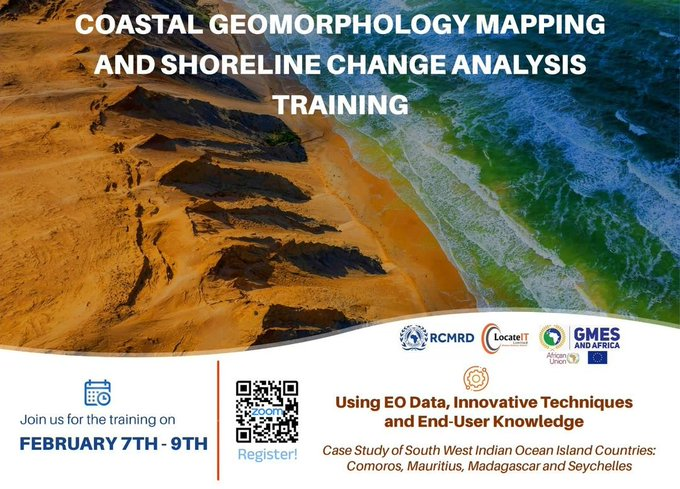
Please join us starting today at 2:00pm EAT for a training on Coastal Geomorphology Mapping and Shoreline Change Analysis hosted by <a href="/RCMRD_/">RCMRD 🇰🇪 🇺🇬 🇸🇴 🇹🇿 🇲🇼 🇰🇲 🇿🇲 🇱🇸 🇸🇿</a>  in partnership with LocateIT. The registration link is found here:           us06web.zoom.us/meeting/regist…
LocateIT_KE (@locateit_ke) 's Twitter Profile Photo

🌊Explore the intricacies of Coastal Erosion Monitoring in Indian Ocean Island Countries. Today marked the start of our 3-day training in partnership with RCMRD GMES project Hundreds joined us virtually to explore coastal erosion dynamics. Join us tomorrow for Shoreline Analysis📉

🌊Explore the intricacies of Coastal Erosion Monitoring in Indian Ocean Island Countries. Today marked the start of our 3-day training in partnership with <a href="/RCMRD_GMES/">RCMRD GMES project</a>  Hundreds joined us virtually to explore coastal erosion dynamics. Join us tomorrow for Shoreline Analysis📉
LocateIT_KE (@locateit_ke) 's Twitter Profile Photo

5-years on and it still feels just like yesterday. There's not a day that goes by without us thinking of you Erick Khamala Your spirit and timeless philosophy on life still continues to be our guiding light. Dearly loved & missed by your family, colleagues, friends & mentees!!!
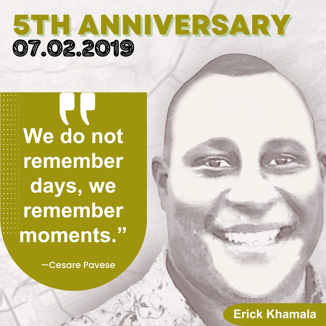
5-years on and it still feels just like yesterday. There's not a day that goes by without us thinking of you <a href="/Erick_Khamala/">Erick Khamala</a> Your spirit and timeless philosophy on life still continues to be our guiding light. Dearly loved &amp; missed by your family, colleagues, friends &amp; mentees!!!
RCMRD GMES project (@rcmrd_gmes) 's Twitter Profile Photo

Day 1 of Coastal Geomorphology Mapping and Shoreline Change Analysis Online Training done! Over 295 participants joined us Join us again today for Day 2 at the same time! Login:us06web.zoom.us/meeting/regist… LocateIT_KE GMES, and Africa GMES&Africa MARCOSIO
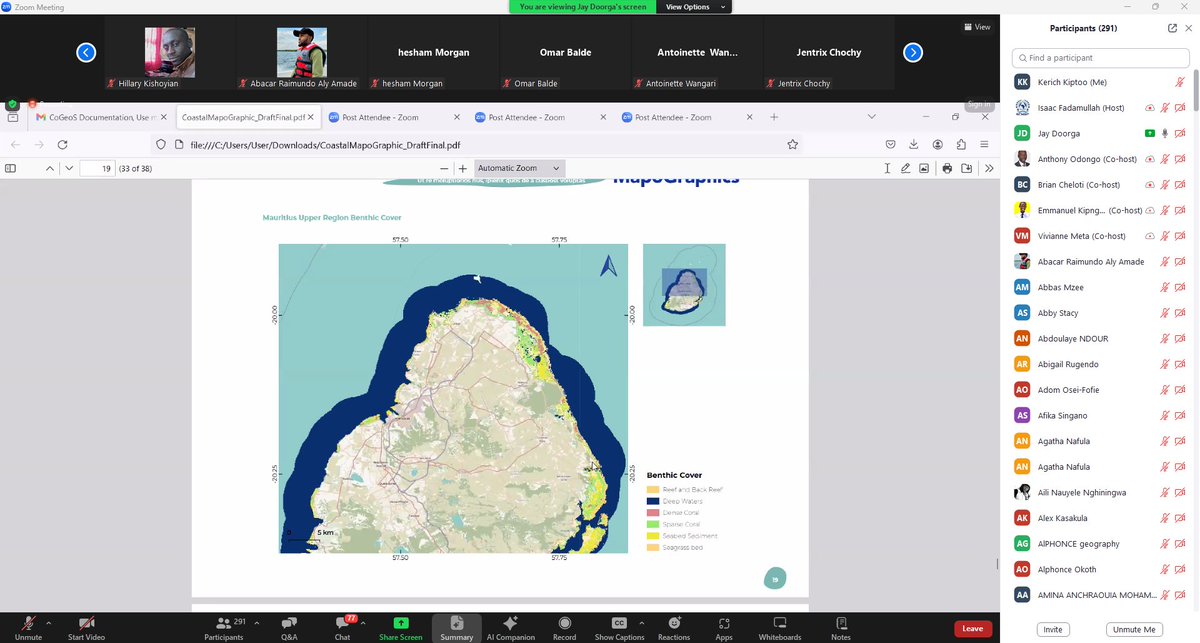
Day 1 of Coastal Geomorphology Mapping and Shoreline Change Analysis Online Training done!
Over 295 participants joined us
Join us again today for Day 2 at the same time!
Login:us06web.zoom.us/meeting/regist…
<a href="/LocateIT_KE/">LocateIT_KE</a>  <a href="/GMESAfrica/">GMES, and Africa</a> <a href="/AfricaGmes/">GMES&Africa MARCOSIO</a>
LocateIT_KE (@locateit_ke) 's Twitter Profile Photo

"🌊 🏝️Today, with RCMRD GMES project we completed shoreline change analysis. Tomorrow, Feb 9th, don't miss our final day! Experience hands-on training with our QGIS plugin for coastal erosion monitoring and discover our visualization dashboard. Stay tuned 14:00 GMT+3📊🗺️ "
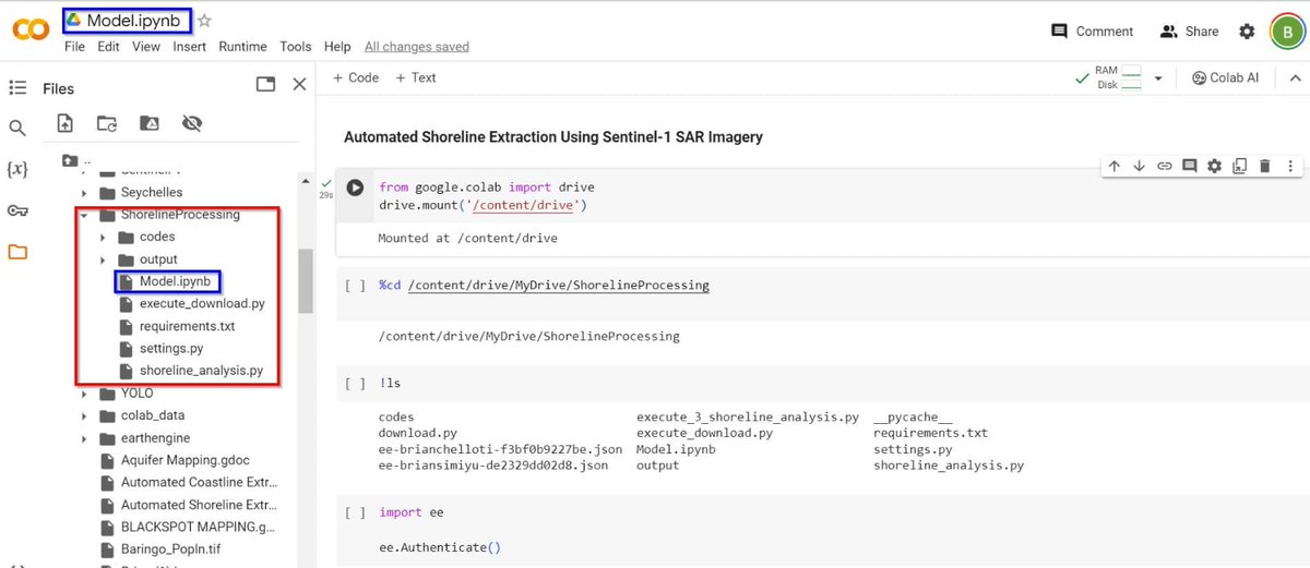
"🌊 🏝️Today, with <a href="/RCMRD_GMES/">RCMRD GMES project</a> we completed shoreline change analysis. Tomorrow, Feb 9th, don't miss our final day! Experience hands-on training with our QGIS plugin for coastal erosion monitoring and discover our visualization dashboard. Stay tuned 14:00 GMT+3📊🗺️ "
GMES, and Africa (@gmesafrica) 's Twitter Profile Photo

And also Training officer of the G&A Programme! In the field of Earth observation, the African Union, with the support of the European Commission, is implementing GMES and Africa. Launched in 2017, this AU Commission's flagship programme contributes per se to the architecture of

LocateIT_KE (@locateit_ke) 's Twitter Profile Photo

🌊 With RCMRD GMES project ,Three days of Coastal Geomorphology Mapping and Shoreline Change Analysis Training were concluded successfully! Gratitude to all participants for their invaluable contributions. 🗺️🏝️
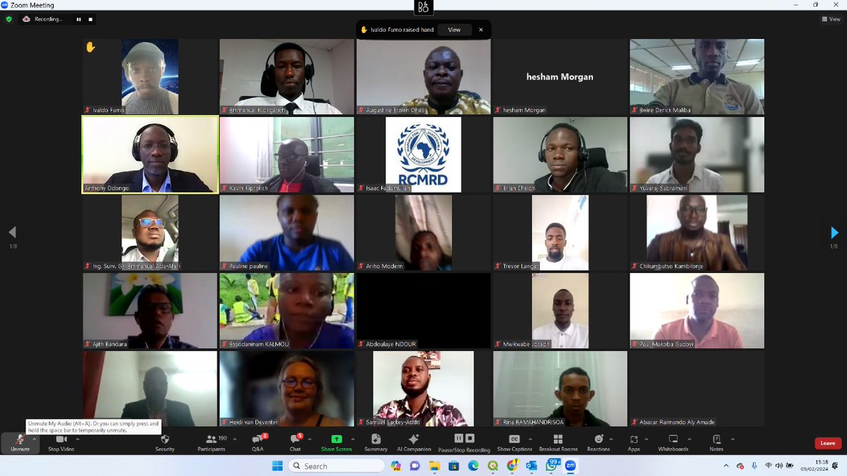
🌊 With <a href="/RCMRD_GMES/">RCMRD GMES project</a> ,Three days of Coastal Geomorphology Mapping and Shoreline Change Analysis Training were concluded successfully! Gratitude to all participants for their invaluable contributions. 🗺️🏝️
LocateIT_KE (@locateit_ke) 's Twitter Profile Photo

🌍 Exciting kickoff Garissa University Geospatial Innovation Center!🚀5 days of hands-on GIS training, a collaborative effort with Garissa County & Mercy Corps ASAL Adapts program empowering departmental focal persons with vital skills for data management, analysis & decisions 📊

🌍 Exciting kickoff  <a href="/GarissaUni/">Garissa University</a> Geospatial Innovation Center!🚀5 days of hands-on GIS training, a collaborative effort with <a href="/GarissaCountyKE/">Garissa County</a> &amp; <a href="/mercycorps/">Mercy Corps</a> ASAL Adapts program empowering departmental focal persons with vital  skills for data management, analysis &amp; decisions 📊
EMMANUEL KIPNGETICH (@kip__emmanuel) 's Twitter Profile Photo

🌍 Grateful to have showcased LocateIT_KE 's, Under RCMRD GMES project, Marine Ecosystem Monitoring Tools #CoGEOS🌊 🛰️ for biodiversity conservation at the Data Training Workshop led by RCMRD 🇰🇪 🇺🇬 🇸🇴 🇹🇿 🇲🇼 🇰🇲 🇿🇲 🇱🇸 🇸🇿 BIOPAMA RRH in Eastern and Southern Africa! 🌿 #RCoE
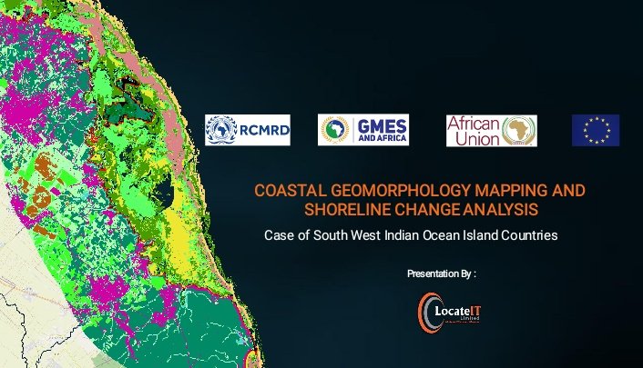
🌍 Grateful to have showcased  <a href="/LocateIT_KE/">LocateIT_KE</a> 's, Under <a href="/RCMRD_GMES/">RCMRD GMES project</a>, Marine Ecosystem Monitoring  Tools #CoGEOS🌊 🛰️  for biodiversity conservation at the Data Training Workshop led by <a href="/RCMRD_/">RCMRD 🇰🇪 🇺🇬 🇸🇴 🇹🇿 🇲🇼 🇰🇲 🇿🇲 🇱🇸 🇸🇿</a>  BIOPAMA RRH in Eastern and Southern Africa! 🌿 #RCoE
RCMRD GMES project (@rcmrd_gmes) 's Twitter Profile Photo

Coastal Geomorphology Map is one of our products under GMES, and Africa project developed for the Indian Ocean countries. The product has been utilised to  assess the vulnerability of coastal areas to erosion, sea-level rise, and storm events.gmes.rcmrd.org/news/news/174-…
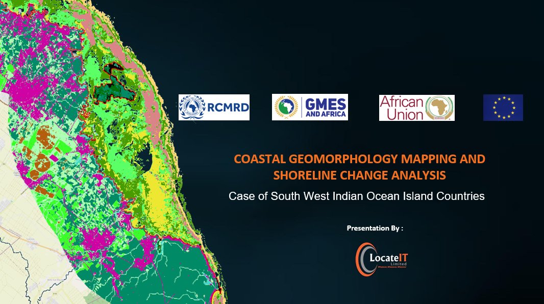
Coastal Geomorphology Map is one of our products under <a href="/GMESAfrica/">GMES, and Africa</a> project developed for the Indian Ocean countries. The product has been utilised to  assess the vulnerability of coastal areas to erosion, sea-level rise, and storm events.gmes.rcmrd.org/news/news/174-…
RCMRD GMES project (@rcmrd_gmes) 's Twitter Profile Photo

Coastal Erosion Monitoring tools, developed through the partnership with RCMRD 🇰🇪 🇺🇬 🇸🇴 🇹🇿 🇲🇼 🇰🇲 🇿🇲 🇱🇸 🇸🇿 & LocateIT_KE under the GMES, and Africa program, have shown great insights into coastal dynamics. These tools are vital for coastal zone management and sustainable development.
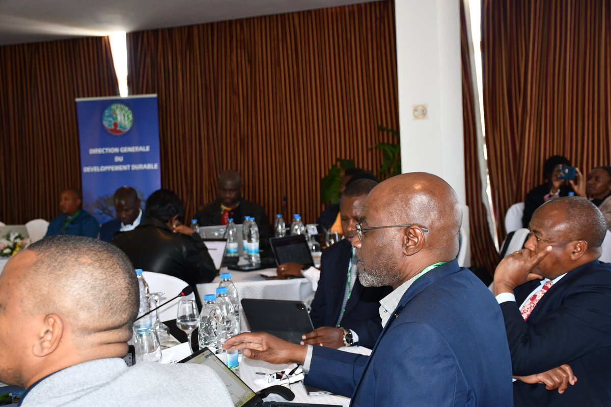
Coastal Erosion Monitoring tools, developed through the partnership with <a href="/RCMRD_/">RCMRD 🇰🇪 🇺🇬 🇸🇴 🇹🇿 🇲🇼 🇰🇲 🇿🇲 🇱🇸 🇸🇿</a>  &amp; <a href="/LocateIT_KE/">LocateIT_KE</a> under the <a href="/GMESAfrica/">GMES, and Africa</a> program, have shown great insights into coastal dynamics. These tools are vital for coastal zone management and sustainable development.
GAIN Kenya (@gainalliance_ke) 's Twitter Profile Photo

We encourage you to frequently consume a variety of veggies especially the green leafy vegetables, such as managu, terere, and spinach that are powerhouses of essential vitamins and minerals, like iron and calcium and vitamins A and C.  #Vegetables4All #HealthierDiets4All