Kenneth Wong (@kenneth_khw) 's Twitter Profile
Kenneth Wong

@kenneth_khw

Urbanist, Map nerd, GIS, #RStats | Previously Teaching Assistant & Researcher @HKUniversity | kennethhkhw.bsky.social

ID: 985921631439568896

linkhttp://mappyurbanist.com calendar_today16-04-2018 16:43:29

653 Tweet

1,1K Takipçi

414 Takip Edilen

Kenneth Wong (@kenneth_khw) 's Twitter Profile Photo

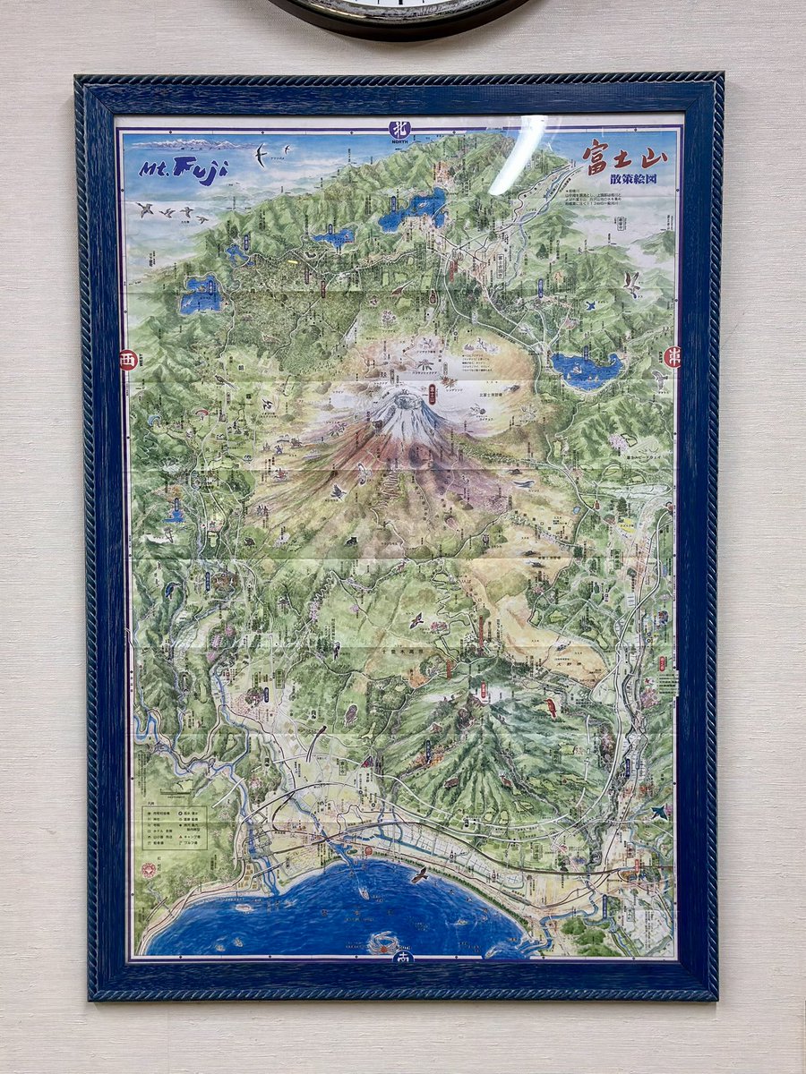
#MapsInTheWild a detailed illustration of Mount Fuji’s surrounding areas 🗻 Found this map at Mishima Taisha Shrine. The deeper you explore the map, the more intricate details you could uncover

#MapsInTheWild a detailed illustration of Mount Fuji’s surrounding areas 🗻

Found this map at Mishima Taisha Shrine. The deeper you explore the map, the more intricate details you could uncover
Kenneth Wong (@kenneth_khw) 's Twitter Profile Photo

Release of QGIS 4 is undoubtedly exciting news - I still remember the huge UI/UX leap when upgrading from QGIS v2 to v3 on my Mac somewhere in 2019 🚀 #gischat blog.qgis.org/2025/04/17/qgi…

Kenneth Wong (@kenneth_khw) 's Twitter Profile Photo

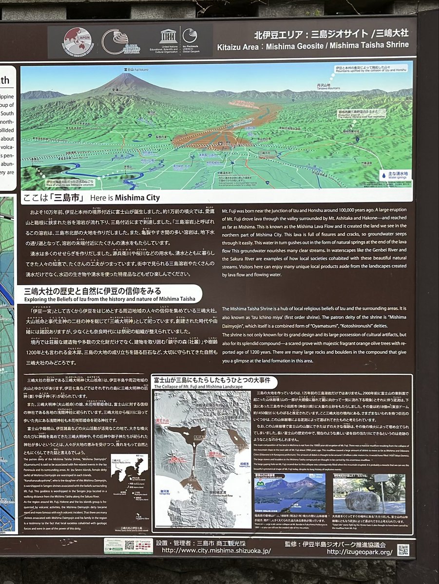
#MapsInTheWild Topography of Izu Pensisula with illustrations of plate tectonics of the area in Mishima, Shizuoka 🌋🗻 Brings me back the vibes of old high school geography textbook

#MapsInTheWild Topography of Izu Pensisula with illustrations of plate tectonics of the area in Mishima, Shizuoka 🌋🗻

Brings me back the vibes of old high school geography textbook
SCMP Graphics (@scmpgraphics) 's Twitter Profile Photo

New visual story! Introducing the new pet-friendly transportation rules in Hong Kong and beyond: bit.ly/4klDFKf - Visual story by Catherine Ma and Brian Wang #petfriendly #scmpgraphics #infographic #datavisualization #illustration

Kenneth Wong (@kenneth_khw) 's Twitter Profile Photo

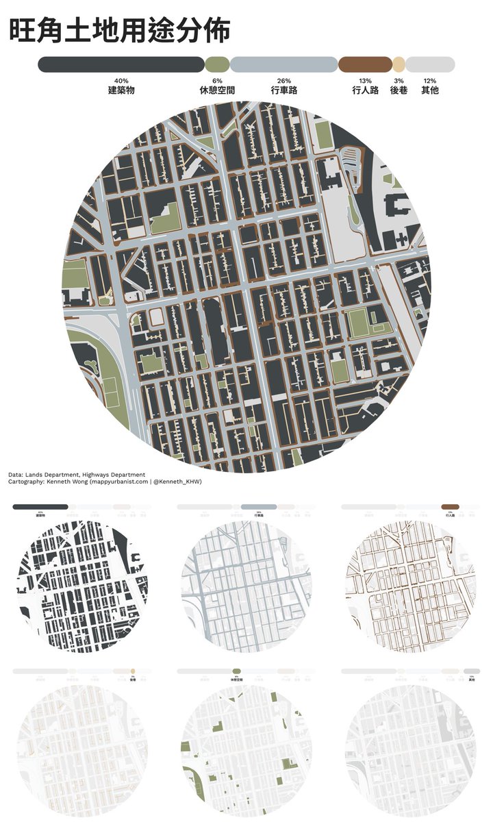
Back to a #QGIS #cartography project of mapping land use distribution in Mong Kok, Hong Kong by breaking down land into 6 key categories. Together with small multiples showing area of: built structure, carriageway, footway, back-lane, open space, and others

Back to a #QGIS #cartography project of mapping land use distribution in Mong Kok, Hong Kong by breaking down land into 6 key categories.

Together with small multiples showing area of: built structure, carriageway, footway, back-lane, open space, and others
Kenneth Wong (@kenneth_khw) 's Twitter Profile Photo

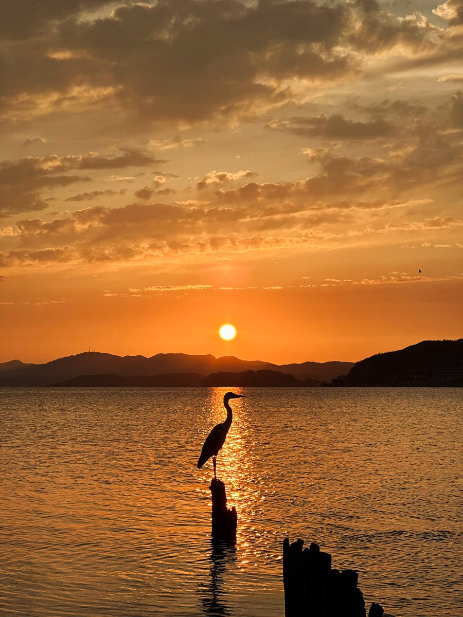
Took a short trip to San’in region last few days and this is the sunset of Lake Shinji, Matsue 🌅 先週、山陰地方へ小旅行に行った際、松江の宍道湖で絶景の夕日を追いかけました。

Took a short trip to San’in region last few days and this is the sunset of Lake Shinji, Matsue 🌅

先週、山陰地方へ小旅行に行った際、松江の宍道湖で絶景の夕日を追いかけました。
Kenneth Wong (@kenneth_khw) 's Twitter Profile Photo

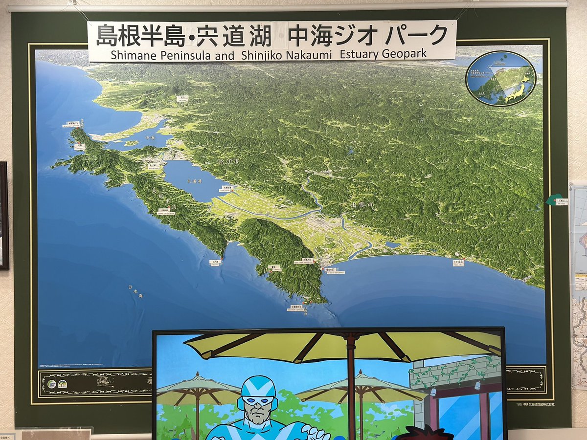
#MapsInTheWild Axonometric map of the Shimane Peninsula at the visitor centre of Hinomisaki Lighthouse Stunning greenish hillshades and subtle ocean depth bluish gradients 🌊⛰️🗾

#MapsInTheWild Axonometric map of the Shimane Peninsula at the visitor centre of Hinomisaki Lighthouse

Stunning greenish hillshades and subtle ocean depth bluish gradients 🌊⛰️🗾
Evan Applegate (@youwillmakemaps) 's Twitter Profile Photo

Most mapmaker hours are spent labeling; a good map has "no collisions, no elisions" The computer can roughly place your text, but following rivers and stretching type out from the coastline is all manual; hope you like dragging bezier handles in Illustrator

Kenneth Wong (@kenneth_khw) 's Twitter Profile Photo

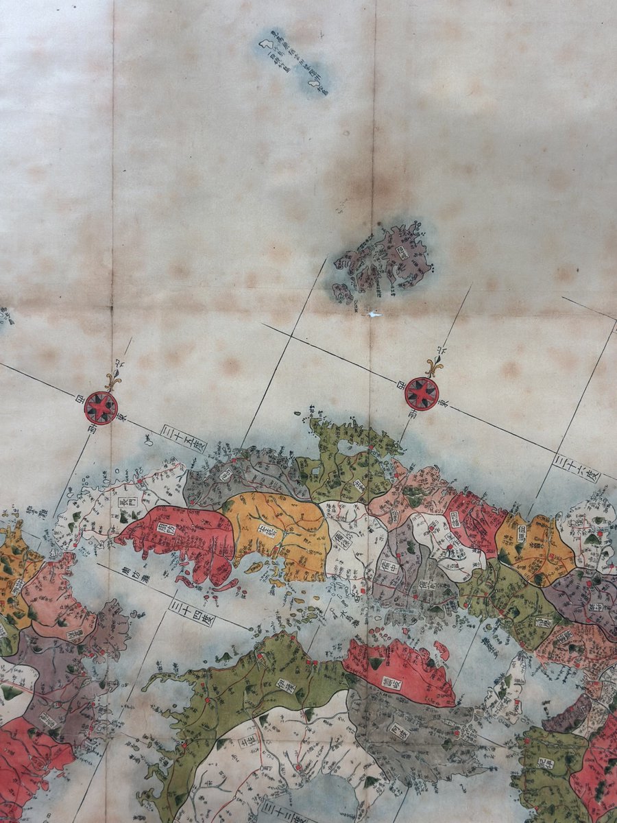
A historical map of Japan crafted in late-1700s I stumbled across during the trip last month Line up of graticules together with latitude labels (三十六度 means 36°N), muted graduated colour of shorelines, fading lines… all executed and blended so well Sort of #MapsInTheWild?

A historical map of Japan crafted in late-1700s I stumbled across during the trip last month

Line up of graticules together with latitude labels (三十六度 means 36°N), muted graduated colour of shorelines, fading lines… all executed and blended so well

Sort of #MapsInTheWild?
Kenneth Wong (@kenneth_khw) 's Twitter Profile Photo

For those map nerds here: I just found the full-sized map is publicly available in the UC Berkeley Library! (wow) Revised geographical route map / 改正日本輿地路程全図 🔗🗾 digicoll.lib.berkeley.edu/record/140537

For those map nerds here: I just found the full-sized map is publicly available in the UC Berkeley Library! (wow)

Revised geographical route map / 改正日本輿地路程全図
🔗🗾 digicoll.lib.berkeley.edu/record/140537
Steven Bernard (@sdbernard) 's Twitter Profile Photo

NEW: Will Iran start a new tanker war? Data from Global Maritime Traffic highlights how much of a chokepoint the Strait of Hormuz is for tankers Read Chloe Cornish and John Paul Rathbone's latest Financial Times Military Briefing ft.com/content/f452a2… #dataviz

NEW: Will Iran start a new tanker war? Data from Global Maritime Traffic highlights how much of a chokepoint the Strait of Hormuz is for tankers

Read <a href="/ChloeNCornish/">Chloe Cornish</a> and <a href="/JP_Rathbone/">John Paul Rathbone</a>'s latest <a href="/FT/">Financial Times</a> Military Briefing
ft.com/content/f452a2…
#dataviz
MIERUNE Inc. (@mierune_inc) 's Twitter Profile Photo

#QGIS 3.44がリリースされました🎉🎉 QGIS 3シリーズの最終バージョンとなる今回の更新では、「3D地球ビュー」機能の追加やラベル管理のアップデートが行われました🆕 #QGISLAB では、その他の追加機能もご紹介しています! ぜひご確認ください☺️ 紹介記事➡️qgis.mierune.co.jp/posts/blog_new…

#QGIS 3.44がリリースされました🎉🎉

QGIS 3シリーズの最終バージョンとなる今回の更新では、「3D地球ビュー」機能の追加やラベル管理のアップデートが行われました🆕

#QGISLAB では、その他の追加機能もご紹介しています!
ぜひご確認ください☺️

紹介記事➡️qgis.mierune.co.jp/posts/blog_new…