Jenna Greenhill (@jgreenhillwx) 's Twitter Profile
Jenna Greenhill

@jgreenhillwx

WMBF News Meteorologist

ID: 1668193212236718080

linkhttps://www.wmbfnews.com/ calendar_today12-06-2023 09:47:22

4,4K Tweet

435 Takipçi

203 Takip Edilen

Jenna Greenhill (@jgreenhillwx) 's Twitter Profile Photo

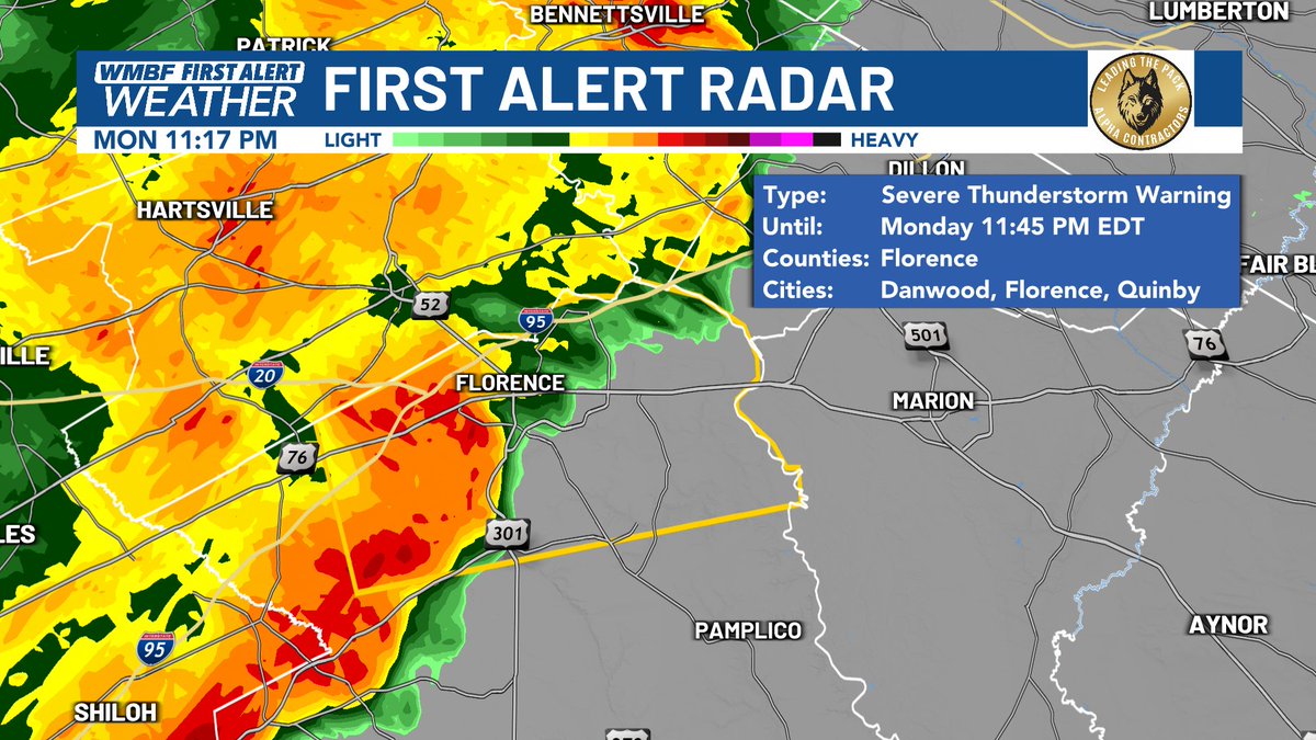
11:17 PM A SEVERE THUNDERSTORM WARNING has been issued for Florence County, wind gusts up to 60 mph as well as penny sized hail within this storm. #scwx WMBF News

11:17 PM A SEVERE THUNDERSTORM WARNING has been issued for Florence County, wind gusts up to 60 mph as well as penny sized hail within this storm. #scwx <a href="/wmbfnews/">WMBF News</a>
Jenna Greenhill (@jgreenhillwx) 's Twitter Profile Photo

TOMORROW | The morning will start off dry with clouds around. As we head into the afternoon the sea breeze will help produce a few afternoon showers and thunderstorms. #scwx WMBF News

TOMORROW | The morning will start off dry with clouds around. As we head into the afternoon the sea breeze will help produce a few afternoon showers and thunderstorms. #scwx <a href="/wmbfnews/">WMBF News</a>
Jenna Greenhill (@jgreenhillwx) 's Twitter Profile Photo

TOMORROW | Showers and storms will be seen through the afternoon and into the early evening, no need to completely cancel any outdoor plans through the evening. #scwx WMBF News

TOMORROW | Showers and storms will be seen through the afternoon and into the early evening, no need to completely cancel any outdoor plans through the evening. #scwx <a href="/wmbfnews/">WMBF News</a>
Jenna Greenhill (@jgreenhillwx) 's Twitter Profile Photo

3:52 PM RADAR | Storms continue to develop, most activity remains inland heavy downpours, lightning and gusty winds, watching for small hail in some of these storms. #scwx WMBF News

3:52 PM RADAR | Storms continue to develop, most activity remains inland heavy downpours, lightning and gusty winds, watching for small hail in some of these storms. #scwx <a href="/wmbfnews/">WMBF News</a>
Jenna Greenhill (@jgreenhillwx) 's Twitter Profile Photo

A SEVERE THUNDERSTORM WARNING has now been issued for Marion and Inland Horry County, this storm producing wind gusts up to 60 miles per hour and penny sized hail could be seen. #scwx WMBF News

A SEVERE THUNDERSTORM WARNING has now been issued for Marion and Inland Horry County, this storm producing wind gusts up to 60 miles per hour and penny sized hail could be seen. #scwx <a href="/wmbfnews/">WMBF News</a>
Jenna Greenhill (@jgreenhillwx) 's Twitter Profile Photo

We have seen up to 170 lightning strikes within the severe storm in Marion County, this storm is working into inland Horry County. #scwx WMBF News

We have seen up to 170 lightning strikes within the severe storm in Marion County, this storm is working into inland Horry County. #scwx <a href="/wmbfnews/">WMBF News</a>
Jenna Greenhill (@jgreenhillwx) 's Twitter Profile Photo

Reports of tree down across Calder Road in Marion County from the severe thunderstorm that worked through. #scwx WMBF News  If you have any storm damage photos let us know here > wmbfnews.com/community/user…

Reports of tree down across Calder Road in Marion County from the severe thunderstorm that worked through. #scwx <a href="/wmbfnews/">WMBF News</a> 

If you have any storm damage photos let us know here &gt; wmbfnews.com/community/user…
Jenna Greenhill (@jgreenhillwx) 's Twitter Profile Photo

A FLOOD ADVISORY has been issued for Horry County as heavy rain continues to fall, minor flooding in lowlying areas can be seen. #scwx WMBF News

A FLOOD ADVISORY has been issued for Horry County as heavy rain continues to fall, minor flooding in lowlying areas can be seen. #scwx <a href="/wmbfnews/">WMBF News</a>