Jeff Penner (@jeffpennerkshb) 's Twitter Profile
Jeff Penner

@jeffpennerkshb

Weekend AM Meteorologist at KSHB TV, husband, father of an 18 year old high school graduate son

ID: 382155525

linkhttp://www.kshb.com calendar_today29-09-2011 15:43:09

9,9K Tweet

6,6K Followers

1,1K Following

Jeff Penner (@jeffpennerkshb) 's Twitter Profile Photo

We are tracking 3 main rain (no severe wx) chances. 1. Today until 3-5 PM: Scattered showers/sprinkles 2. Friday morning: Rain, few T-Storms from KC & south. A few showers may linger during the afternoon. 3. Saturday morning/early PM: Rain, few T-Storms from KC & south. KSHB 41 News
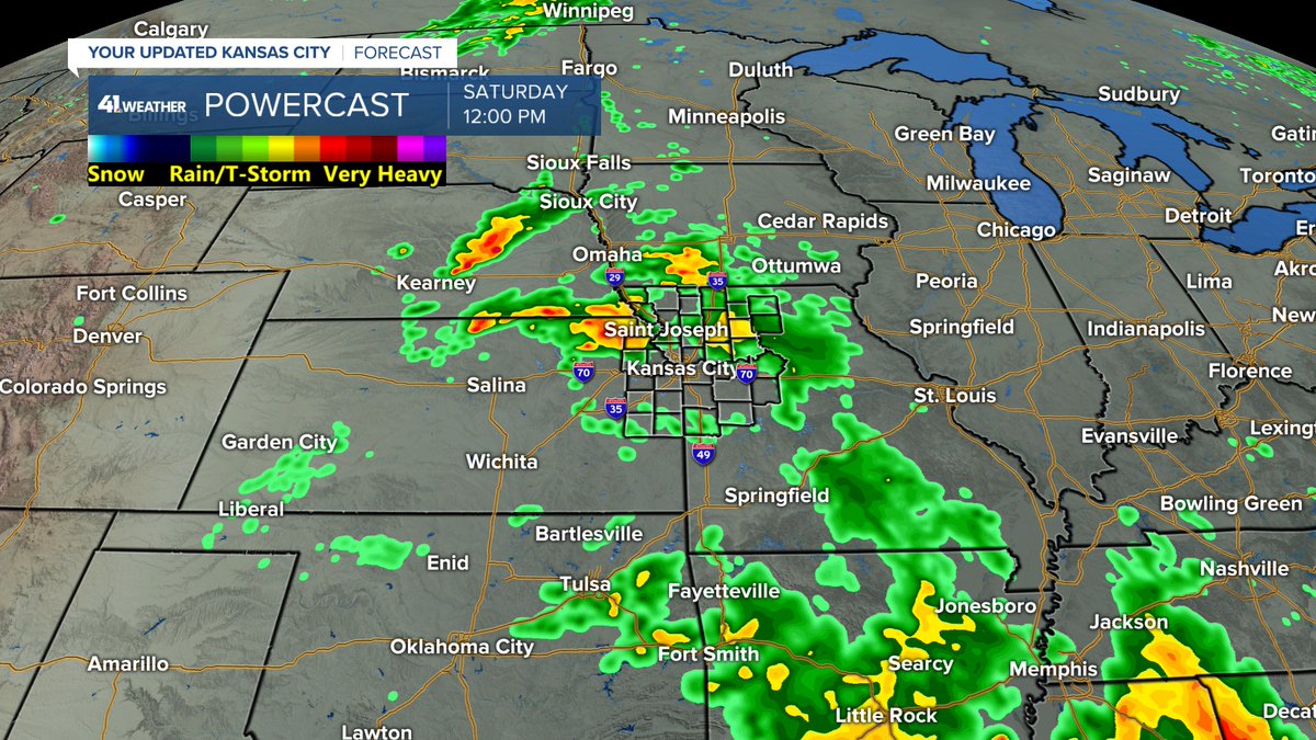
We are tracking 3 main rain (no severe wx) chances.
1. Today until 3-5 PM: Scattered showers/sprinkles
2. Friday morning: Rain, few T-Storms from KC & south. A few showers may linger during the afternoon.
3. Saturday morning/early PM: Rain, few T-Storms from KC &amp; south. <a href="/KSHB41/">KSHB 41 News</a>
Jeff Penner (@jeffpennerkshb) 's Twitter Profile Photo

The Weather Service went back out to re-survey the tornado at the Truman Sports Complex. They found tree damage consistent with an EF-0. The path length went up from .25 to .90 miles, starting just west of I-435. It's width was 50 yards & was on the ground for 3 minutes. KSHB 41 News

The Weather Service went back out to re-survey the tornado at the Truman Sports Complex. They found tree damage consistent with an EF-0.
The path length went up from .25 to .90 miles, starting just west of I-435. It's width was 50 yards &amp; was on the ground for 3 minutes.
<a href="/KSHB41/">KSHB 41 News</a>
Jeff Penner (@jeffpennerkshb) 's Twitter Profile Photo

We will be dodging raindrops at times today through Sunday. Right now, there are a few rain showers around, but the most widespread rain is about 50-100 miles south of KC. Details on the weekend rain is in our updated KSHB 41 News weather blog at: kshb.com/weather/kshb-4…
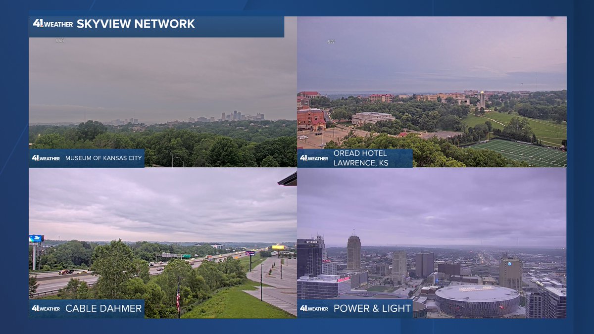
We will be dodging raindrops at times today through Sunday. Right now, there are a few rain showers around, but the most widespread rain is about 50-100 miles south of KC.
Details on the weekend rain is in our updated <a href="/KSHB41/">KSHB 41 News</a> weather blog at:

kshb.com/weather/kshb-4…
Jeff Penner (@jeffpennerkshb) 's Twitter Profile Photo

A line of heavy rain and thunderstorms will cross all KC between now and 2 PM. 30-40 mph wind gusts and ponding of water on roads is likely. After the rain it will become a nice afternoon and evening. Temps in the 70s. ⁦KSHB 41 News

Jeff Penner (@jeffpennerkshb) 's Twitter Profile Photo

It is has become a super Saturday evening after a midday deluge. The weather will be near perfect this evening. Sunday will start with great weather. But, we have a severe weather threat by afternoon. Details are in our updated KSHB 41 News weather blog at: kshb.com/weather/kshb-4…

It is has become a super Saturday evening after a midday deluge. The weather will be near perfect this evening.

Sunday will start with great weather. But, we have a severe weather threat by afternoon.

Details are in our updated <a href="/KSHB41/">KSHB 41 News</a> weather blog at:

kshb.com/weather/kshb-4…
Jeff Penner (@jeffpennerkshb) 's Twitter Profile Photo

The severe threat for KC is over. The line of T-Storms from north Oklahoma to central Illinois is the cold front. The severe threat is along that line & south. The line is moving southeast at 20 mph. Clinton, Sedalia may T-Storms with hail the next 1 hour. KSHB 41 News

The severe threat for KC is over. The line of T-Storms from north Oklahoma to central Illinois is the cold front. The severe threat is along that line &amp; south. The line is moving southeast at 20 mph. Clinton, Sedalia may T-Storms with hail the next 1 hour.
<a href="/KSHB41/">KSHB 41 News</a>
Jeff Penner (@jeffpennerkshb) 's Twitter Profile Photo

A band of scattered showers and a few non-severe thunderstorms will cross KC between 6 and 9 PM. Very small hail could come from one of the thunderstorms. Temperatures will drop to the 60s. KSHB 41 News
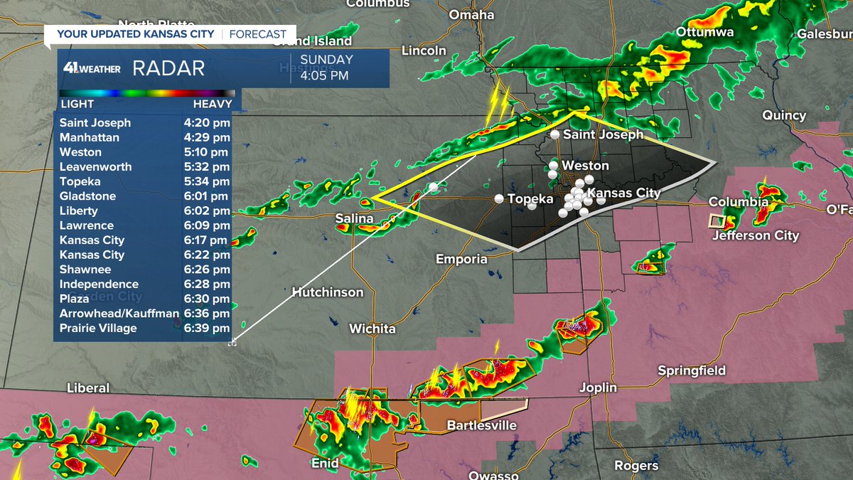
A band of scattered showers and a few non-severe thunderstorms will cross KC between 6 and 9 PM. Very small hail could come from one of the thunderstorms. Temperatures will drop to the 60s. <a href="/KSHB41/">KSHB 41 News</a>
Jeff Penner (@jeffpennerkshb) 's Twitter Profile Photo

WEATHER UPDATE: Scattered showers & a few T-Storms will cross KC between 6 & 8 PM with temps in the 60s. There is a new line of T-Storms from Rich Hill, MO to northeast of Marshall, MO. These may produce up to quarter size hail as they move southeast at 30 mph. KSHB 41 News

WEATHER UPDATE:
Scattered showers &amp; a few T-Storms will cross KC between 6 &amp; 8 PM with temps in the 60s. There is a new line of T-Storms from Rich Hill, MO to northeast of Marshall, MO. These may produce up to quarter size hail as they move southeast at 30 mph. <a href="/KSHB41/">KSHB 41 News</a>
Jeff Penner (@jeffpennerkshb) 's Twitter Profile Photo

A few small downpours have formed during the last hour with 20-30 mph wind gusts & 10 minutes of heavy rain. 1 Just left the stadiums. A 2nd is just south of Spring Hill, KS. They are moving north 20 mph. A few downpours until 8-10 PM, then they will fall apart. KSHB 41 News
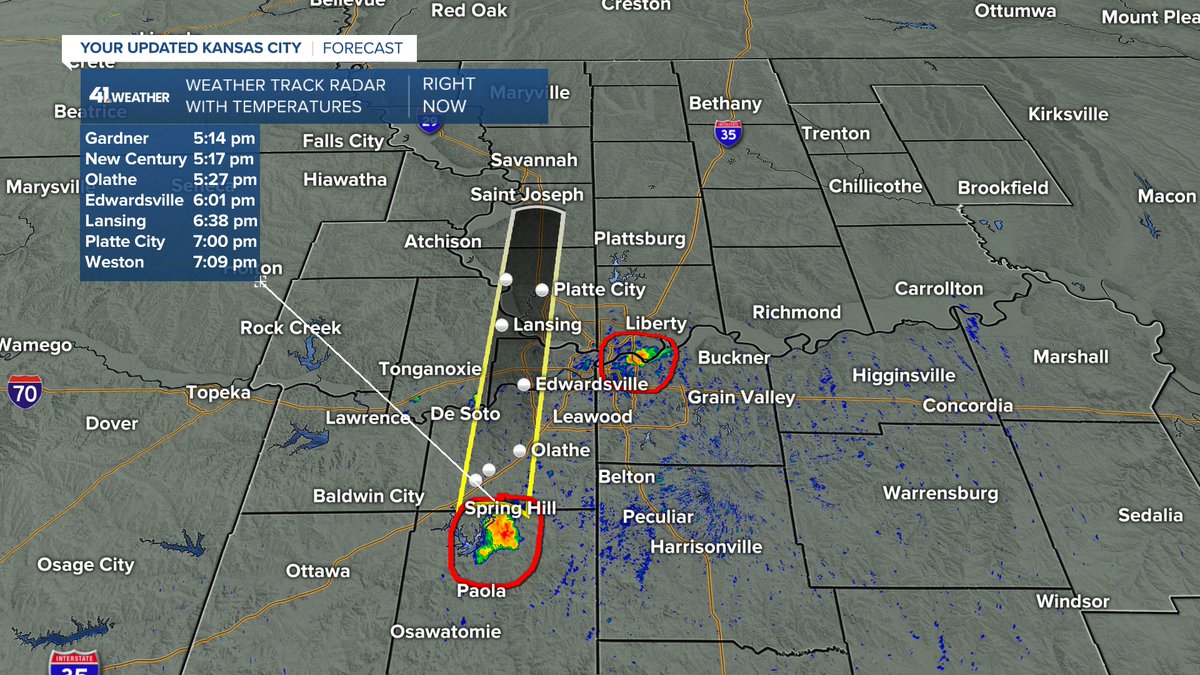
A few small downpours have formed during the last hour with 20-30 mph wind gusts &amp; 10 minutes of heavy rain. 1 Just left the stadiums. A 2nd is just south of Spring Hill, KS. They are moving north 20 mph. A few downpours until 8-10 PM, then they will fall apart. <a href="/KSHB41/">KSHB 41 News</a>
Jeff Penner (@jeffpennerkshb) 's Twitter Profile Photo

There is a heavy downpour around Belton, MO. If it holds together, it would affect the "K" around 7 PM. It would bring a 10-15 minute downpour. So, a dely might occur, but no rain outs. After 8-10 PM all of these will fall apart. KSHB 41 News
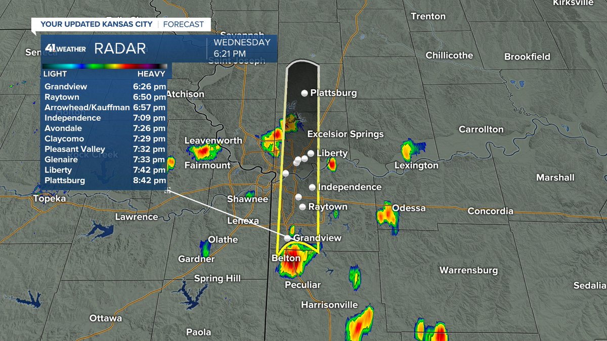
There is a heavy downpour around Belton, MO. If it holds together, it would affect the "K" around 7 PM. It would bring a 10-15 minute downpour. So, a dely might occur, but no rain outs. After 8-10 PM all of these will fall apart. <a href="/KSHB41/">KSHB 41 News</a>
Jeff Penner (@jeffpennerkshb) 's Twitter Profile Photo

It looks like rain, but there has not been much rain. During the last hour a few showers have formed south & west of KC. They are moving northwest at 15 mph. A few showers & T-Storms will be around all night, mostly south & east of KC. KSHB 41 News

It looks like rain, but there has not been much rain. During the last hour a few showers have formed south &amp; west of KC. They are moving northwest at 15 mph. A few showers &amp; T-Storms will be around all night, mostly south &amp; east of KC. <a href="/KSHB41/">KSHB 41 News</a>
Jeff Penner (@jeffpennerkshb) 's Twitter Profile Photo

We are in for great Friday evening weather with temps in the 70s. Saturday we will see great pool weather with highs in the 80s. Father's Day may end up with T-Storms as we will be tracking an area to the west. It may stay west, leaving us with a dry Father's Day. KSHB 41 News
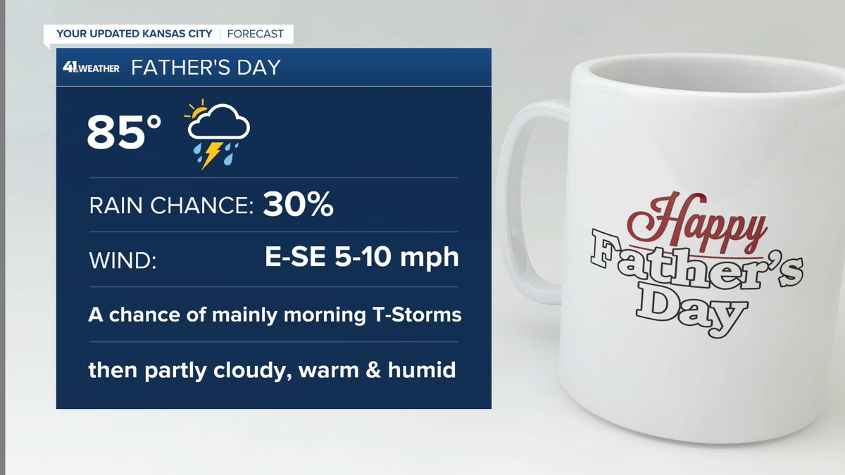
We are in for great Friday evening weather with temps in the 70s.
Saturday we will see great pool weather with highs in the 80s.
Father's Day may end up with T-Storms as we will be tracking an area to the west. It may stay west, leaving us with a dry Father's Day. <a href="/KSHB41/">KSHB 41 News</a>
Jeff Penner (@jeffpennerkshb) 's Twitter Profile Photo

Rainfall the last 24-72 hours as been southwest & east of KC. We are tracking several chances of thunderstorms through Wednesday. Will they be a hit or miss? Details are in our updated KSHB 41 News weather blog at: kshb.com/weather/kshb-4…
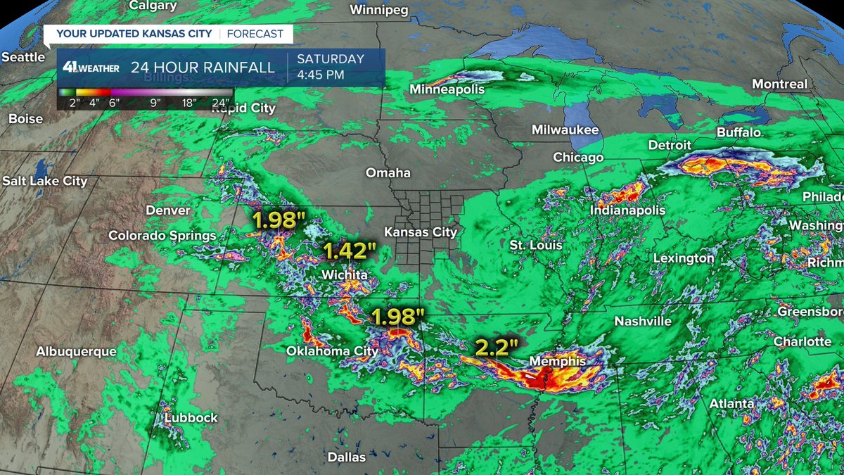
Rainfall the last 24-72 hours as been southwest &amp; east of KC. We are tracking several chances of thunderstorms through Wednesday. Will they be a hit or miss?

Details are in our updated <a href="/KSHB41/">KSHB 41 News</a> weather blog at:

kshb.com/weather/kshb-4…
Jeff Penner (@jeffpennerkshb) 's Twitter Profile Photo

The week ahead features 2 days that could see significant thunderstorms. Those days are Tuesday & Wednesday. Details are in our updated KSHB 41 News weather blog at: kshb.com/weather/kshb-4…
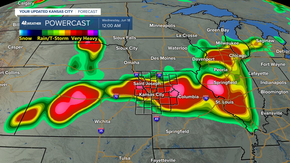
The week ahead features 2 days that could see significant thunderstorms. Those days are Tuesday &amp; Wednesday.

Details are in our updated <a href="/KSHB41/">KSHB 41 News</a> weather blog at:

kshb.com/weather/kshb-4…
Jeff Penner (@jeffpennerkshb) 's Twitter Profile Photo

It is a beautiful last sunrise of Spring. Summer begins at 9:42 PM and the heat is right on schedule. Highs today will reach 90°, officially, for the 1st time since October 12th. This is 251 days ago. KSHB 41 News
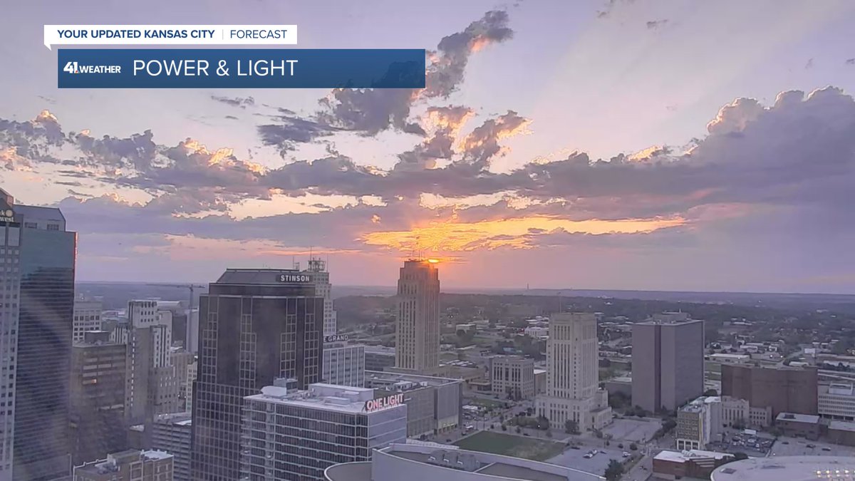
It is a beautiful last sunrise of Spring. Summer begins at 9:42 PM and the heat is right on schedule. Highs today will reach 90°, officially, for the 1st time since October 12th. This is 251 days ago. <a href="/KSHB41/">KSHB 41 News</a>
Jeff Penner (@jeffpennerkshb) 's Twitter Profile Photo

Summer begins at 9:42 PM and a stretch of hot, dry weather begins today. We know Summer ends on September 22nd at 1:19 PM. But, how long will the higher heat and dry weather last? Details are in our updated KSHB 41 News weather blog at: kshb.com/weather/kshb-4…

Summer begins at 9:42 PM and a stretch of hot, dry weather begins today. We know Summer ends on September 22nd at 1:19 PM. But, how long will the higher heat and dry weather last?

Details are in our updated <a href="/KSHB41/">KSHB 41 News</a> weather blog at:

kshb.com/weather/kshb-4…
Jeff Penner (@jeffpennerkshb) 's Twitter Profile Photo

The high today was 93° for the 2nd straight day. Before Friday, the last time it was 93°, was September 20th. This is the hottest stretch since August 28-29. We are not alone in this heat as it is 96° in Minneapolis. Our next cold front is 7-10 days away. KSHB 41 News
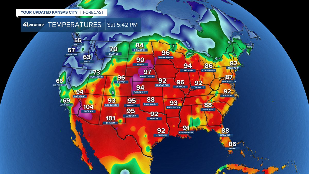
The high today was 93° for the 2nd straight day. Before Friday, the last time it was 93°, was September 20th. 
This is the hottest stretch since August 28-29.

We are not alone in this heat as it is 96° in Minneapolis.
Our next cold front is 7-10 days away. <a href="/KSHB41/">KSHB 41 News</a>
Jeff Penner (@jeffpennerkshb) 's Twitter Profile Photo

SPRINKLER WARNING: Rain chances the next 5-7 days are quite low. Northwest Missouri & northeast Kansas do have a bit better rain chances, but they have seen low rainfall totals all Spring. It takes 1.00"-1.50" per week to keep the yard green this time of year. KSHB 41 News
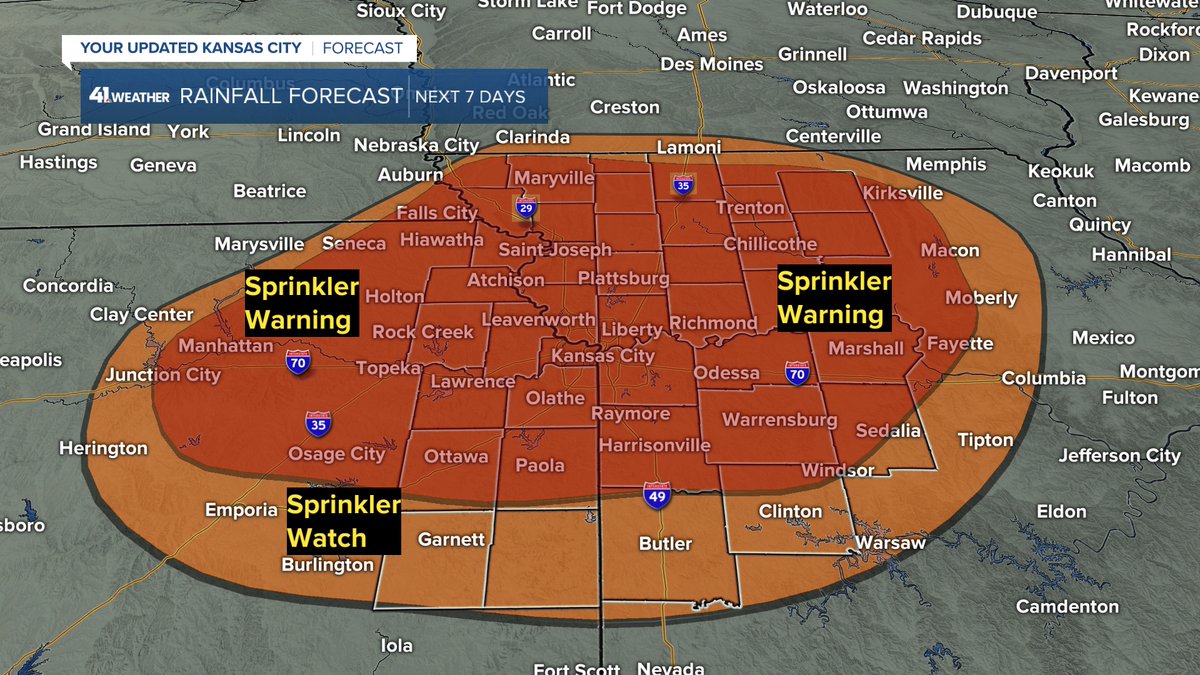
SPRINKLER WARNING:
Rain chances the next 5-7 days are quite low. Northwest Missouri &amp; northeast Kansas do have a bit better rain chances, but they have seen low rainfall totals all Spring.
It takes 1.00"-1.50" per week to keep the yard green this time of year. <a href="/KSHB41/">KSHB 41 News</a>
Jeff Penner (@jeffpennerkshb) 's Twitter Profile Photo

We all could use some rain & heat relief. There is not much in the way of heat relief. But, there is a chance of thunderstorms in some locations. Details are in our updated KSHB 41 News weather blog at: kshb.com/weather/kshb-4…
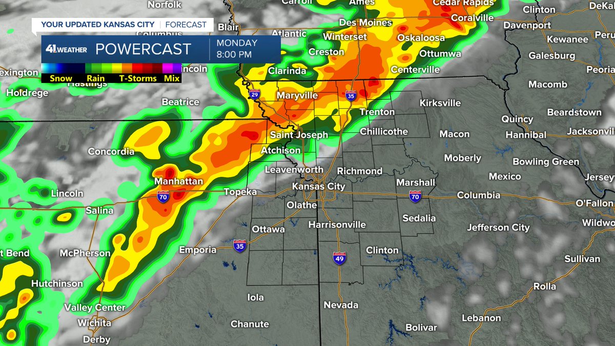
We all could use some rain &amp; heat relief. There is not much in the way of heat relief. But, there is a chance of thunderstorms in some locations.

Details are in our updated <a href="/KSHB41/">KSHB 41 News</a> weather blog at:

kshb.com/weather/kshb-4…