Jeff Harrison (@jeffharrison) 's Twitter Profile
Jeff Harrison

@jeffharrison

Working on interoperability, geosocial networking and democratic access. Recovering entrepreneur, intelligence officer, open geospatial guy.

ID: 3824841

calendar_today08-04-2007 22:19:27

9,9K Tweet

3,3K Followers

2,2K Following

Army Geospatial (@armygeospatial) 's Twitter Profile Photo

#DYK Army Geospatial is experimenting with AI conversational interfaces for interacting with Releasable Basemap Tiles (#RBT). We can pan (“move 20 km to the east”), navigate (“go to Turin”), and change map styles (“make built-up areas opaque”). Just beginning ...

#DYK <a href="/ArmyGeospatial/">Army Geospatial</a> is experimenting with AI conversational interfaces for interacting with Releasable Basemap Tiles (#RBT). We can pan (“move 20 km to the east”), navigate  (“go to Turin”), and change map styles (“make built-up areas opaque”). Just beginning ...
USACE HQ (@usacehq) 's Twitter Profile Photo

.Army Geospatial recently added 2.3 billion buildings from Overture Maps Foundation to its next-generation basemap, Releasable Basemap Tiles (#RBT). The open data consists of building footprints and heights from multiple sources with many derived from high-resolution satellite imagery.
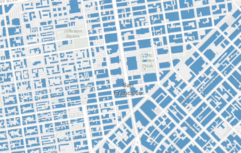
.<a href="/ArmyGeospatial/">Army Geospatial</a> recently added 2.3 billion buildings from <a href="/OvertureMaps/">Overture Maps Foundation</a> to its next-generation basemap, Releasable Basemap Tiles (#RBT). The open data  consists of building footprints and heights from multiple sources with many derived from high-resolution satellite imagery.
Army Geospatial (@armygeospatial) 's Twitter Profile Photo

#DYK. The Releasable Basemap Tiles (#RBT) program has developed a "Lite" version that provides a global basemap in multiple styles, using only 3.5 GB of storage. RBT Lite lets users access data down to about a 1:100,000-scale for strategic and operational level missions.

#DYK. The Releasable Basemap Tiles (#RBT) program has developed a "Lite" version that provides a global basemap in multiple styles, using only 3.5 GB of storage. RBT Lite lets users access data down to about a 1:100,000-scale for strategic and operational level missions.
Damien Symon (@detresfa_) 's Twitter Profile Photo

First set of satellite images are now online, revealing damage at Iran's Natanz Nuclear Enrichment Facility struck during Israel’s Operation Rising Lion

First set of satellite images are now online, revealing damage at Iran's Natanz Nuclear Enrichment Facility struck during Israel’s Operation Rising Lion
OSINTtechnical (@osinttechnical) 's Twitter Profile Photo

Israeli aircraft have reportedly struck Iran's Fordow Fuel Enrichment Plant, a reinforced nuclear enrichment facility dug under a mountain in Qom province, Iran.

Israeli aircraft have reportedly struck Iran's Fordow Fuel Enrichment Plant, a reinforced nuclear enrichment facility dug under a mountain in Qom province, Iran.
Damien Symon (@detresfa_) 's Twitter Profile Photo

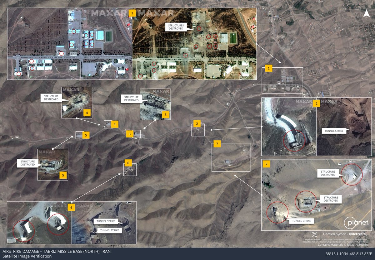
New imagery from Maxar & Planet shows fresh damage at Iran's Tabriz missile base (north), struck once again by Israel - key observation: all underground tunnel entrances have been struck obstructing access to the subterranean facility at this base

New imagery from Maxar &amp; Planet shows fresh damage at Iran's Tabriz missile base (north), struck once again by Israel - key observation: all underground tunnel entrances have been struck obstructing access to the subterranean facility at this base
OSINTtechnical (@osinttechnical) 's Twitter Profile Photo

New imagery of Iran’s Arak heavy water reactor after Israeli Air Force aircraft hit the facility this morning. The inactive reactor containment building can be seen split open by multiple Israeli bombs. Via Maxar Technologies

New imagery of Iran’s Arak heavy water reactor after Israeli Air Force aircraft hit the facility this morning. 

The inactive reactor containment building can be seen split open by multiple Israeli bombs. 

Via <a href="/Maxar/">Maxar Technologies</a>
Damien Symon (@detresfa_) 's Twitter Profile Photo

Imagery collected today shows an underground facility targeted by Israel approximately 20-kilometers west of the Fordow nuclear site in Iran The Intel Lab 📍maps.app.goo.gl/fu5LxanUKGeiw6…

NOAA Satellites (@noaasatellites) 's Twitter Profile Photo

Today is not just #FullDiskFriday, but also the official start of astronomical #summer here in the Northern Hemisphere! 🌎 This animation uses imagery from NOAA's #GOESEast 🛰️ to show the changing seasons over the past year as the sun’s angle shifts due to Earth’s tilt.

Open Source Centre (@osc_london) 's Twitter Profile Photo

On 21 June 2025, President Trump announced the US had struck Iran’s Fordow Nuclear Facility with GBU-57A/B MOP bunker busting bombs. High-resolution imagery taken on 22 June 2025 shows the site after it had been struck.

On 21 June 2025, President Trump announced the US had struck Iran’s Fordow Nuclear Facility with GBU-57A/B MOP bunker busting bombs. High-resolution imagery taken on 22 June 2025 shows the site after it had been struck.
Damien Symon (@detresfa_) 's Twitter Profile Photo

The first image of Fordow has now been released, a set of munition entry holes are visible just above the suspected underground facility while signs of land subsidence is seen, possibly as the area of interest caved inwards as result of the strike

The first image of Fordow has now been released, a set of munition entry holes are visible just above the suspected underground facility while signs of land subsidence is seen, possibly as the area of interest caved inwards as result of the strike
MapLibre (@maplibre) 's Twitter Profile Photo

We’ve had a fantastic round of conferences so far: ✨ State of the Map US , all materials available at: github.com/maplibre/works… ✨ FOSS4G Netherlands Next stop FOSS4G Europe 2025, meet our team and join the conversation on open source mapping #maplibre #foss4g #FOSS4GE #mostar #osgeo
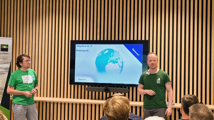
We’ve had a fantastic round of conferences so far:
✨ State of the Map US , all materials available at: github.com/maplibre/works…
✨ FOSS4G Netherlands

Next stop <a href="/foss4ge/">FOSS4G Europe 2025</a>, meet our team and join the conversation on open source mapping
#maplibre #foss4g #FOSS4GE #mostar #osgeo
OpenStreetMap (@openstreetmap) 's Twitter Profile Photo

We are happy to announce the deployment of #VectorTiles on OSM Foundation servers & the publication of the layer on the OSM website. We have been working hard to bring you a fresh look to OSM data, paired with exciting technological upgrades. For details: blog.openstreetmap.org/2025/07/22/vec…

We are happy to announce the deployment of #VectorTiles on OSM Foundation servers &amp; the publication of the layer on the OSM website. We have been working hard to bring you a fresh look to OSM data, paired with exciting technological upgrades.

For details: blog.openstreetmap.org/2025/07/22/vec…
GeoSolutions 🇮🇹 🇺🇸 🇪🇺 🔝 (@geosolutions_it) 's Twitter Profile Photo

🌟 Save the Date! #FOSS4GNA2025 is coming Nov 3-5 to Reston, VA! Join us for 100+ tech talks, 20+ workshops, a B2B session, and updates on GeoServer, GeoNode & MapStore by @GeoSolutions_it. Check our blog post📍 geosolutionsgroup.com/news/foss4g-no… #FOSS4G #GeoServer #MapStore #GeoNode

🌟 Save the Date!
#FOSS4GNA2025 is coming Nov 3-5 to Reston, VA!
Join us for 100+ tech talks, 20+ workshops, a B2B session, and updates on GeoServer, GeoNode &amp; MapStore by @GeoSolutions_it.

Check our blog post📍 geosolutionsgroup.com/news/foss4g-no…

#FOSS4G #GeoServer #MapStore #GeoNode