Zhang Yunjun (@yunjun_z) 's Twitter Profile
Zhang Yunjun

@yunjun_z

Geodesist / Geophysicist / Professor @ Chinese Academy of Sciences

ID: 2276532636

linkhttps://yunjunz.github.io calendar_today04-01-2014 19:13:45

381 Tweet

796 Takipçi

426 Takip Edilen

Hannes Vasyura-Bathke (@hvasbath) 's Twitter Profile Photo

Major new BEAT release 2.0.0. is out! Finally, supporting python3.9+. #pymc #pyrocko #pytensor installation. New features: Multi-Sourcetype inference (e.g.Rectangular & MTSource) and boundary element modeling mode using GPU #cutde Ben Thompson. New tutorials coming. Stay tuned!

EOS Remote Sensing (@eos_rs) 's Twitter Profile Photo

A damage proxy map for the M7.4 #TaiwanEarthquake on 3 Apr 2024. From #ALOS2 satellite #SAR data acquired 40 hours after the earthquake. We hope this map will support relief efforts. More maps and information at eos-rs-products.earthobservatory.sg/EOS-RS_202404_…

A damage proxy map for the M7.4 #TaiwanEarthquake on 3 Apr 2024. From #ALOS2 satellite #SAR data acquired 40 hours after the earthquake. We hope this map will support relief efforts. More maps and information at eos-rs-products.earthobservatory.sg/EOS-RS_202404_…
Wang Yu (@wangyu_1979) 's Twitter Profile Photo

Fresh out! The ALOS-2 #InSAR result of 2022 and 2024 #earthquakes in eastern #Taiwan from IES, Academia Sinica. The result suggests most of the deformations were offshore, with moderate coastal deformation. This is similar to what we observed along the coastline.

Fresh out!

The ALOS-2 #InSAR result of 2022 and 2024 #earthquakes in eastern #Taiwan from IES, Academia Sinica. The result suggests most of the deformations were offshore, with moderate coastal deformation. This is similar to what we observed along the coastline.
Franz J Meyer (@sarevangelist) 's Twitter Profile Photo

Deeply honored to receiving this award for #SAR capacity building from IEEE Geoscience and Remote Sensing Society. Thanks to the many of you I’ve had the pleasure of working with to make #SAR data more accessible. #GoldenAgeOfSAR AKSatelliteFacility UAF Geophysical Institute

AKSatelliteFacility (@ak_satellite) 's Twitter Profile Photo

🚨ASF’s Sentinel-1 Burst Archive is complete!!! 🚨 You can now download burst data for ANY #Sentinel-1 scene in our archive. Learn more below 👇#GoldenAgeOfSAR #S1Bursts asf.alaska.edu/datasets/daac/…

Franz J Meyer (@sarevangelist) 's Twitter Profile Photo

🗞️#InSAR Crowd🗞️ Today is first day of the annual EarthScope Consortium InSAR course based on ISCE & MintPy 🥳. We will go through stuff from InSAR processing to InSAR time series & geophysical modeling. Right now Dr Gareth Funning is kicking us off with InSAR in Geophysics. #GoldenAgeOfSAR
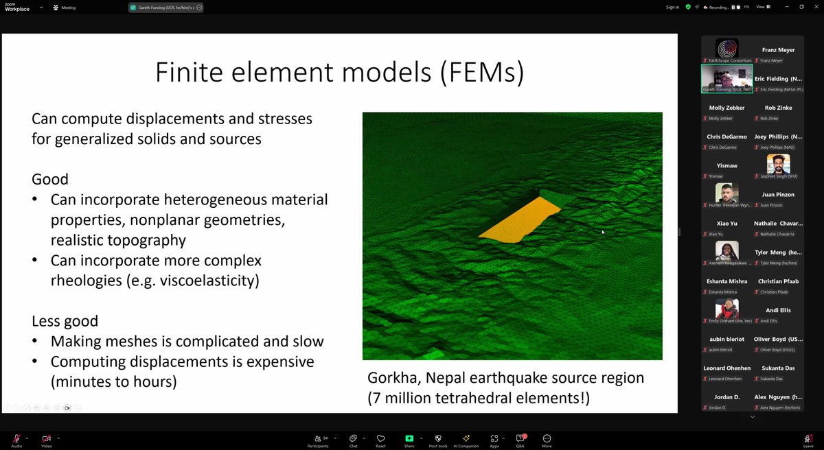
🗞️#InSAR Crowd🗞️
Today is first day of the annual <a href="/EarthScope_sci/">EarthScope Consortium</a> InSAR course based on ISCE &amp; MintPy 🥳. We will go through stuff from InSAR processing to InSAR time series &amp; geophysical modeling. 
Right now <a href="/gfun/">Dr Gareth Funning</a> is kicking us off with InSAR in Geophysics. 
#GoldenAgeOfSAR
Franz J Meyer (@sarevangelist) 's Twitter Profile Photo

🚨Final Day EarthScope Consortium InSAR Class🚨 Today is #InSAR Time Series day 🥳. Right now, Heresh Fattahi is introducing ISCE3, the next-gen of #ISCE for use with NISAR 🛰️! Next Zhang Yunjun will lead exercises on SBAS processing with #MIntPy. Unroll for resources 🧵 #GoldenAgeOfSAR

🚨Final Day <a href="/EarthScope_sci/">EarthScope Consortium</a> InSAR Class🚨
Today is #InSAR Time Series day 🥳. Right now, <a href="/HereshF/">Heresh Fattahi</a> is introducing ISCE3, the next-gen of #ISCE for use with NISAR 🛰️! Next <a href="/yunjun_z/">Zhang Yunjun</a> will lead exercises on SBAS processing with #MIntPy. Unroll for resources 🧵
#GoldenAgeOfSAR
Get HyP3! (@asfhyp3) 's Twitter Profile Photo

Sentinel-1 orbit files are now available in the Registry of Open Data on AWS! • Publicly available, no login required 🎉 • Less downtime, thanks to Amazon S3 🎊 • Accessible via a new s1_orbits Python library and standard S3 tools 🥳 asf.alaska.edu/notices/sentin…

Science Magazine (@sciencemagazine) 's Twitter Profile Photo

The 2024 magnitude 7.5 Noto earthquake in Japan occurred on a fault system that has seen repeated seismic swarms since 2020. New research in Science deciphers the intense ground motion of the event. Learn more in this week's issue: scim.ag/86Y

The 2024 magnitude 7.5 Noto earthquake in Japan occurred on a fault system that has seen repeated seismic swarms since 2020. New research in Science deciphers the intense ground motion of the event.

Learn more in this week's issue: scim.ag/86Y
Zhang Yunjun (@yunjun_z) 's Twitter Profile Photo

Excited to see our work on the 2024 Noto EQ led by Liuwei Xu, Ji Chen, and Lingsen Meng featured on the cover of Science Magazine! Combining seismic & geodetic data, we found complex ruptures in the initial stage of this New Year's EQ that led to violent shaking

Excited to see our work on the 2024 Noto EQ led by <a href="/liuwei_xu/">Liuwei Xu</a>, Ji Chen, and <a href="/LingsenMeng/">Lingsen Meng</a> featured on the cover of <a href="/ScienceMagazine/">Science Magazine</a>! Combining seismic &amp; geodetic data, we found complex ruptures in the initial stage of this New Year's EQ that led to violent shaking
Cunren Liang (@cunrenliang) 's Twitter Profile Photo

Sharing our paper titled An analysis of the potentials of L-band SAR satellites for measuring azimuth motion. Download the paper for free until November 15, 2024 at authors.elsevier.com/a/1jqnq7qzT3EYm

Sharing our paper titled An analysis of the potentials of L-band SAR satellites for measuring azimuth motion. Download the paper for free until November 15, 2024 at authors.elsevier.com/a/1jqnq7qzT3EYm
Journal of Remote Sensing (@journalofrs) 's Twitter Profile Photo

💡Highlights: Sandy beach intertidal topography estimation based on lCESat-2, is a methodology that can capturenarrow sandy beach intertidal topography and extendit globally. 🌟Keywords: Intertidal, topography, sandy beach, lowland, ICESat-2, Sentinel-2.

💡Highlights: Sandy beach intertidal topography estimation based on lCESat-2,  is a methodology that can capturenarrow sandy beach intertidal topography and extendit globally.
🌟Keywords: Intertidal, topography, sandy beach, lowland, ICESat-2, Sentinel-2.
Taiyi Wang (@taiyi_wang) 's Twitter Profile Photo

In our new paper jvolcanica.org/ojs/index.php/…, we explore how Graph Neural Network and spherical harmonics can potentially help volcano geodesy move beyond simple spheroidal reservoir geometries.

In our new paper
jvolcanica.org/ojs/index.php/…, we explore how Graph Neural Network and spherical harmonics can potentially help volcano geodesy move beyond simple spheroidal reservoir geometries.
Krittanon (Pond) Sirorattanakul (@seismopond) 's Twitter Profile Photo

A chapter from my Caltech PhD thesis has been published in nature. We (me, @StacyLarocheIIe, V. Rubino, N. Lapusta, A. Rosakis) show that interfaces under non-zero shear stress are always sliding, even if they appear to be stationary to the naked eye. nature.com/articles/s4158…

USGS Earthquakes (@usgs_quakes) 's Twitter Profile Photo

We are compiling our observations from satellite observations on this web map, and updating the map when new data become available: shorturl.at/YmjY1

We are compiling our observations from satellite observations on this web map, and updating the map when new data become available:
shorturl.at/YmjY1
Yuan-Kai Liu (@yuan_kai_liu) 's Twitter Profile Photo

Long-wavelength radar signals—once dismissed as noise—can reveal how entire tectonic plates rotate. In our paper on GRL, we use radar interferometry over the Arabia to infer plate motion—without relying on GNSS. Zhang Yunjun , Mark Simons Open Access link: doi.org/10.1029/2025GL…

Long-wavelength radar signals—once dismissed as noise—can reveal how entire tectonic plates rotate.

In our paper on GRL, we use radar interferometry over the Arabia to infer plate motion—without relying on GNSS. <a href="/yunjun_z/">Zhang Yunjun</a> , Mark Simons

Open Access link: doi.org/10.1029/2025GL…
Zhang Yunjun (@yunjun_z) 's Twitter Profile Photo

Great to see our paper led by Yuan-Kai Liu is out on GRL AGU (American Geophysical Union)! We demonstrate that InSAR velocity can be used to est. the Euler pole of tectonic plates, and it can be more accurate than using GNSS alone, providing future plate motion models with a new type of obs constraint.