Weather Loop Of The Day (@wx_loopofday) 's Twitter Profile
Weather Loop Of The Day

@wx_loopofday

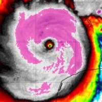
I will post Satellite, Radar, or other remote sensing images/loops Daily! Putting my Meteorology degree to use as a hobby ⚡️☀️⛈️

ID: 1954540354369372160

calendar_today10-08-2025 13:48:40

19 Tweet

7 Takipçi

32 Takip Edilen

Weather Loop Of The Day (@wx_loopofday) 's Twitter Profile Photo

A weak tropical wave over the gulf pumping moisture towards Florida under southeast flow. Rainfall totals upwards of 15"+ over 8 hours in St James City, FL with flooding reported. #flwx

Weather Loop Of The Day (@wx_loopofday) 's Twitter Profile Photo

(08.09.2025 - 08.10.2025) #Milwaukee, #WI sees about 24 hours of constant rain with little in the way of breaks. This led to a 2000 sq mi swath of 6-10" with localized amounts up to 12+ and heavy #flooding. jsonline.com/picture-galler…

Weather Loop Of The Day (@wx_loopofday) 's Twitter Profile Photo

What I am looking to everyday is show people how interesting the world can be using technology available. Whether it be #Satellite, #Radar, or handheld anemometer, there are stories to be shown everywhere. Here is a 12 hour Infrared/Visible loop overlayed with Sea surface

Weather Loop Of The Day (@wx_loopofday) 's Twitter Profile Photo

#Typhoon #Podul barreling towards #Taiwan with ragged but well defined eye. It looks to be strengthening into #landfall as its attempts to close off its eye. Reports of about a 950mb storm signifying its quite measurable strength. All people In Taiwan should heed the warnings and

Weather Loop Of The Day (@wx_loopofday) 's Twitter Profile Photo

One of my favorite charts of the week updates on Thursdays. The U.S. #Drought Monitor provides the current overview on the USA Drought and its impacts. Personally, I am looking at a 13.5" deficit on the year in South #Florida (D3, or Extreme Drought) which explains my excitement

One of my favorite charts of the week updates on Thursdays. The U.S. #Drought Monitor provides the current overview on the USA Drought and its impacts. Personally, I am looking at a 13.5" deficit on the year in South #Florida (D3, or Extreme Drought) which explains my excitement
Weather Loop Of The Day (@wx_loopofday) 's Twitter Profile Photo

#Erin as seen through 3 different #Satellite Bands. 1. Water Vapor View, Showing how she is moistening her environment. 2. Visible View, What we would see from space with our own eyes, good for looking at structure of the storm. 3. Infrared View, showing temperatures of the

Weather Loop Of The Day (@wx_loopofday) 's Twitter Profile Photo

In one of the most impressive rapid intensifications I have ever seen, #HurricaneErin has strengthened from a cat1 to a #Cat5 in about 18 hours. Check out this 13 hour loop of this intensification process.

Weather Loop Of The Day (@wx_loopofday) 's Twitter Profile Photo

The #Eye of #HurricaneErin approaching the bounds of San Juan Radar. This will be quite the valuable resource to use as she passes north of the Islands!

Weather Loop Of The Day (@wx_loopofday) 's Twitter Profile Photo

#HurricaneErin lashing #StThomas, #StJohn, and the rest of the #VirginIslands with consistent bands of heavy rain. With the mountainous landscape, there will surely be flash flooding occurring, signifying that this is NOT a fish storm! Be safe out there!

Weather Loop Of The Day (@wx_loopofday) 's Twitter Profile Photo

#HurricaneErin seen exiting towards the west, giving 24 hours of rain and wind to Puerto Rico and the Virgin Islands. It's a reminder not to focus on the center of storm, but to understand all of the modes of impact a storm has. Check out this 24 hr #radar Loop!

Weather Loop Of The Day (@wx_loopofday) 's Twitter Profile Photo

#Erin put on quite a show the past day and a half! It made a couple wobble loops but stayed offshore to maintain quite the beautiful view on radar. Check out the 30 hr loop from storm entrance to exit of the San Juan #radar's range!

Weather Loop Of The Day (@wx_loopofday) 's Twitter Profile Photo

Growing up in Florida on the coast, you start to understand how fast the sea breeze develops and moves inland, will determine if you will get a storm. The faster it moves inland (10am-11am) the less likely for storms. Seems constant this year, check out today's loop!

Weather Loop Of The Day (@wx_loopofday) 's Twitter Profile Photo

Even 460 miles away, Erin has a synoptic influence over our weather in Florida. She has changed the wind direction to be from the north resulting in the sea breeze storms racing southward. Tomorrow, I anticipate more of a westerly component the north wind, allowing for east

Weather Loop Of The Day (@wx_loopofday) 's Twitter Profile Photo

Erin continues her synoptic scale influence across much of the eastern seaboard. She is providing that cyclonic low level wind some 550 miles extending from the center. Truly a sight to behold!

Weather Loop Of The Day (@wx_loopofday) 's Twitter Profile Photo

South Florida swamp fire get doused by a storm but appears to have survived. It also looks like the rising air from the fire might have enhanced the thunderstorm with the rising air and extra condensation nuclei from the ash. Unique meteorology in quite a dry environment lately

Weather Loop Of The Day (@wx_loopofday) 's Twitter Profile Photo

Thunderstorm outflow resulted in a massive dust storm over Phoenix, AZ. The front edge of the storm, seen on radar, resulted in spectacular photos of the dust storm! azcentral.com/picture-galler…