Mike Potter (@mpotter2013) 's Twitter Profile
Mike Potter

@mpotter2013

Local Emergency Response Coordinator For The Oklahoma State Department Of Health

ID: 23470202

calendar_today09-03-2009 17:52:36

13,13K Tweet

577 Takipçi

386 Takip Edilen

Pottawatomie County Emergency Operations Center (@pottcooem) 's Twitter Profile Photo

Please stay home if you do not have to be out on the roads today, the roads are slick and hazardous. If you have to get out, please slow down. Pack an emergency kit with blankets, snacks, water, phone charger, and make sure you have a full tank.... tp5qs.app.goo.gl/y8WH

Mike Potter (@mpotter2013) 's Twitter Profile Photo

.Kevin Wallace HB-3835 enables for-profit companies to dictate to co-ops what they should pay to attach on co-op poles. This approach is not consumer focused, nor it is community driven. Co-ops are not-for-profit, they put members first. Vote “NO” on HB-3835.
NWS Norman (@nwsnorman) 's Twitter Profile Photo

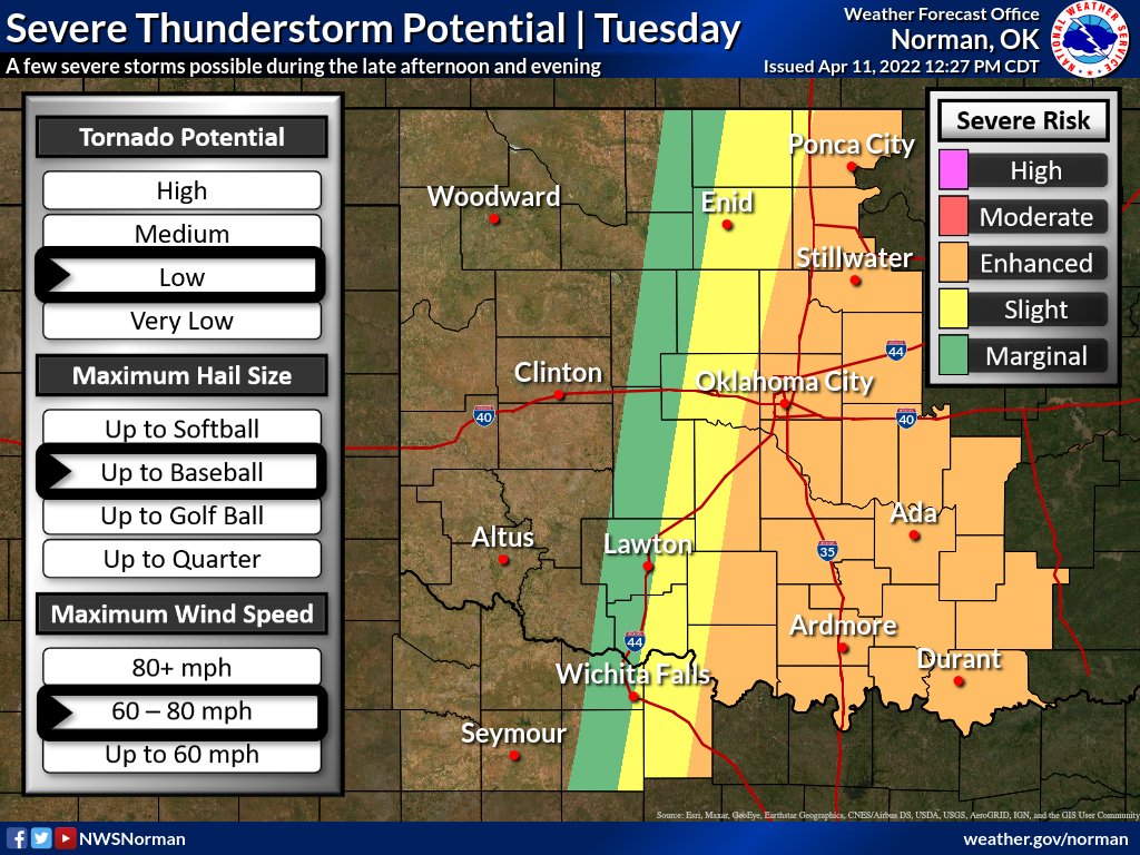
Tuesday will be an important day to be aware of the weather. A dryline will move into OK/TX with very dry & windy conditions west which will bring extreme fire danger. Storms will be possible east of the dryline, and if storms do develop, severe weather is likely. #okwx #texomawx

Tuesday will be an important day to be aware of the weather. A dryline will move into OK/TX with very dry & windy conditions west which will bring extreme fire danger. Storms will be possible east of the dryline, and if storms do develop, severe weather is likely. #okwx #texomawx
NWS Norman (@nwsnorman) 's Twitter Profile Photo

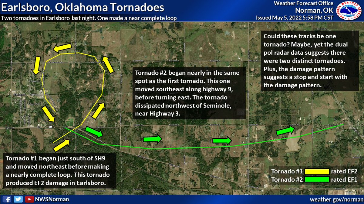
#Tornadoes do weird things. Most of us know that, but here is a weird thing from yesterday. Radar analysis and preliminary damage surveys indicate two tornadoes near Earlsboro around 8:30. The first made nearly a complete loop. #okwx #txwx

#Tornadoes do weird things. Most of us know that, but here is a weird thing from yesterday. Radar analysis and preliminary damage surveys indicate two tornadoes near Earlsboro around 8:30. The first made nearly a complete loop. #okwx #txwx
Mike Potter (@mpotter2013) 's Twitter Profile Photo

Hey DIRECTV – Don’t drop my favorite FOX Sports programming like NFL on FOX, FIFA World Cup on FOX and FS1, and more. I want to #KEEPFOXSPORTS! keepfox.com

Oklahoma Mesonet (@okmesonet) 's Twitter Profile Photo

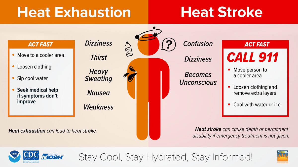
Introducing the newest Oklahoma Mesonet extreme: 126F heat index at the Paul’s Valley site. This is our highest ever heat index measurement in our nearly 30 year history. 😳#okmesonet #okwx

Introducing the newest Oklahoma Mesonet extreme: 126F heat index at the Paul’s Valley site. This is our highest ever heat index measurement in our nearly 30 year history. 😳#okmesonet #okwx
Travel - State Dept (@travelgov) 's Twitter Profile Photo

Lebanon: U.S. citizens who wish to depart Lebanon should leave now, due to the unpredictable security situation. There are still commercial flights available, but there is reduced capacity. Please check flight options at Beirut–Rafic Hariri International Airport

Lebanon: U.S. citizens who wish to depart Lebanon should leave now, due to the unpredictable security situation.  There are still commercial flights available, but there is reduced capacity. Please check flight options at Beirut–Rafic Hariri International Airport
NWS Norman (@nwsnorman) 's Twitter Profile Photo

Our office has compiled a short storymap for the wildfire outbreak, high winds, and blowing dust event that impacted our area on March 14th. Enjoy! tinyurl.com/2s3m8u3x #okwx #texomawx

NWS Norman (@nwsnorman) 's Twitter Profile Photo

2:40 pm - A tornado watch is in effect until late this evening across much of Oklahoma and western north Texas. Severe storms will develop in the next 1-3 hours with the tornado threat ramping up this evening.