Lin Xiong (@lin_umd) 's Twitter Profile
Lin Xiong

@lin_umd

Currently @umdgeography, postdoc at @CoastalECU, PhD @UHEAS. Remote sensing for Earth science. Geospatial data scientist.

ID: 984564077560295425

linkhttps://sites.google.com/view/linxiong/ calendar_today12-04-2018 22:49:03

349 Tweet

223 Takipçi

412 Takip Edilen

Department of Geographical Sciences (@umdgeography) 's Twitter Profile Photo

✨Job alert: We are looking for an associate professor in #RemoteSensing! This kind of opportunity doesn't come every day. If you know anyone qualified, send it their way: ejobs.umd.edu/postings/120364 #gis #tenure

Department of Geographical Sciences (@umdgeography) 's Twitter Profile Photo

Join the 3rd International Quantitative Remote Sensing Summer School from July 10-17. Hosted virtually, it features global experts discussing the latest in remote sensing. Free to attend! #IntGeoCenter go.umd.edu/1p8h

Join the 3rd International Quantitative Remote Sensing Summer School from July 10-17. Hosted virtually, it features global experts discussing the latest in remote sensing. Free to attend! #IntGeoCenter
go.umd.edu/1p8h
Lin Xiong (@lin_umd) 's Twitter Profile Photo

This year we have a combined session for GEDI and ICESat-2, by @helenafricker John Armston ! All are encouraged to submit an abstract! GEDI ICESat-2 AGU (American Geophysical Union) agu.confex.com/agu/agu24/prel…
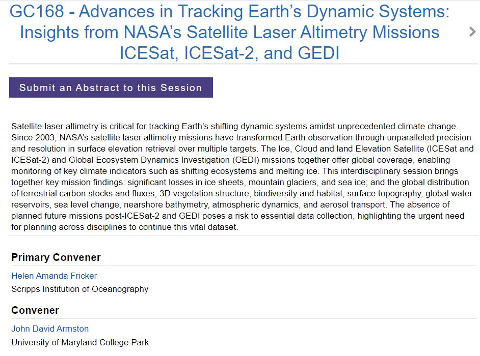
This year we have a combined session for GEDI and ICESat-2, by @helenafricker <a href="/ArmstonJohn/">John Armston</a>  !  All are encouraged to submit an abstract! <a href="/GEDI_Knights/">GEDI</a>  <a href="/NASA_ICESat2/">ICESat-2</a> <a href="/theAGU/">AGU (American Geophysical Union)</a> 
agu.confex.com/agu/agu24/prel…
Lin Xiong (@lin_umd) 's Twitter Profile Photo

new 12m resultion of global mangrove canopy height map is online! Using TanDEM-X data, calibrated by GEDI GEDI . Very important datasets for coastal forest structure and blue carbon dynamics! daac.ornl.gov/CMS/guides/CMS…

new 12m resultion of global mangrove canopy height map is online! Using TanDEM-X data, calibrated by GEDI
<a href="/GEDI_Knights/">GEDI</a>
. Very important datasets for coastal forest structure and blue carbon dynamics!
daac.ornl.gov/CMS/guides/CMS…
NASAEarthdata (@nasaearthdata) 's Twitter Profile Photo

NASA #LPDAAC's GEDI Version 2 Level 1B Geolocated Waveform, Level 2A Elevation and Height Metrics, and Level 2B Canopy Cover and Vertical Profile Metrics products are now available in the NASA Earthdata Cloud. Basemap: USAID NAIP 2020 Learn more: go.nasa.gov/4eNotT7

NASA #LPDAAC's GEDI Version 2 Level 1B Geolocated Waveform, Level 2A Elevation and Height Metrics, and Level 2B Canopy Cover and Vertical Profile Metrics products are now available in the NASA Earthdata Cloud. Basemap: USAID NAIP 2020

Learn more: go.nasa.gov/4eNotT7
Jason Farman (@farman) 's Twitter Profile Photo

This is my 15th year at Univ. of Maryland and I've never seen anything like this: The Artificial Intelligence Interdisciplinary Institute has openings for *30* (!) tenured and/or tenure-track faculty positions in Artificial Intelligence, broadly defined. ejobs.umd.edu/postings/124144

SilviLaser 2025 (@silvilaser25) 's Twitter Profile Photo

Please head over to BlueSky and follow us there to stay up to date with all relevant information for #Silvilaser2025! 🦋 bsky.app/profile/silvil… Abstracts for Silvilaser 2025 are due by February 28th, 2025! All information can be found on our website: silvilaser2025.com

Lin Xiong (@lin_umd) 's Twitter Profile Photo

such a great time to do a group retreat at NEON / SERC field site SmithsonianEnv I did a simple earthengine app so we can find nearby GEDI shots for height and biomass at a given locaiton. lxiong.users.earthengine.app/view/heregedi
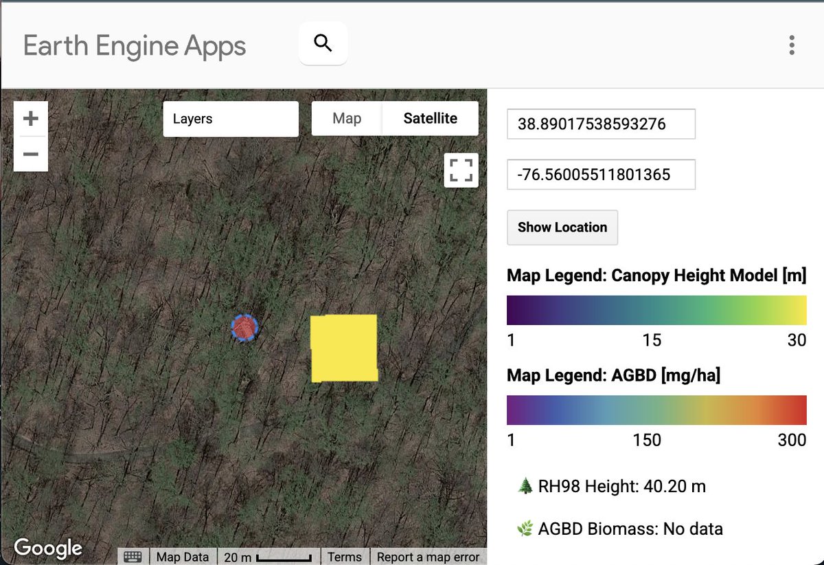
such a great time to do a group retreat at NEON / SERC field site <a href="/SmithsonianEnv/">SmithsonianEnv</a> I did a simple earthengine app so we can find nearby GEDI shots for height and biomass at a given locaiton. lxiong.users.earthengine.app/view/heregedi
eebiomass (@eebiomass) 's Twitter Profile Photo

Join our EEBIOMASS SPECIAL on "Upcoming opportunities and challenges in Forest missions" featuring BIOMASS, NISAR, GEDI and Geo-Trees! eebiomass.org/workshops/ The workshop will take place on March 27, 2025 (Thursday), 13:00-16:00 CET. 📢Register here: survey.academiccloud.de/index.php/9885…

Join our EEBIOMASS SPECIAL on "Upcoming opportunities and challenges in Forest missions" featuring BIOMASS, NISAR, GEDI and Geo-Trees! 
eebiomass.org/workshops/

The workshop will take place on March 27, 2025 (Thursday), 13:00-16:00 CET. 

📢Register here: survey.academiccloud.de/index.php/9885…
GEDI (@gedi_knights) 's Twitter Profile Photo

Environmental drivers of spatial variation in tropical forest canopy height: Insights from NASA’s GEDI spaceborne LiDAR ✨🌳🛰️ pnas.org/doi/10.1073/pn…

ECU Integrated Coastal Programs (@coastalecu) 's Twitter Profile Photo

Dr. David Lagomasino and the Coasts and Oceans Observing Lab are part of an ongoing project in the Florida Everglades! Learn more in this recently published NASA Science web story ⤵️ science.nasa.gov/earth/nasa-res…

GEDI (@gedi_knights) 's Twitter Profile Photo

Another invigorating #GEDI Science Team meeting in the books, our first with this competed science team cohort! ✨ Thank you to everyone who attended both in-person and virtually. Department of Geographical Sciences BSOS @ UMD
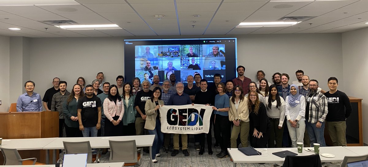
Another invigorating #GEDI Science Team meeting in the books, our first with this competed science team cohort! ✨ Thank you to everyone who attended both in-person and virtually. 

<a href="/umdgeography/">Department of Geographical Sciences</a> <a href="/bsosumd/">BSOS @ UMD</a>
GEDI (@gedi_knights) 's Twitter Profile Photo

📩 All GEDI L4A post-storage datasets are now available on NASAEarthdata via the Oak Ridge Lab DAAC! With this release, all #GEDI footprint level datasets from Level 1 to Level 4 are publicly available up until mission week 311 (except L4C WSCI). search.earthdata.nasa.gov/search/granule…
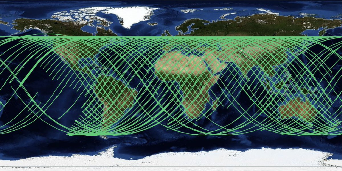
📩 All GEDI L4A post-storage datasets are now available on <a href="/NASAEarthData/">NASAEarthdata</a> via the <a href="/ORNL/">Oak Ridge Lab</a> DAAC!

With this release, all #GEDI footprint level datasets from Level 1 to Level 4 are publicly available up until mission week 311 (except L4C WSCI).

search.earthdata.nasa.gov/search/granule…