IEOS2022 TU Dublin
@ieos2022
The official #Twitter account of the 14th Irish Earth Observation Symposium #IEOS2022 | Hosted by @TU834GeoSurvey @WeAreTUDublin
ID: 1551909284367179776
https://earthobservation.wordpress.com/ 26-07-2022 12:36:51
116 Tweet
55 Takipçi
78 Takip Edilen


Next is Dr Gourav Misra Maynooth University discussing the application of #EO data for urban driveways detection #IEOS2022


Louis from Trinity is presenting about information extraction from bog commission maps Mapalljohn RePEAT Project 🗺🌎 #IEOS2022 TU Dublin / OT Baile Átha Cliath

The final talk is by Rumia from NUIG is talking about soil moisture estimation using Sentinel-2 and OPTRAM model 🛰 💦 #IEOS2022 TU Dublin / OT Baile Átha Cliath

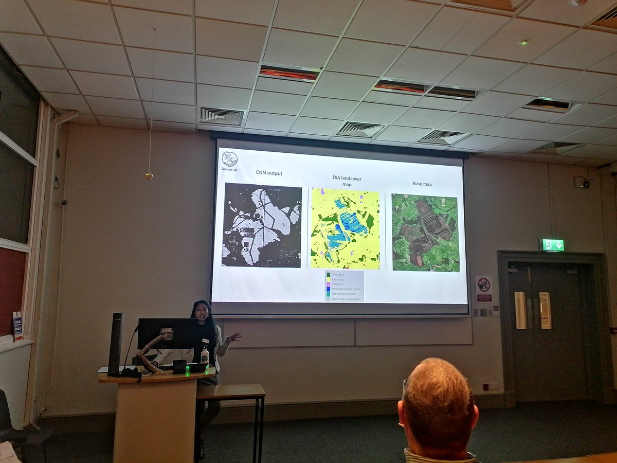
I presented my collaborative work IEOS2022 TU Dublin with @Rob0Hara Jesko Zimmermann 📯 Matt Saunders and Stuart Teagasc (Not on Twitter) on wetland extent extraction from @OrdnanceIreland historical maps using CNN model. This work is part of Terrain-AI School of Natural Sciences, Trinity College Dublin #IEOS2022 @PeatlandECR #PeatECR


Our newest #PhD student @YerayCastillo presented his project today at #IEOS2022. Great stuff Yeray!

Great to see some of the @ihabimap team back presenting EPA Research News

Great that Louis Gilet got to present our work on the RePEAT Project project today IEOS2022 TU Dublin. Dept of Agriculture, Food and the Marine EPA Ireland EPA Research News Terry R Morley @KBruisch Trinity Geography School of Natural Sciences, Trinity College Dublin

Two of the iHabiMap team were presenting today at the IEOS2022 TU Dublin. Jerome O'Connell Proveye gave an oral presentation while Charmaine Cruz delivered a poster presentation. EPA Ireland Trinity Geography School of Natural Sciences, Trinity College Dublin Jim Martin BEC Consultants Kevin McGuinness Insight Research Ireland Centre

Great workshop to close #IEOS2022, last but not least ... Land cover classification using Sentinel 2 and Random Forests with a touch of Python by Dr Aidan Magee from NCG Maynooth University @GeoAerospace_ #QGIS #esa #Sentinel2 #earthobservation TU089 & TU834 Geospatial Surveying Programmes


