Vinícius Hector (@hec_vini) 's Twitter Profile
Vinícius Hector

@hec_vini

Master’s student in Economics at @FGV_EPGE | Into Environmental Economics, DataViz and GIS | #Rstats and Python

ID: 3423112445

linkhttps://github.com/HecVini calendar_today14-08-2015 23:43:31

970 Tweet

384 Takipçi

1,1K Takip Edilen

Ujaval Gandhi (@spatialthoughts) 's Twitter Profile Photo

All #EarthEngine users recently got an email to link their account to a Google Cloud project. Google Cloud can be quite daunting for beginners, so we have compiled a simplified guide with FAQs to help you migrate your legacy GEE account to a cloud project. courses.spatialthoughts.com/gee-sign-up.ht…
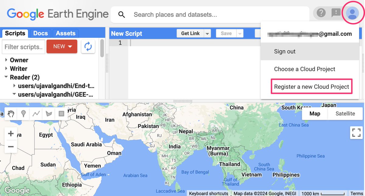
All #EarthEngine users recently got an email to link their account to a Google Cloud project. Google Cloud can be quite daunting for beginners, so we have compiled a simplified guide with FAQs to help you migrate your legacy GEE account to a cloud project. courses.spatialthoughts.com/gee-sign-up.ht…
NASAEarthdata (@nasaearthdata) 's Twitter Profile Photo

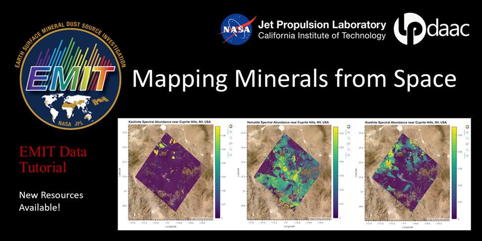
New #Python Tutorial! A new Jupyter Notebook tutorial developed by NASA's Land Processes DAAC (#LPDAAC) shows you how to work with NASA's EMIT L2B Estimated Mineral Identification and Band Depth and Uncertainty data. Access Notebook: go.nasa.gov/3WAVA6a

New #Python Tutorial! A new Jupyter Notebook tutorial developed by NASA's Land Processes DAAC (#LPDAAC) shows you how to work with NASA's EMIT L2B Estimated Mineral Identification and Band Depth and Uncertainty data. 

Access Notebook: go.nasa.gov/3WAVA6a
Melissa Dell (@melissaldell) 's Twitter Profile Photo

Visual communication is key. Thrilled to discover the mini-course "Visual Design in Scholarly Communication" by the phenomenally talented Shannon Shen better-visual.github.io #econtwitter

Diego Saez Gil (@dsaezgil) 's Twitter Profile Photo

WOW this new super high-definition model of CO2 emissions from satellite data by NASA. I wish more saw this to visualize how the atmosphere works! 🌎

NASAEarthdata (@nasaearthdata) 's Twitter Profile Photo

A new Global Urban Polygons and Points Dataset (GUPPD), v1 (1975 – 2030) is available at NASA' #SEDAC. This global dataset provides 123,034 urban settlements with place names and population for the years 1975-2030 in five-year increments. Learn more: go.nasa.gov/3WH8WxK

A new Global Urban Polygons and Points Dataset (GUPPD), v1 (1975 – 2030) is available at NASA' #SEDAC. This global dataset provides 123,034 urban settlements with place names and population for the years 1975-2030 in five-year increments. 

Learn more: go.nasa.gov/3WH8WxK
Raphael Saldanha @rfsaldanha.bsky.social (@rfsaldanhario) 's Twitter Profile Photo

Are you looking for a USA counties road distance and traveling time database? Here it is! rfsaldanha.github.io/data-projects/… Dataset available on Zenodo , computed with the Project OSRM with #rstats

Are you looking for a USA counties road distance and traveling time database? Here it is!

rfsaldanha.github.io/data-projects/…

Dataset available on <a href="/ZENODO_ORG/">Zenodo</a> , computed with the <a href="/ProjectOSRM/">Project OSRM</a> with #rstats
NASAEarthdata (@nasaearthdata) 's Twitter Profile Photo

The SWOT On-Demand Level 2 Raster Generation System (SWODLR) is now integrated into NASA Earthdata Search. Read more about what this means for your use of data from the Surface Water and Ocean Topography (SWOT) mission: go.nasa.gov/47Xu4UE #PODAAC

The SWOT On-Demand Level 2 Raster Generation System (SWODLR) is now integrated into NASA Earthdata Search. Read more about what this means for your use of data from the Surface Water and Ocean Topography (SWOT) mission: go.nasa.gov/47Xu4UE
#PODAAC
Ricardo Dalagnol (@ricardodalagnol) 's Twitter Profile Photo

📢🛰️🌳Forest degradation & tree cover loss in the tropics can now be seen w/ high resolution & attributions based on #ArtificialIntelligence and Planet NICFI Satellite Data Program 5m satellite data 🪵🔥🛣️Available for viz at REDD+AI platform: ctrees.org/reddai CTrees Fabien Wagner

𝙳𝚊𝚟𝚒𝚍 𝚆𝚞𝚎𝚙𝚙𝚎𝚛 (@davidwuepper) 's Twitter Profile Photo

On my way to Université de Genève to talk about the use of satellite data in agricultural, climate, and environmental economics at the "postdoc network in agricultural, climate, and environmental economics" (PoNACEE). Link to paper: ageconsearch.umn.edu/record/344359/…

On my way to <a href="/UNIGEnews/">Université de Genève</a> to talk about the use of satellite data in agricultural, climate, and environmental economics at the "postdoc network in agricultural, climate, and environmental economics" (PoNACEE). 

Link to paper: ageconsearch.umn.edu/record/344359/…
Joseph Shapiro (@_josephshapiro) 's Twitter Profile Photo

1/🚨New chapter in Handbook of Regional & Urban Econ: Spatial Environmental Economics 🌍 How do spatial forces affect the enviro? How does enviro shape spatial outcomes? Thread, chapter explore nascent subfield via stylized acts, models, research guide. w Clare Balboni.

1/🚨New chapter in Handbook of Regional &amp; Urban Econ: Spatial Environmental Economics  🌍 

How do spatial forces affect the enviro? How does enviro shape spatial outcomes?   Thread, chapter explore nascent subfield via stylized acts, models, research guide. w Clare Balboni.