Xiaojiang Li (@gis_jiang) 's Twitter Profile
Xiaojiang Li

@gis_jiang

Urban Scientist, Spatial Data Scientist, Assistant Professor @Penn, co-found @Biometeors, Alum of MIT Senseable City Lab, 50 Rising Stars in Geospatial World.

ID: 2283652956

linkhttp://www.urbanspatial.info/ calendar_today09-01-2014 14:25:34

440 Tweet

1,1K Followers

665 Following

Xiaojiang Li (@gis_jiang) 's Twitter Profile Photo

Just launched my U.S. National Science Foundation funded project website, pedestrian level heat exposure. Please check the mean radiant temperature maps at multiple scales in Philadelphia. xiaojianggis.github.io/pedheat/
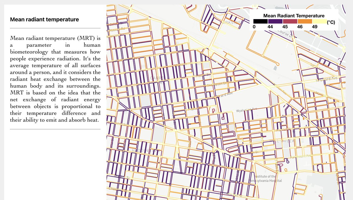
Just launched my <a href="/NSF/">U.S. National Science Foundation</a> funded project website, pedestrian level heat exposure. Please check the mean radiant temperature maps at multiple scales in Philadelphia. 
xiaojianggis.github.io/pedheat/
Xiaojiang Li (@gis_jiang) 's Twitter Profile Photo

Paper alert! Our paper on sensitivity and vulnerability to summer heat in US cities. We generated 1m resolution #UTCI in current weather and 1 degree higher scenarios. iopscience.iop.org/article/10.108… For visualization, check our project of HeatExpo, xiaojianggis.github.io/heatexpo/ Biometeors

Paper alert! Our paper on sensitivity and vulnerability to summer heat in US cities. We generated 1m resolution #UTCI in current weather and 1 degree higher scenarios.  iopscience.iop.org/article/10.108…

For visualization, check our project of HeatExpo, xiaojianggis.github.io/heatexpo/
<a href="/biometeors/">Biometeors</a>
Xiaojiang Li (@gis_jiang) 's Twitter Profile Photo

A new U.S. National Science Foundation funded project publication on E&P B: Urban Analytics and City Science. I modeled and mapped the pedestrian-level heat exposure in Philadelphia. Heat exposure was analyzed at the sidewalk level, and 400m walkshed of each building along the sidewalk, journals.sagepub.com/doi/abs/10.117…

A new <a href="/NSF/">U.S. National Science Foundation</a> funded project publication on <a href="/envplanb/">E&P B: Urban Analytics and City Science</a>. I modeled and mapped the pedestrian-level heat exposure in Philadelphia. Heat exposure was analyzed at the sidewalk level, and 400m walkshed of each building along the sidewalk, journals.sagepub.com/doi/abs/10.117…
Xiaojiang Li (@gis_jiang) 's Twitter Profile Photo

Using meter-resolution urban 3D model from Microsoft Planetary Computer, I don't need to spend a huge amount of time on downloading and processing LiDAR data from USGS locally using tools like PDAL PDAL

Timothy L. Hawthorne (@timlhawthorne) 's Twitter Profile Photo

We’re hiring more faculty in Auburn University Geosciences Department. 🌎 Come join an innovative department committed to student success, research excellence and the land grant mission of Auburn University. ⬇️ auemployment.com/postings/48898 Auburn University #AuburnGeosciences
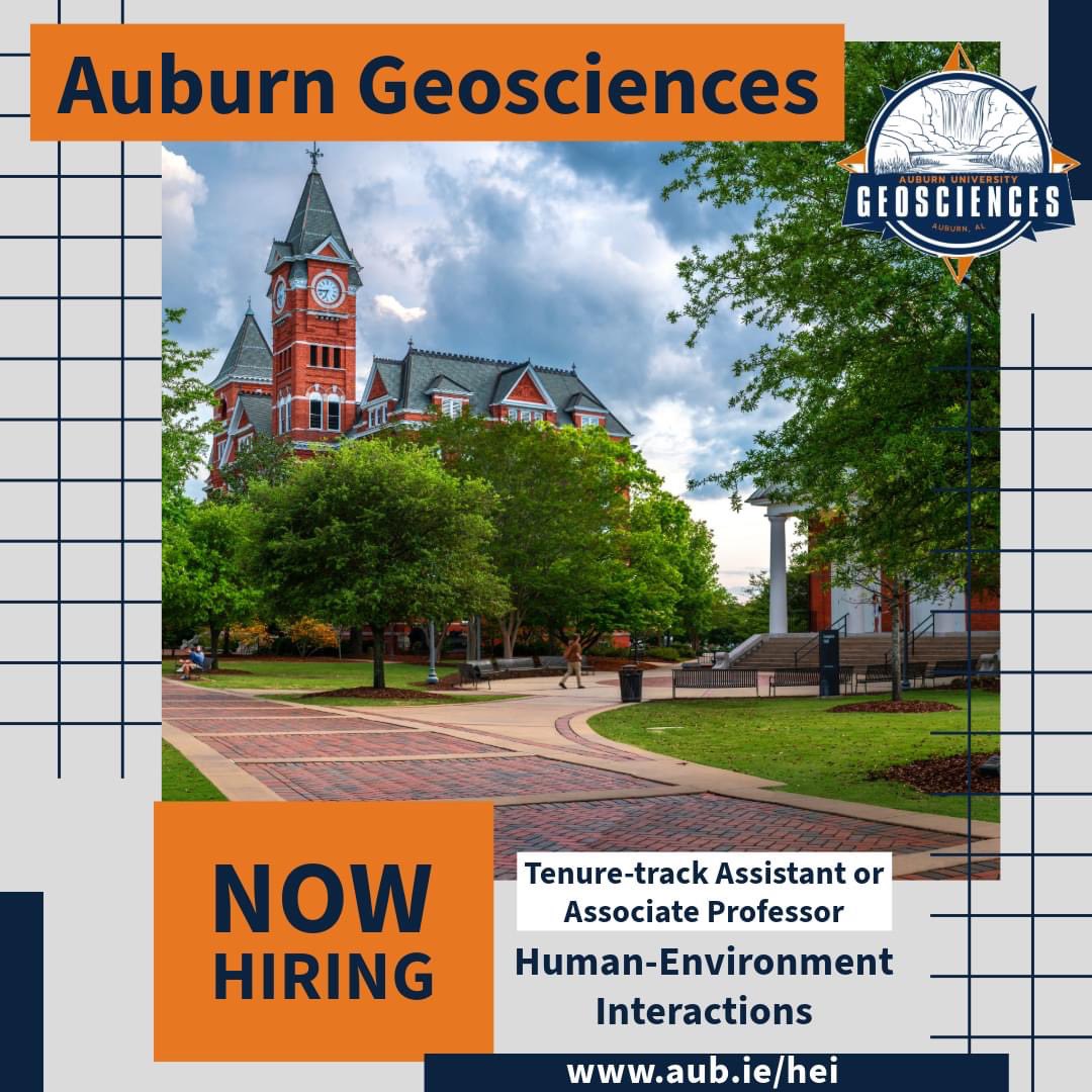
We’re hiring more faculty in Auburn University Geosciences Department. 🌎 

Come join an innovative department committed to student success, research excellence and the land grant mission of Auburn University. ⬇️

auemployment.com/postings/48898 <a href="/AuburnU/">Auburn University</a> #AuburnGeosciences
Christopher Uejio (@ckuejio) 's Twitter Profile Photo

Please consider applying for our Tenure Track Assistant Professor in Human-Environment Interactions <jobs.aag.org/jobs/view/tenu…> Applications due January 6th, 2025

Please consider applying for our Tenure Track Assistant Professor in Human-Environment Interactions &lt;jobs.aag.org/jobs/view/tenu…&gt; Applications due January 6th, 2025
Xiaojiang Li (@gis_jiang) 's Twitter Profile Photo

Thanks for the invitation from Department of Geography at Florida State U. I will give a talk about my recent research in Dec 6th. This is actually my first invitation from geography department to give a talk.

Xiaojiang Li (@gis_jiang) 's Twitter Profile Photo

Our recently published paper uses #GeoAI to generate the highest resolution #albedo map ever in major US cities. This will help us to better understand the urban thermal environment and provide a reference for urban heat management. nature.com/articles/s4159…

Our recently published paper uses #GeoAI to generate the highest resolution #albedo map ever in major US cities. This will help us to better understand the urban thermal environment and provide a reference for urban heat management. nature.com/articles/s4159…
Xiaojiang Li (@gis_jiang) 's Twitter Profile Photo

When you are blocked by falling trees, you tried to use chainsaw to cut through. Then found still several more fallen trees ahead.

When you are blocked by falling trees, you tried to use chainsaw to cut through. Then found still several more fallen trees ahead.