Jeff Pearson (@gis_dog) 's Twitter Profile
Jeff Pearson

@gis_dog

GIS=Geographic Information Science radialspatial.com #KentState Masters 📖#NSU Bachelors 🧑‍🎓 #EnvironmentalScientist #Geographer #GeoDev #AirForceVeteran

ID: 137779669

calendar_today27-04-2010 18:56:06

3,3K Tweet

3,3K Followers

955 Following

Esri (@esri) 's Twitter Profile Photo

Grenada uses ArcGIS Image for ArcGIS Online to host imagery, make 3D basemaps, and perform AI-based feature extraction and land clover classification. 🏝️ See how Grenada’s digital twin was made: ow.ly/aH6u50W1WA0

Grenada uses ArcGIS Image for ArcGIS Online to host imagery, make 3D basemaps, and perform AI-based feature extraction and land clover classification. 

🏝️ See how Grenada’s digital twin was made: ow.ly/aH6u50W1WA0
HustleBitch (@hustlebitch_) 's Twitter Profile Photo

🚨 WHAT JUST RIPPED ACROSS WASHINGTON D.C.? EVEN KARI LAKE IS ASKING QUESTIONS. At 3:30 PM, during a severe storm, a bright, fast-moving object blazed across D.C.’s radar. Not lightning. Not a plane. A clean, surgical streak across the sky, and it’s not showing up on flight

Geo-spatial Information Science (@gsisoffice) 's Twitter Profile Photo

🎉 5.5‼️ We got it ‼️ Geo-Spatial Information Science (GIS) has achieved a 2024 JIF of 5.5 and is continuously ranked in Q1! 🌟🗺️‼️🌍🛰️ A huge thank you to our authors, reviewers & readers for making this possible! 🙌💙 #RemoteSensing #GIS #Geospatial #EI #SCI #ResearchPaper

🎉 5.5‼️ We got it ‼️
Geo-Spatial Information Science (GIS) has achieved a 2024 JIF of 5.5 and is continuously ranked in Q1! 🌟🗺️‼️🌍🛰️
A huge thank you to our authors, reviewers & readers for making this possible! 🙌💙
#RemoteSensing #GIS #Geospatial #EI #SCI #ResearchPaper
Esri Training (@esritraining) 's Twitter Profile Photo

✅Identify emerging hot spots ✅Explain why spatial trends occur ✅Predict how patterns will change Learn how to do all of the above (and more!) in our 3-day Spatial Analysis with ArcGIS Pro course! 👉ow.ly/HcZZ50Wiqs7

✅Identify emerging hot spots
✅Explain why spatial trends occur
✅Predict how patterns will change

Learn how to do all of the above (and more!) in our 3-day Spatial Analysis with ArcGIS Pro course!

👉ow.ly/HcZZ50Wiqs7
Esri (@esri) 's Twitter Profile Photo

Nottingham, England is embracing the future of city planning with a digital twin. Using visualization tech, data analysis, and collaboration, they're transforming the cityscape for urban development. 🏙️ ow.ly/6cfy50W3L5S

Nottingham, England is embracing the future of city planning with a digital twin. Using visualization tech, data analysis, and collaboration, they're transforming the cityscape for urban development. 🏙️ ow.ly/6cfy50W3L5S
Tom Patterson (@mtnmapper) 's Twitter Profile Photo

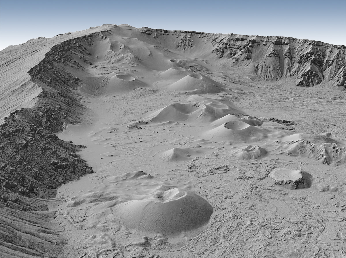
The USGS has released a new batch of Hawaii 1-meter DEMs. These quick 3D renders of Diamond Head and Haleakala show the exquisite terrain detail. apps.nationalmap.gov/downloader/

The USGS has released a new batch of Hawaii 1-meter DEMs. These quick 3D renders of Diamond Head and Haleakala show the exquisite terrain detail. apps.nationalmap.gov/downloader/
HPE (@hpe) 's Twitter Profile Photo

From blueprints to bold moves, HPE Discover Las Vegas 2025 delivered. We didn’t just talk future, we fast-tracked it. If you missed any sessions, be sure to catch the replays here. hpe.to/60194szWT

Dr. Dawn Wright + @deepseadawn.bsky.social 🇺🇦 (@deepseadawn) 's Twitter Profile Photo

We are passionate about hashtag#conservation at @esri ...and so are our users. So why not integrate all the great biodiversity and conservation information in the ArcGIS Living Atlas into a single dataset? ☑️ esri.com/arcgis-blog/pr…

ArcGIS Enterprise (@arcgisxprise) 's Twitter Profile Photo

Join us to learn about the new ArcGIS Well-Architected Framework and the ArcGIS Architecture Center website in our overview session at #EsriUC2025! 📍Tues. July 15 @ 2:30pm ➡️ ow.ly/tX7T50WgRFc

Join us to learn about the new ArcGIS Well-Architected Framework and the ArcGIS Architecture Center website in our overview session at #EsriUC2025!

📍Tues. July 15 @ 2:30pm ➡️ ow.ly/tX7T50WgRFc
Jeff Pearson (@gis_dog) 's Twitter Profile Photo

🚀 One of the most underrated cloud platforms in tech right now is HPE GreenLake. No one’s talking about it ..... but it’s perfect for deploying ArcGIS Enterprise in hybrid environments where performance, control, and scalability matter. #GIS #HybridCloud #HPE #ArcGIS #GISChat

Esri User Conference (@esriuc) 's Twitter Profile Photo

Joining us virtually?👨🏼‍💻Tune in tomorrow at 8:30 AM PT for the Plenary Session live stream! See the latest advancements in ArcGIS technology, exciting demos, and much more. 🔹Sign up to watch: ow.ly/xKNn50WkOFe #EsriUC2025

Joining us virtually?👨🏼‍💻Tune in tomorrow at 8:30 AM PT for the Plenary Session live stream! See the latest advancements in ArcGIS technology, exciting demos, and much more.

🔹Sign up to watch: ow.ly/xKNn50WkOFe

#EsriUC2025
Esri User Conference (@esriuc) 's Twitter Profile Photo

Whether you’re an Esri UC pro or a first-timer, one thing is always certain, it’s going to be a week to remember! 🙌🏽 Your conference experience matters to us. If you have any questions, don’t hesitate to reach out or find an Esri staff member wearing a red badge. #EsriUC2025

United Nations (@un) 's Twitter Profile Photo

For 60+ years, UN Messenger of Peace Jane Goodall has been working to protect our natural world and all that inhabit it. On Monday’s #WorldChimpanzeeDay, we want to thank the pioneer in the study of chimpanzees for her tireless commitment! un.org/en/messengers-…

For 60+ years, UN Messenger of Peace Jane Goodall has been working to protect our natural world and all that inhabit it.

On Monday’s #WorldChimpanzeeDay, we want to thank the pioneer in the study of chimpanzees for her tireless commitment! un.org/en/messengers-…
CAL FIRE (@cal_fire) 's Twitter Profile Photo

From mapping wildfire perimeters and evacuation zones to analyzing fire behavior and managing forest health, Geographic Information Systems (GIS) are vital to CAL FIRE’s mission. At the Esri User Conference—the world’s largest gathering of #GIS professionals— #CALFIRE was honored with the

From mapping wildfire perimeters and evacuation zones to analyzing fire behavior and managing forest health, Geographic Information Systems (GIS) are vital to CAL FIRE’s mission.

At the <a href="/EsriUC/">Esri User Conference</a>—the world’s largest gathering of #GIS professionals— #CALFIRE was honored with the
Jeff Pearson (@gis_dog) 's Twitter Profile Photo

Shout out to The Diamond for an incredible career! 🙌 Thanks for all the unforgettable UFC moments. What an inspiration, both in and out of the Octagon! 🥇👊 #UFC #Legend UFC

Shout out to <a href="/DustinPoirier/">The Diamond</a> for an incredible career! 🙌 Thanks for all the unforgettable UFC moments. What an inspiration, both in and out of the Octagon! 🥇👊 #UFC #Legend <a href="/ufc/">UFC</a>
Esri Training (@esritraining) 's Twitter Profile Photo

🐍Python is for everyone—especially when you take this web course! 👉 ow.ly/KCV650WqNfZ Save time by learning how to automate ArcGIS workflows 🌎.

🐍Python is for everyone—especially when you take this web course!

👉 ow.ly/KCV650WqNfZ

Save time by learning how to automate ArcGIS workflows 🌎.
Jeff Pearson (@gis_dog) 's Twitter Profile Photo

omg why does Postgres + PostGIS always gotta be so picky about versions 😩 like sorry I’m not running exactly 15.3.2.7.1b or whatever 🙄 🤬 😱 PostgreSQL #GIS #Geospatial #PostGIS #PostgreSQL #Mapping #SpatialData #OpenSourceGIS #Cartography #RemoteSensing #QGIS #FOSS4G

omg why does Postgres + PostGIS always gotta be so picky about versions 😩 like sorry I’m not running exactly 15.3.2.7.1b or whatever 🙄 🤬 😱 <a href="/PostgreSQL/">PostgreSQL</a> #GIS #Geospatial #PostGIS #PostgreSQL #Mapping #SpatialData #OpenSourceGIS #Cartography #RemoteSensing #QGIS #FOSS4G