GIS and Beers (@gis_and_beers) 's Twitter Profile
GIS and Beers

@gis_and_beers

¿Hay algo mejor que un buen #mapa?
Sí, un mapa en compañía de #cerveza bien fría. Lo importante siempre es latitud

ID: 3613770735

linkhttp://www.gisandbeers.com calendar_today10-09-2015 22:02:30

10,10K Tweet

9,9K Followers

1,1K Following

IECA (@ieca_andalucia) 's Twitter Profile Photo

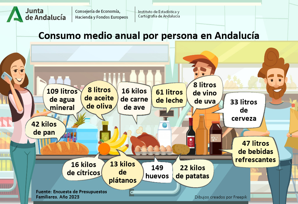
¿Cuántos litros de🍺#cerveza de media por persona se bebieron los #andaluces en 2023? 🍻El #consumo medio anual por persona en #Andalucía de #cerveza fue de 3⃣3⃣litros ➡️Datos de Encuesta Presupuestos Familiares #EPF juntadeandalucia.es/institutodeest… #FEDER #gasto #hogares #DíadelaCerveza

¿Cuántos litros de🍺#cerveza de media por persona se bebieron los #andaluces en 2023?
🍻El #consumo medio anual por persona en #Andalucía de #cerveza fue de 3⃣3⃣litros

➡️Datos de Encuesta Presupuestos Familiares #EPF juntadeandalucia.es/institutodeest… #FEDER #gasto #hogares #DíadelaCerveza
Colegio de Geografos (@colegeografos) 's Twitter Profile Photo

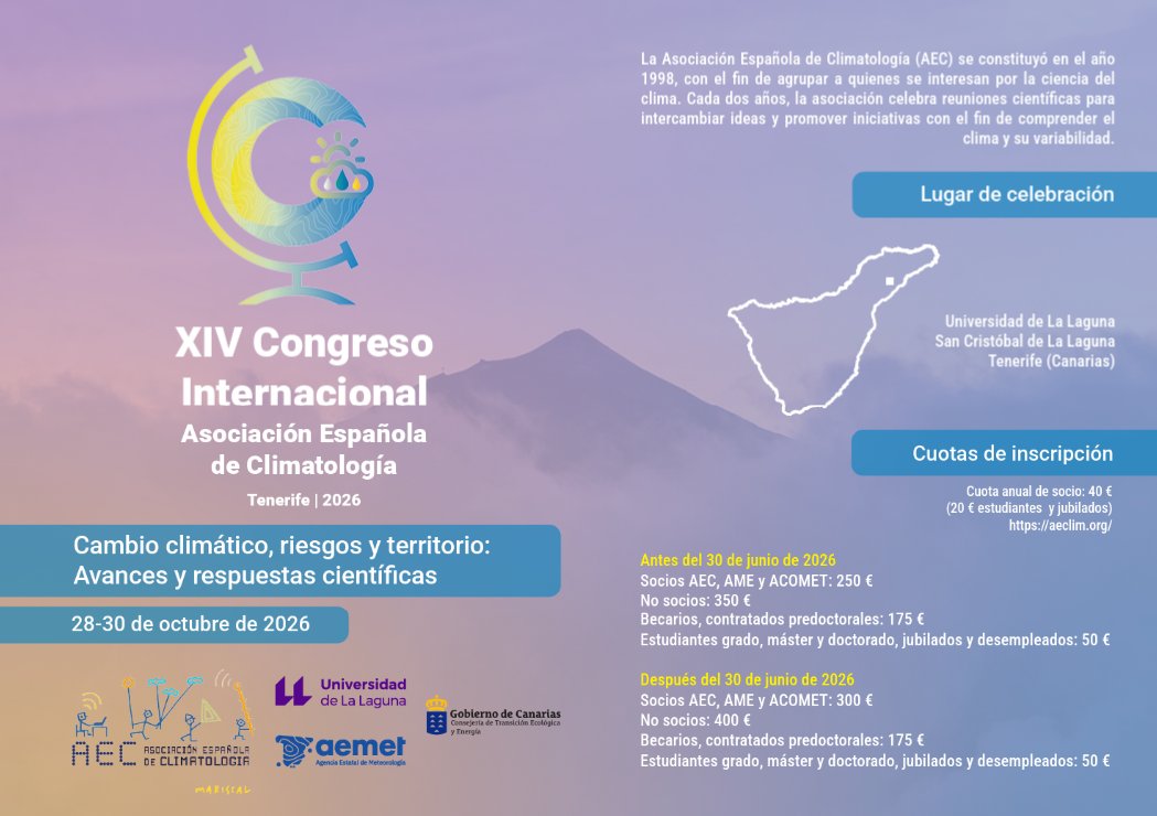
🌍 XIV Congreso Internacional de la Asociación Española de Climatología 📍 Tenerife | 28-30 oct 2026 🧭Cambio climático, riesgos y territorio 🏛️Universidad de La Laguna 🎓Premio a jóvenes investigadores 📅Envío resúmenes desde: 1 oct 2025 🔗aeclim.org

🌍 XIV Congreso Internacional de la Asociación Española de Climatología
📍 Tenerife | 28-30 oct 2026
🧭Cambio climático, riesgos y territorio
🏛️Universidad de La Laguna
🎓Premio a jóvenes investigadores
📅Envío resúmenes desde: 1 oct 2025
🔗aeclim.org
Colegio de Geografos (@colegeografos) 's Twitter Profile Photo

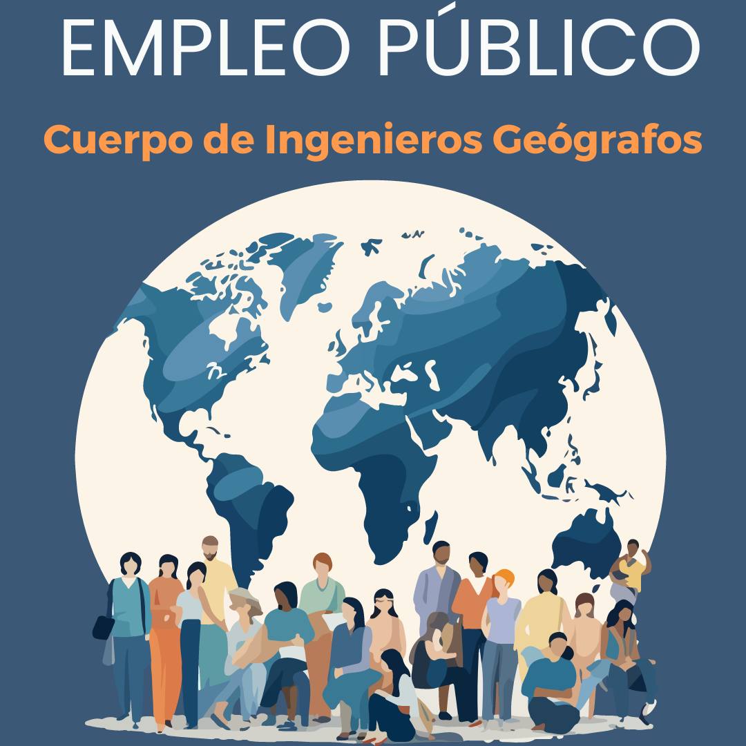
Oferta de empleo público 2025 Ingenieros Geógrafos (A1) → 13 plazas Superior de Gestión Catastral (A1) → 8 plazas Ingenieros Técnicos en Topografía (A2) → 17 plazas Técnicos de Gestión Catastral (A2) → 22 plazas geografos.org/oferta-de-empl…

Oferta de empleo público 2025
Ingenieros Geógrafos (A1) → 13 plazas
Superior de Gestión Catastral (A1) → 8 plazas
Ingenieros Técnicos en Topografía (A2) → 17 plazas 
Técnicos de Gestión Catastral (A2) → 22 plazas
geografos.org/oferta-de-empl…
Instituto Geográfico Nacional-O.A.CNIG (@ignspain) 's Twitter Profile Photo

📢 Nombramiento del Cuerpo de Ingenieros Geógrafos 📋Resolución de 22 de julio de 2025, de la Secretaría de Estado de Función Pública, por la que se nombra personal funcionario de carrera, por el sistema general de acceso libre y promoción interna, del Cuerpo de Ingenieros

📢 Nombramiento del Cuerpo de Ingenieros Geógrafos

📋Resolución de 22 de julio de 2025, de la Secretaría de Estado de Función Pública, por la que se nombra personal funcionario de carrera, por el sistema general de acceso libre y promoción interna, del Cuerpo de Ingenieros
educación forestal (@eforestal) 's Twitter Profile Photo

Estoy pensando en hacer este mapa por comunidades autónomas. Pedid la vuestra y si hay más de 10 peticiones por una en concreto, lo hago. Poned aquí abajo vuestras peticiones.

QField📳🗺️ (@qfieldforqgis) 's Twitter Profile Photo

🔥 QField 3.7's new plugin manager is a game-changer! Curated plugins + one-tap install = field work made easy. Discover routing, geocoding & more instantly! 🗺️ #QField #Makes #FieldWork #Work buff.ly/V8kqE1F

🔥 QField 3.7's new plugin manager is a game-changer! 

Curated plugins + one-tap install = field work made easy. Discover routing, geocoding & more instantly! 🗺️

#QField #Makes #FieldWork #Work

buff.ly/V8kqE1F
GIS and Beers (@gis_and_beers) 's Twitter Profile Photo

Os comparto la última imagen satélite de Copernicus #Sentinel2 de hoy en alta resolución con la situación de los #incendios de #Portugal #León y #Galicia (en el infrarrojo cercano) Áquí, un Sanabrés más, triste de ver por segunda vez el mismo panorama desde el espacio 😢

Os comparto la última imagen satélite de Copernicus #Sentinel2 de hoy en alta resolución con la situación de los #incendios de #Portugal #León y #Galicia (en el infrarrojo cercano)  
Áquí, un Sanabrés más, triste de ver por segunda vez el mismo panorama desde el espacio 😢
educación forestal (@eforestal) 's Twitter Profile Photo

🌳Mapas de cobertura arbórea 2018 de 🇪🇸España por Comunidades Autónomas. (Fuente 🇪🇺Copernicus Land Monitoring Service) En el hilo del siguiente tuit os los podéis encontrar todos.

🌳Mapas de cobertura arbórea 2018 de 🇪🇸España por Comunidades Autónomas.
(Fuente 🇪🇺<a href="/CopernicusLand/">Copernicus Land Monitoring Service</a>)

En el hilo del siguiente tuit os los podéis encontrar todos.
Instituto Geográfico Nacional-O.A.CNIG (@ignspain) 's Twitter Profile Photo

📍 ¡Nueva exposición en Cáceres! Desde hoy, el Palacio de la Isla acoge la exposición itinerante del Instituto Geográfico Nacional: 🗺️ “Ciudades del mundo. Vistas, planos” Una oportunidad única para viajar a través de mapas, planos y representaciones urbanas que muestran cómo

📍 ¡Nueva exposición en Cáceres!

Desde hoy, el Palacio de la Isla acoge la exposición itinerante del Instituto Geográfico Nacional:
🗺️ “Ciudades del mundo. Vistas, planos”

Una oportunidad única para viajar a través de mapas, planos y representaciones urbanas que muestran cómo
Copernicus EU (@copernicuseu) 's Twitter Profile Photo

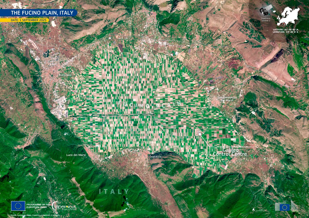
🌾 The Fucino Plain in central Italy 🇮🇹 was once covered by a lake. It was drained in the 19th century. It is now among the most intensively cultivated areas in the country. 🛰️ #ImageOfTheDay by a #CopernicusEU #Sentinel2 reveals its striking patchwork of agricultural fields.

🌾 The Fucino Plain in central Italy 🇮🇹  was once covered by a lake. It was drained in the 19th century.

It is now among the most intensively cultivated areas in the country.

🛰️ #ImageOfTheDay by a #CopernicusEU #Sentinel2 reveals its striking patchwork of agricultural fields.
Copernicus EU (@copernicuseu) 's Twitter Profile Photo

🏝️ A Calima event is affecting the Canary Islands with higher temps, lower air quality, and increased health risks. 🛰️ As visible in this #CopernicusEU #Sentinel3 #ImageOfTheDay (16 Sep), the Saharan dust was transported by easterly winds. Learn more: copernicus.eu/en/media/image…

🏝️ A Calima event is affecting the Canary Islands with higher temps, lower air quality, and increased health risks.

🛰️ As visible in this #CopernicusEU #Sentinel3 #ImageOfTheDay (16 Sep), the Saharan dust was transported by easterly winds.

Learn more: copernicus.eu/en/media/image…
Copernicus EU (@copernicuseu) 's Twitter Profile Photo

🌊 For the first time on record, the Gulf of Panama’s seasonal upwelling failed in 2025. 🛰️ Copernicus Marine data shows warmer seas vs. 2024, raising concerns about reduced nutrients & stress on ecosystems. #CopernicusEU #ImageOfTheDay

🌊 For the first time on record, the Gulf of Panama’s seasonal upwelling failed in 2025. 

🛰️ <a href="/CMEMS_EU/">Copernicus Marine</a> data shows warmer seas vs. 2024, raising concerns about reduced nutrients &amp; stress on ecosystems.

#CopernicusEU #ImageOfTheDay
Copernicus EU (@copernicuseu) 's Twitter Profile Photo

🌍 This data visualisation is based on the Global Land Cover by Copernicus Land Monitoring Service, released in June 2025. 🛰️ Based on #CopernicusEU #Sentinel2 data, the product provides a detailed view of the Earth’s surface. Learn more: copernicus.eu/en/media/image… #ImageOfTheDay
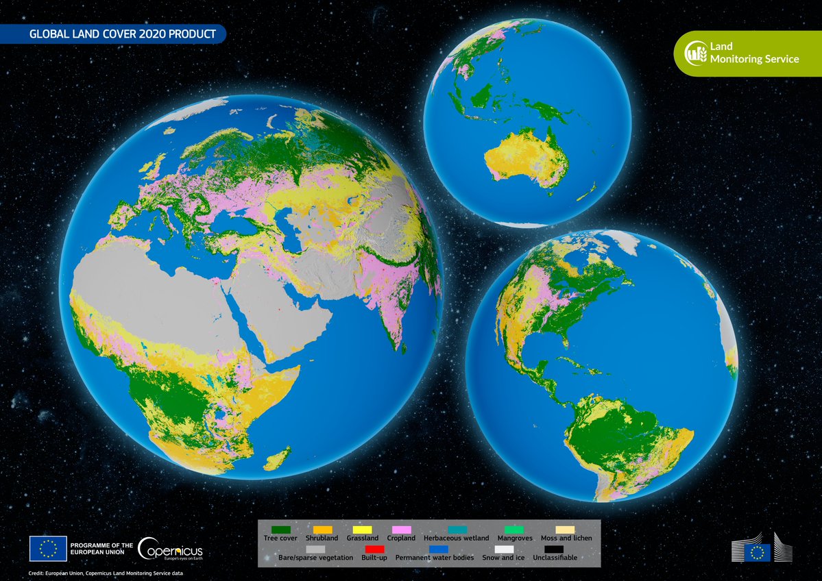
🌍 This data visualisation is based on the Global Land Cover by <a href="/CopernicusLand/">Copernicus Land Monitoring Service</a>, released in June 2025.

🛰️ Based on #CopernicusEU #Sentinel2 data, the product provides a detailed view of the Earth’s surface.

Learn more: copernicus.eu/en/media/image…

#ImageOfTheDay
Copernicus EU (@copernicuseu) 's Twitter Profile Photo

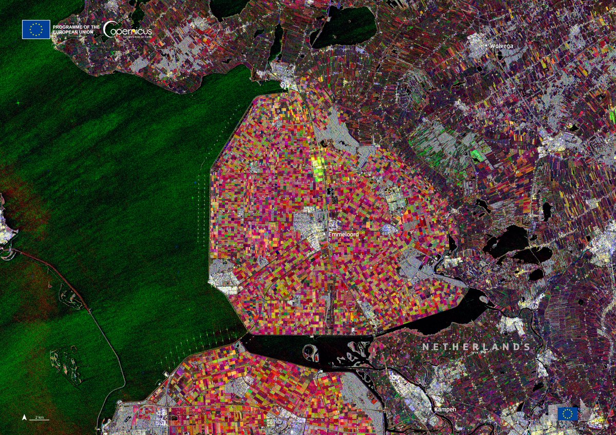
Colourful patterns in Noordoostpolder 🇳🇱 - captured by #CopernicusEU Sentinel-1. Each colour shows a stage of plant growth or harvest. 🚀 Next up: Sentinel-1D launch on 4 Nov - expanding one of the world’s most advanced #EarthObservation systems! 🔗 copernicus.eu/en/news/news/c…

Colourful patterns in Noordoostpolder 🇳🇱 - captured by #CopernicusEU Sentinel-1. Each colour shows a stage of plant growth or harvest.

🚀 Next up: Sentinel-1D launch on 4 Nov - expanding one of the world’s most advanced #EarthObservation systems!

🔗 copernicus.eu/en/news/news/c…
Ben Noll (@bennollweather) 's Twitter Profile Photo

Guess who's back, back again. La Niña's back, tell a friend. For the fifth time in six years, La Niña is back. Is the La Niña trend being influenced by rising global temperatures? Given how important El Niño and La Niña are to weather patterns, it's critical to figure this out!