
Sebastian Langer
@geosebbo
Maps | Infographics | Remote Sensing | Environmental issues | Humanitarian work | Open Data
ID: 1216494690
24-02-2013 20:41:03
719 Tweet
194 Takipçi
798 Takip Edilen

A new The Integrated Food Security Phase Classification report shows over half of people in #SouthSudan will be acutely food insecure next year. The report shows the scale of hunger, ranking areas from stressed to famine levels. What does that look like if #SouthSudan was 100 people? ⏩ Swipe to learn more ⏩


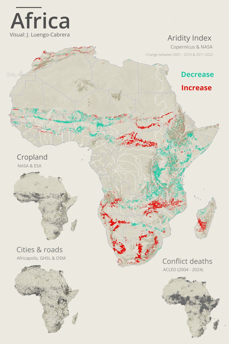
Africa: aridity, cropland, urban infrastructure & armed conflict Data: Copernicus ECMWF, NASA, European Space Agency , Africapolis, EU_ScienceHub, OpenStreetMap & ACLED


Well, it turns out that this approach used by siddharth ahuja (genius!) for Blender CAN ALSO BE USED WITH QGIS!!!! So, my friends, I present to you "MCP QGIS," which gives Claude access to use QGIS directly! The era of "vibe mapping" begins. See how it works: #QGIS #AI


Satellite imagery from Maxar Technologies show the ongoing RSF assault with widespread destruction and deliberate burning of homes throughout the Zamzam IDP camp in North Darfur, Sudan. Both images from April 16, 2025, first taken at 9:08 UTC, other at 12:28 UTC.


🚱 Drought is tightening its grip on Europe. Low rainfall, shrinking rivers & dry soils are straining farming, transport & ecosystems. In early April, the Rhine River dropped to half its usual level. 🔗 Read the latest JRC Drought in Europe report: joint-research-centre.ec.europa.eu/jrc-news-and-u…

🔴 New Food and Agriculture Organization-UNOSAT data reveals that 83.3% of Gaza's cropland has been damaged. Most of it is not accessible, with only 4.6% available for cultivation. The impact of the conflict on the agricultural sector threatens food security for 2+ million people. ow.ly/vct950VZapc
