Dillon Gaudet (@gaudetweather) 's Twitter Profile
Dillon Gaudet

@gaudetweather

Meteorologist at ABC 36 in Lexington | 304 ➡️ 859

ID: 1159099371495088133

calendar_today07-08-2019 13:49:59

23,23K Tweet

2,2K Followers

763 Following

Jed Drenning (@thesignalcaller) 's Twitter Profile Photo

The Coal Rush honoring WV miners has quickly become a must-see environment. Not many fanbases provide this kind of energy for a 2-5 team. When this thing gets rolling again, these folks will have a huge hand in making Mountaineer Field Hell on Earth for visitors.

Josh Morgerman (@icyclone) 's Twitter Profile Photo

HELPFUL TIPS. I've been through 82 hurricanes around the world, including five Cat 5s. I survived them by following a few simple rules. Check them out. And let me know if you have questions. I'm here to help. We're gonna get through #Hurricane #MELISSA.👊

Tropical Cowboy of Danger (@flynonymouswx) 's Twitter Profile Photo

A thread of videos from today’s flight into Hurricane Melissa In this first one we are entering from the southeast just after sunrise and the bright arc on the far northwest eye wall is the light just beginning to make it over the top from behind us.

Dillon Gaudet (@gaudetweather) 's Twitter Profile Photo

Goodness... Prayers for everyone in the path of this storm. A terrifying view of Hurricane Melissa on visible satellite this morning.

Goodness... Prayers for everyone in the path of this storm. 

A terrifying view of Hurricane Melissa on visible satellite this morning.
Tomer Burg (@burgwx) 's Twitter Profile Photo

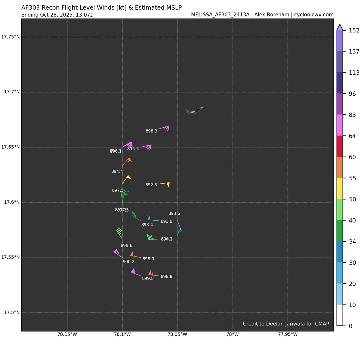
Waiting on a dropsonde to confirm, but Melissa is most certainly below 900 hPa right now. Tragically we are about to witness the 2nd or 1st deepest Atlantic hurricane landfall by min MSLP on record in Jamaica.

Waiting on a dropsonde to confirm, but Melissa is most certainly below 900 hPa right now.

Tragically we are about to witness the 2nd or 1st deepest Atlantic hurricane landfall by min MSLP on record in Jamaica.
Jeremy DeHart (@jeremydehartwx) 's Twitter Profile Photo

Increasingly worried about my crew mates as they have been circling in the eye for over 20 mins now. Still no dropsonde has been transmitted. Extrap SLP is down to 892mb. Hopefully they are just trying to get a good sonde out and it's not something more serious

Increasingly worried about my crew mates as they have been circling in the eye for over 20 mins now. Still no dropsonde has been transmitted. Extrap SLP is down to 892mb. Hopefully they are just trying to get a good sonde out and it's not something more serious
Josh Morgerman (@icyclone) 's Twitter Profile Photo

Folks along coast in St. Elizabeth Parish #Jamaica: SEEK SHELTER IMMEDIATELY IN A REINFORCED CONCRETE STRUCTURE. Strongest winds will be here soon. This is an extreme situation. #Hurricane #MELISSA could be one of strongest landfalling hurricanes ever, anywhere in Atlantic.

Josh Morgerman (@icyclone) 's Twitter Profile Photo

9:35 am. Crashing sounds —like an explosion. Wreckage flying down the street. Trees bending way over. Very unpleasant pressure in the ears. #Hurricane #MELISSA in Crawford, St. Elizabeth Parish #Jamaica

Brad Panovich (@wxbrad) 's Twitter Profile Photo

Where the eyewall passes over the Island, it will be equivalent to a 30-35-mile-wide EF-4 tornado-type wind. #Melissa #Jamaica

Where the eyewall passes over the Island, it will be equivalent to a 30-35-mile-wide EF-4 tornado-type wind. #Melissa #Jamaica