🇺🇦 Gary Oldham (now garytx.bsky.social) (@garytx) 's Twitter Profile
🇺🇦 Gary Oldham (now garytx.bsky.social)

@garytx

Anti-racist. Public safety executive. Former cop. Incident Mgt/ICS/wildland fire mgmt. expert. Ex-FIRESCOPE chair. Views my own. (now garytx.bsky.social)

ID: 14136114

calendar_today12-03-2008 23:49:50

73,73K Tweet

4,4K Followers

4,4K Following

Watch Duty (@watchdutyapp) 's Twitter Profile Photo

When emergency alerts failed during a wildfire, John Clarke Mills built Watch Duty. On the Rapid Response podcast with Robert Safian, our founder shares how we became a trusted lifeline for millions—and why we’re now launching flood alerts to close the gap no one else is filling.

When emergency alerts failed during a wildfire, <a href="/johnclarkemills/">John Clarke Mills</a> built Watch Duty.  On the <a href="/RapidResponseHQ/">Rapid Response</a> podcast with <a href="/rsafian/">Robert Safian</a>, our founder shares how we became a trusted lifeline for millions—and why we’re now launching flood alerts to close the gap no one else is filling.

Lower Colorado River Authority (@lcra) 's Twitter Profile Photo

LCRA is closely monitoring conditions due to an increased chance for rain over the next couple of days. We are continuing to pass inflows from rainfall over the past week through hydrogeneration at Wirtz and Starcke dams and into Lake Travis. HELPFUL LINKS👇

Travis County Emergency Services (@traviscountyes) 's Twitter Profile Photo

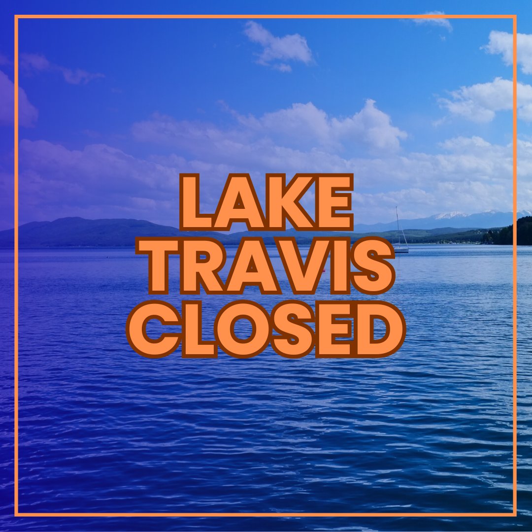
🚫 Lake Travis CLOSED to all water use until further notice 🚫 Due to flood damage, recreational, commercial & navigational activity is currently banned. Only emergency crews allowed. ⚠️ All Travis County Parks boat ramps are CLOSED. 🔗 parks.traviscountytx.gov

🚫 Lake Travis CLOSED to all water use until further notice 🚫

Due to flood damage, recreational, commercial &amp; navigational activity is currently banned. Only emergency crews allowed.

⚠️ All Travis County Parks boat ramps are CLOSED.
🔗 parks.traviscountytx.gov
NWS Austin/San Antonio (@nwssanantonio) 's Twitter Profile Photo

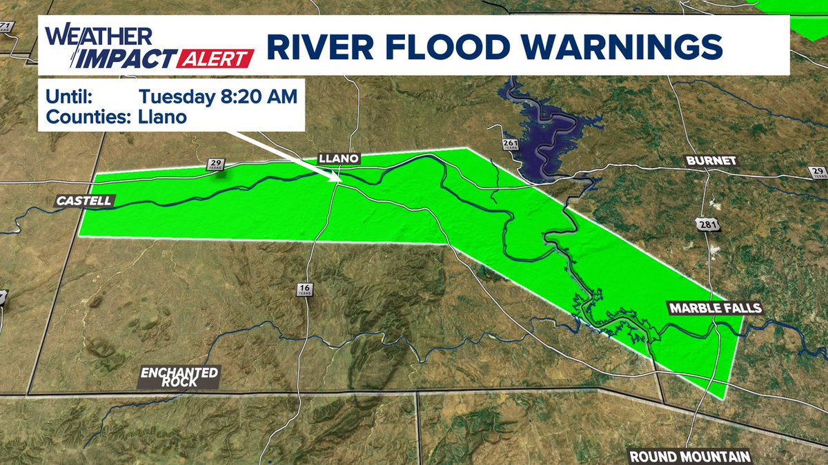
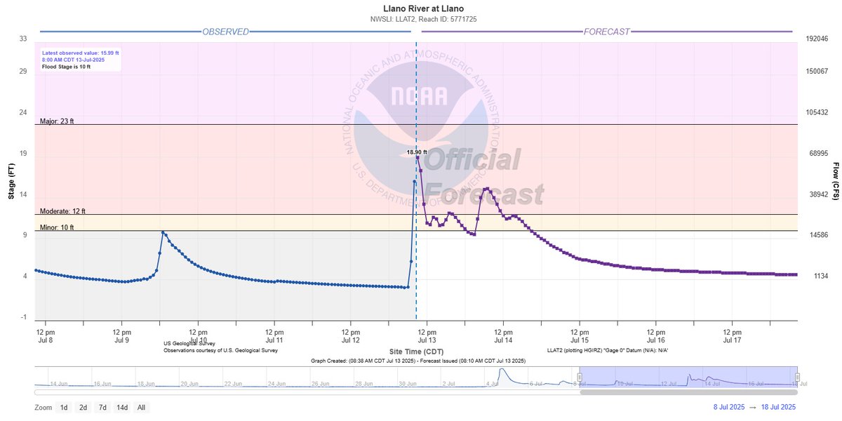
Llano River is already in Moderate Stage and expected to rise further in the next hour to over 18 feet. The river may rise even further. Updated forecasts can be found at water.noaa.gov

Llano River is already in Moderate Stage and expected to rise further in the next hour to over 18 feet. The river may rise even further. Updated forecasts can be found at water.noaa.gov
Lower Colorado River Authority (@lcra) 's Twitter Profile Photo

LCRA has opened one floodgate at Wirtz Dam and will open multiple floodgates at Starcke Dam soon to release storm runoff flowing into Lake LBJ. More info: hydromet.lcra.org/floodstatus

Lower Colorado River Authority (@lcra) 's Twitter Profile Photo

Flows are faster and water levels are higher than usual downstream of the dams. Please take action to protect people and property that may be affected.

Lower Colorado River Authority (@lcra) 's Twitter Profile Photo

Here's a look at rainfall totals since midnight. Follow the Hydromet for the latest real-time data on rainfall, streamflow, lake levels and more: hydromet.lcra.org

Here's a look at rainfall totals since midnight. Follow the Hydromet for the latest real-time data on rainfall, streamflow, lake levels and more: hydromet.lcra.org
🇺🇦 Gary Oldham (now garytx.bsky.social) (@garytx) 's Twitter Profile Photo

What NWS & Wilco fail to mention is that RM-963 and CR-201 is in the town of Burnet in Burnet County. Warning and impacts do in fact threaten warned area in Wilco. #txwx

🇺🇦 Gary Oldham (now garytx.bsky.social) (@garytx) 's Twitter Profile Photo

Lo que el NWS y Wilco no mencionan es que RM-963 y CR-201 están en el pueblo de Burnet, en el condado de Burnet. La advertencia y los impactos sí amenazan de hecho el área bajo advertencia en Wilco. #txwx

🇺🇦 Gary Oldham (now garytx.bsky.social) (@garytx) 's Twitter Profile Photo

Flash Flood Warning for Central/East Burnet County and northwest Williamson County has been extended until noon. (Bertram is included in the warned area but just calling it “Bertram” greatly understates the affected area.)

Chikage Windler WX (@chikageweather) 's Twitter Profile Photo

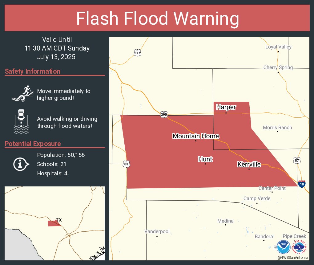
EWX extends time of Flash Flood Warning [flash flood: radar indicated, flash flood damage threat: considerable] for Gillespie, Llano [TX] till Jul 13, 12:45 PM CDT mesonet.agron.iastate.edu/vtec/f/2025-O-…

EWX extends time of Flash Flood Warning [flash flood: radar indicated, flash flood damage threat: considerable] for Gillespie, Llano [TX] till Jul 13, 12:45 PM CDT mesonet.agron.iastate.edu/vtec/f/2025-O-…
LMPD (@lmpd) 's Twitter Profile Photo

🚨 We are aware of a report of an "Active Aggressor" on the property of the Fairgrounds/ Kentucky Venues in #Louisville. At this time there are NO victims found yet. Please avoid the area due to a heavy police presence. #LMPD

🚨 We are aware of a report of an "Active Aggressor" on the property of the Fairgrounds/ <a href="/KyVenues/">Kentucky Venues</a> in #Louisville. At this time there are NO victims found yet. Please avoid the area due to a heavy police presence.  #LMPD