Mike Brown (@wxprof) 's Twitter Profile
Mike Brown

@wxprof

Meteorologist, & State Climatologist for Mississippi. These tweets are mine and do not represent MSU or the State of Mississippi.

ID: 40245271

calendar_today15-05-2009 14:01:53

852 Tweet

1,1K Followers

84 Following

Mike Brown (@wxprof) 's Twitter Profile Photo

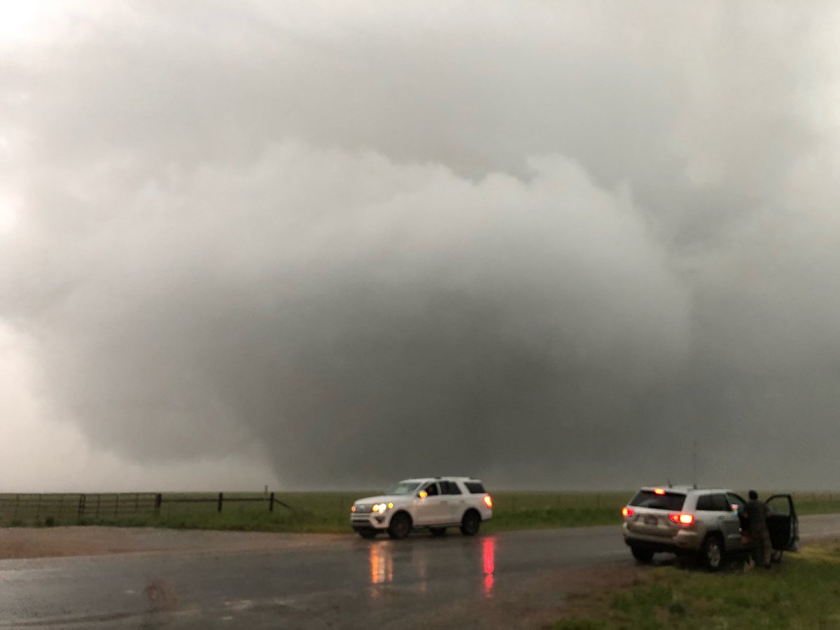
Another good day today. This time in eastern Colorado near Lamar. 05-26-19. We head back to OKC to finish our trip tomorrow. Photo by Amanda Holly.

Another good day today. This time in eastern Colorado near Lamar. 05-26-19. We head back to OKC to finish our trip tomorrow.  Photo by Amanda Holly.
Mike Brown (@wxprof) 's Twitter Profile Photo

6.53 inches of rain for the past 6-days. 20.27 inches since Jan. 1, 2020 (37% of our annual average in 6-weeks). Hats off to Brandon Hardin and his crew. It is amazing that any outdoor sport at MSU can be played this week.

Mike Brown (@wxprof) 's Twitter Profile Photo

As of 7am, March 5th, 2020 for Starkville, MS we have received 27.84" of rain. 232% of normal! Enough rain that if it does not rain again until June 16 we would still be a few 1/100ths above normal on that date. We have recorded 50.1% of our annual average thus far this year!

Mike Brown (@wxprof) 's Twitter Profile Photo

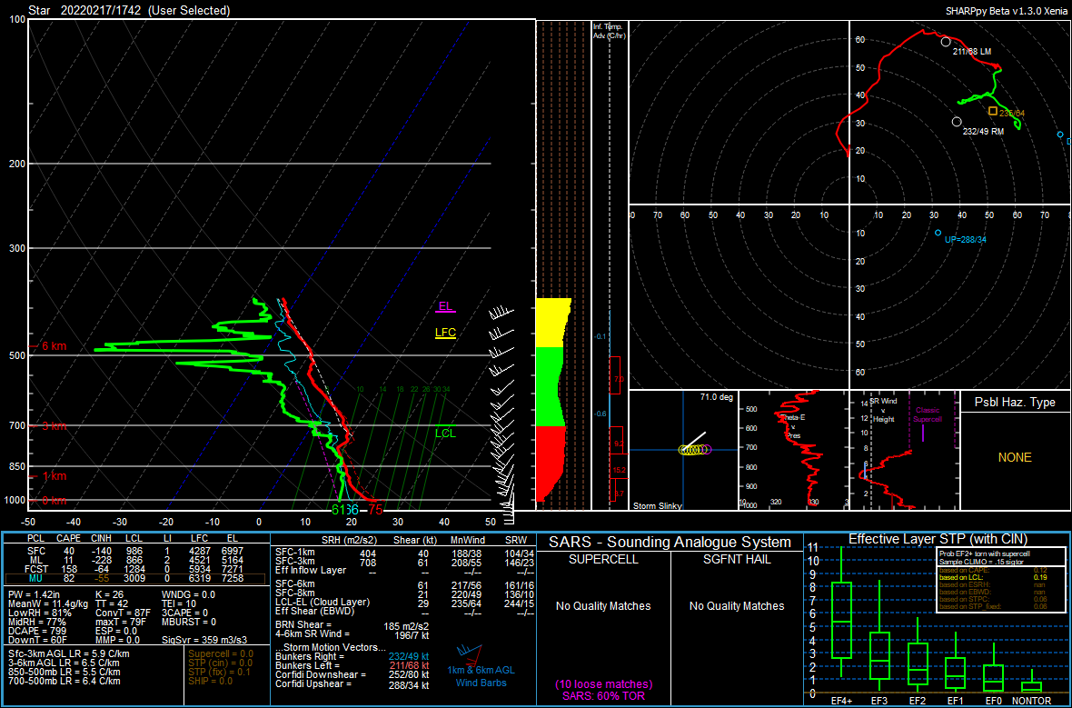
04-12-20 10:25am. Starkville looks to see two rounds of dangerous weather first around 3-4pm and the second around 8-9pm. Tornadoes, hail and wind will be possible with both rounds of intense storms.

Mike Brown (@wxprof) 's Twitter Profile Photo

The circulation associated with the Starkville/Oktibbeha tornado warning should remain south of the city. However, Remain in your safe place for now.

Mike Brown (@wxprof) 's Twitter Profile Photo

3:12pm The circulation on the Starkville/Oktibbeha storm is still in northern Winston County (the county to our south). However, Radar is indicating the possibility of some strong straight-line wind gusts for Starkville in the next 3-4 min.

Mike Brown (@wxprof) 's Twitter Profile Photo

3:17pm the circulation with the Starkville/Oktibbeha warned storm is now due south of Starkville on the Oktibbeha and Winston county line. It is moving ENE at around 45mph. The threat for Starkville from this storm has ended.

Mike Brown (@wxprof) 's Twitter Profile Photo

3:27pm The National Weather Service has removed Starkville and MSU from the warning. I suspect the sirens will stop soon.

Mike Brown (@wxprof) 's Twitter Profile Photo

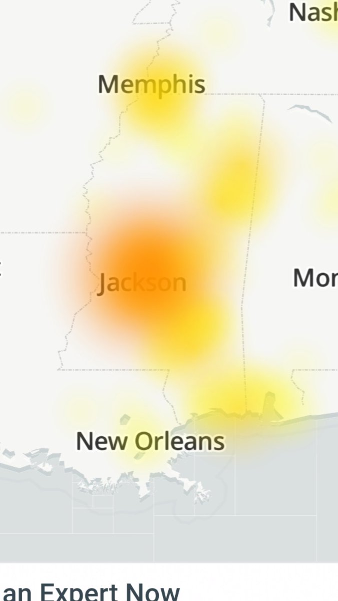
Severe weather on the way for much of southern MS and C Spire has a significant outage. Have redundant ways to get information and warnings

Severe weather on the way for much of southern MS and C Spire has a significant outage. Have redundant ways to get information and warnings