Tommaso Orusa (@tomorusa) 's Twitter Profile
Tommaso Orusa

@tomorusa

MD Forestry & Environmental Sciences | PhD in Earth Observation from space Remote Sensing & GIS | R&D @ INVA spa | Researcher @ IZSAM 🌍🛰🌲🌱🦊 @ait_italiana

ID: 444824256

calendar_today23-12-2011 17:47:38

7,7K Tweet

1,1K Followers

4,4K Following

Joachim Schork (@joachimschork) 's Twitter Profile Photo

After 3 years, 4 months & 2 days of hard work, I have just hit a very big milestone: I have just published the 1000th tutorial on the Statistics Globe website!!! statisticsglobe.com Thank you for being part on the way to this achievement! #RStats #Statistics #DataScience

ESA Earth Observation (@esa_eo) 's Twitter Profile Photo

Join us today from 10:30 as we kickstart the 2025 edition of European Space Agency's Living Planet Symposium! Live on esawebtv.esa.int. The opening ceremony will include the unveiling of the first images from our forest mission, Biomass: lps25.esa.int/opening-sessio… #LPS25
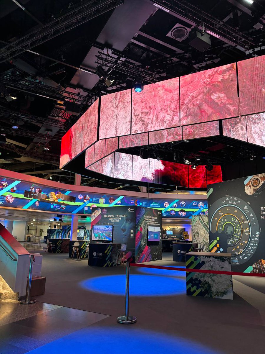
Join us today from 10:30 as we kickstart the 2025 edition of <a href="/esa/">European Space Agency</a>'s Living Planet Symposium! 
Live on esawebtv.esa.int. 

The opening ceremony will include the unveiling of the first images from our forest mission, Biomass: lps25.esa.int/opening-sessio… #LPS25
Tommaso Orusa (@tomorusa) 's Twitter Profile Photo

🌍🌡️ As global temperatures rise, some regions may become increasingly difficult to inhabit due to extreme heat and humidity. A study highlights the real risks of unchecked global warming. 🧪 Scientific study: doi.org/10.1073/pnas.2… 📰 Narrative summary: eurekalert.org/news-releases/…

Qiusheng Wu (@giswqs) 's Twitter Profile Photo

🚀 GeoAI Tutorial #20: Creating Image Chips from Multiple Images and Masks with Just One Line of Code 🛰️ If you're working on land cover classification or any geospatial deep learning task, generating image chips from large volumes of satellite imagery and labeled masks is a

🚀 GeoAI Tutorial #20: Creating Image Chips from Multiple Images and Masks with Just One Line of Code 🛰️

If you're working on land cover classification or any geospatial deep learning task, generating image chips from large volumes of satellite imagery and labeled masks is a
Tommaso Orusa (@tomorusa) 's Twitter Profile Photo

Mega Job Qiusheng Wu with sooner 🚀 Automated change detection for GeoAI Python package. GitHub: github.com/opengeos/geoai Documentation: opengeoai.org #GeoAI #Python #Geospatial #DeepLearning #OpenSource

Qiusheng Wu (@giswqs) 's Twitter Profile Photo

🚀 GeoAI Tutorial 25: Resuming Model Training from a Checkpoint 🏙️🛰️ In this tutorial, I demonstrate how to load a saved model checkpoint to resume training—a crucial technique when working with large models or long training processes. Whether you're continuing after an

🚀 GeoAI Tutorial 25: Resuming Model Training from a Checkpoint 🏙️🛰️

In this tutorial, I demonstrate how to load a saved model checkpoint to resume training—a crucial technique when working with large models or long training processes. Whether you're continuing after an
Qiusheng Wu (@giswqs) 's Twitter Profile Photo

Google just released the AlphaEarth Foundations with 64 dimensions of satellite embeddings at 10-m resolution at the global scale! It is very interesting! Check it out Blog post: deepmind.google/discover/blog/… Dataset: developers.google.com/earth-engine/d… Paper: storage.googleapis.com/deepmind-media… #AI

Brendan Ashworth (@normconstant) 's Twitter Profile Photo

OpenAI’s new open models are HUGE news for open source GIS. Here’s why their first open release in 5 years is a game changer: LLMs are the future of both closed and open source GIS. They allow new users to harness the full power of GIS, and allow experts to work much faster.

OpenAI’s new open models are HUGE news for open source GIS. Here’s why their first open release in 5 years is a game changer:

LLMs are the future of both closed and open source GIS. They allow new users to harness the full power of GIS, and allow experts to work much faster.
Joachim Schork (@joachimschork) 's Twitter Profile Photo

The GWalkR package in R is a powerful tool for data visualization and exploration. Designed to simplify complex data analysis, GWalkR transforms raw data into interactive visualizations, making it easier to understand and interpret your data sets. Here are some key features of

The GWalkR package in R is a powerful tool for data visualization and exploration. Designed to simplify complex data analysis, GWalkR transforms raw data into interactive visualizations, making it easier to understand and interpret your data sets.

Here are some key features of