Tim Kelley (@surfskiweather) 's Twitter Profile
Tim Kelley

@surfskiweather

Curiosity causes me to 'stir it up'. Open minded atmospheric science student since 1963. For love of surf ski weather garden birds.. & T-Rex
Weather Consultant

ID: 19649450

linkhttps://www.youtube.com/channel/UC6yP0bn8Gpdjy8rJf-NTroA calendar_today28-01-2009 12:42:56

116,116K Tweet

22,22K Followers

3,3K Following

NWS Missoula (@nwsmissoula) 's Twitter Profile Photo

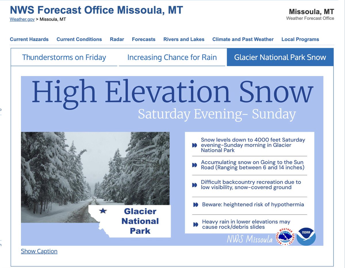
High elevation snow is anticipated in Glacier National Park Saturday evening into Sunday above 4000 feet. If you plan to recreate, be prepared for difficult conditions in the backcountry #mtwx

High elevation snow is anticipated in <a href="/GlacierNPS/">Glacier National Park</a> Saturday evening into Sunday above 4000 feet.  If you plan to recreate, be prepared for difficult conditions in the backcountry #mtwx
Josh Morgerman (@icyclone) 's Twitter Profile Photo

4:15 am. In the heart of San Jose Estancia Grande (16.36N 98.25W), very close to #Hurricane #ERICK's core. Heavy rain but very little wind. The mountains are playing games with the surface circulation.

Tim Kelley (@surfskiweather) 's Twitter Profile Photo

1st landfalling hurricane North America 2025 zoom.earth/maps/satellite… something doesn't jive earth.nullschool.net/#current/wind/…

1st landfalling hurricane North America 2025
zoom.earth/maps/satellite…
something doesn't jive
earth.nullschool.net/#current/wind/…
Tim Kelley (@surfskiweather) 's Twitter Profile Photo

ECMWF continues threat of ~ Derecho'ish ~ Mesoscale Convective Complex ~ MN to ME tmrrw into Sunday (to me this is the biggest weather spectacle of 10-day f'cast ~ overshadowing heat & other storms) (also note wintry mix nw USA & sw Canada this weekend) pivotalweather.com/model.php?m=ec…

Tim Kelley (@surfskiweather) 's Twitter Profile Photo

Out The Door Weather'n More with Steve & T-Rex & TK Thur June 19 '25 Serious Storms New England ~ Why Saturday Night May Be Worse Than Today ~ Weymouth Big Dig & Surf Tracking severe storms and a heat wave. Our weekend in New England may feature a long lived Mesoscale Convective

Out The Door Weather'n More with Steve &amp; T-Rex &amp; TK Thur June 19 '25
Serious Storms New England ~ Why Saturday Night May Be Worse Than Today ~ Weymouth Big Dig &amp; Surf
Tracking severe storms and a heat wave. Our weekend in New England may feature a long lived Mesoscale Convective
Michael Palmer (@mpalmerwx) 's Twitter Profile Photo

While the heat builds in the Midwest and East this weekend, unseasonably chilly temps prevail in the northern Rockies. Snow in the mountains a freeze to the valley floors is likely.

While the heat builds in the Midwest and East this weekend, unseasonably chilly temps prevail in the northern Rockies. Snow in the mountains a freeze to the valley floors is likely.
NWS St. Louis (@nwsstlouis) 's Twitter Profile Photo

Excessive heat is expected late this week through early next week. Do you know the difference between an advisory and warning? An advisory may be less serious, but both headlines bring attention to how excessive heat will impact your daily routine. #mowx #ilwx #stlwx

Excessive heat is expected late this week through early next week. Do you know the difference between an advisory and warning? An advisory may be less serious, but both headlines bring attention to how excessive heat will impact your daily routine. #mowx #ilwx #stlwx