Jeff Gammons (@stormvisuals) 's Twitter Profile
Jeff Gammons

@stormvisuals

Stormbound, an IMAX film (2025). | Capturing hurricanes and severe storms through motion and stills. | South Florida-based storm chaser.

ID: 18323373

linkhttps://stormvisuals.com calendar_today23-12-2008 01:45:14

10,10K Tweet

18,18K Followers

956 Following

OTUS Project (@project_otus) 's Twitter Profile Photo

Night vision drone view about to pass through a tornado near Fort Ransom, ND this evening collecting thermodynamic and wind data

Night vision drone view about to pass through a tornado near Fort Ransom, ND this evening collecting thermodynamic and wind data
OTUS Project (@project_otus) 's Twitter Profile Photo

Our first flight yesterday was inside the tornadogenesis and growth phase of a soon-to-be wedge tornado near Spiritwood and Jamestown, ND. Data and more video will be shared as we process material.

Jeff Gammons (@stormvisuals) 's Twitter Profile Photo

The low-pressure disturbance off the Florida East Coast continues to pump some wild-looking shelf clouds and storm structure across south central Florida. #flwx

The low-pressure disturbance off the Florida East Coast continues to pump some wild-looking shelf clouds and storm structure across south central Florida. #flwx
Jeff Gammons (@stormvisuals) 's Twitter Profile Photo

South Florida, mid-August classic sunset skies with lightning storms on the horizon tonight! The drone is high above all the biting mosquitoes down here with me while I watch this light show on the monitor.

NWS Miami (@nwsmiami) 's Twitter Profile Photo

As #Erin becomes a formidable hurricane over the western Atlantic, the Bahamas Archipelago will shield our waters & beaches from most of the wave action associated with the storm. Still, surf & rip current risk may become elevated on our northern east coast beaches next week.

NWS Miami (@nwsmiami) 's Twitter Profile Photo

As #Erin passes east of the Bahamas next week, we'd like to once again reiterate that no direct impacts are expected here in South Florida. In fact, slightly drier continental air (green/blue colors) may be drawn southward into our area acting to reduce afternoon rain chances.

National Hurricane Center (@nhc_atlantic) 's Twitter Profile Photo

August 16 1130 AM AST: National Hurricane Center Director Mike Brennan provides the latest update on Hurricane #Erin For the latest forecast visit hurricanes.gov youtube.com/live/gto2ao7zx…

Reed Timmer, PhD (@reedtimmerusa) 's Twitter Profile Photo

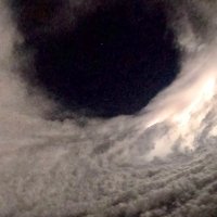
THERE IT IS! Hurricane #Erin has just been upgraded to Category 5 northeast of Puerto Rico. Stadium effect, pin hole eye and minimum pressure bombing down to 917 mb. What a display of nature

THERE IT IS! Hurricane #Erin has just been upgraded to Category 5 northeast of Puerto Rico. Stadium effect, pin hole eye and minimum pressure bombing down to 917 mb. What a display of nature
Michael Lowry (@michaelrlowry) 's Twitter Profile Photo

Erin is only the 5th Category 5 hurricane on record to form this early in the hurricane season and the only Category 5 observed outside the Gulf or Caribbean this early in the year.

Erin is only the 5th Category 5 hurricane on record to form this early in the hurricane season and the only Category 5 observed outside the Gulf or Caribbean this early in the year.
lucy_wx (@lucywx24) 's Twitter Profile Photo

Weather report as Hurricane Erin, now a Category 5, continues to strengthen and the heat builds across the central US!

Nantucket Current (@ackcurrent) 's Twitter Profile Photo

Hurricane Erin turning Nantucket’s south shore beaches into water parks today 😮 The surf is only going to get bigger tomorrow & Thursday, and rip currents will be life-threatening. ACK Harbormaster is urging people to stay out of the water on the south shore
SamWalkerOBXNews.com🎙📻📰🥍🦓 (@samwalkerobx) 's Twitter Profile Photo

Video of the motels area in Buxton during Tuesday PM high tide. Expecting a lot more this evening and Thursday AM and PM high tides. (Courtesy Dare County Current TV) #yestv #ncwx #Erin

Jeff Gammons (@stormvisuals) 's Twitter Profile Photo

Fun pulse storm at sunset tonight, thanks to Hurricane Erin drying out the atmosphere over South Florida, and keeping the seabreeze storms isolated this evening! #flwx

Fun pulse storm at sunset tonight, thanks to Hurricane Erin drying out the atmosphere over South Florida, and keeping the seabreeze storms isolated this evening! #flwx