Martinez Geospatial (@mtz_geospatial) 's Twitter Profile
Martinez Geospatial

@mtz_geospatial

We're a geospatial service provider located in Eagan, MN. We can scan, map, and survey all your geospatial needs! Keep an eye out to see what we are up to!

ID: 778270795432800256

linkhttp://www.mtzgeo.com calendar_today20-09-2016 16:33:12

80 Tweet

41 Followers

119 Following

Martinez Geospatial (@mtz_geospatial) 's Twitter Profile Photo

We had a great time at the Annual ASPRS Golf Social at Kilkarney Hills this past Friday! We had a pair of drives onto the green, too bad we 3 putted... #golfing #ASPRSWesternGreatLakes

We had a great time at the Annual <a href="/ASPRSorg/">ASPRS</a> Golf Social at <a href="/KilkarneyHills/">Kilkarney Hills</a> this past Friday! We had a pair of drives onto the green, too bad we 3 putted... #golfing #ASPRSWesternGreatLakes
Martinez Geospatial (@mtz_geospatial) 's Twitter Profile Photo

Excited to have been able to help MSES.org with their new website! Take a minute to see the great things the organization is doing for engineering education in Minnesota and surrounding states! #engineering #Minnesota #surveying

Martinez Geospatial (@mtz_geospatial) 's Twitter Profile Photo

Check out our new visualization from one of our many AGIS & Airport Layout Plan projects for International Airports around the nation. Share it from here or our webpage on Vimeo at vimeo.com/303306771 #aviation #airports #visualization #photogrammetry #mapping

Martinez Geospatial (@mtz_geospatial) 's Twitter Profile Photo

We now have a blog! Check it out at mtzgeo.com/blog we are posting regular updates to the work we have been doing around the country, along with various MTZ news. #blogger #mapping #3dmodeling

Martinez Geospatial (@mtz_geospatial) 's Twitter Profile Photo

Congratulations to the City of Saint Paul on their City Eng Assoc of MN nomination for project of the year; Jackson Street! It was a perfect project to use Mobile LiDAR with the predesign survey, we were happy to assist
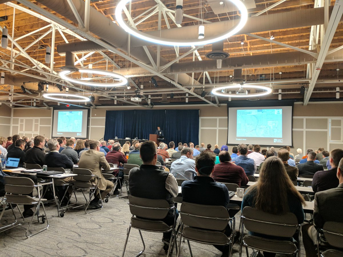
Congratulations to the <a href="/cityofsaintpaul/">City of Saint Paul</a> on their <a href="/CEAM_org/">City Eng Assoc of MN</a> nomination for project of the year; Jackson Street! It was a perfect project to use Mobile LiDAR with the predesign survey, we were happy to assist
Martinez Geospatial (@mtz_geospatial) 's Twitter Profile Photo

Happy to help @BoltonandMenk and Hennepin County with the animation for Webber44! youtu.be/wF30ZG5mjx4 We did the bus stop animations #mobileLiDAR #visualizations #surveying

Martinez Geospatial (@mtz_geospatial) 's Twitter Profile Photo

Yesterday was a tragic day for people around the world as Cathedrale Notre-Dame de Paris burned. Hopefully using photographs and 3-D Laser Scanning, they can rebuild the cathedral as it once stood. on.natgeo.com/2UUmhUB via National Geographic #laserScanning #photogrammetry

NASA Earth (@nasaearth) 's Twitter Profile Photo

At NASA #PictureEarth 24/7 with satellites and instruments from space and aircraft. 🌍 🛰️ Marvel at our home planet’s beauty and celebrate #EarthDay by downloading the new NASA Earth photo book. go.nasa.gov/2tuKoty

Martinez Geospatial (@mtz_geospatial) 's Twitter Profile Photo

Happy #EarthDay everyone! If you can, opt for paper instead of plastic, take the metro instead of driving your car alone, and most importantly, enjoy your day and appreciate the little things about our amazing world! #outdoors #PlanetEarth

Martinez Geospatial (@mtz_geospatial) 's Twitter Profile Photo

Simultaneous localization and mapping is great alternative to traditional laser scanning. It's fast, portable, and precise laser scanning and mobile mapping for architectural, engineering, construction, and facility management applications. mtzgeo.com/slam-lp1/?utm_…

Simultaneous localization and mapping is great alternative to traditional laser scanning. It's fast, portable, and precise laser scanning and mobile mapping for architectural, engineering, construction, and facility management applications.  mtzgeo.com/slam-lp1/?utm_…
Martinez Geospatial (@mtz_geospatial) 's Twitter Profile Photo

At MTZ we are scanning and modeling cities and public spaces with Survey-Grade accuracy. Check out our latest render of City of Minneapolis and a close up of our scan and model of Peavey Plaza for Coen+Partners #Archweek18 #laserscanning #BIM #MTZGEO
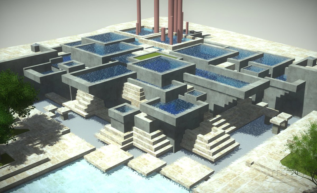
At MTZ we are scanning and modeling cities and public spaces with Survey-Grade accuracy. Check out our latest render of <a href="/CityMinneapolis/">City of Minneapolis</a> and a close up of our scan and model of Peavey Plaza for <a href="/coenpartners/">Coen+Partners</a> #Archweek18 #laserscanning #BIM #MTZGEO
Martinez Geospatial (@mtz_geospatial) 's Twitter Profile Photo

Safe travels, sweet prince! Our Teledyne Optech Mobile LiDAR system is traveling straight down I-35 to Texas for some Highway scanning next week! #mobileLiDAR #TXDOT #MTZGEO