Lucas Murawsky
@lucasmurawsky
ID: 1296248099745062914
20-08-2020 00:50:30
1,1K Tweet
393 Followers
141 Following
 's Twitter Profile Photo")
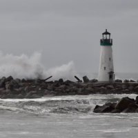
 on Twitter photo Sierra-at-Tahoe: Closed today 3/2 due to heavy snow, high winds + zero visibility. More on the way today! Stay tuned for an update this afternoon on operational plans for tomorrow.
Photo: 3/1 11:00 PM last night, Lower Shop")
 on Twitter photo The battle continues…
Sierra-at-Tahoe will continue to be CLOSED to public today, Sunday, March 3. The storm’s intensity did not let up — in fact it doubled down overnight. Read full write up on mtn conditions page + stay tuned for another update this afternoon.")
 's Twitter Profile Photo")
 on Twitter photo It’s definitely drifty out here in mammoth")
 's Twitter Profile Photo")
Rob Mayeda These are from a ranch in Larkin Valley during that time. They swore it was a tornado. NWS Bay Area 🌉
 on Twitter photo <a href=\"/RobMayeda/\">Rob Mayeda</a> These are from a ranch in Larkin Valley during that time. They swore it was a tornado. <a href=\"/NWSBayArea/\">NWS Bay Area 🌉</a>")
 's Twitter Profile Photo")
 's Twitter Profile Photo")
#UPDATE: State Route 9 between Sanborn and Redwood Gulch Roads near City of Saratoga, CA #SantaClaraCounty remains closed due to unstable hillside. Motorists are encouraged to use an alternate route. For traffic conditions go to Caltrans Quickmap🔗quickmap.dot.ca.gov
 on Twitter photo #UPDATE: State Route 9 between Sanborn and Redwood Gulch Roads near <a href=\"/CityofSaratoga/\">City of Saratoga, CA</a> #SantaClaraCounty remains closed due to unstable hillside. Motorists are encouraged to use an alternate route. For traffic conditions go to Caltrans Quickmap🔗quickmap.dot.ca.gov")
 's Twitter Profile Photo")
 on Twitter photo The northern lights as seen from Felton in the Santa Cruz mountains tonight
📸: Leonard Torres")
 's Twitter Profile Photo")
NEVER FORGET Sgt. Damon Gutzwiller Today, we honor the life and legacy of Santa Cruz County Sheriff's Sergeant Gutzwiller, who was killed in the line of duty on June 6, 2020. Santa Cruz Police will always have his family, friends, and colleagues Santa Cruz SO in our prayers.
 on Twitter photo NEVER FORGET Sgt. Damon Gutzwiller
Today, we honor the life and legacy of Santa Cruz County Sheriff's Sergeant Gutzwiller, who was killed in the line of duty on June 6, 2020.
Santa Cruz Police will always have his family, friends, and colleagues <a href=\"/SantaCruzSO1/\">Santa Cruz SO</a> in our prayers.")
 's Twitter Profile Photo")
 on Twitter photo A level 3 evacuation warning has been issued for the entire town of Copperopolis (Population: 3,819) 35 miles east of Stockton, this is a developing dangerous situation, more updates later. #CAwx #WxTwitter #FireWx #CAfire")
 's Twitter Profile Photo")
 on Twitter photo Thunderstorms remain a risk for the #BayArea and Central Coast tonight through Tuesday. Some thunderstorms may be dry.
#cawx")
 's Twitter Profile Photo")
 on Twitter photo Early signs of potentially major heatwave around 4th of July centered on Northern CA, and this event could bring hot temperatures all the way to the coast (uncommon for early Jul). Early hints at potential for some record-breaking heat & very high grass/brush fire risk. #CAwx")
 's Twitter Profile Photo")
 on Twitter photo Please forego the use of fireworks this Fourth of July. The hot and (already) dry conditions will make ignition easy, and rapid fire spread likely. This graphic explains how fires can spread quickly, especially in an area like ours with lots of grass and steep terrain. @CAwx 🔥🔥")
 on Twitter photo 🌡️ Excessive Heat Warning and Heat Advisory is in effect now until NEXT Tuesday! Inland high temperatures from the upper 90s to near 110 will result in major to extreme risk of heat related illnesses. Never leave people or pets in vehicles! #CAwx")
 on Twitter photo An exceptionally dangerous situation is underway as we enter a potentially historic and deadly heat event. Heat is the number one weather related killer in the United States. By this weekend, it is VERY LIKELY that we add to that statistic if preparations are not taken seriously.")
 on Twitter photo 📃Preliminary Damage Survey Conducted. EF1 tornado observed in Scotts Valley this afternoon, December 14, 2024. The most severe damage was observed along Mt Hermon Rd. Full info: partnerservices.nws.noaa.gov/products/a1fbe… #cawx #scottsvalley")
 's Twitter Profile Photo")
 on Twitter photo Don’t ignore road hazards—report them! Call our 24-hour service line at 831-477-3999 for issues like flooding, mudslides, rock slides or fallen trees on a County-maintained road. Quick action keeps everyone safe.")