Dr Kiran L. Dhanjal-Adams (@kiran_da) 's Twitter Profile
Dr Kiran L. Dhanjal-Adams

@kiran_da

She/her. Postdoc researching conservation and ecoloy @KewScience. Part New-Caledonian, British, Fijian and Punjabi. All views expressed are my own.

ID: 1688296927

linkhttp://kirandhanjaladams.weebly.com calendar_today21-08-2013 13:05:44

1,1K Tweet

604 Followers

598 Following

Reserva Natural Manantial de la Aurora (@manantialaurora) 's Twitter Profile Photo

Súper orgullosos de figurar en la primera guía de campo de polillas de Colombia. Contribuimos a hacer ciencia ya qué hay dos nuevos registros para Santander Somos más que aves ❤️ somos un territorio lleno de biodiversidad y magia. Pueden adquirirla en la SAO

Vlad Demartsev (@vlad_demartsev) 's Twitter Profile Photo

⏳Only one week left to apply!!! Field biology course at the KalahariResearchCentre . Fully funded for South African 🇿🇦students. See the course page for details - cocomo.group/field-course and check out the main course topics in the 🧵👇
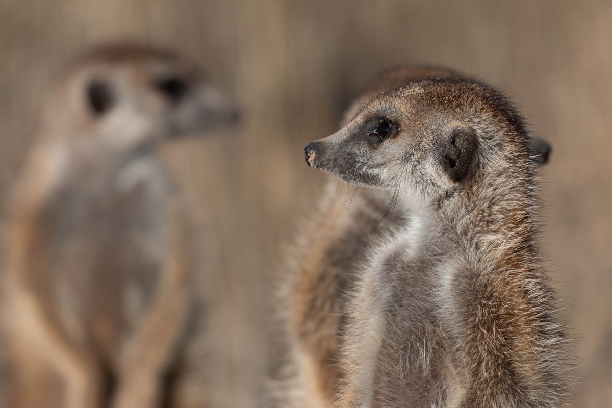
⏳Only one week left to apply!!! Field biology course at the <a href="/KalahariRC/">KalahariResearchCentre</a> . Fully funded for South African 🇿🇦students. See the course page for details - cocomo.group/field-course and check out the main course topics in the 🧵👇
Gerard Talavera (@gerardtalavera) 's Twitter Profile Photo

“Found at last”! Happy to share the results of this long-term international collaboration. We identify the last leg of the longest butterfly migration #vanessacardui pnas.org/doi/10.1073/pn… #FieldWorkMatters #insectmigration #butterflymigration #PhyloMigrationLab Institut Botànic de Barcelona
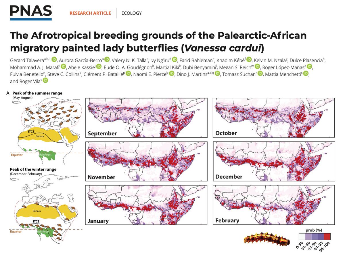
“Found at last”! Happy to share the results of this long-term international collaboration. We identify the last leg of the longest butterfly migration #vanessacardui 

pnas.org/doi/10.1073/pn…

#FieldWorkMatters #insectmigration #butterflymigration  #PhyloMigrationLab <a href="/IBB_botanic/">Institut Botànic de Barcelona</a>
Black in Natural History Museums (@blackinnhms) 's Twitter Profile Photo

The stories of Black scientists are often overlooked & untold. Thus, #BlackInNHMs is proud to share the stories of 17 Black people, who contributed to natural history, with our FIRST exhibit! It was produced in partnership with Florida Museum. Stay tuned for more info below👇🏿

Philippe.ciais (@ciais_philippe) 's Twitter Profile Photo

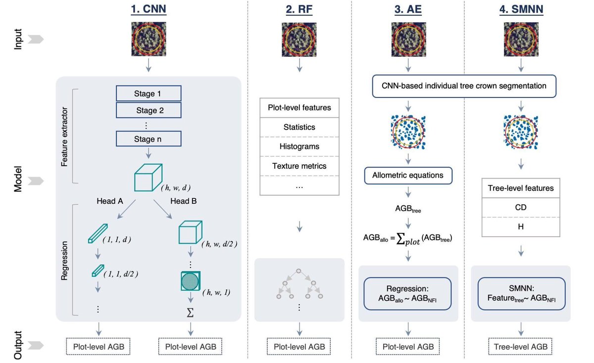
🖼️ A new ground breaking #ArtificialInteligence method gives high accuracy estimates of forest biomass based on very high resolution aerial photos By Sizhuo Li, Martin Brandt and colleagues CEA IPSL 🌍 CTrees researchgate.net/publication/37…

🖼️  A new ground breaking #ArtificialInteligence method gives high accuracy estimates of forest biomass based on very high resolution aerial photos

By Sizhuo Li, <a href="/matin_brandt/">Martin Brandt</a> and colleagues 

<a href="/CEA_Officiel/">CEA</a> <a href="/IPSL_outreach/">IPSL 🌍</a> <a href="/CTrees_org/">CTrees</a> 

researchgate.net/publication/37…
GlobalTreeAssessment (@gta_gtsg) 's Twitter Profile Photo

Today the IUCN Red List has been updated with over 4,000 new assessments for tree species. 70% of trees now have a published IUCN Red List assessment. ow.ly/JPnO50QgHM6

Dr Robbi Bishop-Taylor 🦋 (@satellitesci) 's Twitter Profile Photo

Two beautiful coastal environments on opposite sides of the planet, mapped in 3D using Geoscience Australia #DEAIntertidal. 🏖 🛰 👈 Grays Harbor, WA, USA 👉 Incheon, South Korea Mapped from Microsoft PC #Sentinel2 and #Landsat satellite data, loaded with Open Data Cube and SpatioTemporal Asset Catalog!
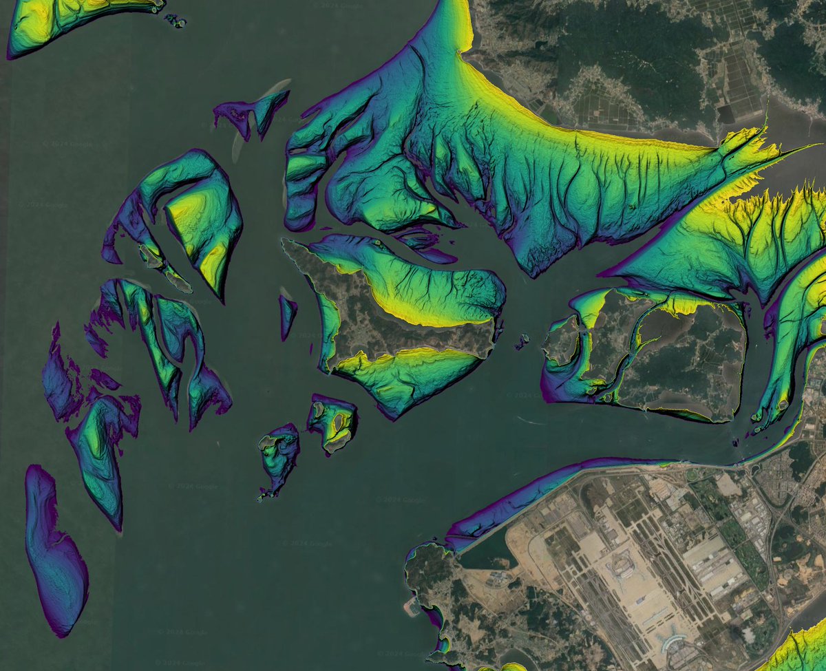
Two beautiful coastal environments on opposite sides of the planet, mapped in 3D using <a href="/GeoscienceAus/">Geoscience Australia</a> #DEAIntertidal. 🏖 🛰

👈 Grays Harbor, WA, USA
👉 Incheon, South Korea

Mapped from Microsoft PC #Sentinel2 and #Landsat satellite data, loaded with <a href="/OpenDataCube/">Open Data Cube</a> and <a href="/STACspec/">SpatioTemporal Asset Catalog</a>!
UK Centre for Ecology & Hydrology (@uk_ceh) 's Twitter Profile Photo

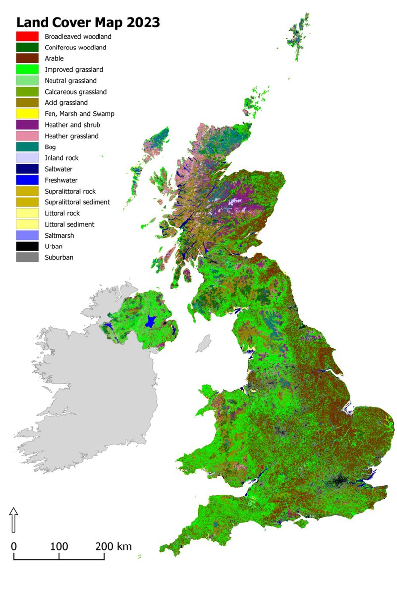
UPDATE: The UKCEH Land Cover Maps for 2022 and 2023 have been released. These additions to our LCM series describe the physical material on the surface of the country, using high-resolution satellite imagery. Discover the collection: catalogue.ceh.ac.uk/documents/c007… #LandCover #GIS

UPDATE: The UKCEH Land Cover Maps for 2022 and 2023 have been released. These additions to our LCM series describe the physical material on the surface of the country, using high-resolution satellite imagery.

Discover the collection: catalogue.ceh.ac.uk/documents/c007…

#LandCover #GIS
Silke Bauer (@silke_bauer) 's Twitter Profile Photo

Interested in developing future scenarios for #bird #migration like in pnas.org/doi/10.1073/pn…? Apply for a #postdoc within @KAPPA-FLU!

GEDI (@gedi_knights) 's Twitter Profile Photo

New dataset ➡️ Gridded GEDI Vegetation Structure Metrics and Biomass Density at Multiple Resolutions Near-global, analysis-ready, multi-res gridded veg structure metrics derived from #GEDI L2 & L4A products associated with 25m diameter lidar footprints! daac.ornl.gov/cgi-bin/dsview…

New dataset ➡️ Gridded GEDI Vegetation Structure Metrics and Biomass Density at Multiple Resolutions

Near-global, analysis-ready, multi-res gridded veg structure metrics derived from #GEDI L2 &amp; L4A products associated with 25m diameter lidar footprints!

daac.ornl.gov/cgi-bin/dsview…
Michael Chimento (@evogom) 's Twitter Profile Photo

🥳🧪new paper out w/ @DamienFarine about how movement shapes networks and interacts with transmission rules to affect spreading dynamics. Key take-away is that spreading on dynamic networks =/= spreading on static representations of those dynamic networks doi.org/10.1098/rstb.2…

Md Mijanur Rahman🛰️🗺️🛰️ (@gisrsstudyhacks) 's Twitter Profile Photo

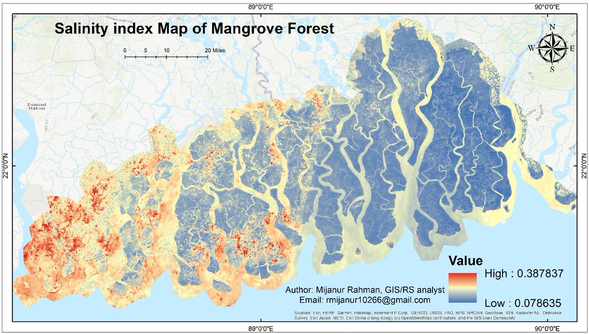
#salinity #mapping using #EarthEngine and #ArcGIS Tutorial Link: youtube.com/live/YDRDm2Ziy… Google Earth Engine provided the GeoTiff format salinity map further use the ArcMap and Create this types of Map.

#salinity #mapping using #EarthEngine and #ArcGIS 
Tutorial Link: youtube.com/live/YDRDm2Ziy…
Google Earth Engine provided the GeoTiff format salinity map further use the ArcMap and Create this types of Map.
Kane Brides (@kanebrides) 's Twitter Profile Photo

Our new paper "New estimate of the trend in world population size of the Spoon-billed Sandpiper suggests continuing decline" has now been published in Wader Study, see - waderstudygroup.org/article/18514/ #Conservation #Ornithology
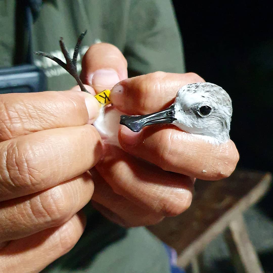
Our new paper "New estimate of the trend in world population size of the Spoon-billed  Sandpiper suggests continuing decline" has now been published in <a href="/WaderStudy/">Wader Study</a>, see - waderstudygroup.org/article/18514/ #Conservation #Ornithology
Lochlan W (@w_lochlan) 's Twitter Profile Photo

Open-source tools like DeepLabCut 🦄 allow us (Visual Insect Neuroeth. @insect-vision.bsky.social) to investigate the active sensing strategies of freely-flying insects with greater detail than previously available 👀🦋 Here is a hummingbird hawkmoth in action, using DLC3.0🔥 #OpenScienceWeek

Dr Kiran L. Dhanjal-Adams (@kiran_da) 's Twitter Profile Photo

Good visual explanation of how geolocation by light works, and why precision is lower or higher at specific times of year… #ornithology #geolocation

Xu Shi (@sxluscinia) 's Twitter Profile Photo

News from down under! Our latest study in Current Biology uses weather radar to uncover Australia’s unique bird migration patterns—smaller in scale but high variable in timing, direction, and magnitude. Link: cell.com/current-biolog…. #ornithology #BirdMigration #Australia
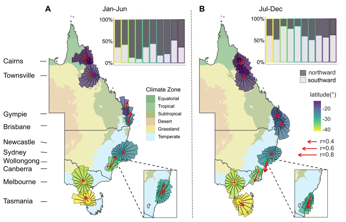
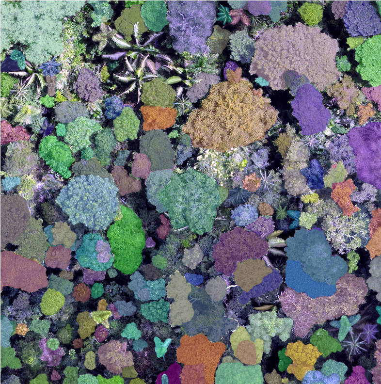
News from down under! Our latest study in <a href="/CurrentBiology/">Current Biology</a>  uses weather radar to uncover Australia’s unique bird migration patterns—smaller in scale but high variable in timing, direction, and magnitude.  Link: cell.com/current-biolog…. #ornithology #BirdMigration #Australia