Kestrel Aerial Image
@kestrelimaging
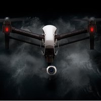
Specializing in affordable Ultra High Definition Aerial Video and Photo, Site Inspection, Mapping and Surveying. Fully insured and FAA licensed Remote Pilot.
ID: 793557535974420485
01-11-2016 20:57:15
22 Tweet
147 Followers
47 Following
 's Twitter Profile Photo")
 on Twitter photo Melinda Gates had concerns over Bill's possible ties to Jeffrey Epstein, according to new bombshell report
foxbusiness.com/lifestyle/meli…")
“Drone Mapping Saves €150,000 in Purchase of Private Forestry” by DroneDeploy blog.dronedeploy.com/drone-mapping-…
“Drones — a Soybean Grower’s Best Friend” by DroneDeploy blog.dronedeploy.com/drones-a-soybe…
“Drone Helps Verify Earthwork at Hospital Construction Site” by DroneDeploy blog.dronedeploy.com/drone-helps-ve…
Can drones be utilized in construction for creating accurate BIM models? | BIM News | The BIM Hub thebimhub.com/2017/01/10/can… via The BIM Hub
 's Twitter Profile Photo")