Jaclyn Whittal(@jwhittalTWN) 's Twitter Profileg
Jaclyn Whittal

@jwhittalTWN

Senior Meteorologist, Climate Change Journalist & Adventurer @weathernetwork, @RCGS_SGRC fellow, FI’ 23 @Explorersclub, partner to Ross, stepmom, glamma,dog/cat

ID:199072462

linkhttp://www.jaclynwhittal.com calendar_today05-10-2010 23:44:04

49,6K Tweets

30,6K Followers

16,8K Following

Follow People
Rhythm Reet TWN(@RhythmTheMet) 's Twitter Profile Photo

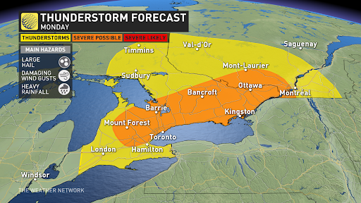
Severe thunderstorm risk for Ontario and southern Quebec.
Main hazards expected to be damaging wind gusts and large hail (2-3cm).

Severe thunderstorm risk for Ontario and southern Quebec. Main hazards expected to be damaging wind gusts and large hail (2-3cm). #onwx #onstorm
account_circle
Dayna Vettese 🌪️(@daynavettese) 's Twitter Profile Photo

A TORNADO WATCH is in effect for parts of eastern Ontario, including . If you would like to learn a bit more about tornadoes and the difference between a watch and a warning, visit The Weather Network's tornado hub: theweathernetwork.com/explore/tornad…

account_circle
Dave Sills 🍁(@dave_sills) 's Twitter Profile Photo

The Marine Tornado Warning for western Lake Erie, issued earlier by EC, has now been cancelled. Some Secere Thunderstorm Watch and Warnings alerts still remain in SW Ontario.

account_circle
Nathan Howes TWN(@HowesNathan) 's Twitter Profile Photo

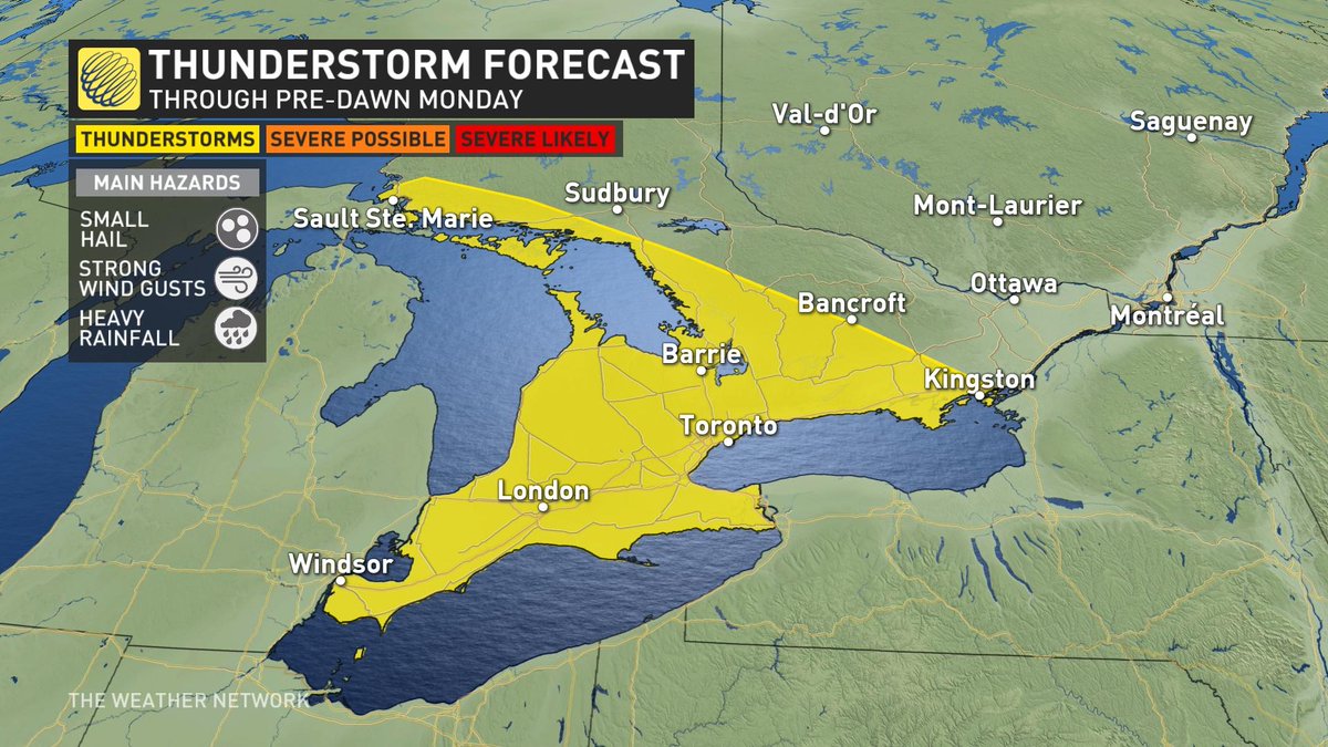
First wave of rain will push over southwestern Ontario Sunday evening, and will include a chance of thunderstorms. Some locales could see severe storms, with the threat of large hail, heavy rain and strong wind gusts. Second round through pre-dawn hours on Monday.

First wave of rain will push over southwestern Ontario Sunday evening, and will include a chance of thunderstorms. Some locales could see severe storms, with the threat of large hail, heavy rain and strong wind gusts. Second round through pre-dawn hours on Monday. #ONstorm #ONwx
account_circle
Rhythm Reet TWN(@RhythmTheMet) 's Twitter Profile Photo

Satellite imagery of the storms across the central USA last night.

Just the shear size of the supercell over northern is jaw dropping.
Also you can see the that passed through , , and
Keep everyone who was affected last night in your prayers.

account_circle
ガンジャスタ(@ganjasta420) 's Twitter Profile Photo

災害が多いなぁ。

『🚨 : トラックストップのシェルガソリンスタンドで大規模な死傷者が出たと発表されました。屋根が崩壊し、最大150人が閉じ込められています。

📌 |

account_circle
DFW Scanner(@DFWscanner) 's Twitter Profile Photo

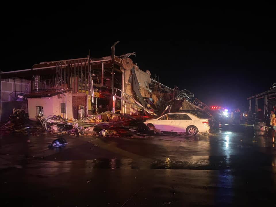
12:16am - Here is a photo of the major damage to buildings at I35 and Lone Oak Road between Valley View and Sanger. Several injuries have been reported. EMS Triage is underway. Ambulances from across Denton and Cooke counties have been sent to the scene. Travel along I35 remains

12:16am - Here is a photo of the major damage to buildings at I35 and Lone Oak Road between Valley View and Sanger. Several injuries have been reported. EMS Triage is underway. Ambulances from across Denton and Cooke counties have been sent to the scene. Travel along I35 remains
account_circle
Jaclyn Whittal(@jwhittalTWN) 's Twitter Profile Photo

Hearing about a mass casualty event has been declared at a truck stop shell gas station with up to 150 people trapped with the roof collapsed. Awful situation in Valley view Texas.

account_circle
R A W S A L E R T S(@rawsalerts) 's Twitter Profile Photo

🚨 : A Mass casualty event has been declared at a truck stop shell gas station with up to 150 people trapped with the roof collapsed

📌 |

Currently, emergency crews have just declared a mass casualty event after a large, violent tornado passed through

account_circle
The Weather Network(@weathernetwork) 's Twitter Profile Photo

Plan your Monday around a risk for severe thunderstorms across parts of southern Ontario. Have a way to get warnings if they're issued for your area. ow.ly/GLo050RVhMC

account_circle
The Weather Network(@weathernetwork) 's Twitter Profile Photo

Just because you don't have a yard, it doesn't mean that you can't grow a garden. Connor O'Donovan spoke to an expert to get tips on how to do it right. ow.ly/TMl750RV20C

account_circle
Jaclyn Whittal(@jwhittalTWN) 's Twitter Profile Photo

Like liquid gold for the Okanagan Valley this time of year. We are in far better position than we were this time last year when it comes to the fire season. The Weather Network

account_circle
Jaclyn Whittal(@jwhittalTWN) 's Twitter Profile Photo

Reminds me of how the El Reno OK made very unpredictable and uncommon changes in it’s trajectory… this RADAR loop is wild from May 23, 2024.

account_circle
Prof. Katharine Hayhoe(@KHayhoe) 's Twitter Profile Photo

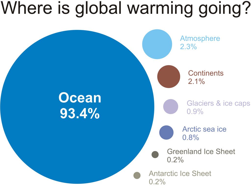
Climate change isn't making hurricanes more frequent. But tropical storms - hurricanes, cyclones, typhoons - are fueled by the ocean, and 93% of the heat trapped inside the climate system by human emissions is going into, you guessed it, the ocean. So here's what's happening...

Climate change isn't making hurricanes more frequent. But tropical storms - hurricanes, cyclones, typhoons - are fueled by the ocean, and 93% of the heat trapped inside the climate system by human emissions is going into, you guessed it, the ocean. So here's what's happening...
account_circle
Judi Watt(@JBMEquiFarms) 's Twitter Profile Photo

Be water aware

Some places will definitely be washed out, and that water can be flowing fast where you least expect it.

account_circle