Jennifer Watson (@jwatson_wx) 's Twitter Profile
Jennifer Watson

@jwatson_wx

Emmy Winning Meteorologist. Watch me on @weatherchannel ➡️ ‘Weather Gone Viral’ & ‘Weird Earth’ Digital Creator, Podcast Host, Speaker. IG: @jenniferweather

ID: 40368131

calendar_today16-05-2009 00:14:05

47,47K Tweet

15,15K Followers

8,8K Following

NWS Atlanta (@nwsatlanta) 's Twitter Profile Photo

Preliminary survey results today confirmed an EF-1 tornado touched down in Paulding County late Saturday evening with maximum winds up to 110 mph. The tornado touched down west of Sudie and continued northeast for over 11 miles through areas of Dallas and New Hope. #gawx

Preliminary survey results today confirmed an EF-1 tornado touched down in Paulding County late Saturday evening with maximum winds up to 110 mph. The tornado touched down west of Sudie and continued northeast for over 11 miles through areas of Dallas and New Hope. #gawx
Charles Peek (@charlespeekwx) 's Twitter Profile Photo

Can some of you social media experts help me get this out to people in Poplar Bluff and Wayne County, MO? If you want to help them call the volunteer #! Please share! #WayneCounty #PoplarBluff #tornado #Missouri

Can some of you social media experts help me get this out to people in Poplar Bluff and Wayne County, MO? If you want to help them call the volunteer #! Please share! #WayneCounty #PoplarBluff #tornado #Missouri
Reed Timmer, PhD (@reedtimmerusa) 's Twitter Profile Photo

UPDATE: Forecast models continue to trend up with the tornado threat in central/northern Illinois into extreme eastern Iowa on Wednesday (tomorrow) afternoon. The trough shape is ideal for big severe weather and tornadoes, with the only limiting factor for a more significant

UPDATE: Forecast models continue to trend up with the tornado threat in central/northern Illinois into extreme eastern Iowa on Wednesday (tomorrow) afternoon. 

The trough shape is ideal for big severe weather and tornadoes, with the only limiting factor for a more significant
Ryan Hall, Y’all (@ryanhallyall) 's Twitter Profile Photo

Strong storms targeting Central Illinois & Western Indiana this afternoon. Multiple tornadoes, large hail & damaging winds possible. Chicago, Indianapolis & surrounding areas should stay weather-aware today. Peak severe threat: mid-afternoon to early evening

Strong storms targeting Central Illinois & Western Indiana this afternoon. Multiple tornadoes, large hail & damaging winds possible. Chicago, Indianapolis & surrounding areas should stay weather-aware today. Peak severe threat: mid-afternoon to early evening
Jim Cantore (@jimcantore) 's Twitter Profile Photo

Nice harmonic pattern continues with embedded storms west to east. Next up another northwest system That has a chance to produce more snow in the north and some SEVERE across the south Sunday. That may open the door for a quick COLD shot early next week for the Great Lakes and

NWS GSP (@nwsgsp) 's Twitter Profile Photo

Did anyone feel shaking this morning? USGS has a preliminary 3.5 magnitude earthquake in east Tennessee. You can check out the interactive map and report shaking here: earthquake.usgs.gov/earthquakes/ev…

Did anyone feel shaking this morning? USGS has a preliminary 3.5 magnitude earthquake in east Tennessee. You can check out the interactive map and report shaking here: earthquake.usgs.gov/earthquakes/ev…
NWS Storm Prediction Center (@nwsspc) 's Twitter Profile Photo

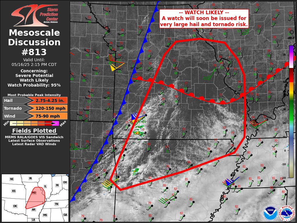
A regional outbreak of severe storms is expected today across parts of the Mid-MS and OH/TN Valleys. Multiple rounds of severe storms may impact some areas. Large to very large hail, several tornadoes (some strong), and swaths of intense/damaging wind gusts are expected.

A regional outbreak of severe storms is expected today across parts of the Mid-MS and OH/TN Valleys. Multiple rounds of severe storms may impact some areas. Large to very large hail, several tornadoes (some strong), and swaths of intense/damaging wind gusts are expected.
NWS Paducah, KY (@nwspaducah) 's Twitter Profile Photo

Today will be a VOLATILE severe weather day. We are in a level 4 of 5, Moderate Risk, for severe weather this afternoon and evening. We are confident in the hazards but unfortunately less confident in the timing. Stay weather aware and have multiple ways to receive warnings!

Today will be a VOLATILE severe weather day. We are in a level 4 of 5, Moderate Risk, for severe weather this afternoon and evening. We are confident in the hazards but unfortunately less confident in the timing. Stay weather aware and have multiple ways to receive warnings!
David Baxte☈📸🎥🌪⛈ (@coloradowxnut) 's Twitter Profile Photo

Quick phone edit of the Rope Tornado earlier near Kim, CO! Kim for the win again! Can't wait to do some high res edits later! Colorado MAGIC! #cowx #Colorado #nikon NWS Pueblo

Quick phone edit of the Rope Tornado earlier near Kim, CO! Kim for the win again! Can't wait to do some high res edits later! Colorado MAGIC!

#cowx #Colorado #nikon <a href="/NWSPueblo/">NWS Pueblo</a>
Jennifer Watson (@jwatson_wx) 's Twitter Profile Photo

What I really needed with Morton, TX supercell as it was coming into Lubbock was a Wind Monitor 5103 from R.M. Young Company!! 🌪️ I hope I win one tomorrow! #RMYoungWind

Jennifer Watson (@jwatson_wx) 's Twitter Profile Photo

Quick update, they have been towed…THANK YOU for the quick response from everyone! I love the storm chaser community ❤️🌪️

Jennifer Watson (@jwatson_wx) 's Twitter Profile Photo

Quick update! They have been towed, thanks everyone!! 🚨🚨 STORM CHASER FRIENDS, the OTUS Project is in need of a tow just southwest of Spearman, TX! If anyone can help them, let me know!! Reed Timmer, PhD Edgar ONeal Aaron Rigsby Jordan Hall Erik Fox Jim Cantore

Quick update! They have been towed, thanks everyone!! 🚨🚨 STORM CHASER FRIENDS, the <a href="/project_otus/">OTUS Project</a> is in need of a tow just southwest of Spearman, TX! If anyone can help them, let me know!! <a href="/ReedTimmerUSA/">Reed Timmer, PhD</a> <a href="/EdgarONealWX/">Edgar ONeal</a> <a href="/AaronRigsbyOSC/">Aaron Rigsby</a> <a href="/JordanHallWX/">Jordan Hall</a> <a href="/erikfox2000/">Erik Fox</a> <a href="/JimCantore/">Jim Cantore</a>