Joel Young, CBM (@joel_off_air) 's Twitter Profile
Joel Young, CBM

@joel_off_air

3x Emmy Nom Meteorologist @KARK4News & @FOX16News | Born & Raised in the MS Delta | Tweets=Mine RT≠Endorsements | #ARStormTeam | #ARwx

ID: 231977957

linkhttp://KARK.com/weather calendar_today30-12-2010 00:07:30

49,49K Tweet

15,15K Followers

4,4K Following

Joel Young, CBM (@joel_off_air) 's Twitter Profile Photo

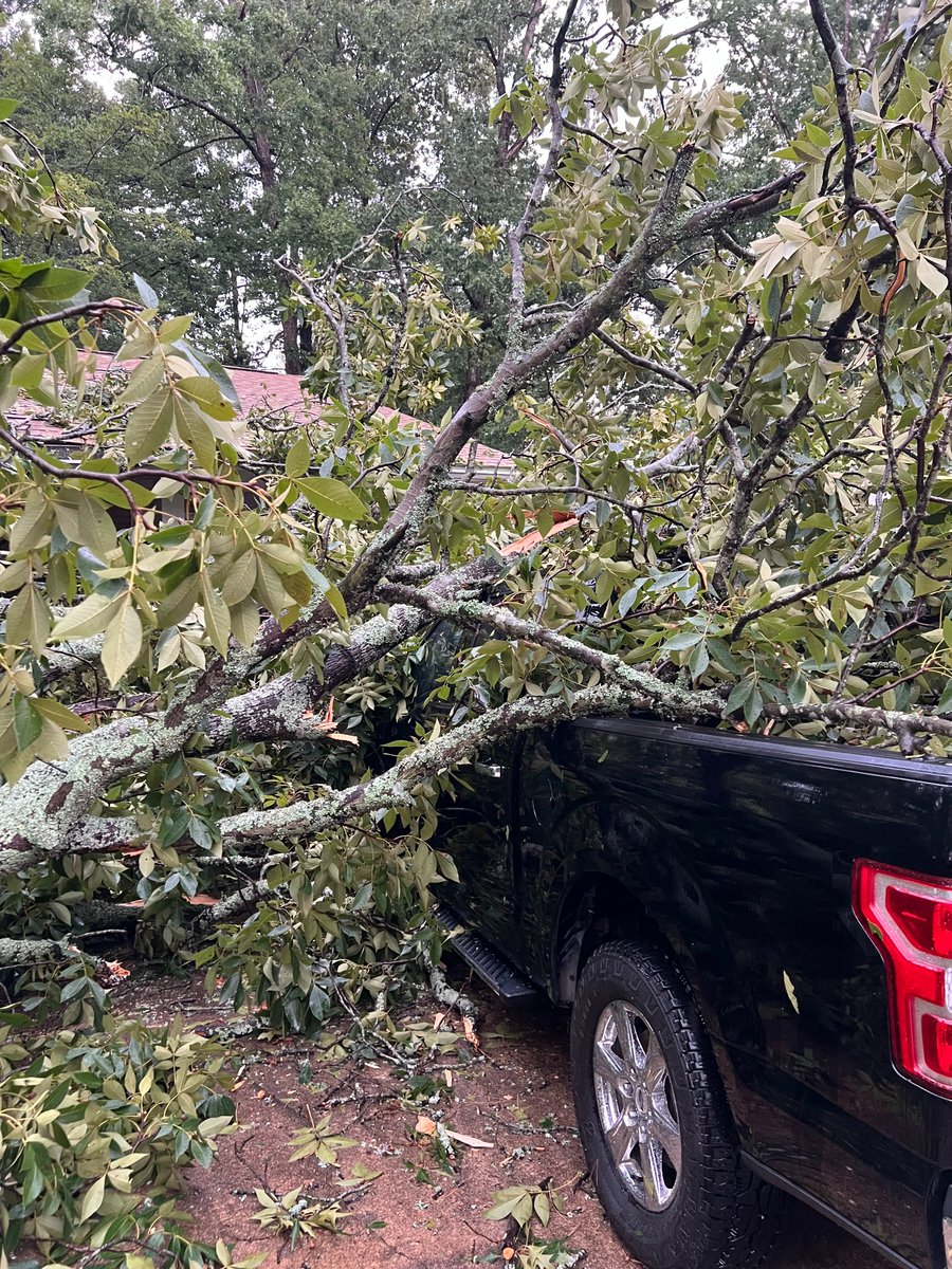
Lots of trees down at Mellons Country Store in Mountain View on Wednesday afternoon as a summer storm put out what appears to have been a very strong damaging microburst. Thanks to Tray Campbell for sharing these pictures. #ARwx

Lots of trees down at Mellons Country Store in Mountain View on Wednesday afternoon as a summer storm put out what appears to have been a very strong damaging microburst. 

Thanks to Tray Campbell for sharing these pictures. #ARwx
Joel Young, CBM (@joel_off_air) 's Twitter Profile Photo

Awful storm damage following Tuesday afternoon storms in Central Arkansas. Thanks to Mary Williams for sharing these pictures. #ARwx

Awful storm damage following Tuesday afternoon storms in Central Arkansas. 

Thanks to Mary Williams for sharing these pictures. #ARwx
Joel Young, CBM (@joel_off_air) 's Twitter Profile Photo

Thursday and Friday will still be hot, but it will be more tolerable behind a cool front that has been passing through. We'll heat up a bit more through the weekend before another cool front arrives Sunday, bringing more meaningful relief into next week. #ARwx

Joel Young, CBM (@joel_off_air) 's Twitter Profile Photo

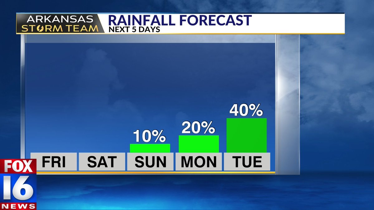
NEXT WEEK🤩 This is probably the most exciting news I've had in a while... ANOTHER cool front arrives Sunday, dropping temperatures into the 80s for much of next week. And it comes with some much-needed rain chances as well--especially on Tuesday. Stay tuned for updates from

NEXT WEEK🤩 This is probably the most exciting news I've had in a while... ANOTHER cool front arrives Sunday, dropping temperatures into the 80s for much of next week. 

And it comes with some much-needed rain chances as well--especially on Tuesday. Stay tuned for updates from
Joel Young, CBM (@joel_off_air) 's Twitter Profile Photo

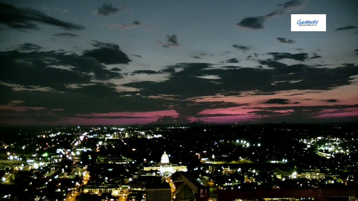
Beautiful view over the state capitol following this evening's beautiful sunset! This is looking west from our Gwatney Chevrolet tower cam. #ARwx

Beautiful view over the state capitol following this evening's beautiful sunset! 

This is looking west from our Gwatney Chevrolet tower cam. #ARwx
Joel Young, CBM (@joel_off_air) 's Twitter Profile Photo

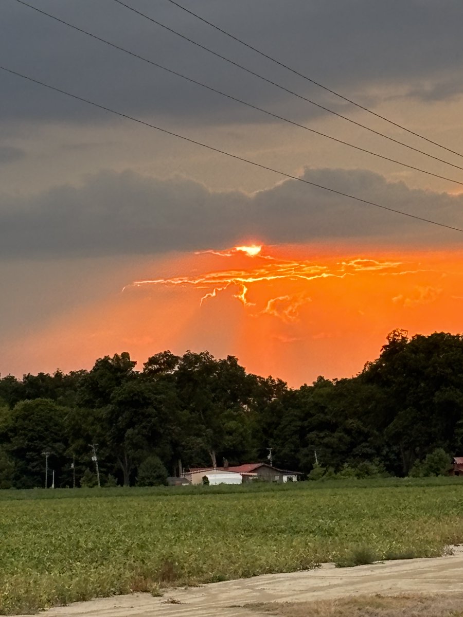
Beautiful view of this Wednesday evening's sunset over southeast Arkansas. Big thanks to Leisa Hobson for sharing this picture from Lake Village. #ARwx

Beautiful view of this Wednesday evening's sunset over southeast Arkansas. 

Big thanks to Leisa Hobson for sharing this picture from Lake Village. #ARwx
Joel Young, CBM (@joel_off_air) 's Twitter Profile Photo

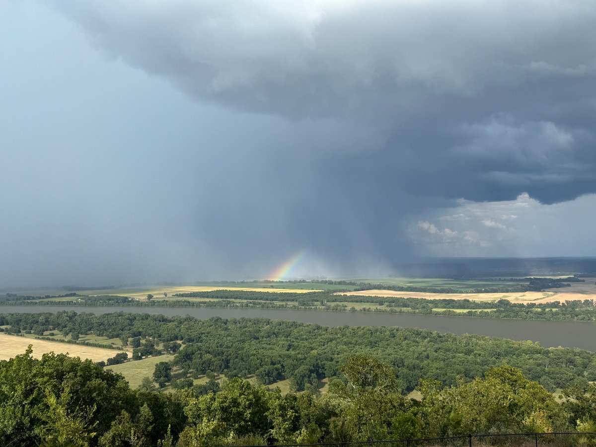
Nice shot of a rainbow this Wednesday afternoon as an isolated downpour moved through the Arkansas River Valley. Big thanks to Janna Virden for sharing this pic from Petit Jean Mountain. #ARwx

Nice shot of a rainbow this Wednesday afternoon as an isolated downpour moved through the Arkansas River Valley. 

Big thanks to Janna Virden for sharing this pic from Petit Jean Mountain. #ARwx
Joel Young, CBM (@joel_off_air) 's Twitter Profile Photo

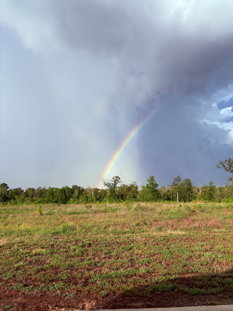
Another great shot of a rainbow this afternoon with a spotty thunderstorm that moved through Faulkner County. Thanks to Casee McConkie for sharing this picture from Greenbrier. #ARwx

Another great shot of a rainbow this afternoon with a spotty thunderstorm that moved through Faulkner County. 

Thanks to Casee McConkie for sharing this picture from Greenbrier. #ARwx
Joel Young, CBM (@joel_off_air) 's Twitter Profile Photo

Great shot of this Wednesday evening's sunset crossing over the I-430 bridge looking west toward Pinnacle Mountain. Big thanks to Ashley Diggs for sharing this picture from Little Rock. #ARwx

Great shot of this Wednesday evening's sunset crossing over the I-430 bridge looking west toward Pinnacle Mountain. 

Big thanks to Ashley Diggs for sharing this picture from Little Rock. #ARwx
Joel Young, CBM (@joel_off_air) 's Twitter Profile Photo

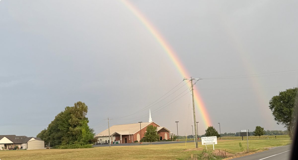
Beautiful double rainbow Wednesday afternoon over a church! Big thanks to Sarita Carver for sharing this picture from Scott. #ARwx

Beautiful double rainbow Wednesday afternoon over a church! Big thanks to Sarita Carver for sharing this picture from Scott. #ARwx
Joel Young, CBM (@joel_off_air) 's Twitter Profile Photo

Another great shot of a summer thundershower rolling across parts of Faulkner County this afternoon. Thanks to Sarai Fureigh for sharing this picture from the Barney area. #ARwx

Another great shot of a summer thundershower rolling across parts of Faulkner County this afternoon. 

Thanks to Sarai Fureigh for sharing this picture from the Barney area. #ARwx
Joel Young, CBM (@joel_off_air) 's Twitter Profile Photo

10:49 PM UPDATE: Our cool front has stalled across southeast Arkansas, perhaps igniting a round of overnight storms. These may be slow-moving, and could result in isolated areas of flash flooding. Meteorologist Julianna Cullen will have you covered Thursday morning on FOX16 News Good Day
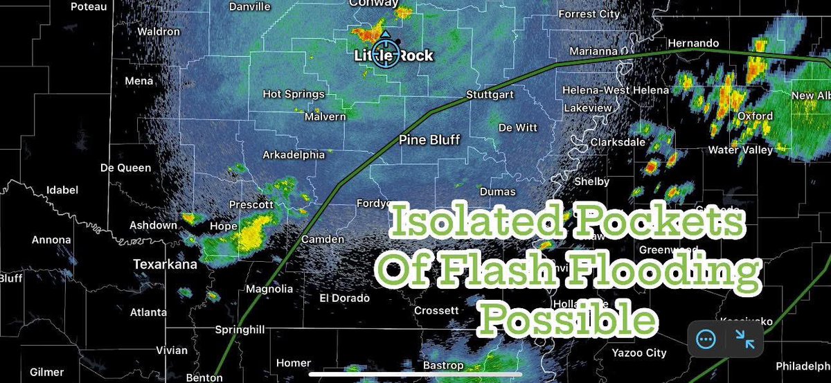
10:49 PM UPDATE: Our cool front has stalled across southeast Arkansas, perhaps igniting a round of overnight storms. These may be slow-moving, and could result in isolated areas of flash flooding. 

<a href="/JCullenWX/">Meteorologist Julianna Cullen</a> will have you covered Thursday morning on <a href="/FOX16News/">FOX16 News</a> Good Day
Joel Young, CBM (@joel_off_air) 's Twitter Profile Photo

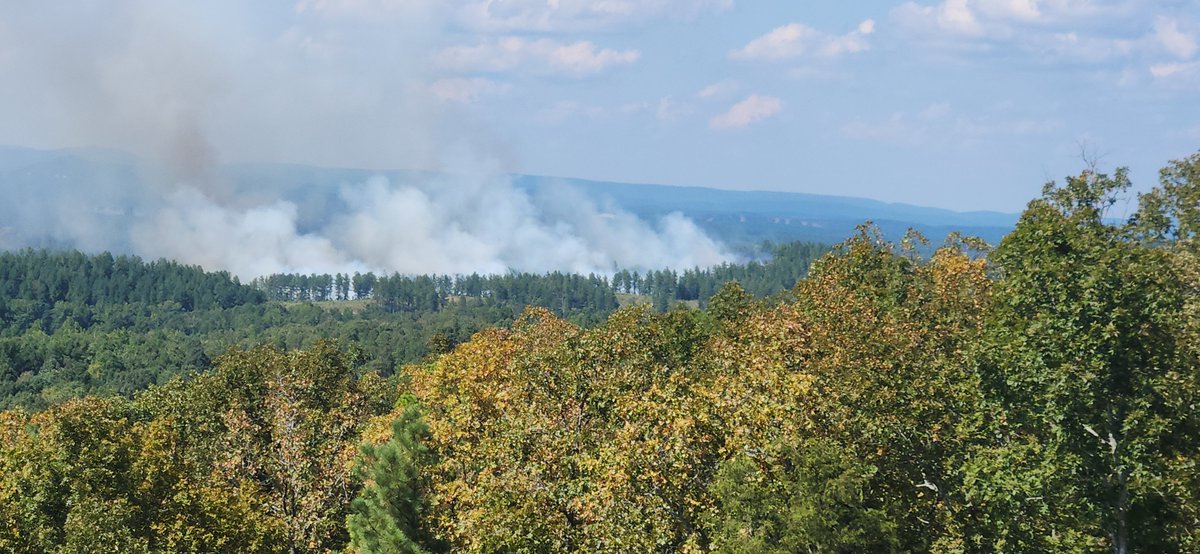
Picture of a wildfire that broke out this afternoon between Hot Springs and Lonsdale. Crews are out fighting the fire now. Thanks to Robert J Simonis for sharing this picture. #ARwx

Picture of a wildfire that broke out this afternoon between Hot Springs and Lonsdale. Crews are out fighting the fire now. 

Thanks to Robert J Simonis for sharing this picture. #ARwx
Joel Young, CBM (@joel_off_air) 's Twitter Profile Photo

Our first front has eased the heat and humidity... But it will still be hot with highs in the lower to mid-90s through the weekend. Then ANOTHER cool front arrives, dropping temperatures even further early next week with greater rain chances as well. #ARwx

Joel Young, CBM (@joel_off_air) 's Twitter Profile Photo

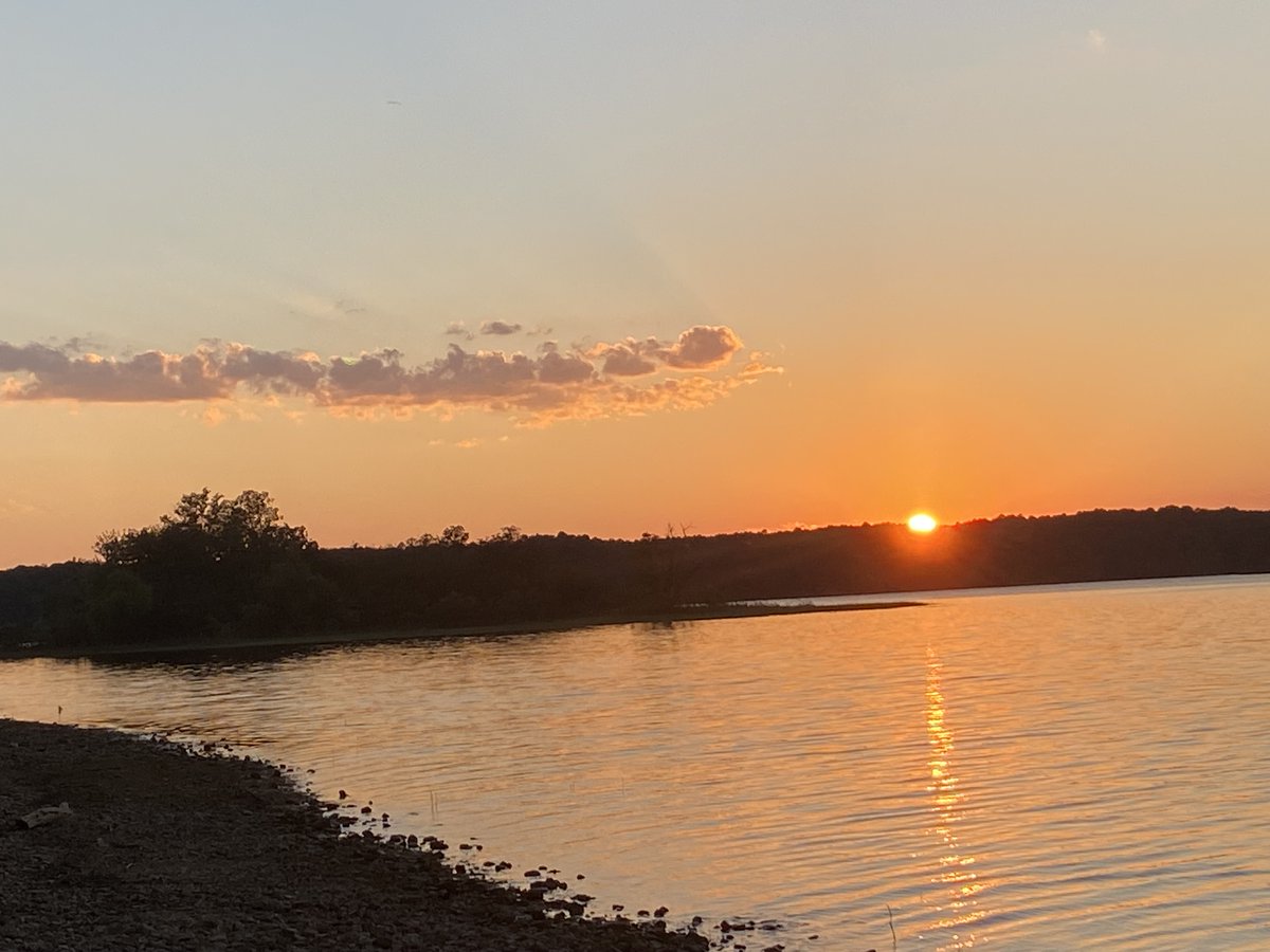
Beautiful sunset this evening over the back side of Lake Ouachita at Tompkins Bend. This is located east of Mt. Ida off Hwy 270. #ARwx Thanks to Angela B for sharing this picture! #ARwx

Beautiful sunset this evening over the back side of Lake Ouachita at Tompkins Bend. This is located east of Mt. Ida off Hwy 270. #ARwx 

Thanks to Angela B for sharing this picture! #ARwx
Joel Young, CBM (@joel_off_air) 's Twitter Profile Photo

Another cool front is on the way... But we still have to get through another hot weekend before it arrives! Temperatures will return to the mid-90s both Saturday and Sunday, but humidity should still be relatively low. #ARwx

Joel Young, CBM (@joel_off_air) 's Twitter Profile Photo

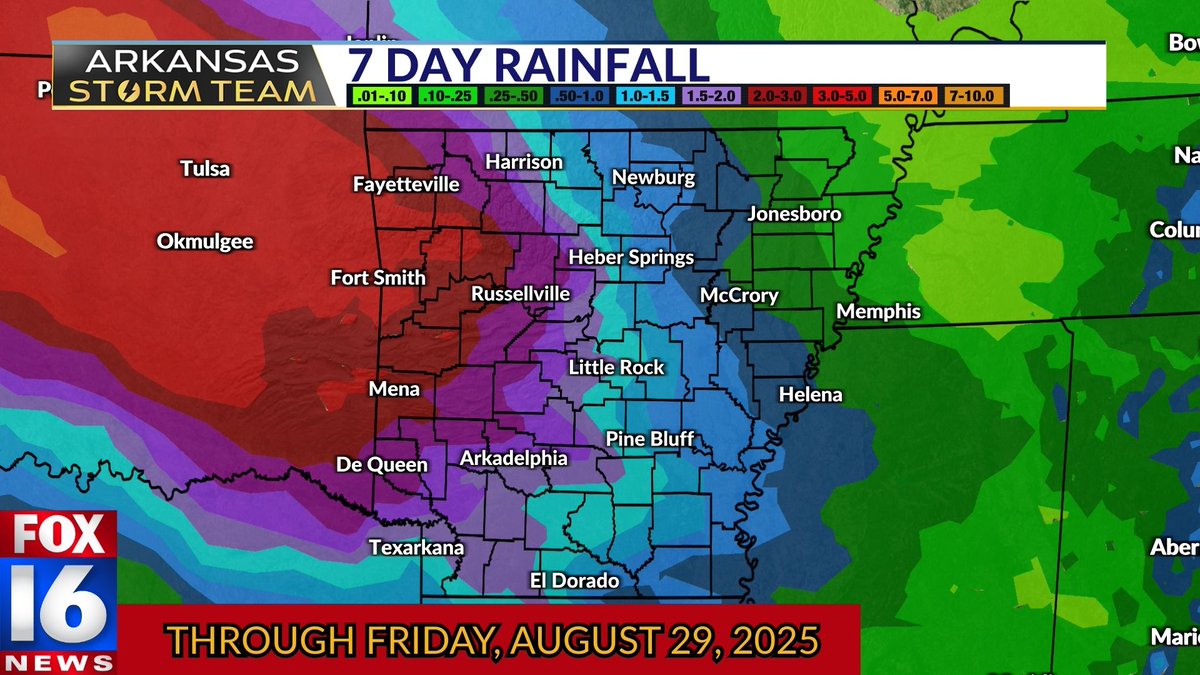
MUCH NEEDED RAIN⛈️ I don't want to get our hopes up, but models continue to show a good dose of rain moving in Monday night through much of Tuesday... BEHIND the cool front! That means temps may be MUCH below average. With this, and perhaps another round late next week, some

MUCH NEEDED RAIN⛈️ I don't want to get our hopes up, but models continue to show a good dose of rain moving in Monday night through much of Tuesday... BEHIND the cool front! 

That means temps may be MUCH below average. With this, and perhaps another round late next week, some
Joel Young, CBM (@joel_off_air) 's Twitter Profile Photo

Beautiful sunset this evening photobombed by a hummingbird! Big thanks to Vickey Armstrong for sharing this picture from Bee Branch, overlooking Greers Ferry Lake. #ARwx

Beautiful sunset this evening photobombed by a hummingbird! 

Big thanks to Vickey Armstrong for sharing this picture from Bee Branch, overlooking Greers Ferry Lake. #ARwx
Joel Young, CBM (@joel_off_air) 's Twitter Profile Photo

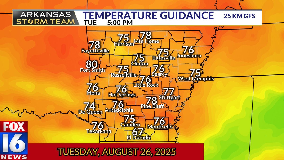
A TASTE OF FALL 🎃 I have REALLY hesitated to throw these numbers out, but models continue to insist on post-frontal rain chances--driving temps into the 60s and 70s Tuesday! The longer the rain lingers, the less opportunity we have to warm up. Stay with the #ARStormTeam for

A TASTE OF FALL 🎃 I have REALLY hesitated to throw these numbers out, but models continue to insist on post-frontal rain chances--driving temps into the 60s and 70s Tuesday! 

The longer the rain lingers, the less opportunity we have to warm up. Stay with the #ARStormTeam for
Joel Young, CBM (@joel_off_air) 's Twitter Profile Photo

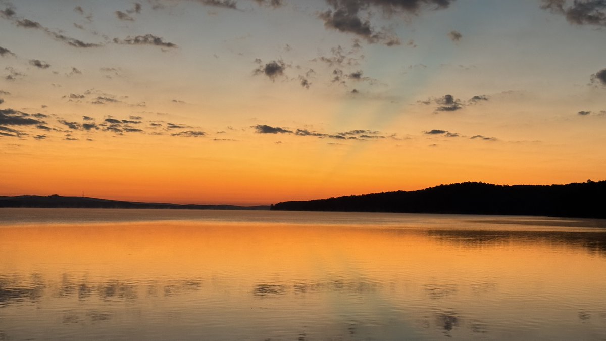
Clear, beautiful sunrise this morning at Vista Point on Lake Maumelle this morning! Thanks to Jodi Morris for sharing this view! #ARwx

Clear, beautiful sunrise this morning at Vista Point on Lake Maumelle this morning! 

Thanks to Jodi Morris for sharing this view! #ARwx