Pontus Olofsson ๐Ÿ‡บ๐Ÿ‡ธ ๐Ÿ‡ธ๐Ÿ‡ช (@j_p_olofsson) 's Twitter Profile
Pontus Olofsson ๐Ÿ‡บ๐Ÿ‡ธ ๐Ÿ‡ธ๐Ÿ‡ช

@j_p_olofsson

Geographer and cineast

ID: 1169731399

calendar_today11-02-2013 18:51:42

1,1K Tweet

1,1K Followers

1,1K Following

ForestSAT (@forestsat) 's Twitter Profile Photo

The deadline for submitting abstracts for the #Forestsat2024 conference is approaching in one month โŒ› Abstract submission closes on 20th March 2024 Visit forestsat2024.com for details of how to submit.

The deadline for submitting abstracts for the #Forestsat2024 conference is approaching in one month โŒ› 
Abstract submission closes on 20th March 2024 Visit forestsat2024.com for details of how to submit.
NASAEarthdata (@nasaearthdata) 's Twitter Profile Photo

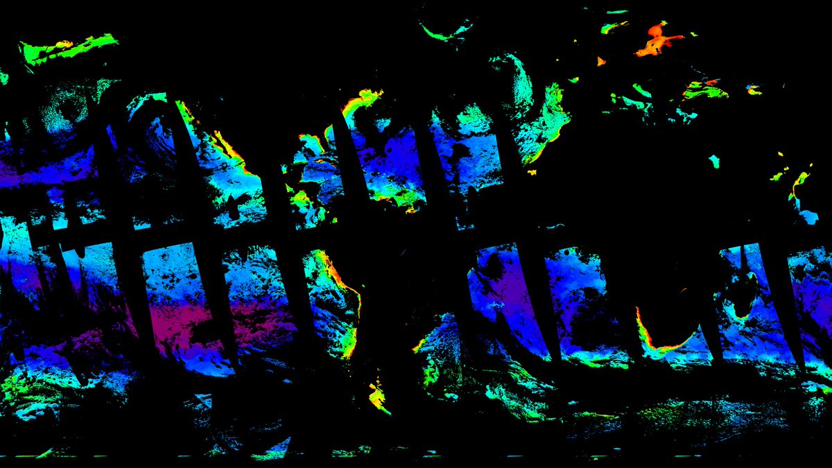
When NASAโ€™s Plankton, Aerosol, Cloud, ocean Ecosystem (PACE) satellite reached orbit, the mission team knew they were ready to work with the data they would be receiving thanks to simulated data that tested PACEโ€™s sensors and data systems. Learn more: go.nasa.gov/49PgkL8

When NASAโ€™s Plankton, Aerosol, Cloud, ocean Ecosystem (PACE) satellite reached orbit, the mission team knew they were ready to work with the data they would be receiving thanks to simulated data that tested PACEโ€™s sensors and data systems. 

Learn more: go.nasa.gov/49PgkL8
Dr. Joanne C. White (@joanne_c_white) 's Twitter Profile Photo

ForestSAT abstracts and registration! Abstracts (deadline March 20, 2024): tcc.eventsair.com/fsat24/call-foโ€ฆ Registration (early bird ends July 10, 2024): tcc.eventsair.com/fsat24/reg-24 #forest #remotesensing #lidar #Landsat #conference #science ForestSAT

USGS Landsat (@usgslandsat) 's Twitter Profile Photo

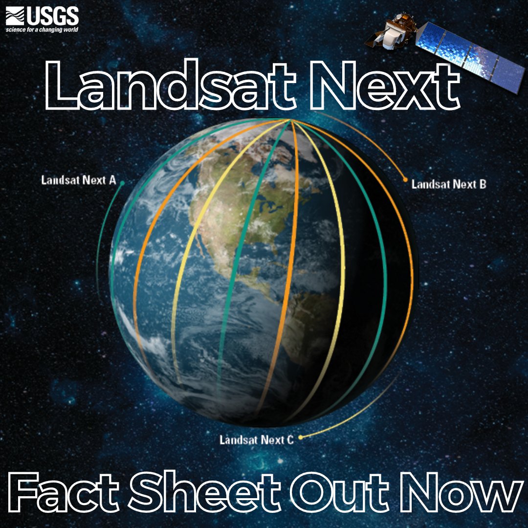
What do 3 satellites, 6-day revisit cycle, and 26 spectral bands all have in common? They are all characteristics of the upcoming 2030 Landsat Next Mission! To Learn more about #Landsat Next visit the newly published Landsat Next fact sheet: ow.ly/tqsM50QTybY #USGS #NASA

What do 3 satellites, 6-day revisit cycle, and 26 spectral bands all have in common?

They are all characteristics of the upcoming 2030 Landsat Next Mission! To Learn more about #Landsat Next visit the newly published Landsat Next fact sheet: ow.ly/tqsM50QTybY

#USGS #NASA
Pontus Olofsson ๐Ÿ‡บ๐Ÿ‡ธ ๐Ÿ‡ธ๐Ÿ‡ช (@j_p_olofsson) 's Twitter Profile Photo

This is a great set of recommendations that efforts like the Satellite Needs Working Group of the US Govt could help implement (and already has: e.g. the NASA JPL OPERA products)

ForestSAT (@forestsat) 's Twitter Profile Photo

The abstract submission deadline for ForestSAT in Rotorua has been extended until 20 April. This is your opportunity to present original research in the oral or poster format. #ForestSAT #conference #abstracts #forestry #spatialanalysis Submit now: buff.ly/3PxgK17

The abstract submission deadline for ForestSAT in Rotorua has been extended until 20 April.  
This is your opportunity to present original research in the oral or poster format. 
#ForestSAT #conference #abstracts #forestry #spatialanalysis
Submit now: buff.ly/3PxgK17
Land-Cover & Land-Use Change (LCLUC) Program (@lclucprogram) 's Twitter Profile Photo

Assistant prof @Wangathan from University of Utah School of Biological Sciences Dynamic Carbon and Ecosystems Lab presented a project that aims to map forest mortality using lidar, reflectance, and temperature data Land-Cover & Land-Use Change (LCLUC) Program Science Team Meeting 2024! The team analyzed the vulnerability to drought across western US. PC @shijuan_chen !
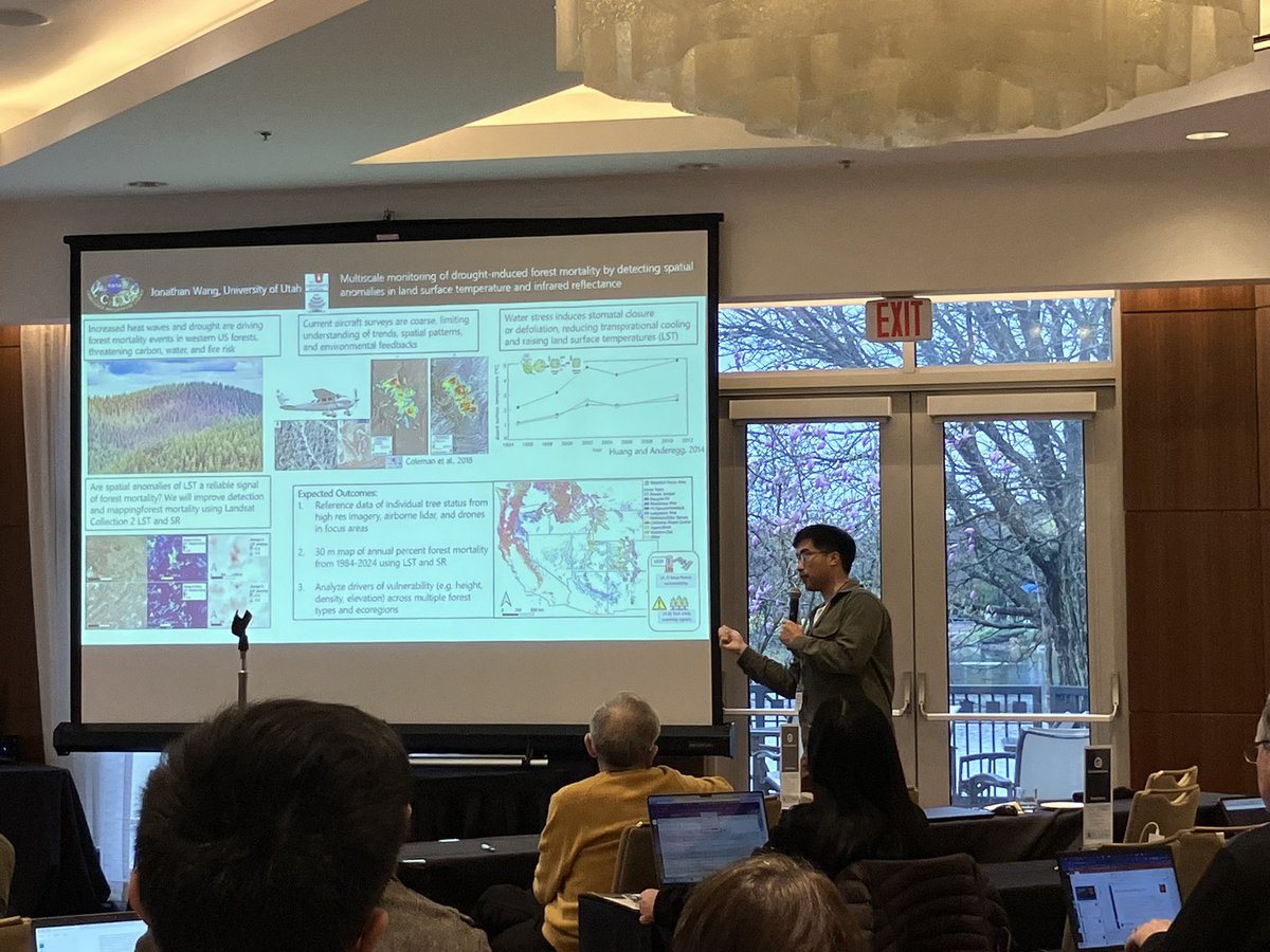
Assistant prof @Wangathan from <a href="/UofUBiology/">University of Utah School of Biological Sciences</a> <a href="/DYCE_Lab/">Dynamic Carbon and Ecosystems Lab</a> presented a project that aims to map forest mortality using lidar, reflectance, and temperature data <a href="/LCLUCProgram/">Land-Cover & Land-Use Change (LCLUC) Program</a> Science Team Meeting 2024! The team analyzed the vulnerability to drought across western US. PC @shijuan_chen !
Dr. Xiaojing Tang (@xjtang_jmu) 's Twitter Profile Photo

New pan-tropical near real-time forest disturbance alerts using time series analysis of Landsat and Sentinel-2. Results and time series visualization tool can be found here fusionnrt.projects.earthengine.app/view/fnrt-2023 for 2023 and here fusionnrt.projects.earthengine.app/view/fnrt-2024 for 2024 (will be routinely updated)

Mike Flannigan (@mikeflannigan) 's Twitter Profile Photo

Climate Change Research Ecologist, BC Ministry of Forests (closing Aug. 22, 2024) One job - two postings one for registered professional foresters and agrologists (LSO3) bcpublicservice.hua.hrsmart.com/hr/ats/Postingโ€ฆ applicants without these professional designations (STO27) bcpublicservice.hua.hrsmart.com/hr/ats/Postingโ€ฆ

Mike Wulder (@mikewulder) 's Twitter Profile Photo

๐Ÿคฉ"All required metrics from the confusion matrix can be easily computed and included confidence levels with scikit-eo following guidance proposed by [Pontus Olofsson ๐Ÿ‡บ๐Ÿ‡ธ ๐Ÿ‡ธ๐Ÿ‡ช] et al. (2014)." Good practices for estimating area and assessing accuracy of land change. tinyurl.com/28b4m36b

Mike Wulder (@mikewulder) 's Twitter Profile Photo

Looks like Prof Coops Integrated RS Studio was making an announcement... co-organizing and hosting #Silvilaser2025 with Alexis Achim! September 29 - October 3, 2025 Quรฉbec City, QC, Canada ๐Ÿ‡จ๐Ÿ‡ฆ ๐Ÿ”—silvilaser2025.com

Looks like Prof Coops <a href="/IRSS_UBC/">Integrated RS Studio</a> was making an announcement... co-organizing and hosting #Silvilaser2025 with <a href="/AlexisAchim/">Alexis Achim</a>!  
September 29 - October 3, 2025
Quรฉbec City, QC, Canada ๐Ÿ‡จ๐Ÿ‡ฆ
๐Ÿ”—silvilaser2025.com
Mike Wulder (@mikewulder) 's Twitter Profile Photo

Towards Harmonized #Landsat #Sentinel2 (#HLS) for national mapping, including #landcover & change. Jasper Wildfire Complex example with zooms of townsite and Marmot Basin. #NTEMS Dense time series for exclusion of cloud & smoke for improved disturbance capture with lower latency.

Pontus Olofsson ๐Ÿ‡บ๐Ÿ‡ธ ๐Ÿ‡ธ๐Ÿ‡ช (@j_p_olofsson) 's Twitter Profile Photo

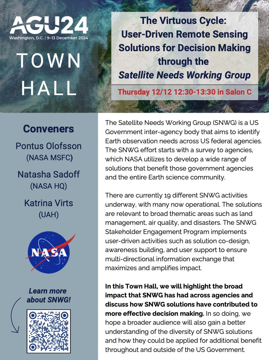
Please join us at #AGU24! NASA's extensive work supporting the Satellite Needs Working Group (SNWG) will be highlighted during a Town Hall on Thursday, Dec. 12 at 12:30 PM. Come learn about what's new in the program and across all the solutions we're implementing.

Please join us at #AGU24! NASA's extensive work supporting the Satellite Needs Working Group (SNWG) will be highlighted during a Town Hall on Thursday, Dec. 12 at 12:30 PM. Come learn about what's new in the program and across all the solutions we're implementing.
Qiusheng Wu (@giswqs) 's Twitter Profile Photo

๐Ÿ“ขLeafmap now supports interactive searching and visualization of NASA OPERA data products! Explore the notebook here: leafmap.org/notebooks/101_โ€ฆ Watch the video: youtu.be/00IHISf4jHY The OPERA project at JPL harnesses satellite radar and optical instruments to generate six