Riley Doxsee (@iptcwcdirector) 's Twitter Profile
Riley Doxsee

@iptcwcdirector

Weather Enthusiast and NWPAC Climatologist. Director at @IPTCWC. PRO AMERICA 🇺🇸 ROLL TIDE 🐘 Everglades Photographer🐊🦩🦌 Florida Man🌴 Matthew 24:24 🙏

ID: 1489990383690031105

calendar_today05-02-2022 15:52:54

9,9K Tweet

1,1K Followers

435 Following

Riley Doxsee (@iptcwcdirector) 's Twitter Profile Photo

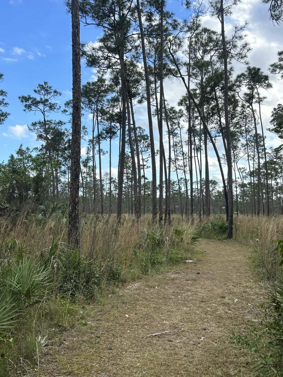
Trip today out in the Everglades, was off Skillet Strand North, slightly north of US41. It is extremely dry out there. Walked around 3 miles on trail then turned around. Seen signs of human activity more than animal. However, one interesting print uncovered. Could it be?

Trip today out in the Everglades, was off Skillet Strand North, slightly north of US41. It is extremely dry out there. Walked around 3 miles on trail then turned around. Seen signs of human activity more than animal. However, one interesting print uncovered. Could it be?
Riley Doxsee (@iptcwcdirector) 's Twitter Profile Photo

Day 1 of a 2 day trip to Everglades National Park, I come down here to the park on average about twice a year. Was an absolutely beautiful day yesterday, with a nice sunset view, and I seen 2 Deer on Research Road. Going to flamingo today, but rain lingers in the forecast.

Day 1 of a 2 day trip to Everglades National Park, I come down here to the park on average about twice a year. Was an absolutely beautiful day yesterday, with a nice sunset view, and I seen 2 Deer on Research Road. Going to flamingo today, but rain lingers in the forecast.
Riley Doxsee (@iptcwcdirector) 's Twitter Profile Photo

Captured video of Everglades Mink today around 10am in Fakahatchee Strand Preserve State Park. This is one of the rarest and most endangered animals in the world. I’m in rare air. Not even park biologist see them, and less than a half dozen have ever captured clear video of one…

Riley Doxsee (@iptcwcdirector) 's Twitter Profile Photo

29S ERROL 250416 1200 14.4S 118.9E SHEM 140 919 Cyclone #Errol has undergone very rapid intensification and is now upgraded to a Category 5 Tropical Cyclone by the JTWC. One could argue previous storms could get a bump up post analysis, but for now, first official C5 of 2025.

29S ERROL 250416 1200 14.4S 118.9E SHEM 140 919

Cyclone #Errol has undergone very rapid intensification and is now upgraded to a Category 5 Tropical Cyclone by the JTWC. One could argue previous storms could get a bump up post analysis, but for now, first official C5 of 2025.
Riley Doxsee (@iptcwcdirector) 's Twitter Profile Photo

My 2025 Northern Hemisphere TC predictions. With the expectation of a cold neutral ENSO and -PDO, I am forecasting the following for each NHEM basin. Confidence level = 70/100. Forecast accounts for expected activity June 1-Nov 30 across all 4 basins.

My 2025 Northern Hemisphere TC predictions. With the expectation of a cold neutral ENSO and -PDO, I am forecasting the following for each NHEM basin. Confidence level = 70/100. Forecast accounts for expected activity June 1-Nov 30 across all 4 basins.
Riley Doxsee (@iptcwcdirector) 's Twitter Profile Photo

And neither do you anymore when Romania government took it away and threw you in jail then you ran from your problems after you ripped people off.

Riley Doxsee (@iptcwcdirector) 's Twitter Profile Photo

So far it has been one of the latest starting WPAC seasons on record, with no named storms yet. However the EPS and GFS are in agreement that is likely to change. Seasons such as 2016 started a full month later, and produced a solid season. #Wutip is the first name of 2025.

So far it has been one of the latest starting WPAC seasons on record, with no named storms yet. However the EPS and GFS are in agreement that is likely to change. Seasons such as 2016 started a full month later, and produced a solid season. #Wutip is the first name of 2025.
Riley Doxsee (@iptcwcdirector) 's Twitter Profile Photo

#Wutip, the first storm of the WPAC season is steadily strengthening in the western South China Sea, radar is now showing well defined banding features and a partial core underneath the strong connection. Clearly impacted by Northeasterly shear from the monsoon however.

#Wutip, the first storm of the WPAC season is steadily strengthening in the western South China Sea, radar is now showing well defined banding features and a partial core underneath the strong connection. Clearly impacted by Northeasterly shear from the monsoon however.
Riley Doxsee (@iptcwcdirector) 's Twitter Profile Photo

#Wutip appears to be making landfall on the western end of Hainan Island, China. The intensity is estimated as a STS (Severe Tropical Storm) by JTWC and JMA, however CMA is estimating a typhoon. No recon, but radar suggests the latter. Came together fast for a June SCS system.

#Wutip appears to be making landfall on the western end of Hainan Island, China. The intensity is estimated as a STS (Severe Tropical Storm) by JTWC and JMA, however CMA is estimating a typhoon. No recon, but radar suggests the latter. Came together fast for a June SCS system.
Riley Doxsee (@iptcwcdirector) 's Twitter Profile Photo

#Wutip is back over water and is rebounding quite well. It has around 6-8 hours until it hits the Chinese mainland slightly west of Zhenjiang. Warm waters of the Gulf of Tonkin and it’s concave coastline similar to BOC, is likely to promote intensification until landfall.

#Wutip is back over water and is rebounding quite well. It has around 6-8 hours until it hits the Chinese mainland slightly west of Zhenjiang. Warm waters of the Gulf of Tonkin and it’s concave coastline similar to BOC, is likely to promote intensification until landfall.
Bernie Sanders (@berniesanders) 's Twitter Profile Photo

Netanyahu is not the President of the United States. He should not be determining U.S. foreign and military policy. If the people of Israel support his decision to start a war with Iran, that is their business and their war. The United States must not be a part of it.