Hugh Graham @hughagraham@fosstodon.org (@hughagraham) 's Twitter Profile
Hugh Graham @[email protected]

@hughagraham

Environmental Scientist with a big interest in #geospatial #rstats #rspatial #python #QGIS #EarthEngine #beavers

ID: 4016856743

linkhttps://h-a-graham.github.io/ calendar_today22-10-2015 12:34:13

2,2K Tweet

944 Followers

769 Following

@tylermorganwall.bsky.social (@tylermorganwall) 's Twitter Profile Photo

‼️New #rayshader release (v0.32.5)! This version brings 3rd person views to your maps, generated directly from a spatial path: turn your GPS bike rides/runs/hikes into cool 3D animations, directly in #RStats! You can even steady the camera or add rotation for a cinematic effect.

Permian Global (@permianglobal) 's Twitter Profile Photo

Permian Global has released its in-house developed software for processing satellite imagery as open-source and help others working in remote sensing to analyse biomass and land-use imagery. Christopher Philipson Hugh Graham @[email protected] #opensource #satellitedata permianglobal.com/press-release/…

Hugh Graham @hughagraham@fosstodon.org (@hughagraham) 's Twitter Profile Photo

If you're an #rstats #rspatial fan and you've not discovered {rsi} yet check it out at: permian-global-research.github.io/rsi/ it's an amazing package by @[email protected] that massively streamlines your #remotesensing workflows! 🌏🌴🌳🛰️

terence (@researchremora) 's Twitter Profile Photo

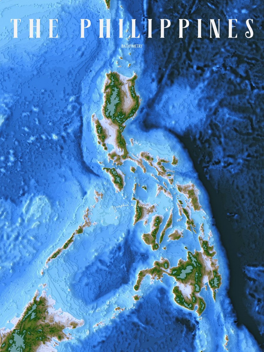
Coastal bathymetric contours (left) and topobathymetric contours (right) of the Philippines. #rayshader adventures, an #rstats tale

Coastal bathymetric contours (left) and topobathymetric contours (right) of the Philippines. 

#rayshader adventures, an #rstats tale
Milos Makes Maps (@milosmakesmaps) 's Twitter Profile Photo

Thrilled to unveil my new tutorial! 🚀 Learn to download 🗺️ Meta and World Resources Institute latest tree canopy height data at 1m resolution and create stunning #maps with ggplot2 & interactive ones with #leaflet. Join the journey here: youtu.be/bIi5yUfkDUc

Sofia Lazar (@lazarsofia1) 's Twitter Profile Photo

🗣️Mapped the urban #canopy 🌳of 5 cities leading the way in #urbantreeequity! Using high-res data, it's inspiring to see how #Portland 🇺🇸, #Vancouver 🇨🇦,#Seattle 🇺🇸, #Melbourne 🇦🇺,#Berlin 🇩🇪 are prioritizing green spaces for all residents. Thanks to Milos Popovic #DataScience #R
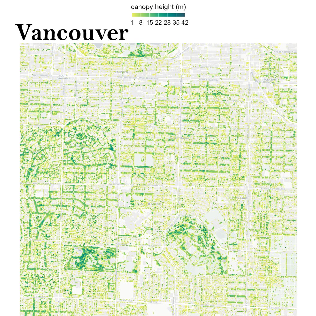
🗣️Mapped the urban #canopy 🌳of 5 cities leading the way in #urbantreeequity! Using high-res data, it's inspiring to see how #Portland 🇺🇸, #Vancouver 🇨🇦,#Seattle 🇺🇸, #Melbourne 🇦🇺,#Berlin 🇩🇪 are prioritizing green spaces for all residents. Thanks to <a href="/milos_agathon/">Milos Popovic</a> #DataScience #R
Alex (@alexgleith) 's Twitter Profile Photo

Since the MSPC Hub has been decommissioned, I'd love to hear from folks if they have a good alternative? Also, I've been deploying their template and since have adapted it to a new template, so if there's anyone who would like advice on how to deploy their own, let me know.

Dr Robbi Bishop-Taylor 🦋 (@satellitesci) 's Twitter Profile Photo

Tide in, tide out: spectacular change between low and high tide across intertidal sand banks near Darwin, Australia.🌊 Check out the tidal currents and mobilised sediment flowing through channels between the mangrove islands during ebb tides! #DigitalEarthAU

GEDI (@gedi_knights) 's Twitter Profile Photo

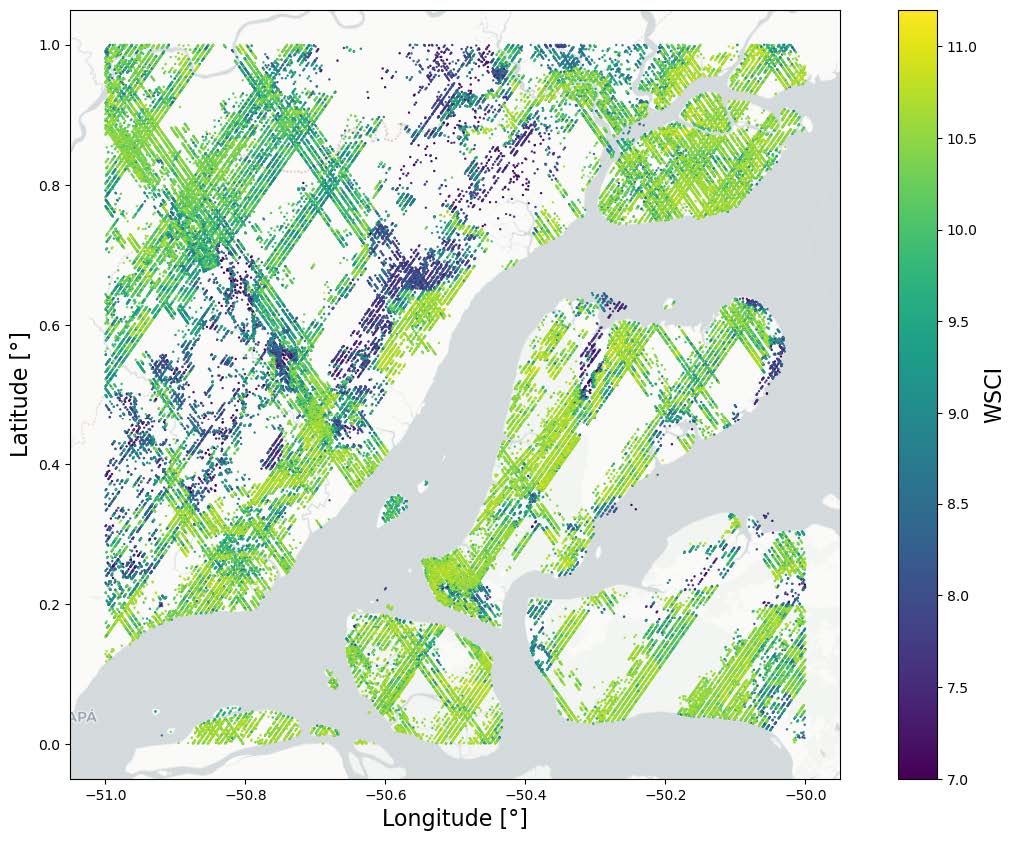
GEDI L4C Footprint Level Waveform Structural Complexity Index, Version 2 has been released! This dataset estimates of prediction intervals for each footprint estimate at 95% confidence. daac.ornl.gov/GEDI/guides/GE…

GEDI L4C Footprint Level Waveform Structural Complexity Index, Version 2 has been released! This dataset estimates of prediction intervals for each footprint estimate at 95% confidence. 

daac.ornl.gov/GEDI/guides/GE…
Jan Pauls (@jan_pauls_) 's Twitter Profile Photo

Our paper "Estimating Canopy Height at Scale" has been accepted to #ICML24, where we significantly advance global canopy height mapping. w/ Max Zimmer, U. Kelly, M. Schwartz, S. Saatchi, Philippe.ciais , Sebastian Pokutta , Martin Brandt, F. Gieseke arxiv.org/abs/2406.01076 🧵 1/5
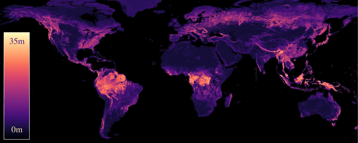
Our paper "Estimating Canopy Height at Scale" has been accepted to #ICML24, where we significantly advance global canopy height mapping.

w/ <a href="/maxzimmerberlin/">Max Zimmer</a>, U. Kelly, M. Schwartz, S. Saatchi, <a href="/ciais_philippe/">Philippe.ciais</a> , <a href="/spokutta/">Sebastian Pokutta</a> , <a href="/matin_brandt/">Martin Brandt</a>, F. Gieseke
arxiv.org/abs/2406.01076
🧵 1/5
Milto Miltiadou (She) (@drmiltiadou) 's Twitter Profile Photo

Hello, we are seeking reviewers for our paper on PlotToSat, a tool that simplifies extracting Sentinel-1 and Sentinel-2 time-series for thousands of plot regions. The journal has asked us to list more reviewers before submission. Your support would be greatly appreciated. 🙏

chris (@dickie_roper) 's Twitter Profile Photo

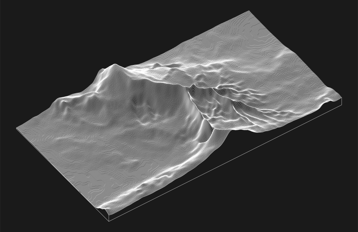
It turns out that using images of lightning bolts as height maps can create some interesting terrain. Best to view at full size to avoid artefacts #RStats #ggplot2

It turns out that using images of lightning bolts as height maps can create some interesting terrain.

Best to view at full size to avoid artefacts

#RStats #ggplot2
Alasdair Rae (@undertheraedar) 's Twitter Profile Photo

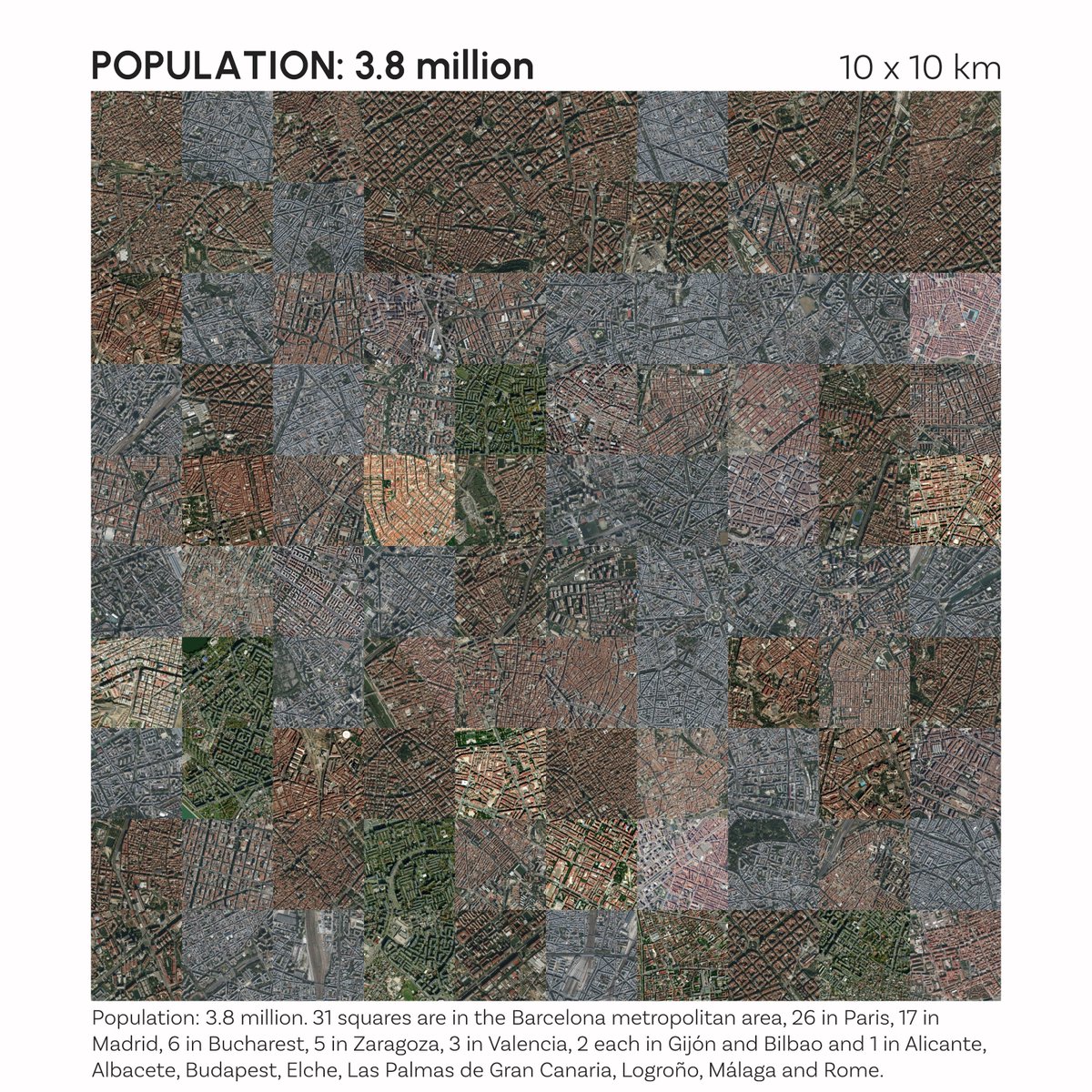
The 100 most densely populated 1km x 1km grid squares in Europe, arranged in a 10km x 10km square - spot which ones aren't in Spain

The 100 most densely populated 1km x 1km grid squares in Europe, arranged in a 10km x 10km square - spot which ones aren't in Spain
terence (@researchremora) 's Twitter Profile Photo

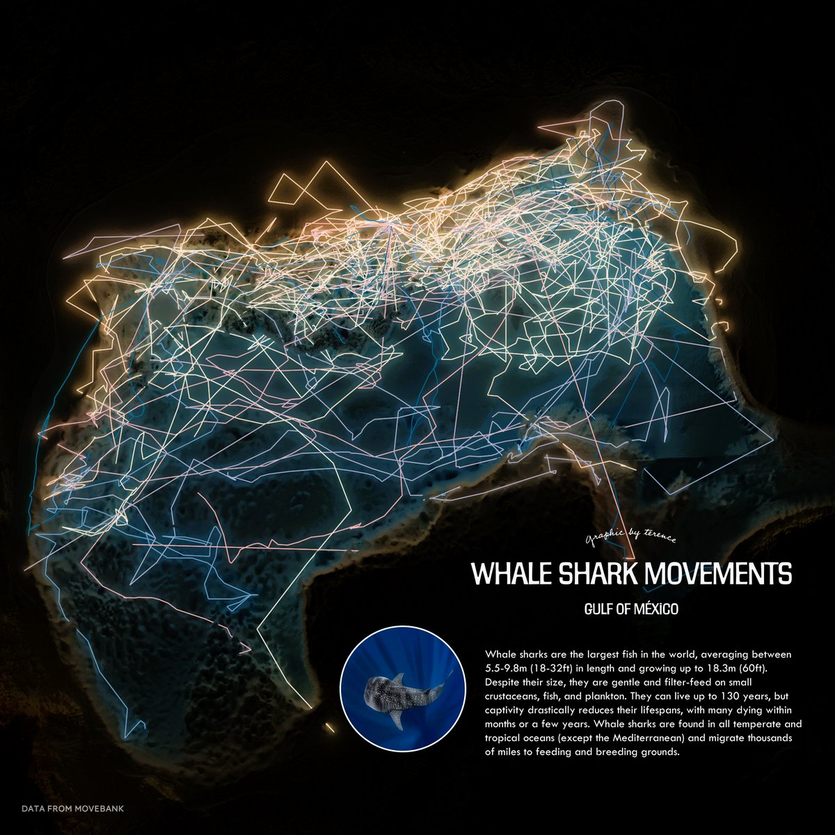
Whale shark movements in the Gulf of México. Would love to see one of these majestic creatures the next time I go diving. #rayshader adventures, an #rstats tale

Whale shark movements in the Gulf of México. Would love to see one of these majestic creatures the next time I go diving.

#rayshader adventures, an #rstats tale