Horry County EMD (@horryemd) 's Twitter Profile
Horry County EMD

@horryemd

HCEMD works to prevent/mitigate, prepare for, respond to and recover from all natural, technological, civil/political disorders, emergencies or disasters.

ID: 3404152570

linkhttp://www.horrycounty.org/Departments/EmergencyManagement.aspx calendar_today05-08-2015 12:06:19

5,5K Tweet

6,6K Followers

469 Following

NWS Wilmington, NC (@nwswilmingtonnc) 's Twitter Profile Photo

An Extreme Heat Warning remains in effect over the entire area both Sunday and Monday for max heat indices in the 110-115 degree range, with isolated to scattered showers and thunderstorms both days.

An Extreme Heat Warning remains in effect over the entire area both Sunday and Monday for max heat indices in the 110-115 degree range, with isolated to scattered showers and thunderstorms both days.
NWS Wilmington, NC (@nwswilmingtonnc) 's Twitter Profile Photo

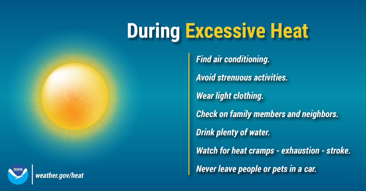
The extreme heat continues today with most areas expected to reach or exceed a heat index of 110F this afternoon. Heat is the leading cause of weather-related deaths most years. Protect yourself during excessive heat and stay Weather-Ready. #ncwx #scwx weather.gov/heat

The extreme heat continues today with most areas expected to reach or exceed a heat index of 110F this afternoon. Heat is the leading cause of weather-related deaths most years. Protect yourself during excessive heat and stay Weather-Ready. #ncwx #scwx weather.gov/heat
NWS Wilmington, NC (@nwswilmingtonnc) 's Twitter Profile Photo

A special weather statement has been issued for Socastee SC, North Myrtle Beach SC and Garden City SC until 9:30 PM EDT #NCwx #SCwx

A special weather statement has been issued for Socastee SC, North Myrtle Beach SC and  Garden City SC until 9:30 PM EDT #NCwx #SCwx
FEMA (@fema) 's Twitter Profile Photo

Take time now to protect your home before a storm could impact your area this hurricane season. - Check your flood insurance policy or talk with your agent about the options available: floodsmart.gov - Know your areas flood risk: msc.fema.gov

Take time now to protect your home before a storm could impact your area this hurricane season.

- Check your flood insurance policy or talk with your agent about the options available: floodsmart.gov
- Know your areas flood risk: msc.fema.gov
NWS Wilmington, NC (@nwswilmingtonnc) 's Twitter Profile Photo

⛈️Plentiful moisture near the coast will lead to heavy rainfall with the best chance of flash flooding in SC. Otherwise, below normal temps continue. #ilmwx #myrwx #ncwx #scwx

⛈️Plentiful moisture near the coast will lead to heavy rainfall with the best chance of flash flooding in SC. Otherwise, below normal temps continue.
#ilmwx #myrwx #ncwx #scwx
Horry County EMD (@horryemd) 's Twitter Profile Photo

The Waccamaw River from the NC state line down to Conway remains in minor flood stage with a Flood Warning in effect. Minor flooding is occurring along the immediate river area. If you encounter a barricade indicating a road is closed due to flooding, don't drive around it.

NWS Wilmington, NC (@nwswilmingtonnc) 's Twitter Profile Photo

A special weather statement has been issued for Little River SC, Sunset Beach NC and Carolina Shores NC until 3:45 PM EDT #NCwx #SCwx

A special weather statement has been issued for Little River SC, Sunset Beach NC and  Carolina Shores NC until 3:45 PM EDT #NCwx #SCwx
NWS Wilmington, NC (@nwswilmingtonnc) 's Twitter Profile Photo

Stay Dry When the Waves Are High! Crashing waves can be beautiful to look at, but it’s easy to underestimate their power. Stay aware of your surroundings along the shore, as waves can quickly catch you off guard. weather.gov/safety/beach #WeatherReady

Stay Dry  When the Waves Are High! Crashing waves can be beautiful to look at,  but it’s easy to underestimate their power. Stay aware of your  surroundings along the shore, as waves can quickly catch you off guard. weather.gov/safety/beach #WeatherReady