RS4GeoHZ (@gfzremote) 's Twitter Profile
RS4GeoHZ

@gfzremote

Remote Sensing for GeoHazards (RS4GeoHZ) group at GFZ Potsdam, Germany, focuses on understanding the geo-hazards in light of the current Climate Crisis.

ID: 1601404607175004162

calendar_today10-12-2022 02:33:22

148 Tweet

392 Followers

18 Following

RS4GeoHZ (@gfzremote) 's Twitter Profile Photo

An Interactive map of #land #subsidence in #Iran, developed in a collaboration between Leibniz Uni Hannover & GFZ subsmap.github.io/iran/ Link to paper-> science.org/doi/10.1126/sc… link to Zenodo -> zenodo.org/records/108155… UNESCO Land Subsidence International Initiative United Nations University-FLORES Mahdi Motagh Mahmud Haghshenas
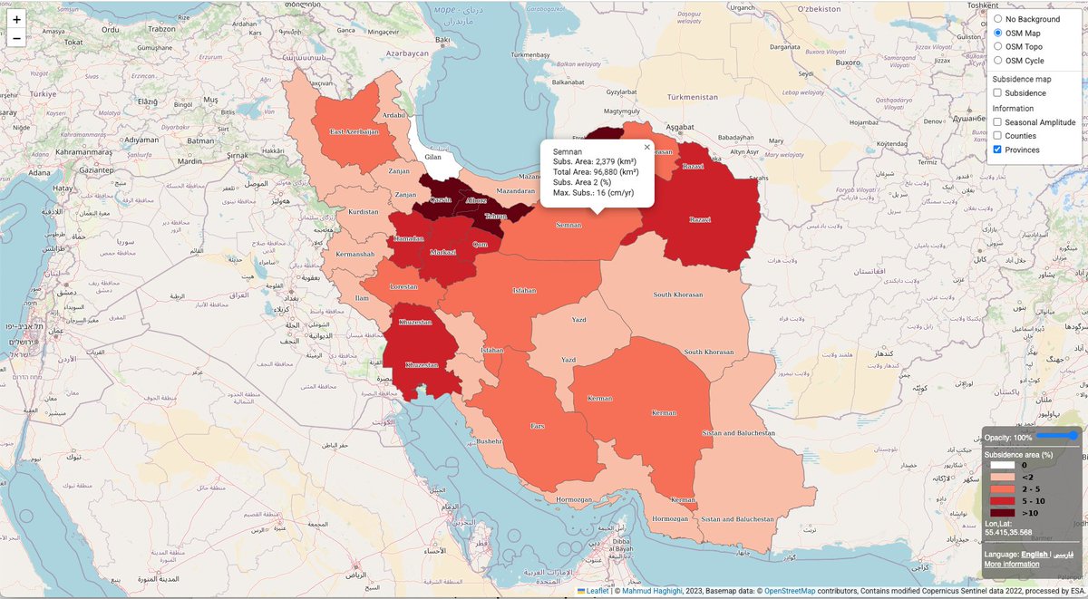
An Interactive map of #land #subsidence in #Iran, developed in a collaboration between <a href="/UniHannover/">Leibniz Uni Hannover</a> &amp; <a href="/GFZ_Potsdam/">GFZ</a>

subsmap.github.io/iran/

Link to paper-&gt;
science.org/doi/10.1126/sc…

link to Zenodo -&gt;
zenodo.org/records/108155…

<a href="/Land_Subsidence/">UNESCO Land Subsidence International Initiative</a>
<a href="/UNU_FLORES/">United Nations University-FLORES</a> 
<a href="/MahdiMotagh/">Mahdi Motagh</a> 
<a href="/Mahmudhh/">Mahmud Haghshenas</a>