Dr_Ali
@dr_ali_hs
#RemoteSensing, #GIS, #wildfire, #Hydrology, #Ecology, #Grassland, #Geospatial, #Climate
ID: 1329010400872919043
https://scholar.google.com/citations?user=hMoT8egAAAAJ&hl=en&oi=aoHe 18-11-2020 10:35:58
1,1K Tweet
636 Followers
4,4K Following


🚀🗺️Create Professional Maps with GeoGPT AI — No GIS Software Needed! youtu.be/zDCZqnY_yuk #ai #GIS #GeoGPT #geoObserver 🌍🔭@[email protected] QFieldCloud 📳☁️


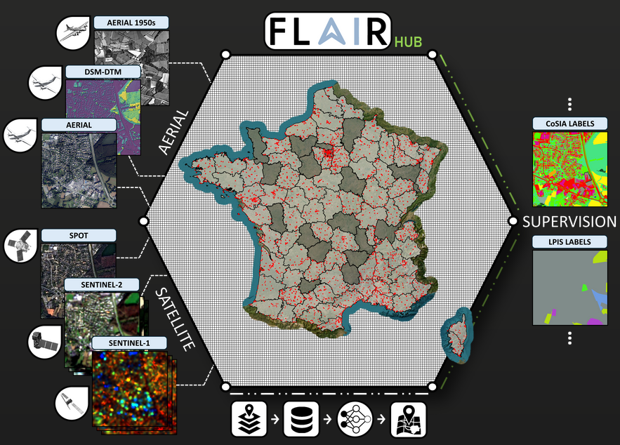
My team at IGN France French Geographic Institute just released new public dataset FLAIR-HUB on Hugging Face Large-scale Multimodal Dataset for Land Cover and Crop Mapping (aerial, satellite, multi annotations) with code, pretrained models, data paper! Huge work! Congrats

Introducing my new #rstats {fpaR} package, a collection functions and utilities that help with common time intelligence and business analytics functions. the functions are flexible to either dataframe or database and are inspired by Microsoft PowerBI syntax github.com/alejandrohagan…

🚀LDSR-S2 v1.0.0 is now officially released! ➡️The full codebase, pretrained weights, & documentation for our multispectral diffusion-based super-resolution model for Sentinel-2 are publicly available: 👉Google Colab colab.research.google.com/drive/1NJuysws… 🔗GitHub github.com/ESAOpenSR/open…

📊 Forest data matters for climate goals – learn how with 2 publications available in 🇬🇧/🇫🇷/🇪🇸 by Food and Agriculture Organization, a GFOI Lead partner. 📗 Grounded in data: openknowledge.fao.org/handle/20.500.… 📘 Pathways to forest data transparency: doi.org/10.4060/cd3208… #ClimateAction #ForestMonitoring


