Eric Bruning (@deeplycloudy) 's Twitter Profile
Eric Bruning

@deeplycloudy

Pythonic electrical meteorologist, electro-microphysical temporal cartographer.

ID: 16715623

calendar_today13-10-2008 02:57:07

8,8K Tweet

725 Followers

361 Following

MetPy (@metpy) 's Twitter Profile Photo

Have you used MetPy? We'd love for you to take our 2023 User Survey. It should only take 5-10 minutes and is really important: results are used in our reports to NSF and guide our on-going improvements. Feel free to share with others who might miss it. forms.gle/BxcMzFG41MaJo1…

Thomas Hinterdorfer (@hinto62) 's Twitter Profile Photo

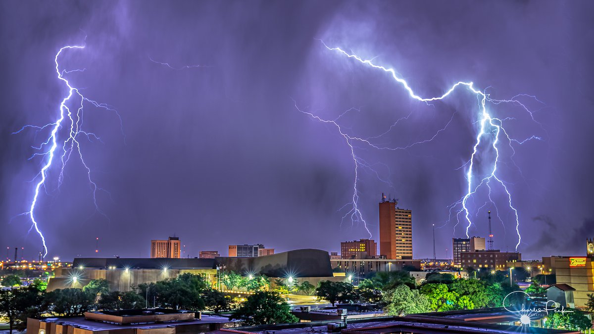
My first upward lightning strike captured. Single 25sec exposure. This was taken around 11pm West of Slaton, looking West to the South of Lubbock, Texas NWS Lubbock #TXwx

My first upward lightning strike captured. Single 25sec exposure. This was taken around 11pm West of Slaton, looking West to the South of Lubbock, Texas <a href="/NWSLubbock/">NWS Lubbock</a> #TXwx
Chris Schultz (@cschultzwx) 's Twitter Profile Photo

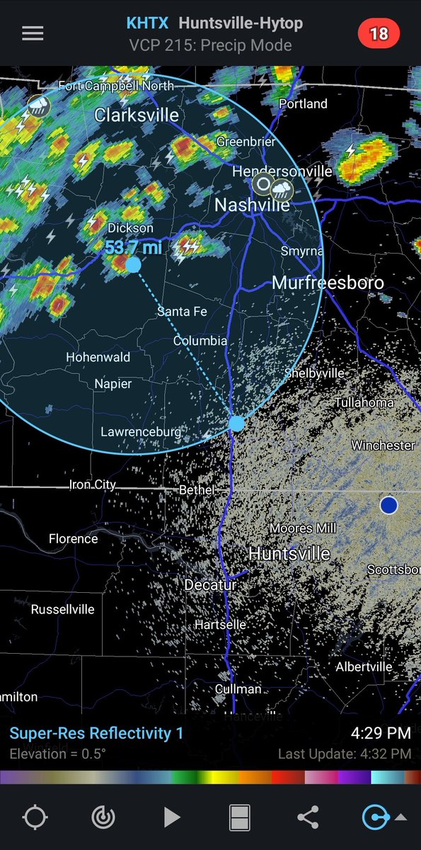
One reason to have multiple lightning datasets when working decision support for #LightningSafety. This lightning flash is real but mislocated. Radar, satellite, GLM, and LMA all do not support lightning is this area of #tnwx near Lawrenceburg

One reason to have multiple lightning datasets when working decision support for #LightningSafety. This lightning flash is real but mislocated. Radar, satellite, GLM, and LMA all do not support lightning is this area of #tnwx near Lawrenceburg
Kelcy Brunner (@kelcybrunner) 's Twitter Profile Photo

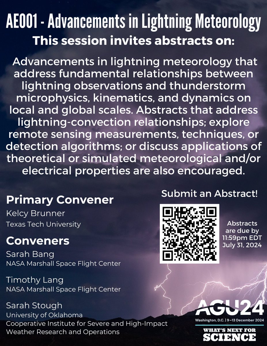
Hey! We have a session! Sarah Bang, @WxSarahS , and I are convening a session AGU (American Geophysical Union) annual meeting on Advancements in Lightning Meteorology, the session info can be found here: agu.confex.com/agu/fm23/preli… It's a co-organized session with ASE and Atmospheric Sciences.

Lightning Safety Council (@ltgsafecouncil) 's Twitter Profile Photo

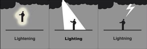
As we always do at the start of #LightningSafety Awareness Week, let’s start with a spelling lesson to remind you what we’re talking about this week. It’s #lightning. #LSAW23

As we always do at the start of #LightningSafety Awareness Week, let’s start with a spelling lesson to remind you what we’re talking about this week. It’s #lightning. #LSAW23
NSF Unidata (@unidata) 's Twitter Profile Photo

🌪️ Don't miss the new MetPy Monday tutorial on our YouTube channel, showing you how to use mouse click events to draw weather fronts and other features on a map with Python. 🗺️#MetPyMonday #WeatherVisualization #PythonProgramming youtu.be/I5d6ze6kRGU

EUMETSAT (@eumetsat) 's Twitter Profile Photo

Are you ready to be thunderstruck? We will soon reveal the first results from #MTGI1’s Lightning Imager! ⚡️ This is the FIRST EVER 🛰️ instrument designed to detect lightning over Europe & Africa! Save the date and join EUMETSAT, European Space Agency & Leonardo Space next week to find out more 👇

Are you ready to be thunderstruck? 
We will soon reveal the first results from #MTGI1’s Lightning Imager! ⚡️
This is the FIRST EVER 🛰️ instrument designed to detect lightning over Europe &amp; Africa! 
Save the date and join <a href="/eumetsat/">EUMETSAT</a>, <a href="/esa/">European Space Agency</a> &amp; <a href="/LDO_Space/">Leonardo Space</a> next week to find out more 👇
MetPy (@metpy) 's Twitter Profile Photo

Reminder: If you've used MetPy, we'd love for you to take our 2023 User Survey, which closes at the end of the week. This should only take 5-10 minutes and is really important for guiding our work and reporting to our NSF sponsor. forms.gle/s312GsEjGFR2p1…

UW-Madison CIMSS (@uwcimss) 's Twitter Profile Photo

The 1-minute Infrared images with an overlay of #GLM Flash Extent Density showed abundant lightning activity associated with this Mesoscale Convective System: cimss.ssec.wisc.edu/satellite-blog… #IAwx #MOwx #ILwx

EUMETSAT (@eumetsat) 's Twitter Profile Photo

Here are the extraordinary 1st results from #MTGI1's Lightning Imager!⚡️ We can now for the first time detect lightning over Europe & Africa👏 Watch here: youtu.be/wjNq-xMWE28 Please note: These animations were created from raw preliminary data and are not for operational use.

Riley Goodside (@goodside) 's Twitter Profile Photo

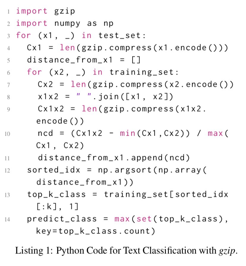
this is wild — kNN using a gzip-based distance metric outperforms BERT and other neural methods for OOD sentence classification intuition: 2 texts similar if cat-ing one to the other barely increases gzip size no training, no tuning, no params — this is the entire algorithm:

this is wild — kNN using a gzip-based distance metric outperforms BERT and other neural methods for OOD sentence classification

intuition: 2 texts similar if cat-ing one to the other barely increases gzip size

no training, no tuning, no params — this is the entire algorithm: