Carolina Weather Group (@carolinawxgroup) 's Twitter Profile
Carolina Weather Group

@carolinawxgroup

Weekly weather podcast discussing weather, science, technology, and more from North Carolina and South Carolina.

ID: 2439154200

linkhttp://www.carolinaweathergroup.com calendar_today11-04-2014 22:31:38

30,30K Tweet

6,6K Followers

1,1K Following

NWS Wilmington, NC (@nwswilmingtonnc) 's Twitter Profile Photo

Historic rain has fallen across Carolina Beach, Southport, and BSL today. Volunteer gauges have recorded over a foot of rain since midnight. NOAA Atlas 14 shows 12"/12 hr occurs, on average, once every 200 years. 18"/12hr is once every 1000 years! hdsc.nws.noaa.gov/pfds/pfds_map_… #ncwx

Historic rain has fallen across Carolina Beach, Southport, and BSL today. Volunteer gauges have recorded over a foot of rain since midnight. NOAA Atlas 14 shows 12"/12 hr occurs, on average, once every 200 years. 18"/12hr is once every 1000 years! hdsc.nws.noaa.gov/pfds/pfds_map_… #ncwx
NWS Wilmington, NC (@nwswilmingtonnc) 's Twitter Profile Photo

Photos shared by Ryland Matthews from near the US Highway 17 intersection with NC Highway 87 in Brunswick County. Never drive around barricades, and please do not drive through flooded roads. #ncwx #PTC8

Photos shared by Ryland Matthews from near the US Highway 17 intersection with NC Highway 87 in Brunswick County.  Never drive around barricades, and please do not drive through flooded roads. #ncwx #PTC8
NHC Fire Rescue 🚒 (@nhcfr) 's Twitter Profile Photo

One thing for certain, two things for sure— NHCFR is always up to crossing a bridge to assist our neighbors. County Fiire crews with North Carolina Task Force 11 assist with rescues due to yesterday's storm's flooding and rising waters. #NHCFR NC Emergency Management

One thing for certain, two things for sure— NHCFR is always up to crossing a bridge to assist our neighbors.

County Fiire crews with North Carolina Task Force 11 assist with rescues due to yesterday's storm's flooding and rising waters. #NHCFR <a href="/NCEmergency/">NC Emergency Management</a>
NCDOT NC12 (@ncdot_nc12) 's Twitter Profile Photo

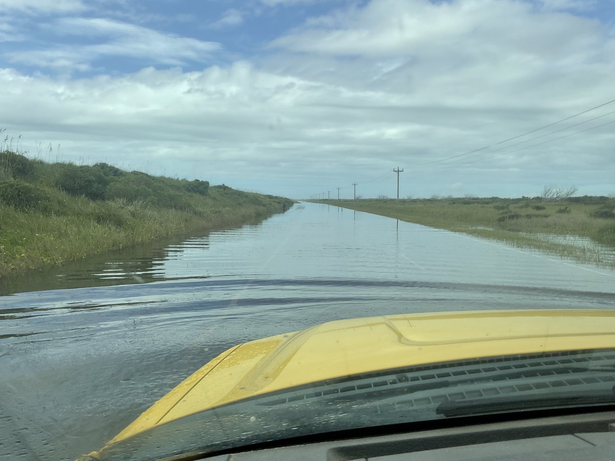
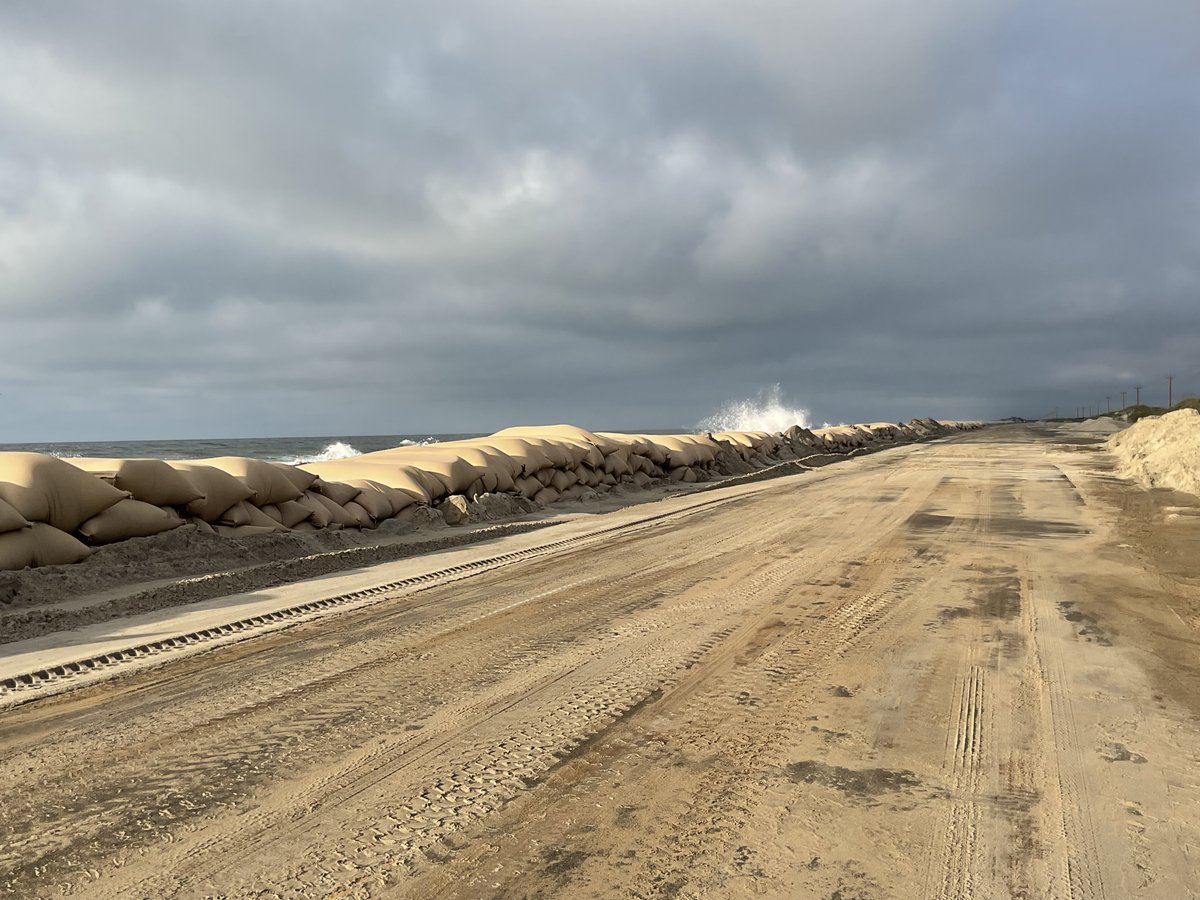
Due to heavy rains and continued ocean overwash, we will NOT be reopening NC12 on the north end of Ocracoke Island today. The water is extremely deep and conditions are unsafe for driving. NCDOT crews will re-evaluate conditions after Wednesday morning's high tide.

Due to heavy rains and continued ocean overwash, we will NOT be reopening NC12 on the north end of Ocracoke Island today. The water is extremely deep and conditions are unsafe for driving. NCDOT crews will re-evaluate conditions after Wednesday morning's high tide.
Governor Roy Cooper (@nc_governor) 's Twitter Profile Photo

The effects of yesterday’s weather system continue to impact our state. Please be safe as there are many roadways impacted and unsafe conditions around the state. 🔗 governor.nc.gov/news/press-rel…

The effects of yesterday’s weather system continue to impact our state. Please be safe as there are many roadways impacted and unsafe conditions around the state.

🔗 governor.nc.gov/news/press-rel…
Carolina Weather Group (@carolinawxgroup) 's Twitter Profile Photo

AKQ issues Flash Flood Warning [flash flood: observed, flash flood damage threat: considerable] for Currituck [NC] till Sep 17, 8:15 PM EDT mesonet.agron.iastate.edu/vtec/f/2024-O-…

AKQ issues Flash Flood Warning [flash flood: observed, flash flood damage threat: considerable] for Currituck [NC] till Sep 17, 8:15 PM EDT mesonet.agron.iastate.edu/vtec/f/2024-O-…
Town of Duck (@duckobx) 's Twitter Profile Photo

❗NC-12 (Duck Road) by the Sanderling Inn is currently impassable due to high water. Police are redirecting traffic through the parking lot of Kimball's Kitchen until the water recedes. Do not drive unless absolutely necessary. Updates will be posted as they become available.

❗NC-12 (Duck Road) by the Sanderling Inn is currently impassable due to high water.  Police are redirecting traffic through the parking lot of Kimball's Kitchen until the water recedes. Do not drive unless absolutely necessary. Updates will be posted as they become available.
NWS Wilmington, NC (@nwswilmingtonnc) 's Twitter Profile Photo

A preliminary event summary for Potential Tropical Cyclone Eight can be found on our webpage at weather.gov/ilm/2024PTC8 that details the historic flooding and heavy rain seen across southeastern NC yesterday.

Carolina Weather Group (@carolinawxgroup) 's Twitter Profile Photo

AKQ extends time of Flash Flood Warning [flash flood: observed] for Camden, Currituck [NC] till Sep 17, 9:30 PM EDT mesonet.agron.iastate.edu/vtec/f/2024-O-…

AKQ extends time of Flash Flood Warning [flash flood: observed] for Camden, Currituck [NC] till Sep 17, 9:30 PM EDT mesonet.agron.iastate.edu/vtec/f/2024-O-…
Carolina Weather Group (@carolinawxgroup) 's Twitter Profile Photo

RAH issues Flash Flood Warning [flash flood: radar indicated] for Durham, Franklin, Granville, Orange, Wake [NC] till Sep 17, 9:30 PM EDT mesonet.agron.iastate.edu/vtec/f/2024-O-…

RAH issues Flash Flood Warning [flash flood: radar indicated] for Durham, Franklin, Granville, Orange, Wake [NC] till Sep 17, 9:30 PM EDT mesonet.agron.iastate.edu/vtec/f/2024-O-…
Carolina Weather Group (@carolinawxgroup) 's Twitter Profile Photo

MHX extends time of Flash Flood Warning [flash flood: observed] for Dare [NC] till Sep 17, 7:30 PM EDT mesonet.agron.iastate.edu/vtec/f/2024-O-…

MHX extends time of Flash Flood Warning [flash flood: observed] for Dare [NC] till Sep 17, 7:30 PM EDT mesonet.agron.iastate.edu/vtec/f/2024-O-…
Carolina Weather Group (@carolinawxgroup) 's Twitter Profile Photo

RNK issues Flash Flood Warning [flash flood: radar indicated] for Stokes, Surry [NC] till Sep 18, 12:30 AM EDT mesonet.agron.iastate.edu/vtec/f/2024-O-…

RNK issues Flash Flood Warning [flash flood: radar indicated] for Stokes, Surry [NC] till Sep 18, 12:30 AM EDT mesonet.agron.iastate.edu/vtec/f/2024-O-…
Carolina Weather Group (@carolinawxgroup) 's Twitter Profile Photo

AKQ extends time of Flash Flood Warning [flash flood: observed, flash flood damage threat: considerable] for Currituck [NC] till Sep 17, 9:30 PM EDT mesonet.agron.iastate.edu/vtec/f/2024-O-…

AKQ extends time of Flash Flood Warning [flash flood: observed, flash flood damage threat: considerable] for Currituck [NC] till Sep 17, 9:30 PM EDT mesonet.agron.iastate.edu/vtec/f/2024-O-…
NC Climate Office (@ncsco) 's Twitter Profile Photo

Rainfall totals exceeded 20 inches in parts of southeastern NC from Potential Tropical Cyclone Eight. Our Climate Blog has more on this surprising event, its extreme totals, and how it compares to the likes of Floyd in our state's history. #ncwx 📰: climate.ncsu.edu/blog/2024/09/r…

Rainfall totals exceeded 20 inches in parts of southeastern NC from Potential Tropical Cyclone Eight.

Our Climate Blog has more on this surprising event, its extreme totals, and how it compares to the likes of Floyd in our state's history. #ncwx

📰: climate.ncsu.edu/blog/2024/09/r…
NCDOT Ferry Division (@ncdot_ferry) 's Twitter Profile Photo

While the Southport-Fort Fisher ferry route remains suspended due to unsafe road conditions, our ferries there are helping move NCDOT crews and equipment into place to repair damaged roads and bridges.

While the Southport-Fort Fisher ferry route remains suspended due to unsafe road conditions, our ferries there are helping move NCDOT crews and equipment into place to repair damaged roads and bridges.
NWS Newport/Morehead (@nwsmoreheadcity) 's Twitter Profile Photo

Tonight at 6 PM we will be at the Filling Station in Pollocksville to discuss hurricane preparedness and history. ➡Register now: weather.gov/mhx/hurricanec… This was how Pollocksville looked like 6 years ago with #Florence #nws

Tonight at 6 PM we will be at the Filling Station in Pollocksville to discuss hurricane preparedness and history.
➡Register now: weather.gov/mhx/hurricanec…
This was how Pollocksville looked like 6 years ago with #Florence #nws
NCDOT NC12 (@ncdot_nc12) 's Twitter Profile Photo

Good news! We will be reopening NC12 on the north end of Ocracoke at 12:30 p.m. today. There is still some water and sand on the roadway, so drive with EXTREME caution. Ferry service will resume with departures from both Hatteras and Ocracoke at 12:30.

Good news! We will be reopening NC12 on the north end of Ocracoke at 12:30 p.m. today. There is still some water and sand on the roadway, so drive with EXTREME caution. Ferry service will resume with departures from both Hatteras and Ocracoke at 12:30.
Village of Bald Head Island (@villagebhi) 's Twitter Profile Photo

By six o'clock last night, the Village had both 10-inch pumps releasing stormwater off the island at the emergency outfall. Video from last evening.